| 6/27/2024 6:10 PM MDT |
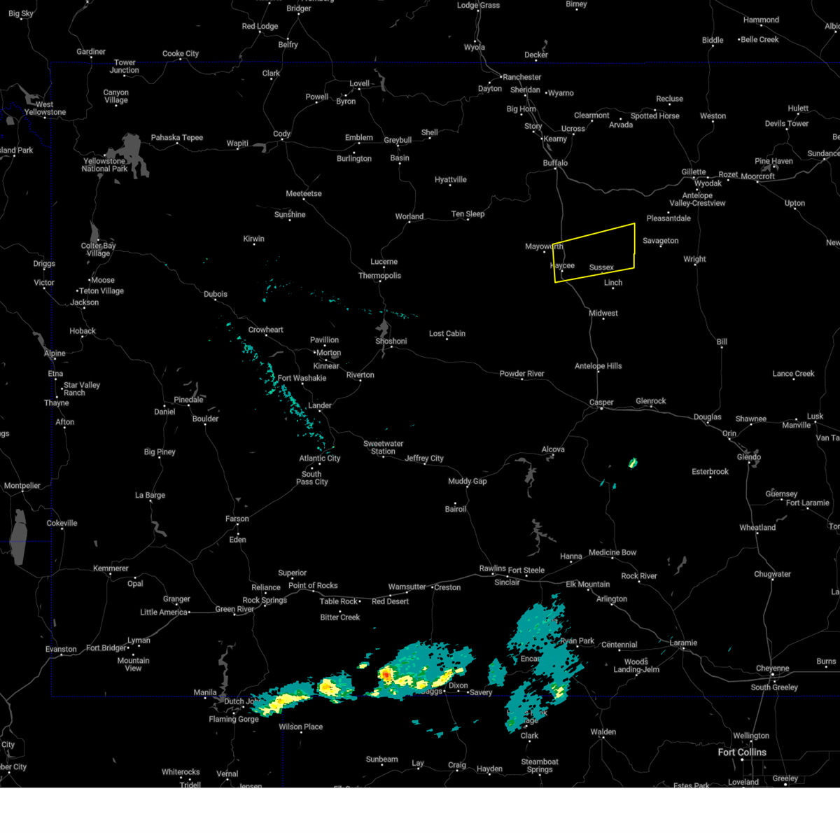 The storm which prompted the warning has weakened below severe limits, and no longer poses an immediate threat to life or property. therefore, the warning will be allowed to expire. however, gusty winds are still possible with this thunderstorm. The storm which prompted the warning has weakened below severe limits, and no longer poses an immediate threat to life or property. therefore, the warning will be allowed to expire. however, gusty winds are still possible with this thunderstorm.
|
| 6/27/2024 5:54 PM MDT |
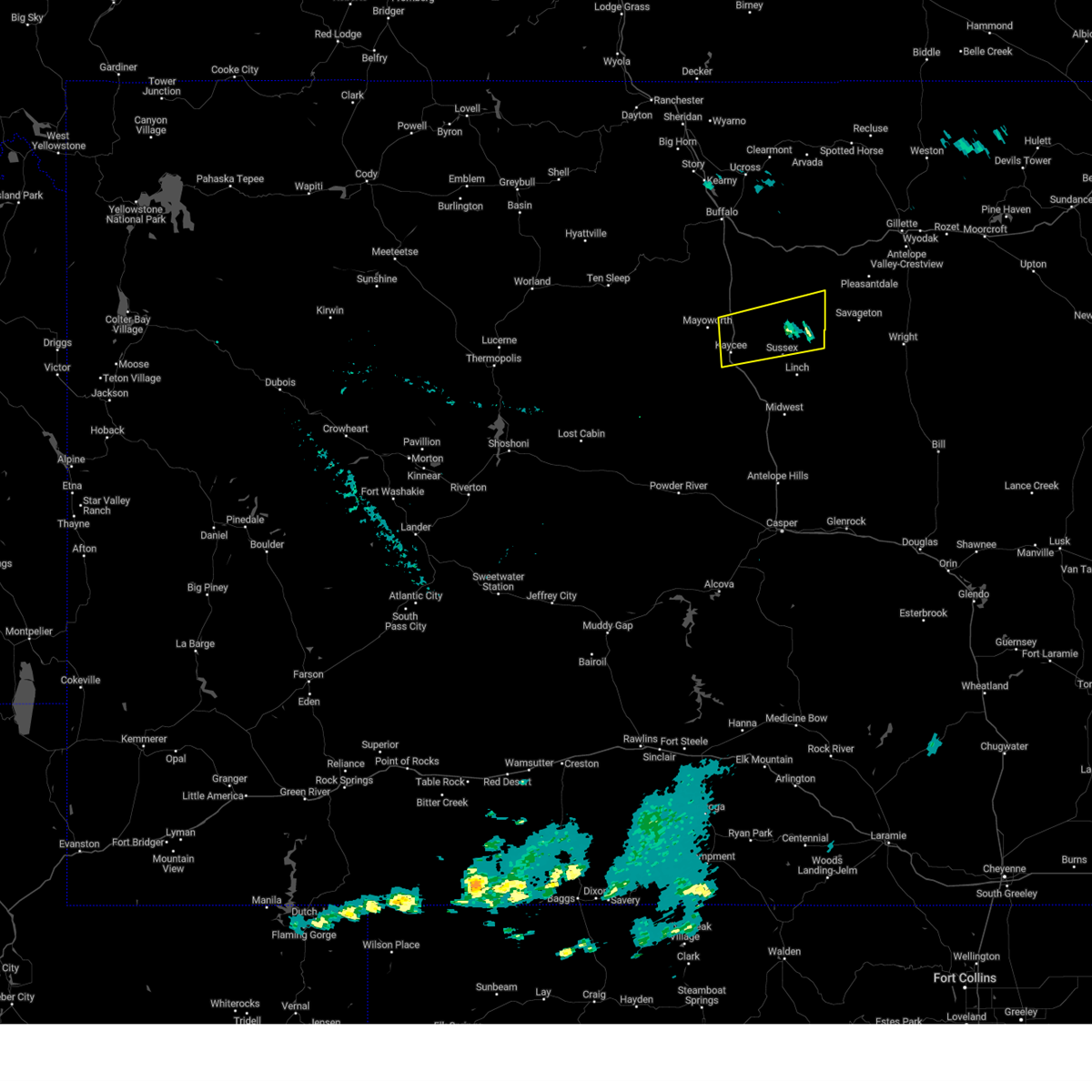 At 554 pm mdt, a severe thunderstorm was located near fort reno historical site, which is 18 miles northeast of kaycee, moving southeast at 30 mph (radar indicated). Hazards include 60 mph wind gusts. Expect damage to roofs, siding, and trees. locations impacted include, kaycee, fort reno historical site, and sussex. This includes interstate 25 between mile markers 250 and 267. At 554 pm mdt, a severe thunderstorm was located near fort reno historical site, which is 18 miles northeast of kaycee, moving southeast at 30 mph (radar indicated). Hazards include 60 mph wind gusts. Expect damage to roofs, siding, and trees. locations impacted include, kaycee, fort reno historical site, and sussex. This includes interstate 25 between mile markers 250 and 267.
|
| 6/27/2024 5:24 PM MDT |
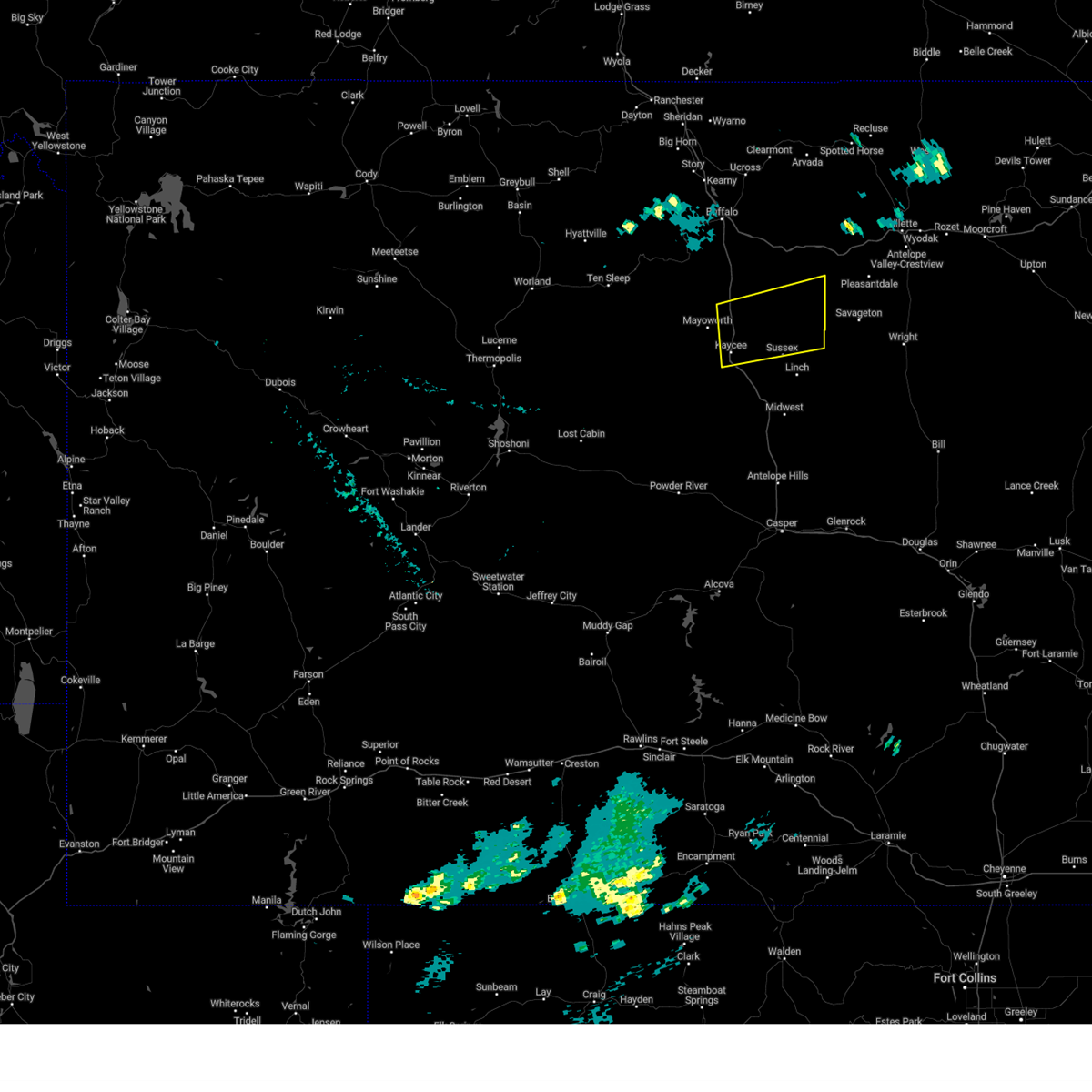 Svrriw the national weather service in riverton has issued a * severe thunderstorm warning for, southeastern johnson county in north central wyoming, * until 615 pm mdt. * at 524 pm mdt, a severe thunderstorm was located 16 miles northwest of fort reno historical site, which is 24 miles northeast of kaycee, moving south at 30 mph (radar indicated). Hazards include 60 mph wind gusts. expect damage to roofs, siding, and trees Svrriw the national weather service in riverton has issued a * severe thunderstorm warning for, southeastern johnson county in north central wyoming, * until 615 pm mdt. * at 524 pm mdt, a severe thunderstorm was located 16 miles northwest of fort reno historical site, which is 24 miles northeast of kaycee, moving south at 30 mph (radar indicated). Hazards include 60 mph wind gusts. expect damage to roofs, siding, and trees
|
| 7/8/2023 1:49 PM MDT |
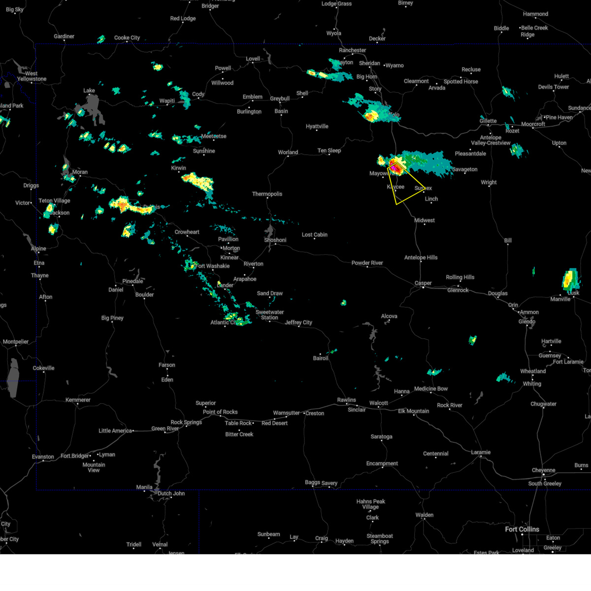 At 149 pm mdt, a severe thunderstorm was located near kaycee, moving southeast at 30 mph (radar indicated). Hazards include golf ball size hail and 60 mph wind gusts. People and animals outdoors will be injured. expect hail damage to roofs, siding, windows, and vehicles. expect wind damage to roofs, siding, and trees. this severe thunderstorm will remain over mainly rural areas of southeastern johnson county. this includes interstate 25 between mile markers 246 and 270. thunderstorm damage threat, considerable hail threat, radar indicated max hail size, 1. 75 in wind threat, radar indicated max wind gust, 60 mph. At 149 pm mdt, a severe thunderstorm was located near kaycee, moving southeast at 30 mph (radar indicated). Hazards include golf ball size hail and 60 mph wind gusts. People and animals outdoors will be injured. expect hail damage to roofs, siding, windows, and vehicles. expect wind damage to roofs, siding, and trees. this severe thunderstorm will remain over mainly rural areas of southeastern johnson county. this includes interstate 25 between mile markers 246 and 270. thunderstorm damage threat, considerable hail threat, radar indicated max hail size, 1. 75 in wind threat, radar indicated max wind gust, 60 mph.
|
| 7/8/2023 1:40 PM MDT |
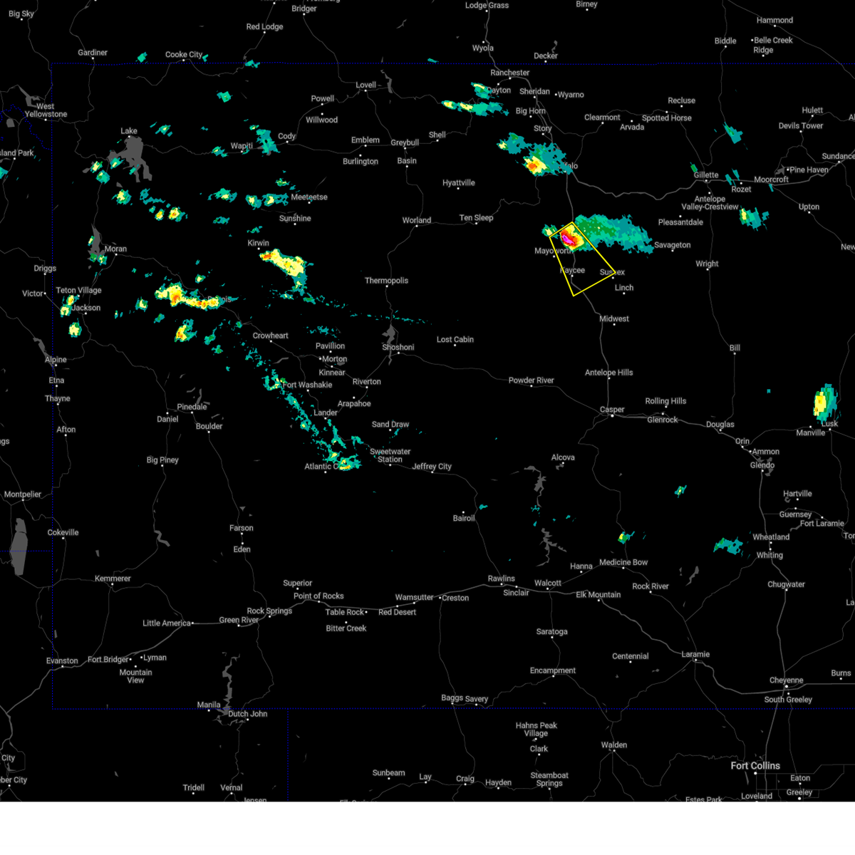 At 139 pm mdt, a severe thunderstorm was located 9 miles north of kaycee, moving southeast at 30 mph (radar indicated). Hazards include 60 mph wind gusts and half dollar size hail. Hail damage to vehicles is expected. expect wind damage to roofs, siding, and trees. this severe thunderstorm will be near, kaycee around 155 pm mdt. this includes interstate 25 between mile markers 246 and 277. hail threat, radar indicated max hail size, 1. 25 in wind threat, radar indicated max wind gust, 60 mph. At 139 pm mdt, a severe thunderstorm was located 9 miles north of kaycee, moving southeast at 30 mph (radar indicated). Hazards include 60 mph wind gusts and half dollar size hail. Hail damage to vehicles is expected. expect wind damage to roofs, siding, and trees. this severe thunderstorm will be near, kaycee around 155 pm mdt. this includes interstate 25 between mile markers 246 and 277. hail threat, radar indicated max hail size, 1. 25 in wind threat, radar indicated max wind gust, 60 mph.
|
| 7/6/2023 8:02 PM MDT |
Golf Ball sized hail reported 19.1 miles NNE of Kaycee, WY, golf ball sized hail and 40 to 50 mph wind gusts.
|
| 7/6/2023 7:56 PM MDT |
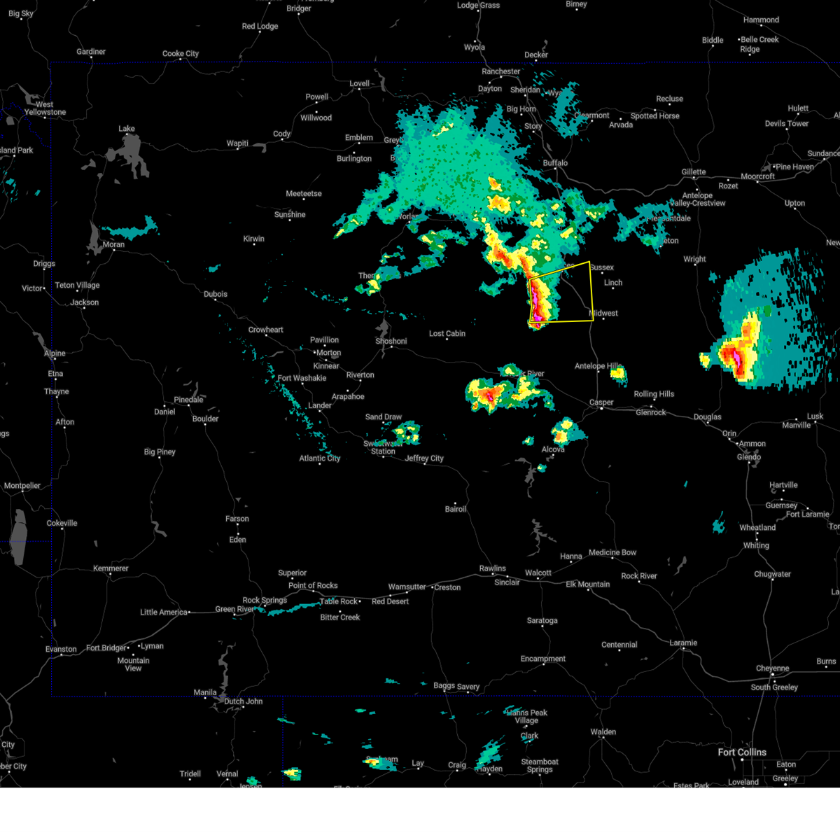 At 755 pm mdt, severe thunderstorms were located along a line extending from 13 miles southwest of kaycee to near hole in the wall to near red wall, moving east at 35 mph (radar indicated). Hazards include 70 mph wind gusts and quarter size hail. Hail damage to vehicles is expected. expect considerable tree damage. wind damage is also likely to mobile homes, roofs, and outbuildings. these severe thunderstorms will remain over mainly rural areas of north central natrona and south central johnson counties, including the following locations, barnum. this includes interstate 25 between mile markers 227 and 254. thunderstorm damage threat, considerable hail threat, radar indicated max hail size, 1. 00 in wind threat, radar indicated max wind gust, 70 mph. At 755 pm mdt, severe thunderstorms were located along a line extending from 13 miles southwest of kaycee to near hole in the wall to near red wall, moving east at 35 mph (radar indicated). Hazards include 70 mph wind gusts and quarter size hail. Hail damage to vehicles is expected. expect considerable tree damage. wind damage is also likely to mobile homes, roofs, and outbuildings. these severe thunderstorms will remain over mainly rural areas of north central natrona and south central johnson counties, including the following locations, barnum. this includes interstate 25 between mile markers 227 and 254. thunderstorm damage threat, considerable hail threat, radar indicated max hail size, 1. 00 in wind threat, radar indicated max wind gust, 70 mph.
|
| 7/6/2023 7:33 PM MDT |
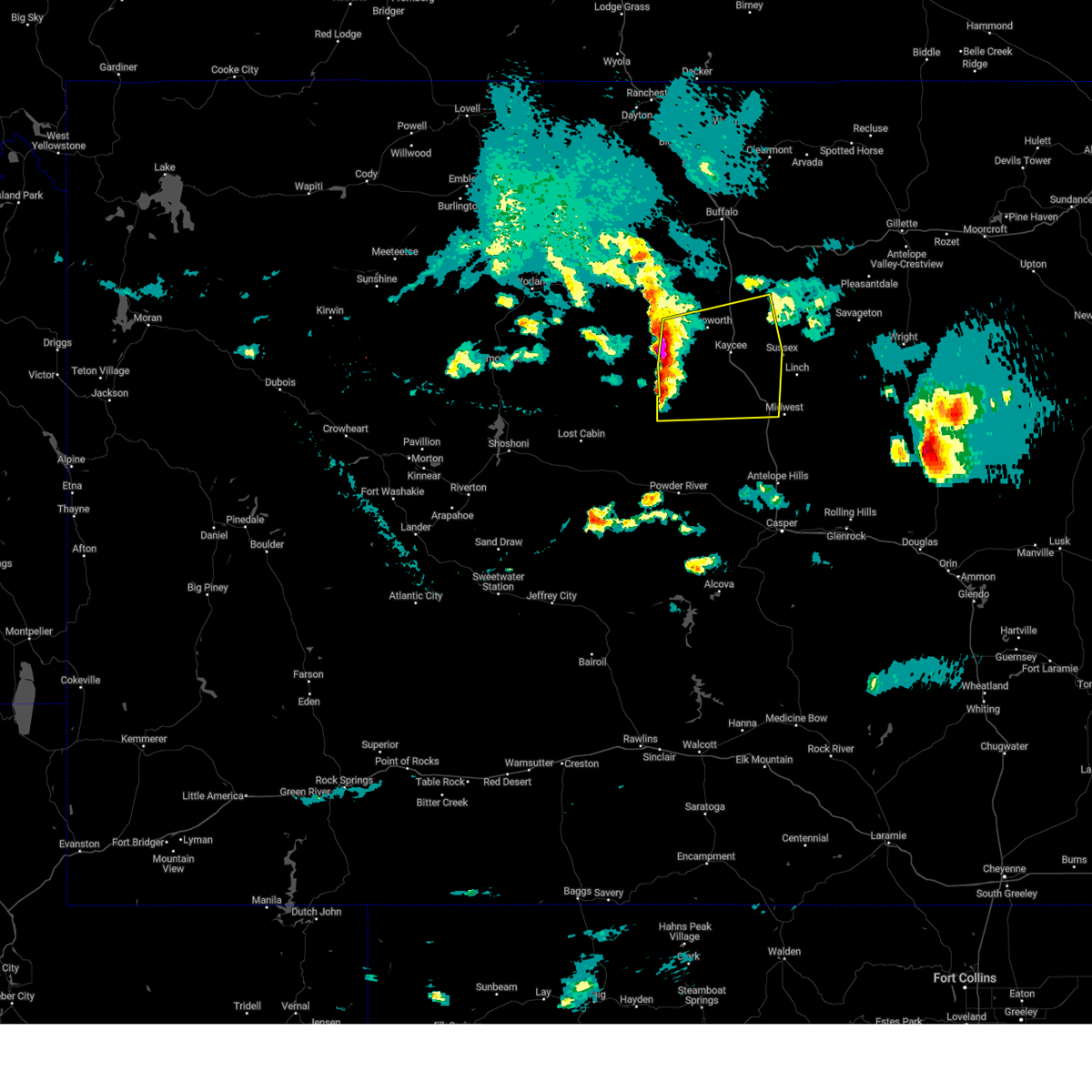 At 733 pm mdt, severe thunderstorms were located along a line extending from 11 miles west of mayoworth to 11 miles northwest of hole in the wall to 8 miles northwest of red wall, moving east at 50 mph (radar indicated). Hazards include 70 mph wind gusts and ping pong ball size hail. People and animals outdoors will be injured. expect hail damage to roofs, siding, windows, and vehicles. expect considerable tree damage. wind damage is also likely to mobile homes, roofs, and outbuildings. severe thunderstorms will be near, mayoworth around 745 pm mdt. hole in the wall around 750 pm mdt. other locations in the path of these severe thunderstorms include kaycee. this includes interstate 25 between mile markers 227 and 270. thunderstorm damage threat, considerable hail threat, radar indicated max hail size, 1. 50 in wind threat, radar indicated max wind gust, 70 mph. At 733 pm mdt, severe thunderstorms were located along a line extending from 11 miles west of mayoworth to 11 miles northwest of hole in the wall to 8 miles northwest of red wall, moving east at 50 mph (radar indicated). Hazards include 70 mph wind gusts and ping pong ball size hail. People and animals outdoors will be injured. expect hail damage to roofs, siding, windows, and vehicles. expect considerable tree damage. wind damage is also likely to mobile homes, roofs, and outbuildings. severe thunderstorms will be near, mayoworth around 745 pm mdt. hole in the wall around 750 pm mdt. other locations in the path of these severe thunderstorms include kaycee. this includes interstate 25 between mile markers 227 and 270. thunderstorm damage threat, considerable hail threat, radar indicated max hail size, 1. 50 in wind threat, radar indicated max wind gust, 70 mph.
|
| 6/28/2023 1:35 PM MDT |
Ping Pong Ball sized hail reported 13.2 miles SSW of Kaycee, WY
|
| 6/23/2023 2:53 PM MDT |
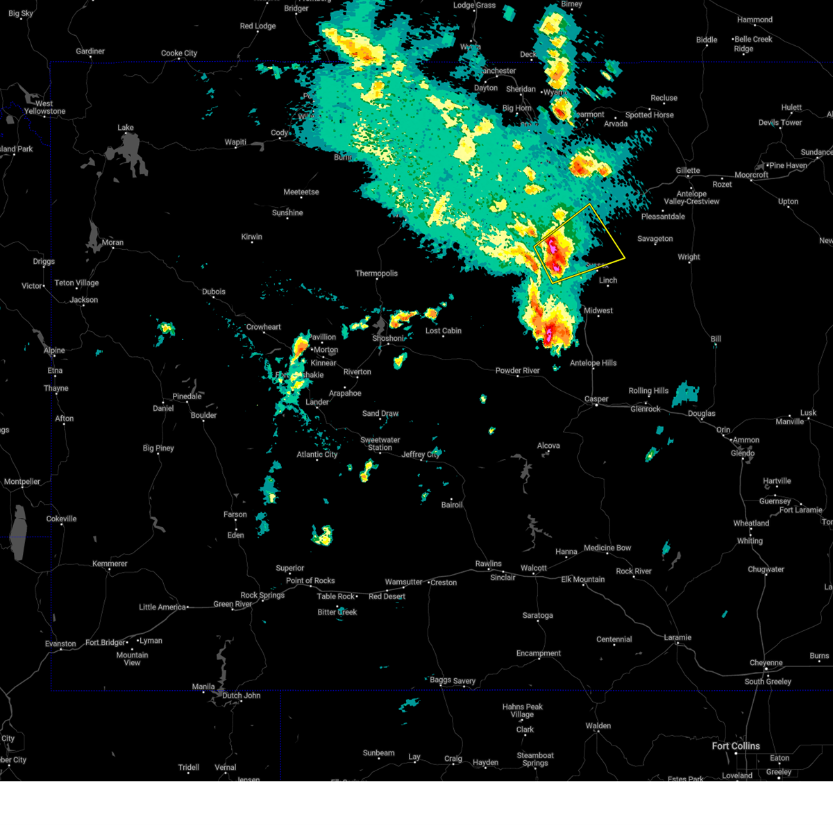 At 253 pm mdt, a severe thunderstorm was located 7 miles northeast of kaycee, moving northeast at 30 mph (radar indicated). Hazards include golf ball size hail and 60 mph wind gusts. People and animals outdoors will be injured. expect hail damage to roofs, siding, windows, and vehicles. expect wind damage to roofs, siding, and trees. locations impacted include, kaycee, mayoworth and fort reno historical site. This includes interstate 25 between mile markers 249 and 271. At 253 pm mdt, a severe thunderstorm was located 7 miles northeast of kaycee, moving northeast at 30 mph (radar indicated). Hazards include golf ball size hail and 60 mph wind gusts. People and animals outdoors will be injured. expect hail damage to roofs, siding, windows, and vehicles. expect wind damage to roofs, siding, and trees. locations impacted include, kaycee, mayoworth and fort reno historical site. This includes interstate 25 between mile markers 249 and 271.
|
| 6/23/2023 2:41 PM MDT |
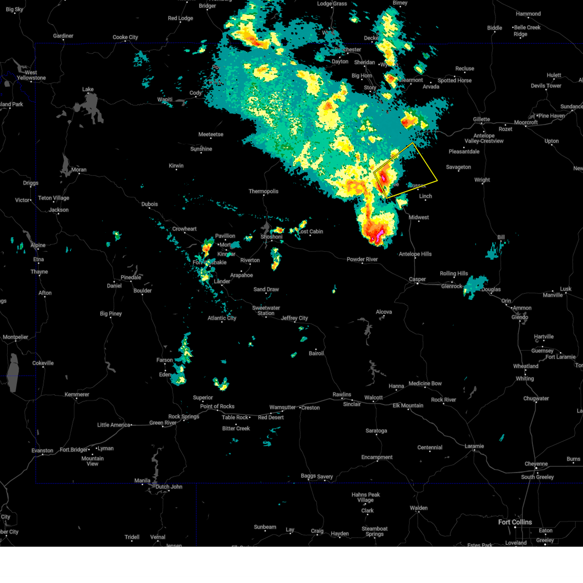 At 241 pm mdt, a severe thunderstorm was located over kaycee, moving northeast at 30 mph (radar indicated). Hazards include 60 mph wind gusts and half dollar size hail. Hail damage to vehicles is expected. Expect wind damage to roofs, siding, and trees. At 241 pm mdt, a severe thunderstorm was located over kaycee, moving northeast at 30 mph (radar indicated). Hazards include 60 mph wind gusts and half dollar size hail. Hail damage to vehicles is expected. Expect wind damage to roofs, siding, and trees.
|
| 6/23/2023 2:37 PM MDT |
Quarter sized hail reported 0 miles E of Kaycee, WY
|
| 6/23/2023 2:33 PM MDT |
Quarter sized hail reported 7 miles ENE of Kaycee, WY, delayed report. rancher reported quarter sized hail and swirling clouds. no tornado or touchdown best they knew.
|
| 6/23/2023 2:15 PM MDT |
Baseball sized hail reported 14.7 miles ENE of Kaycee, WY, public report relayed to em.
|
| 6/23/2023 2:11 PM MDT |
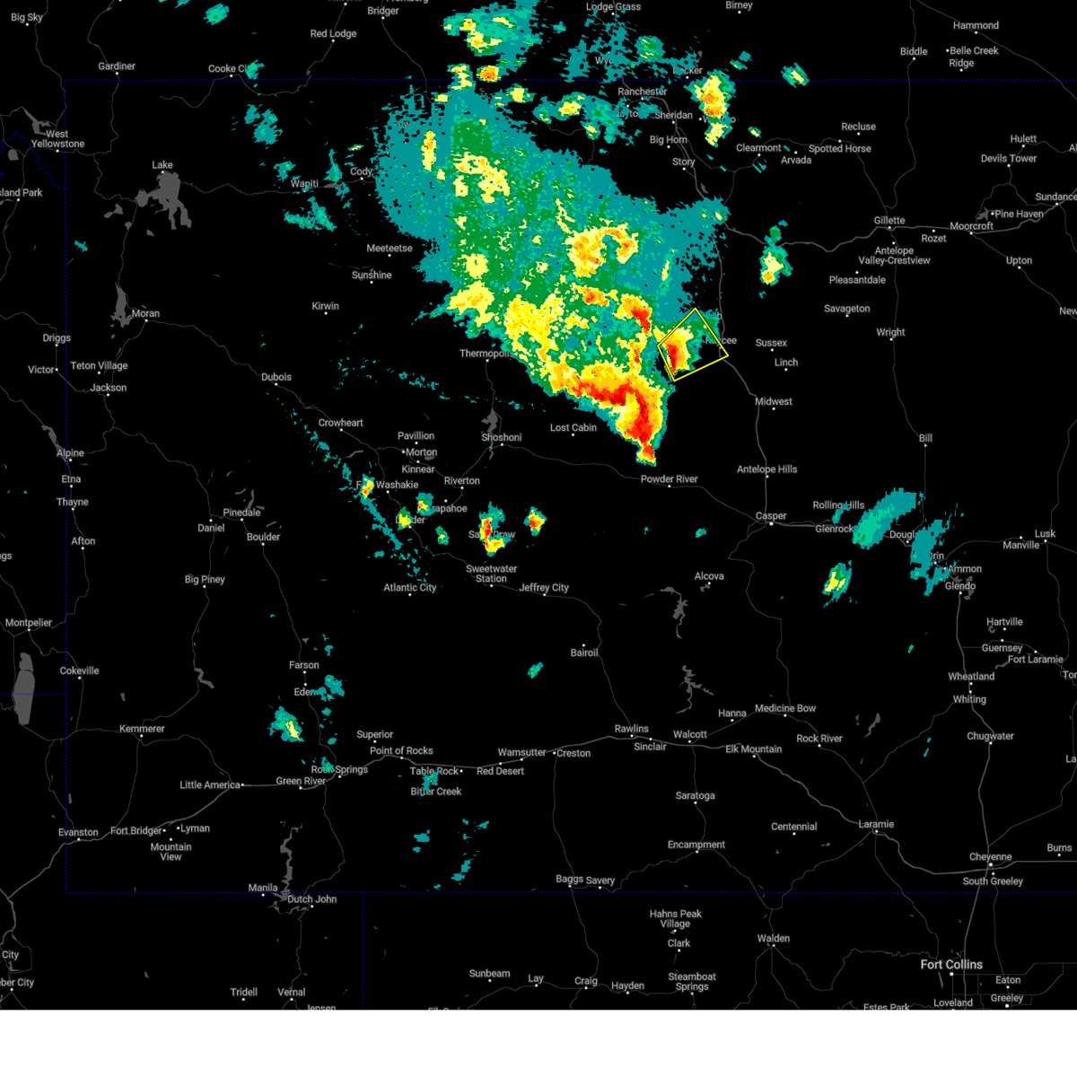 At 211 pm mdt, a severe thunderstorm was located 10 miles northwest of hole in the wall, which is also 13 miles west of kaycee, moving northeast at 20 mph (radar indicated). Hazards include ping pong ball size hail and 60 mph wind gusts. People and animals outdoors will be injured. expect hail damage to roofs, siding, windows, and vehicles. Expect wind damage to roofs, siding, and trees. At 211 pm mdt, a severe thunderstorm was located 10 miles northwest of hole in the wall, which is also 13 miles west of kaycee, moving northeast at 20 mph (radar indicated). Hazards include ping pong ball size hail and 60 mph wind gusts. People and animals outdoors will be injured. expect hail damage to roofs, siding, windows, and vehicles. Expect wind damage to roofs, siding, and trees.
|
| 6/24/2022 4:27 PM MDT |
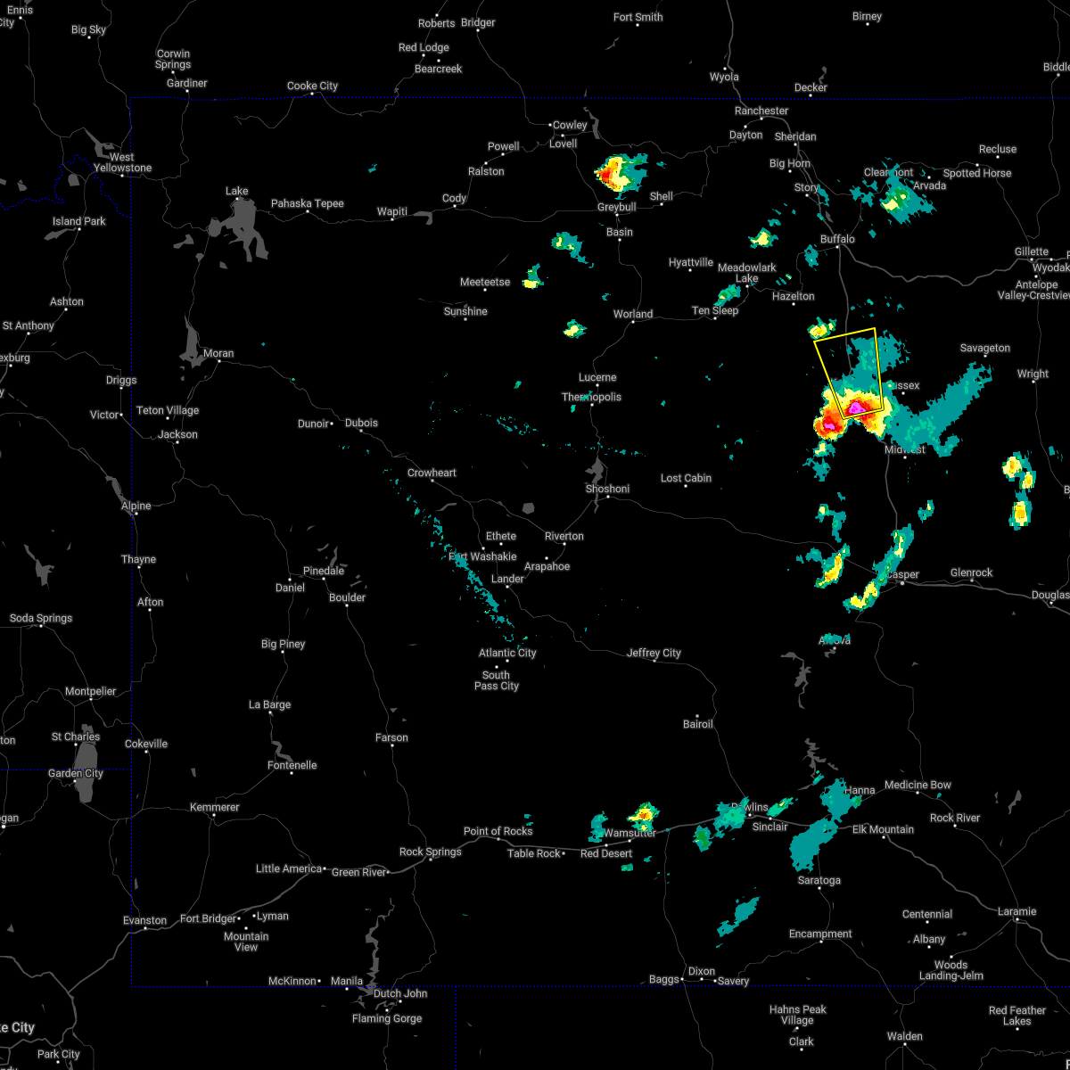 At 426 pm mdt, a severe thunderstorm was located south of kaycee, moving north at 20 mph (radar indicated). Hazards include 60 mph wind gusts and quarter size hail. Hail damage to vehicles is expected. expect wind damage to roofs, siding, and trees. this severe thunderstorm will be near, kaycee around 435 pm mdt. this includes interstate 25 between mile markers 245 and 271. hail threat, radar indicated max hail size, 1. 00 in wind threat, radar indicated max wind gust, 60 mph. At 426 pm mdt, a severe thunderstorm was located south of kaycee, moving north at 20 mph (radar indicated). Hazards include 60 mph wind gusts and quarter size hail. Hail damage to vehicles is expected. expect wind damage to roofs, siding, and trees. this severe thunderstorm will be near, kaycee around 435 pm mdt. this includes interstate 25 between mile markers 245 and 271. hail threat, radar indicated max hail size, 1. 00 in wind threat, radar indicated max wind gust, 60 mph.
|
| 6/24/2022 3:58 PM MDT |
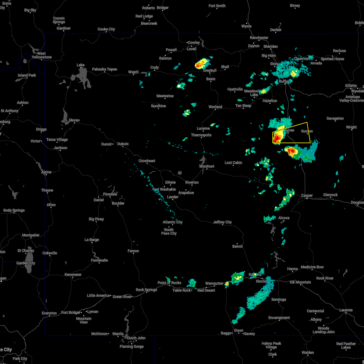 At 357 pm mdt, a severe thunderstorm was located near kaycee, moving east at 30 mph (public. at 350 pm public reported 1 inch hail near barnum). Hazards include 60 mph wind gusts and quarter size hail. Hail damage to vehicles is expected. expect wind damage to roofs, siding, and trees. locations impacted include, kaycee, barnum and sussex. this includes interstate 25 between mile markers 242 and 259. hail threat, observed max hail size, 1. 00 in wind threat, radar indicated max wind gust, 60 mph. At 357 pm mdt, a severe thunderstorm was located near kaycee, moving east at 30 mph (public. at 350 pm public reported 1 inch hail near barnum). Hazards include 60 mph wind gusts and quarter size hail. Hail damage to vehicles is expected. expect wind damage to roofs, siding, and trees. locations impacted include, kaycee, barnum and sussex. this includes interstate 25 between mile markers 242 and 259. hail threat, observed max hail size, 1. 00 in wind threat, radar indicated max wind gust, 60 mph.
|
| 6/24/2022 3:50 PM MDT |
Quarter sized hail reported 15.2 miles ENE of Kaycee, WY
|
| 6/24/2022 3:45 PM MDT |
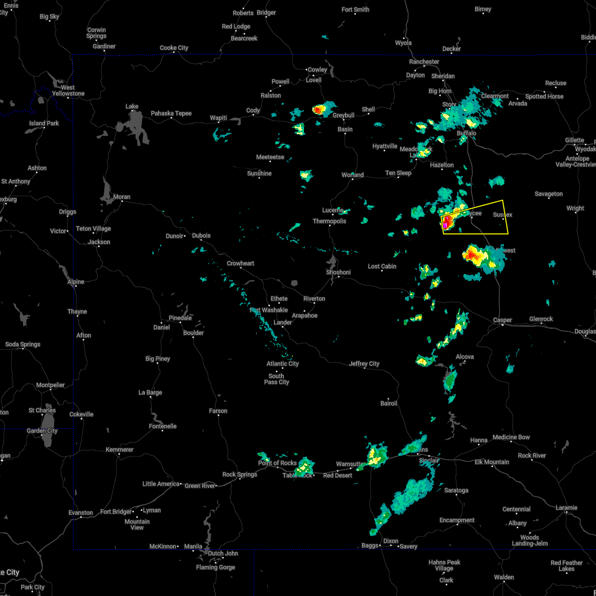 At 343 pm mdt, a severe thunderstorm was located near barnum, or 10 miles southwest of kaycee, moving east at 30 mph (radar indicated). Hazards include 60 mph wind gusts and quarter size hail. Hail damage to vehicles is expected. Expect wind damage to roofs, siding, and trees. At 343 pm mdt, a severe thunderstorm was located near barnum, or 10 miles southwest of kaycee, moving east at 30 mph (radar indicated). Hazards include 60 mph wind gusts and quarter size hail. Hail damage to vehicles is expected. Expect wind damage to roofs, siding, and trees.
|
| 8/1/2020 3:10 PM MDT |
Half Dollar sized hail reported 18.5 miles NNE of Kaycee, WY
|
| 7/5/2020 4:56 PM MDT |
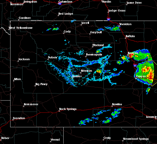 At 456 pm mdt, a severe thunderstorm was located 10 miles northeast of kaycee, moving northeast at 25 mph (radar indicated). Hazards include 60 mph wind gusts and quarter size hail. Hail damage to vehicles is expected. expect wind damage to roofs, siding, and trees. this severe thunderstorm will be near, fort reno historical site around 520 pm mdt. This includes interstate 25 between mile markers 245 and 258. At 456 pm mdt, a severe thunderstorm was located 10 miles northeast of kaycee, moving northeast at 25 mph (radar indicated). Hazards include 60 mph wind gusts and quarter size hail. Hail damage to vehicles is expected. expect wind damage to roofs, siding, and trees. this severe thunderstorm will be near, fort reno historical site around 520 pm mdt. This includes interstate 25 between mile markers 245 and 258.
|
| 6/28/2020 5:12 PM MDT |
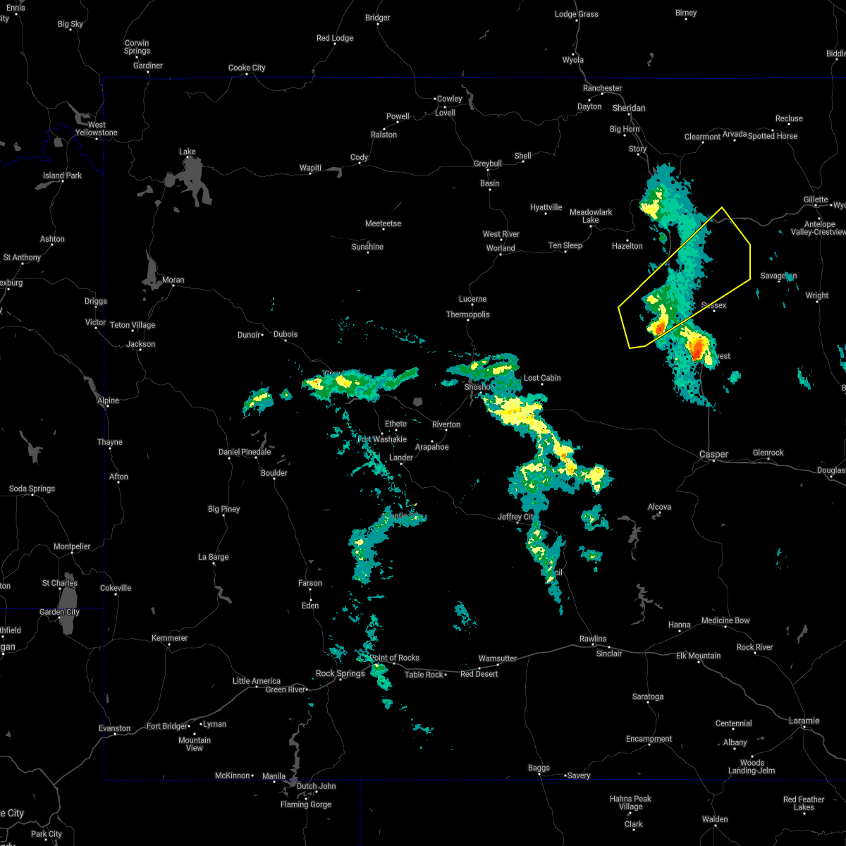 The severe thunderstorm warning for southern johnson county will expire at 515 pm mdt, the storm which prompted the warning has weakened below severe limits, and no longer poses an immediate threat to life or property. therefore, the warning will be allowed to expire. however gusty winds are still possible with this thunderstorm. remember, a severe thunderstorm warning still remains in effect for southeast johnson and northeast natrona counties. The severe thunderstorm warning for southern johnson county will expire at 515 pm mdt, the storm which prompted the warning has weakened below severe limits, and no longer poses an immediate threat to life or property. therefore, the warning will be allowed to expire. however gusty winds are still possible with this thunderstorm. remember, a severe thunderstorm warning still remains in effect for southeast johnson and northeast natrona counties.
|
| 6/28/2020 4:56 PM MDT |
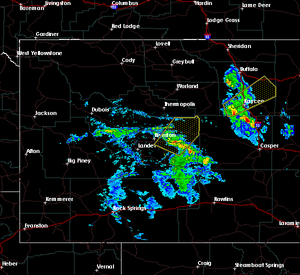 At 455 pm mdt, a severe thunderstorm was located 13 miles east of mayoworth, which is 14 miles north of kaycee, moving northeast at 55 mph (radar indicated). Hazards include 60 mph wind gusts. Expect damage to roofs, siding, and trees. this severe storm will be near, powder river rest area around 525 pm mdt. other locations impacted by this severe thunderstorm include barnum. this includes the following highways, interstate 25 between mile markers 246 and 273. Interstate 90 between mile markers 80 and 88. At 455 pm mdt, a severe thunderstorm was located 13 miles east of mayoworth, which is 14 miles north of kaycee, moving northeast at 55 mph (radar indicated). Hazards include 60 mph wind gusts. Expect damage to roofs, siding, and trees. this severe storm will be near, powder river rest area around 525 pm mdt. other locations impacted by this severe thunderstorm include barnum. this includes the following highways, interstate 25 between mile markers 246 and 273. Interstate 90 between mile markers 80 and 88.
|
| 6/28/2020 4:35 PM MDT |
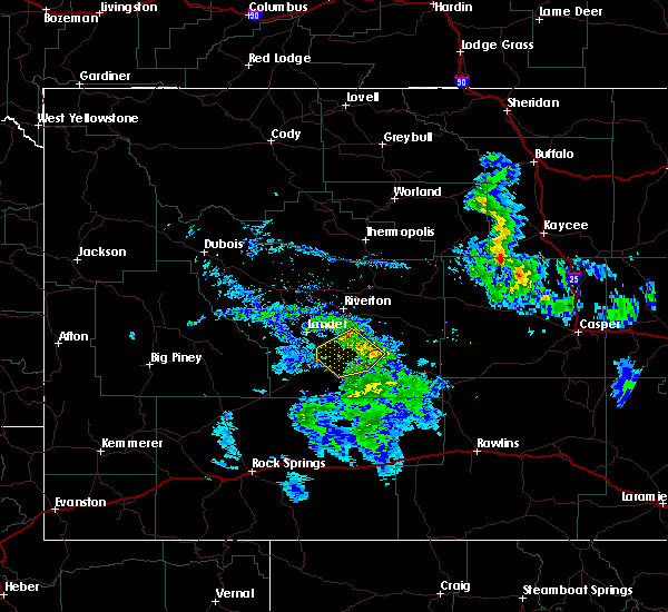 At 434 pm mdt, a severe thunderstorm was located 7 miles southwest of mayoworth, which is 11 miles west of kaycee, moving northeast at 50 mph (radar indicated). Hazards include 60 mph wind gusts and penny size hail. Expect damage to roofs, siding, and trees. this severe thunderstorm will be near, mayoworth around 440 pm mdt. kaycee around 445 pm mdt. other locations impacted by this severe thunderstorm include barnum. this includes the following highways, interstate 25 between mile markers 246 and 277. Interstate 90 between mile markers 79 and 88. At 434 pm mdt, a severe thunderstorm was located 7 miles southwest of mayoworth, which is 11 miles west of kaycee, moving northeast at 50 mph (radar indicated). Hazards include 60 mph wind gusts and penny size hail. Expect damage to roofs, siding, and trees. this severe thunderstorm will be near, mayoworth around 440 pm mdt. kaycee around 445 pm mdt. other locations impacted by this severe thunderstorm include barnum. this includes the following highways, interstate 25 between mile markers 246 and 277. Interstate 90 between mile markers 79 and 88.
|
| 6/6/2020 4:35 PM MDT |
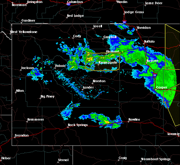 At 434 pm mdt, severe thunderstorms were located along a line extending from 7 miles southeast of cloud peak to near pine tree junction, moving northeast at 65 mph (radar indicated). Hazards include 60 to 65 mph wind gusts. Expect damage to roofs, siding, and trees. these severe thunderstorms will remain over mainly rural areas of johnson county, including the following locations, sussex and lost cabin campground. this includes the following highways, interstate 25 between mile markers 241 and 292. interstate 90 between mile markers 69 and 95. Time, mot, loc 2234z 245deg 154kt 4429 10709 4360 10575. At 434 pm mdt, severe thunderstorms were located along a line extending from 7 miles southeast of cloud peak to near pine tree junction, moving northeast at 65 mph (radar indicated). Hazards include 60 to 65 mph wind gusts. Expect damage to roofs, siding, and trees. these severe thunderstorms will remain over mainly rural areas of johnson county, including the following locations, sussex and lost cabin campground. this includes the following highways, interstate 25 between mile markers 241 and 292. interstate 90 between mile markers 69 and 95. Time, mot, loc 2234z 245deg 154kt 4429 10709 4360 10575.
|
|
|
| 6/6/2020 4:23 PM MDT |
 At 421 pm mdt, severe thunderstorms were located along a line extending from near red wall to 6 miles northeast of evansville, moving northeast at 65 mph (radar indicated. at 412pm mdt, 76 mph was reported near tisdale). Hazards include 70 mph wind gusts. Expect considerable tree damage. damage is likely to mobile homes, roofs, and outbuildings. locations impacted include, kaycee, midwest, mayoworth, edgerton, linch, hole in the wall, teapot rock, fort reno historical site, red wall, barnum and sussex. This includes interstate 25 between mile markers 207 and 268. At 421 pm mdt, severe thunderstorms were located along a line extending from near red wall to 6 miles northeast of evansville, moving northeast at 65 mph (radar indicated. at 412pm mdt, 76 mph was reported near tisdale). Hazards include 70 mph wind gusts. Expect considerable tree damage. damage is likely to mobile homes, roofs, and outbuildings. locations impacted include, kaycee, midwest, mayoworth, edgerton, linch, hole in the wall, teapot rock, fort reno historical site, red wall, barnum and sussex. This includes interstate 25 between mile markers 207 and 268.
|
| 6/6/2020 4:12 PM MDT |
Tidsdale divide wydot anemometer in johnson county WY, 13.1 miles NW of Kaycee, WY
|
| 6/6/2020 4:02 PM MDT |
 At 401 pm mdt, severe thunderstorms were located along a line extending from 10 miles south of red wall to near beartrap meadows county park, moving northeast at 65 mph (radar indicated). Hazards include 70 mph wind gusts. Expect considerable tree damage. damage is likely to mobile homes, roofs, and outbuildings. locations impacted include, kaycee, midwest, mayoworth, edgerton, linch, hole in the wall, teapot rock, fort reno historical site, red wall, barnum and sussex. This includes interstate 25 between mile markers 207 and 268. At 401 pm mdt, severe thunderstorms were located along a line extending from 10 miles south of red wall to near beartrap meadows county park, moving northeast at 65 mph (radar indicated). Hazards include 70 mph wind gusts. Expect considerable tree damage. damage is likely to mobile homes, roofs, and outbuildings. locations impacted include, kaycee, midwest, mayoworth, edgerton, linch, hole in the wall, teapot rock, fort reno historical site, red wall, barnum and sussex. This includes interstate 25 between mile markers 207 and 268.
|
| 6/6/2020 3:53 PM MDT |
 At 352 pm mdt, severe thunderstorms were located along a line extending from 12 miles south of red wall to beartrap meadows county park, moving northeast at 65 mph (radar indicated). Hazards include 60 mph wind gusts. expect damage to roofs, siding, and trees At 352 pm mdt, severe thunderstorms were located along a line extending from 12 miles south of red wall to beartrap meadows county park, moving northeast at 65 mph (radar indicated). Hazards include 60 mph wind gusts. expect damage to roofs, siding, and trees
|
| 6/6/2020 2:51 AM MDT |
 The severe thunderstorm warning for hot springs, southern johnson and washakie counties will expire at 300 am mdt, the storms which prompted the warning have weakened. therefore, the warning will be allowed to expire. The severe thunderstorm warning for hot springs, southern johnson and washakie counties will expire at 300 am mdt, the storms which prompted the warning have weakened. therefore, the warning will be allowed to expire.
|
| 6/6/2020 2:37 AM MDT |
 At 234 am mdt, doppler radar indicated scattered showers across hot springs, southern johnson and washakie counties (radar indicated). Hazards include 60 mph wind gusts. Expect damage to roofs, siding, and trees. These showers are capable of producing wind gusts of 50 to 65 mph with little or no notice. At 234 am mdt, doppler radar indicated scattered showers across hot springs, southern johnson and washakie counties (radar indicated). Hazards include 60 mph wind gusts. Expect damage to roofs, siding, and trees. These showers are capable of producing wind gusts of 50 to 65 mph with little or no notice.
|
| 6/6/2020 1:46 AM MDT |
 At 142 am mdt, weak showers with damaging winds were located along a line extending from near anchor dam to near midwest, moving north at 45 mph (radar indicated. at 1235 am, the casper airport measured a wind gust of 60 mph. at 125 am, the riverton airport measured a 59 mph wind gust). Hazards include 60 mph wind gusts. Expect damage to roofs, siding, and trees. severe thunderstorms will be near, midwest and edgerton around 150 am mdt. hamilton dome around 200 am mdt. linch and legend rock state petroglyph site around 205 am mdt. fort reno historical site around 225 am mdt. other locations impacted by these severe thunderstorms include badlands overlook, hot springs county airport, hot springs county fairgrounds, grass creek, leigh creek campground, wigwam fish rearing station, washakie county fairgrounds, sussex, lost cabin campground and barnum. This includes interstate 25 between mile markers 220 and 285. At 142 am mdt, weak showers with damaging winds were located along a line extending from near anchor dam to near midwest, moving north at 45 mph (radar indicated. at 1235 am, the casper airport measured a wind gust of 60 mph. at 125 am, the riverton airport measured a 59 mph wind gust). Hazards include 60 mph wind gusts. Expect damage to roofs, siding, and trees. severe thunderstorms will be near, midwest and edgerton around 150 am mdt. hamilton dome around 200 am mdt. linch and legend rock state petroglyph site around 205 am mdt. fort reno historical site around 225 am mdt. other locations impacted by these severe thunderstorms include badlands overlook, hot springs county airport, hot springs county fairgrounds, grass creek, leigh creek campground, wigwam fish rearing station, washakie county fairgrounds, sussex, lost cabin campground and barnum. This includes interstate 25 between mile markers 220 and 285.
|
| 7/8/2019 5:24 PM MDT |
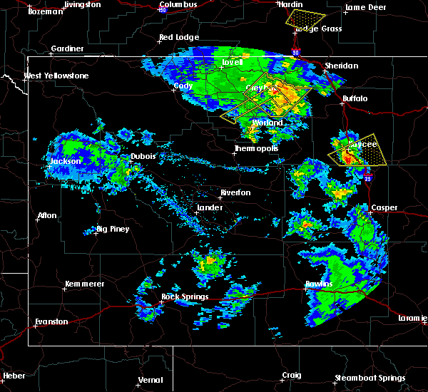 At 523 pm mdt, a severe thunderstorm was located 9 miles east of hole in the wall, which is 9 miles south of kaycee, moving northeast at 20 mph (radar indicated). Hazards include quarter size hail. Damage to vehicles is expected. this severe thunderstorm will remain over mainly rural areas of southeastern johnson county, including the following locations, sussex. This includes interstate 25 between mile markers 235 and 255. At 523 pm mdt, a severe thunderstorm was located 9 miles east of hole in the wall, which is 9 miles south of kaycee, moving northeast at 20 mph (radar indicated). Hazards include quarter size hail. Damage to vehicles is expected. this severe thunderstorm will remain over mainly rural areas of southeastern johnson county, including the following locations, sussex. This includes interstate 25 between mile markers 235 and 255.
|
| 7/8/2019 5:09 PM MDT |
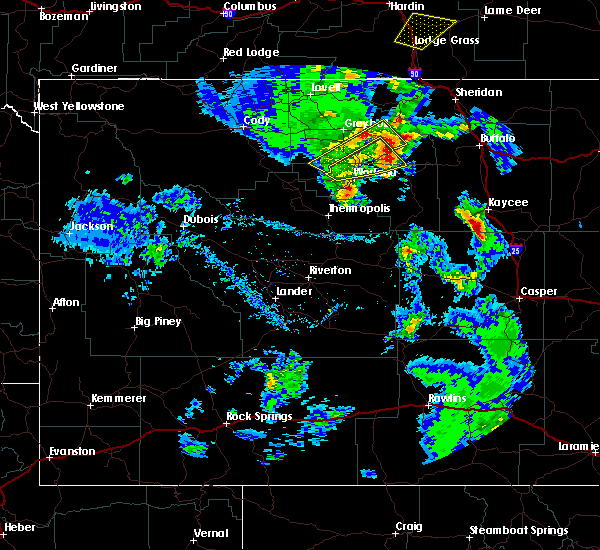 The national weather service in riverton has issued a * severe thunderstorm warning for. southeastern johnson county in north central wyoming. until 600 pm mdt. At 509 pm mdt, a severe thunderstorm was located near hole in the wall, which is 12 miles south of kaycee, moving northeast at 30. The national weather service in riverton has issued a * severe thunderstorm warning for. southeastern johnson county in north central wyoming. until 600 pm mdt. At 509 pm mdt, a severe thunderstorm was located near hole in the wall, which is 12 miles south of kaycee, moving northeast at 30.
|
| 7/4/2019 7:09 PM MDT |
Quarter sized hail reported 17.5 miles W of Kaycee, WY
|
| 7/4/2019 6:46 PM MDT |
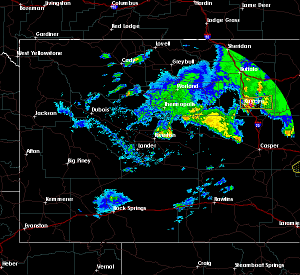 At 646 pm mdt, a severe thunderstorm was located 8 miles east of kaycee, moving east at 35 mph (radar indicated). Hazards include ping pong ball size hail and 60 mph wind gusts. People and animals outdoors will be injured. expect hail damage to roofs, siding, windows, and vehicles. expect wind damage to roofs, siding, and trees. this severe storm will be near, fort reno historical site around 700 pm mdt. other locations impacted by this severe thunderstorm include sussex. This includes interstate 25 between mile markers 248 and 262. At 646 pm mdt, a severe thunderstorm was located 8 miles east of kaycee, moving east at 35 mph (radar indicated). Hazards include ping pong ball size hail and 60 mph wind gusts. People and animals outdoors will be injured. expect hail damage to roofs, siding, windows, and vehicles. expect wind damage to roofs, siding, and trees. this severe storm will be near, fort reno historical site around 700 pm mdt. other locations impacted by this severe thunderstorm include sussex. This includes interstate 25 between mile markers 248 and 262.
|
| 7/4/2019 6:38 PM MDT |
Ping Pong Ball sized hail reported 1 miles W of Kaycee, WY, mostly nickle to quarter sized hail
|
| 7/4/2019 6:31 PM MDT |
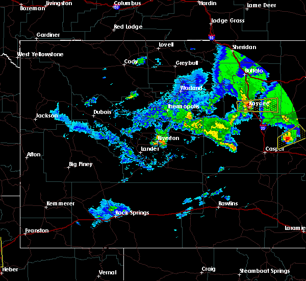 At 630 pm mdt, a severe thunderstorm was located over kaycee, moving east at 35 mph (radar indicated). Hazards include ping pong ball size hail and 60 mph wind gusts. People and animals outdoors will be injured. expect hail damage to roofs, siding, windows, and vehicles. expect wind damage to roofs, siding, and trees. this severe storm will be near, fort reno historical site around 700 pm mdt. other locations impacted by this severe thunderstorm include sussex. This includes interstate 25 between mile markers 248 and 263. At 630 pm mdt, a severe thunderstorm was located over kaycee, moving east at 35 mph (radar indicated). Hazards include ping pong ball size hail and 60 mph wind gusts. People and animals outdoors will be injured. expect hail damage to roofs, siding, windows, and vehicles. expect wind damage to roofs, siding, and trees. this severe storm will be near, fort reno historical site around 700 pm mdt. other locations impacted by this severe thunderstorm include sussex. This includes interstate 25 between mile markers 248 and 263.
|
| 7/4/2019 6:22 PM MDT |
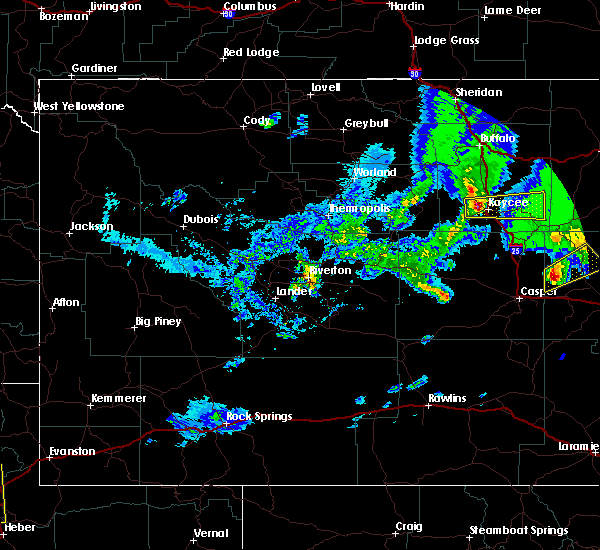 At 621 pm mdt, a severe thunderstorm was located near mayoworth, which is 7 miles west of kaycee, moving east at 35 mph (radar indicated). Hazards include 60 mph wind gusts and quarter size hail. Hail damage to vehicles is expected. expect wind damage to roofs, siding, and trees. this severe thunderstorm will be near, kaycee around 635 pm mdt. fort reno historical site around 700 pm mdt. other locations impacted by this severe thunderstorm include sussex. This includes interstate 25 between mile markers 248 and 263. At 621 pm mdt, a severe thunderstorm was located near mayoworth, which is 7 miles west of kaycee, moving east at 35 mph (radar indicated). Hazards include 60 mph wind gusts and quarter size hail. Hail damage to vehicles is expected. expect wind damage to roofs, siding, and trees. this severe thunderstorm will be near, kaycee around 635 pm mdt. fort reno historical site around 700 pm mdt. other locations impacted by this severe thunderstorm include sussex. This includes interstate 25 between mile markers 248 and 263.
|
| 7/4/2019 4:15 PM MDT |
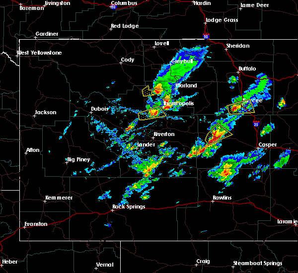 At 415 pm mdt, a severe thunderstorm was located near hole in the wall, which is 10 miles southwest of kaycee, moving east at 15 mph (radar indicated). Hazards include quarter size hail. Damage to vehicles is expected. this severe thunderstorm will be near, kaycee around 455 pm mdt. other locations impacted by this severe thunderstorm include barnum. This includes interstate 25 between mile markers 239 and 258. At 415 pm mdt, a severe thunderstorm was located near hole in the wall, which is 10 miles southwest of kaycee, moving east at 15 mph (radar indicated). Hazards include quarter size hail. Damage to vehicles is expected. this severe thunderstorm will be near, kaycee around 455 pm mdt. other locations impacted by this severe thunderstorm include barnum. This includes interstate 25 between mile markers 239 and 258.
|
| 7/4/2019 3:49 PM MDT |
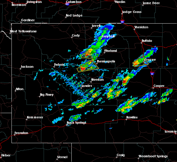 At 349 pm mdt, a severe thunderstorm was located 8 miles northwest of hole in the wall, which is 12 miles west of kaycee, moving northeast at 25 mph (radar indicated). Hazards include 60 mph wind gusts and quarter size hail. Hail damage to vehicles is expected. expect wind damage to roofs, siding, and trees. this severe storm will be near, kaycee around 415 pm mdt. other locations impacted by this severe thunderstorm include barnum. This includes interstate 25 between mile markers 245 and 262. At 349 pm mdt, a severe thunderstorm was located 8 miles northwest of hole in the wall, which is 12 miles west of kaycee, moving northeast at 25 mph (radar indicated). Hazards include 60 mph wind gusts and quarter size hail. Hail damage to vehicles is expected. expect wind damage to roofs, siding, and trees. this severe storm will be near, kaycee around 415 pm mdt. other locations impacted by this severe thunderstorm include barnum. This includes interstate 25 between mile markers 245 and 262.
|
| 7/4/2019 3:33 PM MDT |
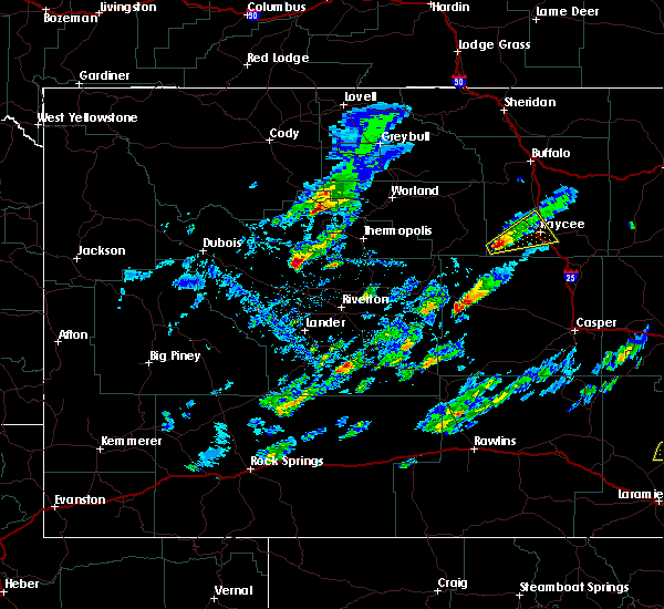 At 332 pm mdt, a severe thunderstorm was located 8 miles northwest of hole in the wall, which is 14 miles west of kaycee, moving northeast at 20 mph (radar indicated). Hazards include 60 mph wind gusts and quarter size hail. Hail damage to vehicles is expected. expect wind damage to roofs, siding, and trees. this severe thunderstorm will be near, kaycee around 415 pm mdt. other locations impacted by this severe thunderstorm include barnum. This includes interstate 25 between mile markers 245 and 262. At 332 pm mdt, a severe thunderstorm was located 8 miles northwest of hole in the wall, which is 14 miles west of kaycee, moving northeast at 20 mph (radar indicated). Hazards include 60 mph wind gusts and quarter size hail. Hail damage to vehicles is expected. expect wind damage to roofs, siding, and trees. this severe thunderstorm will be near, kaycee around 415 pm mdt. other locations impacted by this severe thunderstorm include barnum. This includes interstate 25 between mile markers 245 and 262.
|
| 7/3/2019 8:11 PM MDT |
Golf Ball sized hail reported 17.5 miles W of Kaycee, WY
|
| 7/3/2019 7:58 PM MDT |
Golf Ball sized hail reported 15 miles W of Kaycee, WY
|
| 7/3/2019 7:53 PM MDT |
Quarter sized hail reported 7 miles W of Kaycee, WY
|
| 7/3/2019 7:25 PM MDT |
Quarter sized hail reported 1 miles W of Kaycee, WY
|
| 7/3/2019 7:13 PM MDT |
Quarter sized hail reported 1 miles W of Kaycee, WY
|
| 7/3/2019 7:09 PM MDT |
Quarter sized hail reported 0 miles E of Kaycee, WY
|
| 7/3/2019 7:06 PM MDT |
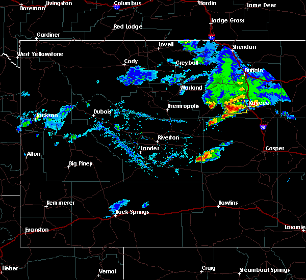 At 703 pm mdt, a severe thunderstorm was located near kaycee, moving northeast at 25 mph (there have been reports from the public of hail one inch to half dollar sized). Hazards include 60 mph wind gusts and half dollar size hail. Hail damage to vehicles is expected. expect wind damage to roofs, siding, and trees. this severe thunderstorm will be near, fort reno historical site around 730 pm mdt. This includes interstate 25 between mile markers 254 and 261. At 703 pm mdt, a severe thunderstorm was located near kaycee, moving northeast at 25 mph (there have been reports from the public of hail one inch to half dollar sized). Hazards include 60 mph wind gusts and half dollar size hail. Hail damage to vehicles is expected. expect wind damage to roofs, siding, and trees. this severe thunderstorm will be near, fort reno historical site around 730 pm mdt. This includes interstate 25 between mile markers 254 and 261.
|
| 7/3/2019 6:57 PM MDT |
Quarter sized hail reported 0 miles E of Kaycee, WY, multiple reports of hail at least 1 inch with one report of half dollar sized.
|
|
|
| 7/1/2019 3:50 PM MDT |
 At 349 pm mdt, a severe thunderstorm was located near hole in the wall, which is 9 miles southwest of kaycee, moving southeast at 35 mph (radar indicated). Hazards include 60 mph wind gusts and quarter size hail. Hail damage to vehicles is expected. expect wind damage to roofs, siding, and trees. this severe thunderstorm will be near, midwest and edgerton around 430 pm mdt. other locations impacted by this severe thunderstorm include barnum. This includes interstate 25 between mile markers 215 and 257. At 349 pm mdt, a severe thunderstorm was located near hole in the wall, which is 9 miles southwest of kaycee, moving southeast at 35 mph (radar indicated). Hazards include 60 mph wind gusts and quarter size hail. Hail damage to vehicles is expected. expect wind damage to roofs, siding, and trees. this severe thunderstorm will be near, midwest and edgerton around 430 pm mdt. other locations impacted by this severe thunderstorm include barnum. This includes interstate 25 between mile markers 215 and 257.
|
| 7/26/2018 6:40 PM MDT |
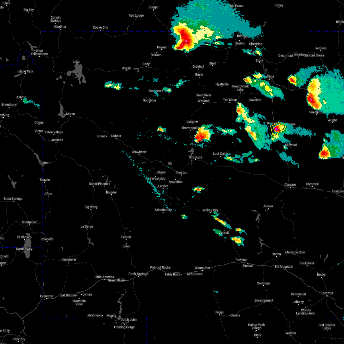 At 640 pm mdt, a severe thunderstorm was located near kaycee, moving southeast at 25 mph (trained weather spotters. ping pong size hail was reported on the east side of kaycee). Hazards include ping pong ball size hail. People and animals outdoors will be injured. expect damage to roofs, siding, windows, and vehicles. this severe thunderstorm will remain over mainly rural areas of south central johnson county. This includes interstate 25 between mile markers 244 and 253. At 640 pm mdt, a severe thunderstorm was located near kaycee, moving southeast at 25 mph (trained weather spotters. ping pong size hail was reported on the east side of kaycee). Hazards include ping pong ball size hail. People and animals outdoors will be injured. expect damage to roofs, siding, windows, and vehicles. this severe thunderstorm will remain over mainly rural areas of south central johnson county. This includes interstate 25 between mile markers 244 and 253.
|
| 7/26/2018 6:35 PM MDT |
Ping Pong Ball sized hail reported 1 miles W of Kaycee, WY, a trained spotter reported reported up to ping pong ball size hail just east of kaycee.
|
| 7/26/2018 6:28 PM MDT |
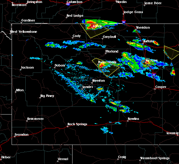 At 628 pm mdt, a severe thunderstorm was located over kaycee, moving southeast at 35 mph (radar indicated). Hazards include half dollar size hail. Damage to vehicles is expected. this severe thunderstorm will remain over mainly rural areas of south central johnson county. This includes interstate 25 between mile markers 244 and 261. At 628 pm mdt, a severe thunderstorm was located over kaycee, moving southeast at 35 mph (radar indicated). Hazards include half dollar size hail. Damage to vehicles is expected. this severe thunderstorm will remain over mainly rural areas of south central johnson county. This includes interstate 25 between mile markers 244 and 261.
|
| 7/26/2018 6:06 PM MDT |
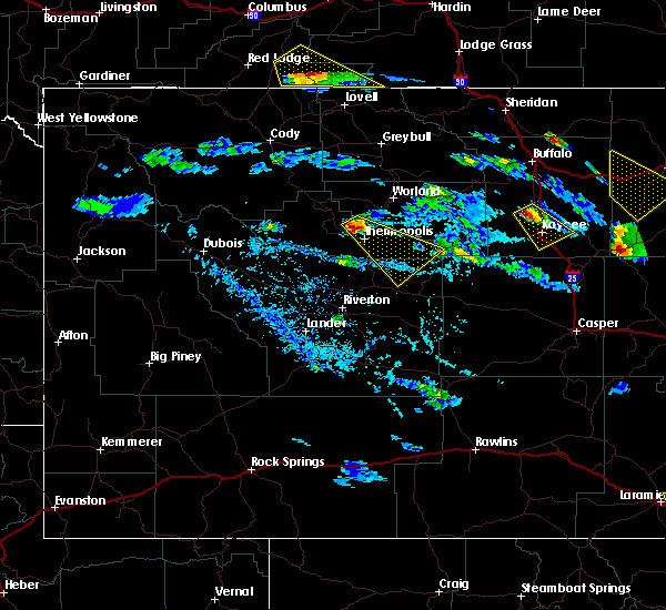 At 605 pm mdt, a severe thunderstorm was located over mayoworth, or 12 miles northwest of kaycee, moving southeast at 25 mph (radar indicated). Hazards include half dollar size hail. Damage to vehicles is expected. this severe thunderstorm will be near, kaycee around 640 pm mdt. This includes interstate 25 between mile markers 245 and 269. At 605 pm mdt, a severe thunderstorm was located over mayoworth, or 12 miles northwest of kaycee, moving southeast at 25 mph (radar indicated). Hazards include half dollar size hail. Damage to vehicles is expected. this severe thunderstorm will be near, kaycee around 640 pm mdt. This includes interstate 25 between mile markers 245 and 269.
|
| 6/8/2018 5:25 PM MDT |
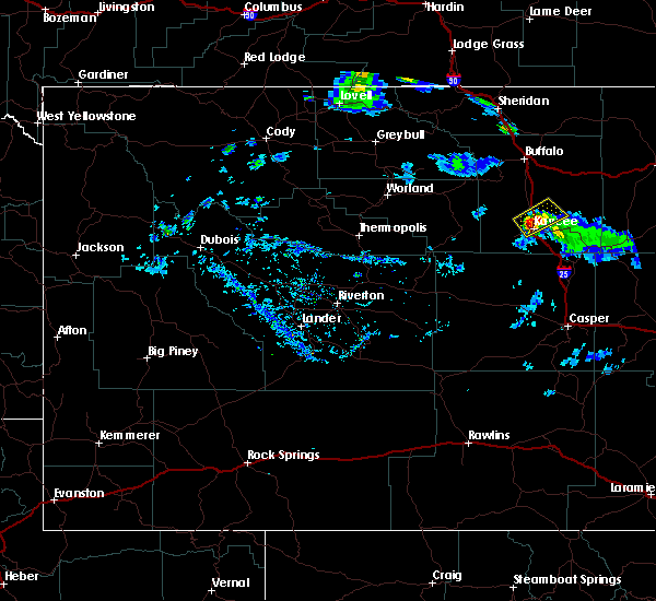 At 524 pm mdt, a severe thunderstorm was located near kaycee, moving northeast at 25 mph (radar indicated). Hazards include 60 mph wind gusts and half dollar size hail. Hail damage to vehicles is expected. expect wind damage to roofs, siding, and trees. this severe thunderstorm will remain over mainly rural areas of south central johnson county. This includes interstate 25 between mile markers 251 and 267. At 524 pm mdt, a severe thunderstorm was located near kaycee, moving northeast at 25 mph (radar indicated). Hazards include 60 mph wind gusts and half dollar size hail. Hail damage to vehicles is expected. expect wind damage to roofs, siding, and trees. this severe thunderstorm will remain over mainly rural areas of south central johnson county. This includes interstate 25 between mile markers 251 and 267.
|
| 5/9/2018 3:29 PM MDT |
Half Dollar sized hail reported 7 miles W of Kaycee, WY, hail slightly larger than a quarter but smaller than a golf ball fell along state highway 192 east of kaycee.
|
| 6/12/2017 7:50 PM MDT |
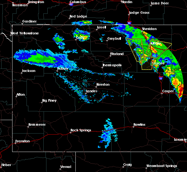 At 749 pm mdt, a severe thunderstorm was located near kaycee, moving north at 45 mph (radar indicated). Hazards include 60 mph wind gusts and half dollar size hail. Hail damage to vehicles is expected. expect wind damage to roofs, siding, and trees. this severe thunderstorm will remain over mainly rural areas of south central johnson county and i25. This includes interstate 25 between mile markers 250 and 272. At 749 pm mdt, a severe thunderstorm was located near kaycee, moving north at 45 mph (radar indicated). Hazards include 60 mph wind gusts and half dollar size hail. Hail damage to vehicles is expected. expect wind damage to roofs, siding, and trees. this severe thunderstorm will remain over mainly rural areas of south central johnson county and i25. This includes interstate 25 between mile markers 250 and 272.
|
| 6/12/2017 7:24 PM MDT |
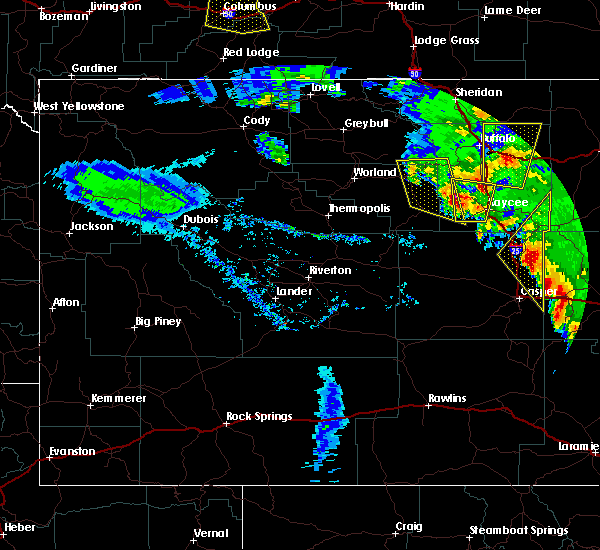 At 722 pm mdt, a severe thunderstorm was located 8 miles southwest of mayoworth, which is 16 miles west of kaycee, moving north at 60 mph (radar indicated). Hazards include two inch hail and 60 mph wind gusts. People and animals outdoors will be injured. expect hail damage to roofs, siding, windows, and vehicles. expect wind damage to roofs, siding, and trees. locations impacted include, areas in the southern bighorn mountains west of barnum and mayoworth. This includes interstate 25 between mile markers 250 and 272. At 722 pm mdt, a severe thunderstorm was located 8 miles southwest of mayoworth, which is 16 miles west of kaycee, moving north at 60 mph (radar indicated). Hazards include two inch hail and 60 mph wind gusts. People and animals outdoors will be injured. expect hail damage to roofs, siding, windows, and vehicles. expect wind damage to roofs, siding, and trees. locations impacted include, areas in the southern bighorn mountains west of barnum and mayoworth. This includes interstate 25 between mile markers 250 and 272.
|
| 6/12/2017 7:07 PM MDT |
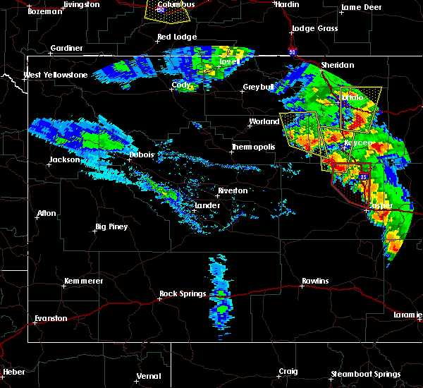 At 707 pm mdt, a severe thunderstorm was located near hole in the wall, which is 17 miles southwest of kaycee, moving north at 35 mph (radar indicated). Hazards include golf ball size hail and 60 mph wind gusts. People and animals outdoors will be injured. expect hail damage to roofs, siding, windows, and vehicles. expect wind damage to roofs, siding, and trees. this severe thunderstorm will be near, hole in the wall around 715 pm mdt. kaycee around 735 pm mdt. mayoworth around 750 pm mdt. other locations impacted by this severe thunderstorm include barnum. This includes interstate 25 between mile markers 245 and 272. At 707 pm mdt, a severe thunderstorm was located near hole in the wall, which is 17 miles southwest of kaycee, moving north at 35 mph (radar indicated). Hazards include golf ball size hail and 60 mph wind gusts. People and animals outdoors will be injured. expect hail damage to roofs, siding, windows, and vehicles. expect wind damage to roofs, siding, and trees. this severe thunderstorm will be near, hole in the wall around 715 pm mdt. kaycee around 735 pm mdt. mayoworth around 750 pm mdt. other locations impacted by this severe thunderstorm include barnum. This includes interstate 25 between mile markers 245 and 272.
|
| 6/12/2017 6:00 PM MDT |
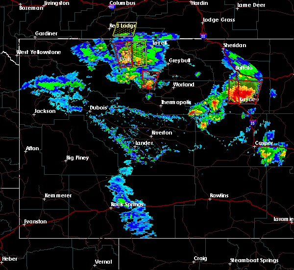 The national weather service in riverton has issued a * tornado warning for. central johnson county in north central wyoming. Until 630 pm mdt * at 559 pm mdt, a likely tornado was located 12 miles west of fort reno historical site, which is 12 miles northeast of kaycee,. The national weather service in riverton has issued a * tornado warning for. central johnson county in north central wyoming. Until 630 pm mdt * at 559 pm mdt, a likely tornado was located 12 miles west of fort reno historical site, which is 12 miles northeast of kaycee,.
|
| 6/12/2017 5:48 PM MDT |
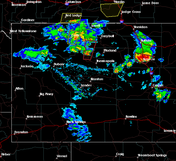 At 547 pm mdt, a confirmed tornado was located near kaycee, moving north at 10 mph. another possible tornado could be north of the road between kaycee and sussex (weather spotters confirmed tornado). Hazards include damaging tornado and tennis ball size hail. Flying debris will be dangerous to those caught without shelter. mobile homes will be damaged or destroyed. damage to roofs, windows, and vehicles will occur. tree damage is likely. this tornado will be near, mayoworth around 555 pm mdt. This includes interstate 25 between mile markers 246 and 270. At 547 pm mdt, a confirmed tornado was located near kaycee, moving north at 10 mph. another possible tornado could be north of the road between kaycee and sussex (weather spotters confirmed tornado). Hazards include damaging tornado and tennis ball size hail. Flying debris will be dangerous to those caught without shelter. mobile homes will be damaged or destroyed. damage to roofs, windows, and vehicles will occur. tree damage is likely. this tornado will be near, mayoworth around 555 pm mdt. This includes interstate 25 between mile markers 246 and 270.
|
| 6/12/2017 5:36 PM MDT |
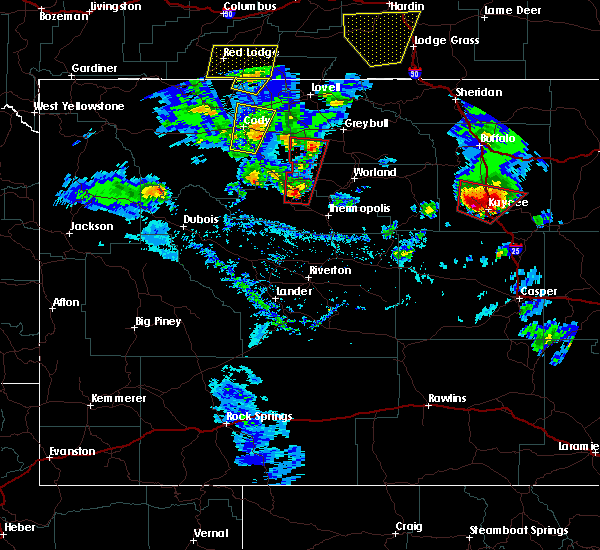 At 535 pm mdt, a severe thunderstorm capable of producing a tornado was located over kaycee, moving north at 45 mph (radar indicated rotation). Hazards include tornado and tennis ball size hail. Flying debris will be dangerous to those caught without shelter. mobile homes will be damaged or destroyed. damage to roofs, windows, and vehicles will occur. tree damage is likely. this dangerous storm will be near, kaycee around 540 pm mdt, mayoworth around 545 pm mdt. This includes interstate 25 between mile markers 245 and 270. At 535 pm mdt, a severe thunderstorm capable of producing a tornado was located over kaycee, moving north at 45 mph (radar indicated rotation). Hazards include tornado and tennis ball size hail. Flying debris will be dangerous to those caught without shelter. mobile homes will be damaged or destroyed. damage to roofs, windows, and vehicles will occur. tree damage is likely. this dangerous storm will be near, kaycee around 540 pm mdt, mayoworth around 545 pm mdt. This includes interstate 25 between mile markers 245 and 270.
|
| 6/12/2017 5:34 PM MDT |
Quarter sized hail reported 0 miles E of Kaycee, WY
|
| 6/12/2017 5:27 PM MDT |
Tennis Ball sized hail reported 5 miles NE of Kaycee, WY, golf ball to tennis ball sized hail.
|
| 6/12/2017 5:23 PM MDT |
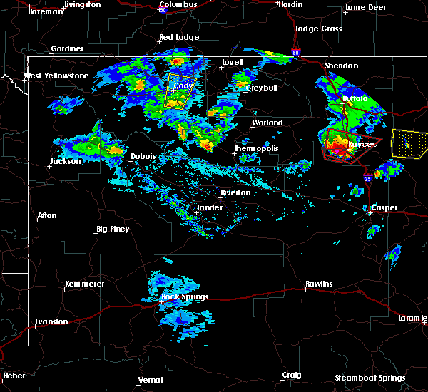 At 522 pm mdt, a severe thunderstorm capable of producing a tornado was located near kaycee, moving northeast at 35 mph (radar indicated rotation). Hazards include tornado and hail up to two inches in diameter. Flying debris will be dangerous to those caught without shelter. mobile homes will be damaged or destroyed. damage to roofs, windows, and vehicles will occur. tree damage is likely. this dangerous storm will be near, kaycee around 535 pm mdt. This includes interstate 25 between mile markers 242 and 270. At 522 pm mdt, a severe thunderstorm capable of producing a tornado was located near kaycee, moving northeast at 35 mph (radar indicated rotation). Hazards include tornado and hail up to two inches in diameter. Flying debris will be dangerous to those caught without shelter. mobile homes will be damaged or destroyed. damage to roofs, windows, and vehicles will occur. tree damage is likely. this dangerous storm will be near, kaycee around 535 pm mdt. This includes interstate 25 between mile markers 242 and 270.
|
| 6/12/2017 5:13 PM MDT |
Ping Pong Ball sized hail reported 14 miles ENE of Kaycee, WY, quarter to golf ball sized hail.
|
| 6/11/2017 10:01 PM MDT |
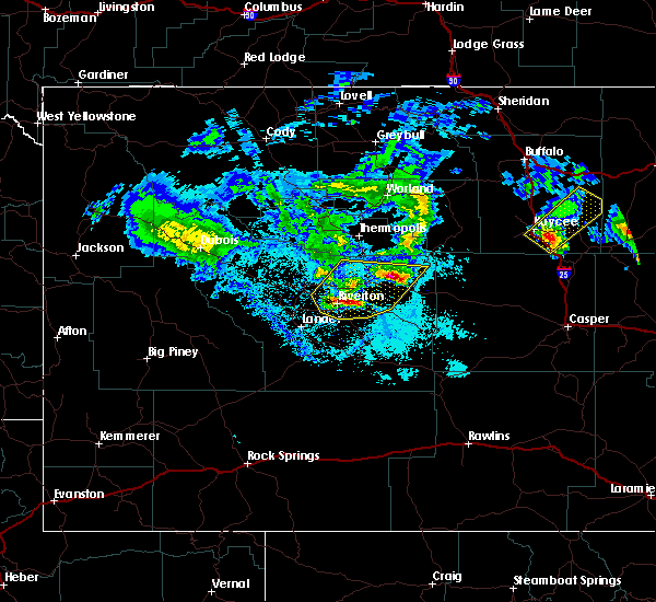 At 1000 pm mdt, a severe thunderstorm was located 9 miles southeast of kaycee, moving northeast at 30 mph (radar indicated). Hazards include quarter size hail. Damage to vehicles is expected. this severe thunderstorm will be near, fort reno historical site around 1040 pm mdt. This includes interstate 25 between mile markers 236 and 255. At 1000 pm mdt, a severe thunderstorm was located 9 miles southeast of kaycee, moving northeast at 30 mph (radar indicated). Hazards include quarter size hail. Damage to vehicles is expected. this severe thunderstorm will be near, fort reno historical site around 1040 pm mdt. This includes interstate 25 between mile markers 236 and 255.
|
| 6/17/2016 8:20 PM MDT |
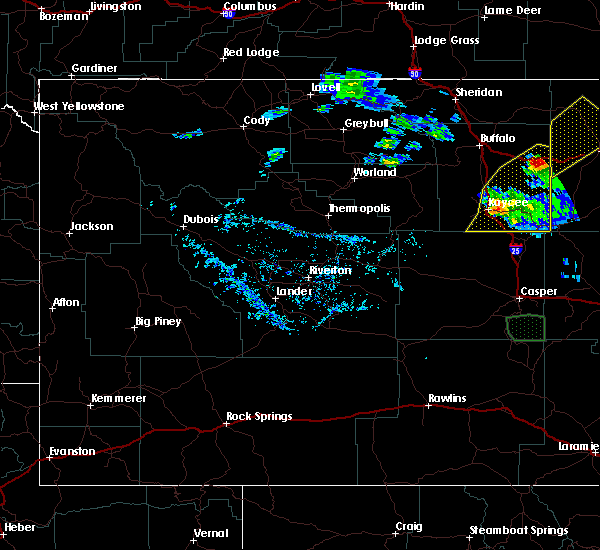 At 818 pm mdt, a severe thunderstorm was located over powder river rest area, which is 31 miles east of buffalo, moving northeast at 35 mph. also, another storm was beginning to intensify near kaycee (radar indicated). Hazards include golf ball size hail and 60 mph wind gusts. People and animals outdoors will be injured. expect hail damage to roofs, siding, windows and vehicles. expect wind damage to roofs, siding and trees. this includes the following highways, interstate 25 between mile markers 236 and 271. Interstate 90 between mile markers 78 and 95. At 818 pm mdt, a severe thunderstorm was located over powder river rest area, which is 31 miles east of buffalo, moving northeast at 35 mph. also, another storm was beginning to intensify near kaycee (radar indicated). Hazards include golf ball size hail and 60 mph wind gusts. People and animals outdoors will be injured. expect hail damage to roofs, siding, windows and vehicles. expect wind damage to roofs, siding and trees. this includes the following highways, interstate 25 between mile markers 236 and 271. Interstate 90 between mile markers 78 and 95.
|
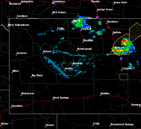
| 6/17/2016 8:02 PM MDT |
 At 758 pm mdt, doppler radar indicated a couple of severe thunderstorms across eastern and southeastern johnson county. one thunderstorm was about 10 miles north of fort reno historical site, which is 25 miles northeast of kaycee. the other severe thunderstorm was near the powder river rest area. the storms were moving east to northeast at around 35 mph (radar indicated). Hazards include golf ball size hail and 60 mph wind gusts. People and animals outdoors will be injured. expect hail damage to roofs, siding, windows and vehicles. expect wind damage to roofs, siding and trees. this severe thunderstorm will remain over mainly rural areas of eastern and southeastern johnson county. this includes the following highways, interstate 25 between mile markers 236 and 271. Interstate 90 between mile markers 78 and 95. At 758 pm mdt, doppler radar indicated a couple of severe thunderstorms across eastern and southeastern johnson county. one thunderstorm was about 10 miles north of fort reno historical site, which is 25 miles northeast of kaycee. the other severe thunderstorm was near the powder river rest area. the storms were moving east to northeast at around 35 mph (radar indicated). Hazards include golf ball size hail and 60 mph wind gusts. People and animals outdoors will be injured. expect hail damage to roofs, siding, windows and vehicles. expect wind damage to roofs, siding and trees. this severe thunderstorm will remain over mainly rural areas of eastern and southeastern johnson county. this includes the following highways, interstate 25 between mile markers 236 and 271. Interstate 90 between mile markers 78 and 95.
|
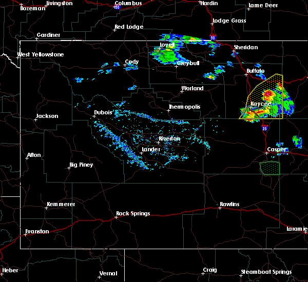
| 6/17/2016 7:50 PM MDT |
 At 747 pm mdt, doppler radar indicated a few severe thunderstorms along and east of interstate 25 and south of interstate 90 across johnson county. the strongest storm was located 8 miles west of linch, which is 14 miles southeast of kaycee, moving east northeast at 25 mph (radar indicated). Hazards include 60 mph wind gusts and quarter size hail. Hail damage to vehicles is expected. expect wind damage to roofs, siding and trees. this severe thunderstorm will be near, linch around 810 pm mdt. this includes the following highways, interstate 25 between mile markers 236 and 271. Interstate 90 between mile markers 78 and 95. At 747 pm mdt, doppler radar indicated a few severe thunderstorms along and east of interstate 25 and south of interstate 90 across johnson county. the strongest storm was located 8 miles west of linch, which is 14 miles southeast of kaycee, moving east northeast at 25 mph (radar indicated). Hazards include 60 mph wind gusts and quarter size hail. Hail damage to vehicles is expected. expect wind damage to roofs, siding and trees. this severe thunderstorm will be near, linch around 810 pm mdt. this includes the following highways, interstate 25 between mile markers 236 and 271. Interstate 90 between mile markers 78 and 95.
|
| 5/24/2016 8:07 PM MDT |
Half Dollar sized hail reported 31.7 miles WSW of Kaycee, WY
|
| 8/17/2015 6:53 PM MDT |
Quarter sized hail reported 15.7 miles NNW of Kaycee, WY, spotter near i-25 reported quarter sized hail.
|
| 8/17/2015 6:35 PM MDT |
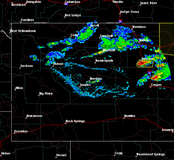 At 635 pm mdt, a severe thunderstorm was located 7 miles northeast of hole in the wall, which is 7 miles south of kaycee, moving southeast at 25 mph (public). Hazards include quarter size hail. Damage to vehicles is expected. this storm will generally remain over areas of southern johnson county near and around lone bear road. a spotter approximately 8 miles west-southwest of kaycee along highway 190 did report hail of dime to quarter size around 625 pm mdt. This includes interstate 25 between mile markers 236 and 256. At 635 pm mdt, a severe thunderstorm was located 7 miles northeast of hole in the wall, which is 7 miles south of kaycee, moving southeast at 25 mph (public). Hazards include quarter size hail. Damage to vehicles is expected. this storm will generally remain over areas of southern johnson county near and around lone bear road. a spotter approximately 8 miles west-southwest of kaycee along highway 190 did report hail of dime to quarter size around 625 pm mdt. This includes interstate 25 between mile markers 236 and 256.
|
| 8/17/2015 6:24 PM MDT |
Quarter sized hail reported 8 miles ENE of Kaycee, WY, spotter reported hail of dime to quarter size.
|
|
|
| 8/17/2015 6:17 PM MDT |
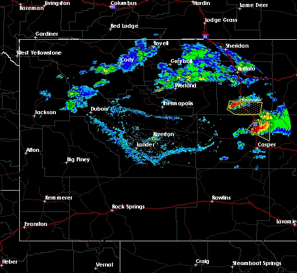 At 616 pm mdt, a severe thunderstorm was located 7 miles west of kaycee, moving east-southeast at 30 mph (radar indicated). Hazards include 60 mph wind gusts and quarter size hail. Hail damage to vehicles is expected. expect wind damage to roofs, siding and trees. this severe thunderstorm will be near, kaycee around 630 pm mdt. This includes interstate 25 between mile markers 236 and 257. At 616 pm mdt, a severe thunderstorm was located 7 miles west of kaycee, moving east-southeast at 30 mph (radar indicated). Hazards include 60 mph wind gusts and quarter size hail. Hail damage to vehicles is expected. expect wind damage to roofs, siding and trees. this severe thunderstorm will be near, kaycee around 630 pm mdt. This includes interstate 25 between mile markers 236 and 257.
|
| 6/3/2015 7:25 PM MDT |
The severe thunderstorm warning for southeastern johnson county will expire at 730 pm mdt, the storm which prompted the warning has weakened below severe limits, and no longer pose an immediate threat to life or property. therefore the warning will be allowed to expire. however small.
|
| 6/3/2015 6:41 PM MDT |
At 640 pm mdt, a severe thunderstorm was located 8 miles southwest of fort reno historical site, which is 13 miles east of kaycee, moving north at 20 mph (radar indicated). Hazards include 60 mph wind gusts and quarter size hail. Hail damage to vehicles is expected. expect wind damage to roofs, siding and trees. this severe thunderstorm will be near, fort reno historical site around 655 pm mdt. other locations impacted by this severe thunderstorm include sussex, kaycee branch library, kaycee elementary school, powder river cabins and kaycee high school. this includes interstate 25 between mile markers 248 and 277. A tornado watch remains in effect until 900 pm mdt for north central wyoming.
|
| 6/2/2015 6:01 PM MDT |
Golf Ball sized hail reported 8.6 miles W of Kaycee, WY
|
| 6/2/2015 6:01 PM MDT |
Ping Pong Ball sized hail reported 0 miles E of Kaycee, WY, reported hail slightly smaller than golf ball. also posted picture to facebook.
|
| 6/2/2015 5:51 PM MDT |
At 551 pm mdt, a severe thunderstorm was located 9 miles east of kaycee, moving east at 20 mph (radar indicated). Hazards include ping pong ball size hail and 60 mph wind gusts. People and animals outdoors will be injured. expect hail damage to roofs, siding, windows and vehicles. expect wind damage to roofs, siding and trees. this severe thunderstorm will be near, linch and fort reno historical site around 625 pm mdt. other locations impacted by this severe thunderstorm include sussex, kaycee branch library, kaycee elementary school, powder river cabins and kaycee high school. This includes interstate 25 between mile markers 244 and 260.
|
| 6/2/2015 5:50 PM MDT |
Quarter sized hail reported 12 miles W of Kaycee, WY
|
| 6/2/2015 5:50 PM MDT |
Ping Pong Ball sized hail reported 2.6 miles ENE of Kaycee, WY
|
| 9/7/2014 2:46 PM MDT |
59 mph winds measured at the poker creek raws site at 6...440 feet ms in johnson county WY, 20.4 miles ENE of Kaycee, WY
|
| 6/10/2014 4:35 PM MDT |
Golf Ball sized hail reported 14 miles W of Kaycee, WY
|
| 6/10/2014 4:33 PM MDT |
Golf Ball sized hail reported 17.5 miles W of Kaycee, WY
|
| 6/10/2014 4:32 PM MDT |
Quarter sized hail reported 12 miles W of Kaycee, WY
|
| 5/26/2013 8:33 PM MDT |
Quarter sized hail reported 3.6 miles SSW of Kaycee, WY, hail sizes vary from nickel to quarter
|
| 5/26/2013 7:25 PM MDT |
Quarter sized hail reported 3.6 miles SSW of Kaycee, WY
|
| 1/1/0001 12:00 AM |
Quarter sized hail reported 23.1 miles WNW of Kaycee, WY
|
 The storm which prompted the warning has weakened below severe limits, and no longer poses an immediate threat to life or property. therefore, the warning will be allowed to expire. however, gusty winds are still possible with this thunderstorm.
 At 554 pm mdt, a severe thunderstorm was located near fort reno historical site, which is 18 miles northeast of kaycee, moving southeast at 30 mph (radar indicated). Hazards include 60 mph wind gusts. Expect damage to roofs, siding, and trees. locations impacted include, kaycee, fort reno historical site, and sussex. This includes interstate 25 between mile markers 250 and 267.
 Svrriw the national weather service in riverton has issued a * severe thunderstorm warning for, southeastern johnson county in north central wyoming, * until 615 pm mdt. * at 524 pm mdt, a severe thunderstorm was located 16 miles northwest of fort reno historical site, which is 24 miles northeast of kaycee, moving south at 30 mph (radar indicated). Hazards include 60 mph wind gusts. expect damage to roofs, siding, and trees
 At 149 pm mdt, a severe thunderstorm was located near kaycee, moving southeast at 30 mph (radar indicated). Hazards include golf ball size hail and 60 mph wind gusts. People and animals outdoors will be injured. expect hail damage to roofs, siding, windows, and vehicles. expect wind damage to roofs, siding, and trees. this severe thunderstorm will remain over mainly rural areas of southeastern johnson county. this includes interstate 25 between mile markers 246 and 270. thunderstorm damage threat, considerable hail threat, radar indicated max hail size, 1. 75 in wind threat, radar indicated max wind gust, 60 mph.
 At 139 pm mdt, a severe thunderstorm was located 9 miles north of kaycee, moving southeast at 30 mph (radar indicated). Hazards include 60 mph wind gusts and half dollar size hail. Hail damage to vehicles is expected. expect wind damage to roofs, siding, and trees. this severe thunderstorm will be near, kaycee around 155 pm mdt. this includes interstate 25 between mile markers 246 and 277. hail threat, radar indicated max hail size, 1. 25 in wind threat, radar indicated max wind gust, 60 mph.
 At 755 pm mdt, severe thunderstorms were located along a line extending from 13 miles southwest of kaycee to near hole in the wall to near red wall, moving east at 35 mph (radar indicated). Hazards include 70 mph wind gusts and quarter size hail. Hail damage to vehicles is expected. expect considerable tree damage. wind damage is also likely to mobile homes, roofs, and outbuildings. these severe thunderstorms will remain over mainly rural areas of north central natrona and south central johnson counties, including the following locations, barnum. this includes interstate 25 between mile markers 227 and 254. thunderstorm damage threat, considerable hail threat, radar indicated max hail size, 1. 00 in wind threat, radar indicated max wind gust, 70 mph.
 At 733 pm mdt, severe thunderstorms were located along a line extending from 11 miles west of mayoworth to 11 miles northwest of hole in the wall to 8 miles northwest of red wall, moving east at 50 mph (radar indicated). Hazards include 70 mph wind gusts and ping pong ball size hail. People and animals outdoors will be injured. expect hail damage to roofs, siding, windows, and vehicles. expect considerable tree damage. wind damage is also likely to mobile homes, roofs, and outbuildings. severe thunderstorms will be near, mayoworth around 745 pm mdt. hole in the wall around 750 pm mdt. other locations in the path of these severe thunderstorms include kaycee. this includes interstate 25 between mile markers 227 and 270. thunderstorm damage threat, considerable hail threat, radar indicated max hail size, 1. 50 in wind threat, radar indicated max wind gust, 70 mph.
 At 253 pm mdt, a severe thunderstorm was located 7 miles northeast of kaycee, moving northeast at 30 mph (radar indicated). Hazards include golf ball size hail and 60 mph wind gusts. People and animals outdoors will be injured. expect hail damage to roofs, siding, windows, and vehicles. expect wind damage to roofs, siding, and trees. locations impacted include, kaycee, mayoworth and fort reno historical site. This includes interstate 25 between mile markers 249 and 271.
 At 241 pm mdt, a severe thunderstorm was located over kaycee, moving northeast at 30 mph (radar indicated). Hazards include 60 mph wind gusts and half dollar size hail. Hail damage to vehicles is expected. Expect wind damage to roofs, siding, and trees.
 At 211 pm mdt, a severe thunderstorm was located 10 miles northwest of hole in the wall, which is also 13 miles west of kaycee, moving northeast at 20 mph (radar indicated). Hazards include ping pong ball size hail and 60 mph wind gusts. People and animals outdoors will be injured. expect hail damage to roofs, siding, windows, and vehicles. Expect wind damage to roofs, siding, and trees.
 At 426 pm mdt, a severe thunderstorm was located south of kaycee, moving north at 20 mph (radar indicated). Hazards include 60 mph wind gusts and quarter size hail. Hail damage to vehicles is expected. expect wind damage to roofs, siding, and trees. this severe thunderstorm will be near, kaycee around 435 pm mdt. this includes interstate 25 between mile markers 245 and 271. hail threat, radar indicated max hail size, 1. 00 in wind threat, radar indicated max wind gust, 60 mph.
 At 357 pm mdt, a severe thunderstorm was located near kaycee, moving east at 30 mph (public. at 350 pm public reported 1 inch hail near barnum). Hazards include 60 mph wind gusts and quarter size hail. Hail damage to vehicles is expected. expect wind damage to roofs, siding, and trees. locations impacted include, kaycee, barnum and sussex. this includes interstate 25 between mile markers 242 and 259. hail threat, observed max hail size, 1. 00 in wind threat, radar indicated max wind gust, 60 mph.
 At 343 pm mdt, a severe thunderstorm was located near barnum, or 10 miles southwest of kaycee, moving east at 30 mph (radar indicated). Hazards include 60 mph wind gusts and quarter size hail. Hail damage to vehicles is expected. Expect wind damage to roofs, siding, and trees.
 At 456 pm mdt, a severe thunderstorm was located 10 miles northeast of kaycee, moving northeast at 25 mph (radar indicated). Hazards include 60 mph wind gusts and quarter size hail. Hail damage to vehicles is expected. expect wind damage to roofs, siding, and trees. this severe thunderstorm will be near, fort reno historical site around 520 pm mdt. This includes interstate 25 between mile markers 245 and 258.
 The severe thunderstorm warning for southern johnson county will expire at 515 pm mdt, the storm which prompted the warning has weakened below severe limits, and no longer poses an immediate threat to life or property. therefore, the warning will be allowed to expire. however gusty winds are still possible with this thunderstorm. remember, a severe thunderstorm warning still remains in effect for southeast johnson and northeast natrona counties.
 At 455 pm mdt, a severe thunderstorm was located 13 miles east of mayoworth, which is 14 miles north of kaycee, moving northeast at 55 mph (radar indicated). Hazards include 60 mph wind gusts. Expect damage to roofs, siding, and trees. this severe storm will be near, powder river rest area around 525 pm mdt. other locations impacted by this severe thunderstorm include barnum. this includes the following highways, interstate 25 between mile markers 246 and 273. Interstate 90 between mile markers 80 and 88.
 At 434 pm mdt, a severe thunderstorm was located 7 miles southwest of mayoworth, which is 11 miles west of kaycee, moving northeast at 50 mph (radar indicated). Hazards include 60 mph wind gusts and penny size hail. Expect damage to roofs, siding, and trees. this severe thunderstorm will be near, mayoworth around 440 pm mdt. kaycee around 445 pm mdt. other locations impacted by this severe thunderstorm include barnum. this includes the following highways, interstate 25 between mile markers 246 and 277. Interstate 90 between mile markers 79 and 88.
 At 434 pm mdt, severe thunderstorms were located along a line extending from 7 miles southeast of cloud peak to near pine tree junction, moving northeast at 65 mph (radar indicated). Hazards include 60 to 65 mph wind gusts. Expect damage to roofs, siding, and trees. these severe thunderstorms will remain over mainly rural areas of johnson county, including the following locations, sussex and lost cabin campground. this includes the following highways, interstate 25 between mile markers 241 and 292. interstate 90 between mile markers 69 and 95. Time, mot, loc 2234z 245deg 154kt 4429 10709 4360 10575.
 At 421 pm mdt, severe thunderstorms were located along a line extending from near red wall to 6 miles northeast of evansville, moving northeast at 65 mph (radar indicated. at 412pm mdt, 76 mph was reported near tisdale). Hazards include 70 mph wind gusts. Expect considerable tree damage. damage is likely to mobile homes, roofs, and outbuildings. locations impacted include, kaycee, midwest, mayoworth, edgerton, linch, hole in the wall, teapot rock, fort reno historical site, red wall, barnum and sussex. This includes interstate 25 between mile markers 207 and 268.
 At 401 pm mdt, severe thunderstorms were located along a line extending from 10 miles south of red wall to near beartrap meadows county park, moving northeast at 65 mph (radar indicated). Hazards include 70 mph wind gusts. Expect considerable tree damage. damage is likely to mobile homes, roofs, and outbuildings. locations impacted include, kaycee, midwest, mayoworth, edgerton, linch, hole in the wall, teapot rock, fort reno historical site, red wall, barnum and sussex. This includes interstate 25 between mile markers 207 and 268.
 At 352 pm mdt, severe thunderstorms were located along a line extending from 12 miles south of red wall to beartrap meadows county park, moving northeast at 65 mph (radar indicated). Hazards include 60 mph wind gusts. expect damage to roofs, siding, and trees
 The severe thunderstorm warning for hot springs, southern johnson and washakie counties will expire at 300 am mdt, the storms which prompted the warning have weakened. therefore, the warning will be allowed to expire.
 At 234 am mdt, doppler radar indicated scattered showers across hot springs, southern johnson and washakie counties (radar indicated). Hazards include 60 mph wind gusts. Expect damage to roofs, siding, and trees. These showers are capable of producing wind gusts of 50 to 65 mph with little or no notice.
 At 142 am mdt, weak showers with damaging winds were located along a line extending from near anchor dam to near midwest, moving north at 45 mph (radar indicated. at 1235 am, the casper airport measured a wind gust of 60 mph. at 125 am, the riverton airport measured a 59 mph wind gust). Hazards include 60 mph wind gusts. Expect damage to roofs, siding, and trees. severe thunderstorms will be near, midwest and edgerton around 150 am mdt. hamilton dome around 200 am mdt. linch and legend rock state petroglyph site around 205 am mdt. fort reno historical site around 225 am mdt. other locations impacted by these severe thunderstorms include badlands overlook, hot springs county airport, hot springs county fairgrounds, grass creek, leigh creek campground, wigwam fish rearing station, washakie county fairgrounds, sussex, lost cabin campground and barnum. This includes interstate 25 between mile markers 220 and 285.
 At 523 pm mdt, a severe thunderstorm was located 9 miles east of hole in the wall, which is 9 miles south of kaycee, moving northeast at 20 mph (radar indicated). Hazards include quarter size hail. Damage to vehicles is expected. this severe thunderstorm will remain over mainly rural areas of southeastern johnson county, including the following locations, sussex. This includes interstate 25 between mile markers 235 and 255.
 The national weather service in riverton has issued a * severe thunderstorm warning for. southeastern johnson county in north central wyoming. until 600 pm mdt. At 509 pm mdt, a severe thunderstorm was located near hole in the wall, which is 12 miles south of kaycee, moving northeast at 30.
 At 646 pm mdt, a severe thunderstorm was located 8 miles east of kaycee, moving east at 35 mph (radar indicated). Hazards include ping pong ball size hail and 60 mph wind gusts. People and animals outdoors will be injured. expect hail damage to roofs, siding, windows, and vehicles. expect wind damage to roofs, siding, and trees. this severe storm will be near, fort reno historical site around 700 pm mdt. other locations impacted by this severe thunderstorm include sussex. This includes interstate 25 between mile markers 248 and 262.
 At 630 pm mdt, a severe thunderstorm was located over kaycee, moving east at 35 mph (radar indicated). Hazards include ping pong ball size hail and 60 mph wind gusts. People and animals outdoors will be injured. expect hail damage to roofs, siding, windows, and vehicles. expect wind damage to roofs, siding, and trees. this severe storm will be near, fort reno historical site around 700 pm mdt. other locations impacted by this severe thunderstorm include sussex. This includes interstate 25 between mile markers 248 and 263.
 At 621 pm mdt, a severe thunderstorm was located near mayoworth, which is 7 miles west of kaycee, moving east at 35 mph (radar indicated). Hazards include 60 mph wind gusts and quarter size hail. Hail damage to vehicles is expected. expect wind damage to roofs, siding, and trees. this severe thunderstorm will be near, kaycee around 635 pm mdt. fort reno historical site around 700 pm mdt. other locations impacted by this severe thunderstorm include sussex. This includes interstate 25 between mile markers 248 and 263.
 At 415 pm mdt, a severe thunderstorm was located near hole in the wall, which is 10 miles southwest of kaycee, moving east at 15 mph (radar indicated). Hazards include quarter size hail. Damage to vehicles is expected. this severe thunderstorm will be near, kaycee around 455 pm mdt. other locations impacted by this severe thunderstorm include barnum. This includes interstate 25 between mile markers 239 and 258.
 At 349 pm mdt, a severe thunderstorm was located 8 miles northwest of hole in the wall, which is 12 miles west of kaycee, moving northeast at 25 mph (radar indicated). Hazards include 60 mph wind gusts and quarter size hail. Hail damage to vehicles is expected. expect wind damage to roofs, siding, and trees. this severe storm will be near, kaycee around 415 pm mdt. other locations impacted by this severe thunderstorm include barnum. This includes interstate 25 between mile markers 245 and 262.
 At 332 pm mdt, a severe thunderstorm was located 8 miles northwest of hole in the wall, which is 14 miles west of kaycee, moving northeast at 20 mph (radar indicated). Hazards include 60 mph wind gusts and quarter size hail. Hail damage to vehicles is expected. expect wind damage to roofs, siding, and trees. this severe thunderstorm will be near, kaycee around 415 pm mdt. other locations impacted by this severe thunderstorm include barnum. This includes interstate 25 between mile markers 245 and 262.
 At 703 pm mdt, a severe thunderstorm was located near kaycee, moving northeast at 25 mph (there have been reports from the public of hail one inch to half dollar sized). Hazards include 60 mph wind gusts and half dollar size hail. Hail damage to vehicles is expected. expect wind damage to roofs, siding, and trees. this severe thunderstorm will be near, fort reno historical site around 730 pm mdt. This includes interstate 25 between mile markers 254 and 261.
 At 349 pm mdt, a severe thunderstorm was located near hole in the wall, which is 9 miles southwest of kaycee, moving southeast at 35 mph (radar indicated). Hazards include 60 mph wind gusts and quarter size hail. Hail damage to vehicles is expected. expect wind damage to roofs, siding, and trees. this severe thunderstorm will be near, midwest and edgerton around 430 pm mdt. other locations impacted by this severe thunderstorm include barnum. This includes interstate 25 between mile markers 215 and 257.
 At 640 pm mdt, a severe thunderstorm was located near kaycee, moving southeast at 25 mph (trained weather spotters. ping pong size hail was reported on the east side of kaycee). Hazards include ping pong ball size hail. People and animals outdoors will be injured. expect damage to roofs, siding, windows, and vehicles. this severe thunderstorm will remain over mainly rural areas of south central johnson county. This includes interstate 25 between mile markers 244 and 253.
 At 628 pm mdt, a severe thunderstorm was located over kaycee, moving southeast at 35 mph (radar indicated). Hazards include half dollar size hail. Damage to vehicles is expected. this severe thunderstorm will remain over mainly rural areas of south central johnson county. This includes interstate 25 between mile markers 244 and 261.
 At 605 pm mdt, a severe thunderstorm was located over mayoworth, or 12 miles northwest of kaycee, moving southeast at 25 mph (radar indicated). Hazards include half dollar size hail. Damage to vehicles is expected. this severe thunderstorm will be near, kaycee around 640 pm mdt. This includes interstate 25 between mile markers 245 and 269.
 At 524 pm mdt, a severe thunderstorm was located near kaycee, moving northeast at 25 mph (radar indicated). Hazards include 60 mph wind gusts and half dollar size hail. Hail damage to vehicles is expected. expect wind damage to roofs, siding, and trees. this severe thunderstorm will remain over mainly rural areas of south central johnson county. This includes interstate 25 between mile markers 251 and 267.
 At 749 pm mdt, a severe thunderstorm was located near kaycee, moving north at 45 mph (radar indicated). Hazards include 60 mph wind gusts and half dollar size hail. Hail damage to vehicles is expected. expect wind damage to roofs, siding, and trees. this severe thunderstorm will remain over mainly rural areas of south central johnson county and i25. This includes interstate 25 between mile markers 250 and 272.
 At 722 pm mdt, a severe thunderstorm was located 8 miles southwest of mayoworth, which is 16 miles west of kaycee, moving north at 60 mph (radar indicated). Hazards include two inch hail and 60 mph wind gusts. People and animals outdoors will be injured. expect hail damage to roofs, siding, windows, and vehicles. expect wind damage to roofs, siding, and trees. locations impacted include, areas in the southern bighorn mountains west of barnum and mayoworth. This includes interstate 25 between mile markers 250 and 272.
 At 707 pm mdt, a severe thunderstorm was located near hole in the wall, which is 17 miles southwest of kaycee, moving north at 35 mph (radar indicated). Hazards include golf ball size hail and 60 mph wind gusts. People and animals outdoors will be injured. expect hail damage to roofs, siding, windows, and vehicles. expect wind damage to roofs, siding, and trees. this severe thunderstorm will be near, hole in the wall around 715 pm mdt. kaycee around 735 pm mdt. mayoworth around 750 pm mdt. other locations impacted by this severe thunderstorm include barnum. This includes interstate 25 between mile markers 245 and 272.
 The national weather service in riverton has issued a * tornado warning for. central johnson county in north central wyoming. Until 630 pm mdt * at 559 pm mdt, a likely tornado was located 12 miles west of fort reno historical site, which is 12 miles northeast of kaycee,.
 At 547 pm mdt, a confirmed tornado was located near kaycee, moving north at 10 mph. another possible tornado could be north of the road between kaycee and sussex (weather spotters confirmed tornado). Hazards include damaging tornado and tennis ball size hail. Flying debris will be dangerous to those caught without shelter. mobile homes will be damaged or destroyed. damage to roofs, windows, and vehicles will occur. tree damage is likely. this tornado will be near, mayoworth around 555 pm mdt. This includes interstate 25 between mile markers 246 and 270.
 At 535 pm mdt, a severe thunderstorm capable of producing a tornado was located over kaycee, moving north at 45 mph (radar indicated rotation). Hazards include tornado and tennis ball size hail. Flying debris will be dangerous to those caught without shelter. mobile homes will be damaged or destroyed. damage to roofs, windows, and vehicles will occur. tree damage is likely. this dangerous storm will be near, kaycee around 540 pm mdt, mayoworth around 545 pm mdt. This includes interstate 25 between mile markers 245 and 270.
 At 522 pm mdt, a severe thunderstorm capable of producing a tornado was located near kaycee, moving northeast at 35 mph (radar indicated rotation). Hazards include tornado and hail up to two inches in diameter. Flying debris will be dangerous to those caught without shelter. mobile homes will be damaged or destroyed. damage to roofs, windows, and vehicles will occur. tree damage is likely. this dangerous storm will be near, kaycee around 535 pm mdt. This includes interstate 25 between mile markers 242 and 270.
 At 1000 pm mdt, a severe thunderstorm was located 9 miles southeast of kaycee, moving northeast at 30 mph (radar indicated). Hazards include quarter size hail. Damage to vehicles is expected. this severe thunderstorm will be near, fort reno historical site around 1040 pm mdt. This includes interstate 25 between mile markers 236 and 255.
 At 818 pm mdt, a severe thunderstorm was located over powder river rest area, which is 31 miles east of buffalo, moving northeast at 35 mph. also, another storm was beginning to intensify near kaycee (radar indicated). Hazards include golf ball size hail and 60 mph wind gusts. People and animals outdoors will be injured. expect hail damage to roofs, siding, windows and vehicles. expect wind damage to roofs, siding and trees. this includes the following highways, interstate 25 between mile markers 236 and 271. Interstate 90 between mile markers 78 and 95.
 At 758 pm mdt, doppler radar indicated a couple of severe thunderstorms across eastern and southeastern johnson county. one thunderstorm was about 10 miles north of fort reno historical site, which is 25 miles northeast of kaycee. the other severe thunderstorm was near the powder river rest area. the storms were moving east to northeast at around 35 mph (radar indicated). Hazards include golf ball size hail and 60 mph wind gusts. People and animals outdoors will be injured. expect hail damage to roofs, siding, windows and vehicles. expect wind damage to roofs, siding and trees. this severe thunderstorm will remain over mainly rural areas of eastern and southeastern johnson county. this includes the following highways, interstate 25 between mile markers 236 and 271. Interstate 90 between mile markers 78 and 95.
 At 747 pm mdt, doppler radar indicated a few severe thunderstorms along and east of interstate 25 and south of interstate 90 across johnson county. the strongest storm was located 8 miles west of linch, which is 14 miles southeast of kaycee, moving east northeast at 25 mph (radar indicated). Hazards include 60 mph wind gusts and quarter size hail. Hail damage to vehicles is expected. expect wind damage to roofs, siding and trees. this severe thunderstorm will be near, linch around 810 pm mdt. this includes the following highways, interstate 25 between mile markers 236 and 271. Interstate 90 between mile markers 78 and 95.
 At 635 pm mdt, a severe thunderstorm was located 7 miles northeast of hole in the wall, which is 7 miles south of kaycee, moving southeast at 25 mph (public). Hazards include quarter size hail. Damage to vehicles is expected. this storm will generally remain over areas of southern johnson county near and around lone bear road. a spotter approximately 8 miles west-southwest of kaycee along highway 190 did report hail of dime to quarter size around 625 pm mdt. This includes interstate 25 between mile markers 236 and 256.
 At 616 pm mdt, a severe thunderstorm was located 7 miles west of kaycee, moving east-southeast at 30 mph (radar indicated). Hazards include 60 mph wind gusts and quarter size hail. Hail damage to vehicles is expected. expect wind damage to roofs, siding and trees. this severe thunderstorm will be near, kaycee around 630 pm mdt. This includes interstate 25 between mile markers 236 and 257.


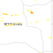




Connect with Interactive Hail Maps