| 9/25/2024 5:15 PM PDT |
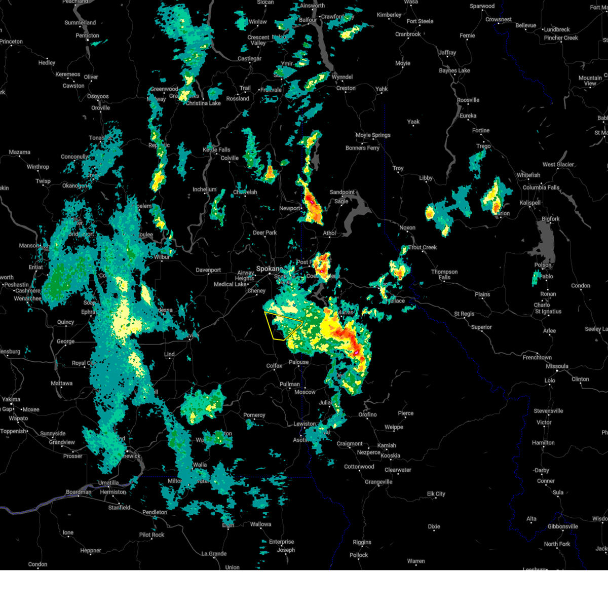 the severe thunderstorm warning has been cancelled and is no longer in effect the severe thunderstorm warning has been cancelled and is no longer in effect
|
| 9/25/2024 4:59 PM PDT |
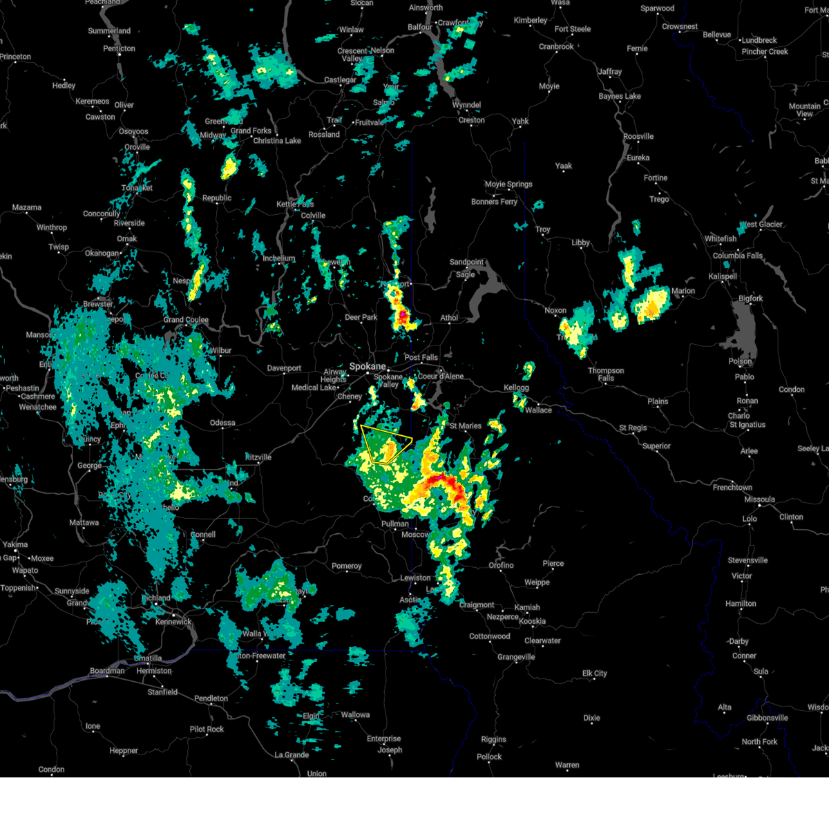 At 458 pm pdt, a severe thunderstorm was located 14 miles north of colfax, or 26 miles north of pullman, moving north at 20 mph (radar indicated). Hazards include 60 mph wind gusts. Expect damage to roofs, siding, and trees. locations impacted include, tekoa, rosalia, oakesdale, latah, and plaza. this includes u. s. Highway 195 in washington between mile markers 57 and 72. At 458 pm pdt, a severe thunderstorm was located 14 miles north of colfax, or 26 miles north of pullman, moving north at 20 mph (radar indicated). Hazards include 60 mph wind gusts. Expect damage to roofs, siding, and trees. locations impacted include, tekoa, rosalia, oakesdale, latah, and plaza. this includes u. s. Highway 195 in washington between mile markers 57 and 72.
|
| 9/25/2024 4:39 PM PDT |
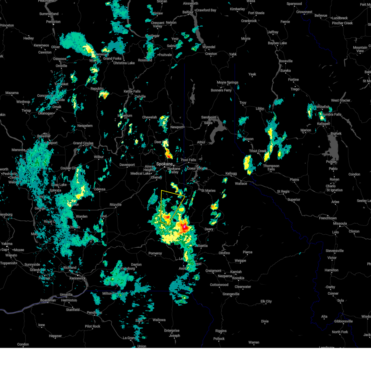 Svrotx the national weather service in spokane has issued a * severe thunderstorm warning for, northeastern whitman county in eastern washington, southeastern spokane county in northeastern washington, * until 615 pm pdt. * at 438 pm pdt, a severe thunderstorm was located 7 miles north of colfax, or 20 miles northwest of pullman, moving north at 20 mph (radar indicated). Hazards include 60 mph wind gusts. areas of blowing dust producing brief visibility below a quarter of a mile. expect damage to roofs, siding, and trees Svrotx the national weather service in spokane has issued a * severe thunderstorm warning for, northeastern whitman county in eastern washington, southeastern spokane county in northeastern washington, * until 615 pm pdt. * at 438 pm pdt, a severe thunderstorm was located 7 miles north of colfax, or 20 miles northwest of pullman, moving north at 20 mph (radar indicated). Hazards include 60 mph wind gusts. areas of blowing dust producing brief visibility below a quarter of a mile. expect damage to roofs, siding, and trees
|
| 9/25/2024 4:27 PM PDT |
 At 426 pm pdt, a severe thunderstorm was located near nine mile falls, or 9 miles north of spokane, and is nearly stationary (radar indicated). Hazards include 70 mph wind gusts and penny size hail. Expect considerable tree damage. damage is likely to mobile homes, roofs, and outbuildings. locations impacted include, moscow, st. maries, troy, potlatch, deary, bovill, parkline, garfield, oakesdale, onaway, farmington, tensed, emida, princeton, belmont, sanders, joel, santa, harvard, and helmer. this includes u. s. Highway 95 in idaho between mile markers 332 and 389. At 426 pm pdt, a severe thunderstorm was located near nine mile falls, or 9 miles north of spokane, and is nearly stationary (radar indicated). Hazards include 70 mph wind gusts and penny size hail. Expect considerable tree damage. damage is likely to mobile homes, roofs, and outbuildings. locations impacted include, moscow, st. maries, troy, potlatch, deary, bovill, parkline, garfield, oakesdale, onaway, farmington, tensed, emida, princeton, belmont, sanders, joel, santa, harvard, and helmer. this includes u. s. Highway 95 in idaho between mile markers 332 and 389.
|
| 9/25/2024 4:17 PM PDT |
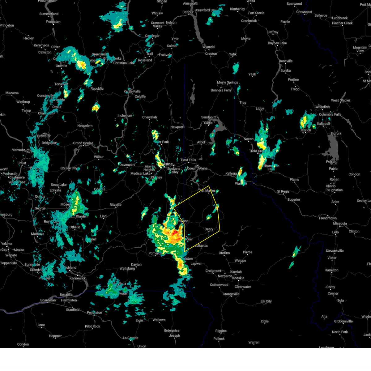
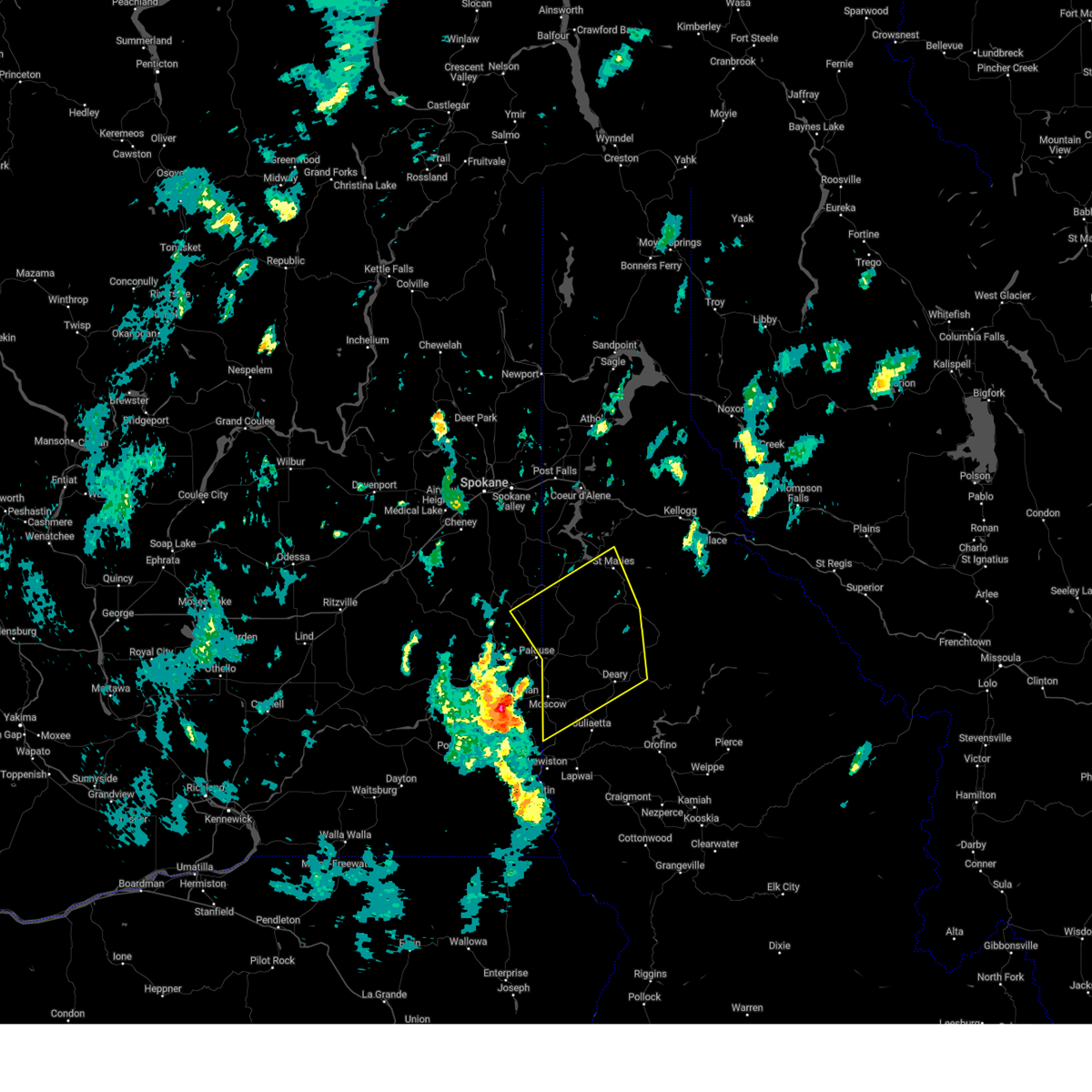 Svrotx the national weather service in spokane has issued a * severe thunderstorm warning for, latah county in the panhandle of idaho, northwestern nez perce county in north central idaho, benewah county in the panhandle of idaho, southern kootenai county in the panhandle of idaho, eastern whitman county in eastern washington, * until 515 pm pdt. * at 416 pm pdt, a severe thunderstorm was located over pullman, moving northeast at 45 mph (radar indicated). Hazards include 60 mph wind gusts and penny size hail. areas of blowing dust is also likely reducing visibility to 1/4 mile at times. expect damage to roofs, siding, and trees Svrotx the national weather service in spokane has issued a * severe thunderstorm warning for, latah county in the panhandle of idaho, northwestern nez perce county in north central idaho, benewah county in the panhandle of idaho, southern kootenai county in the panhandle of idaho, eastern whitman county in eastern washington, * until 515 pm pdt. * at 416 pm pdt, a severe thunderstorm was located over pullman, moving northeast at 45 mph (radar indicated). Hazards include 60 mph wind gusts and penny size hail. areas of blowing dust is also likely reducing visibility to 1/4 mile at times. expect damage to roofs, siding, and trees
|
| 8/11/2022 4:45 PM PDT |
Winds breaking tree branches. hail the size of dime in whitman county WA, 0.1 miles WNW of Oakesdale, WA
|
| 8/11/2022 4:38 PM PDT |
Downed power lines and power outages just west of oakesdale. time estimated from rada in whitman county WA, 0.4 miles E of Oakesdale, WA
|
| 8/11/2022 4:34 PM PDT |
 At 433 pm pdt, a severe thunderstorm was located 17 miles north of colfax, or 27 miles north of pullman, moving northeast at 45 mph (radar indicated). Hazards include quarter size hail. damage to vehicles is expected At 433 pm pdt, a severe thunderstorm was located 17 miles north of colfax, or 27 miles north of pullman, moving northeast at 45 mph (radar indicated). Hazards include quarter size hail. damage to vehicles is expected
|
| 8/11/2022 4:34 PM PDT |
 At 433 pm pdt, a severe thunderstorm was located 17 miles north of colfax, or 27 miles north of pullman, moving northeast at 45 mph (radar indicated). Hazards include quarter size hail. damage to vehicles is expected At 433 pm pdt, a severe thunderstorm was located 17 miles north of colfax, or 27 miles north of pullman, moving northeast at 45 mph (radar indicated). Hazards include quarter size hail. damage to vehicles is expected
|
| 8/11/2022 4:08 PM PDT |
 At 408 pm pdt, a severe thunderstorm was located near colfax, or 13 miles north of pullman, moving northeast at 40 mph (radar indicated). Hazards include 60 mph wind gusts and quarter size hail. Hail damage to vehicles is expected. expect wind damage to roofs, siding, and trees. locations impacted include, colfax, garfield, albion, oakesdale, farmington and belmont. hail threat, radar indicated max hail size, 1. 00 in wind threat, radar indicated max wind gust, 60 mph. At 408 pm pdt, a severe thunderstorm was located near colfax, or 13 miles north of pullman, moving northeast at 40 mph (radar indicated). Hazards include 60 mph wind gusts and quarter size hail. Hail damage to vehicles is expected. expect wind damage to roofs, siding, and trees. locations impacted include, colfax, garfield, albion, oakesdale, farmington and belmont. hail threat, radar indicated max hail size, 1. 00 in wind threat, radar indicated max wind gust, 60 mph.
|
| 8/11/2022 3:54 PM PDT |
 At 354 pm pdt, a severe thunderstorm was located near colfax, or 10 miles northwest of pullman, moving northeast at 40 mph (radar indicated). Hazards include 60 mph wind gusts and quarter size hail. Hail damage to vehicles is expected. Expect wind damage to roofs, siding, and trees. At 354 pm pdt, a severe thunderstorm was located near colfax, or 10 miles northwest of pullman, moving northeast at 40 mph (radar indicated). Hazards include 60 mph wind gusts and quarter size hail. Hail damage to vehicles is expected. Expect wind damage to roofs, siding, and trees.
|
| 7/13/2022 12:04 AM PDT |
 At 1204 am pdt, a severe thunderstorm was located 13 miles north of colfax, or 26 miles northwest of pullman, moving northeast at 50 mph (radar indicated). Hazards include quarter size hail. Damage to vehicles is expected. locations impacted include, rosalia, st. john, oakesdale, malden, thornton and pine city. hail threat, radar indicated max hail size, 1. 00 in wind threat, radar indicated max wind gust, <50 mph. At 1204 am pdt, a severe thunderstorm was located 13 miles north of colfax, or 26 miles northwest of pullman, moving northeast at 50 mph (radar indicated). Hazards include quarter size hail. Damage to vehicles is expected. locations impacted include, rosalia, st. john, oakesdale, malden, thornton and pine city. hail threat, radar indicated max hail size, 1. 00 in wind threat, radar indicated max wind gust, <50 mph.
|
| 7/12/2022 11:44 PM PDT |
 At 1144 pm pdt, a severe thunderstorm was located 17 miles west of colfax, or 30 miles northwest of pullman, moving northeast at 45 mph (radar indicated). Hazards include quarter size hail. damage to vehicles is expected At 1144 pm pdt, a severe thunderstorm was located 17 miles west of colfax, or 30 miles northwest of pullman, moving northeast at 45 mph (radar indicated). Hazards include quarter size hail. damage to vehicles is expected
|
| 7/3/2022 1:15 PM PDT |
Quarter sized hail reported 3.9 miles NE of Oakesdale, WA
|
| 6/5/2022 5:56 PM PDT |
 The severe thunderstorm warning for west central benewah, northeastern whitman and southeastern spokane counties will expire at 600 pm pdt, the storm which prompted the warning has weakened below severe limits, and no longer poses an immediate threat to life or property. therefore, the warning will be allowed to expire. however heavy rain is still possible with this thunderstorm. The severe thunderstorm warning for west central benewah, northeastern whitman and southeastern spokane counties will expire at 600 pm pdt, the storm which prompted the warning has weakened below severe limits, and no longer poses an immediate threat to life or property. therefore, the warning will be allowed to expire. however heavy rain is still possible with this thunderstorm.
|
| 6/5/2022 5:56 PM PDT |
 The severe thunderstorm warning for west central benewah, northeastern whitman and southeastern spokane counties will expire at 600 pm pdt, the storm which prompted the warning has weakened below severe limits, and no longer poses an immediate threat to life or property. therefore, the warning will be allowed to expire. however heavy rain is still possible with this thunderstorm. The severe thunderstorm warning for west central benewah, northeastern whitman and southeastern spokane counties will expire at 600 pm pdt, the storm which prompted the warning has weakened below severe limits, and no longer poses an immediate threat to life or property. therefore, the warning will be allowed to expire. however heavy rain is still possible with this thunderstorm.
|
| 6/5/2022 5:32 PM PDT |
 At 531 pm pdt, a severe thunderstorm was located 19 miles north of colfax, or 28 miles north of pullman, moving northeast at 20 mph (radar indicated). Hazards include quarter size hail. damage to vehicles is expected At 531 pm pdt, a severe thunderstorm was located 19 miles north of colfax, or 28 miles north of pullman, moving northeast at 20 mph (radar indicated). Hazards include quarter size hail. damage to vehicles is expected
|
| 6/5/2022 5:32 PM PDT |
 At 531 pm pdt, a severe thunderstorm was located 19 miles north of colfax, or 28 miles north of pullman, moving northeast at 20 mph (radar indicated). Hazards include quarter size hail. damage to vehicles is expected At 531 pm pdt, a severe thunderstorm was located 19 miles north of colfax, or 28 miles north of pullman, moving northeast at 20 mph (radar indicated). Hazards include quarter size hail. damage to vehicles is expected
|
| 6/5/2022 5:29 PM PDT |
Quarter sized hail reported 0.4 miles E of Oakesdale, WA, report from mping: quarter (1.00 in.).
|
| 7/10/2015 4:00 PM PDT |
Picture of downed tree on twitter. time estimate in whitman county WA, 0.4 miles E of Oakesdale, WA
|
 the severe thunderstorm warning has been cancelled and is no longer in effect
 At 458 pm pdt, a severe thunderstorm was located 14 miles north of colfax, or 26 miles north of pullman, moving north at 20 mph (radar indicated). Hazards include 60 mph wind gusts. Expect damage to roofs, siding, and trees. locations impacted include, tekoa, rosalia, oakesdale, latah, and plaza. this includes u. s. Highway 195 in washington between mile markers 57 and 72.
 Svrotx the national weather service in spokane has issued a * severe thunderstorm warning for, northeastern whitman county in eastern washington, southeastern spokane county in northeastern washington, * until 615 pm pdt. * at 438 pm pdt, a severe thunderstorm was located 7 miles north of colfax, or 20 miles northwest of pullman, moving north at 20 mph (radar indicated). Hazards include 60 mph wind gusts. areas of blowing dust producing brief visibility below a quarter of a mile. expect damage to roofs, siding, and trees
 At 426 pm pdt, a severe thunderstorm was located near nine mile falls, or 9 miles north of spokane, and is nearly stationary (radar indicated). Hazards include 70 mph wind gusts and penny size hail. Expect considerable tree damage. damage is likely to mobile homes, roofs, and outbuildings. locations impacted include, moscow, st. maries, troy, potlatch, deary, bovill, parkline, garfield, oakesdale, onaway, farmington, tensed, emida, princeton, belmont, sanders, joel, santa, harvard, and helmer. this includes u. s. Highway 95 in idaho between mile markers 332 and 389.
 Svrotx the national weather service in spokane has issued a * severe thunderstorm warning for, latah county in the panhandle of idaho, northwestern nez perce county in north central idaho, benewah county in the panhandle of idaho, southern kootenai county in the panhandle of idaho, eastern whitman county in eastern washington, * until 515 pm pdt. * at 416 pm pdt, a severe thunderstorm was located over pullman, moving northeast at 45 mph (radar indicated). Hazards include 60 mph wind gusts and penny size hail. areas of blowing dust is also likely reducing visibility to 1/4 mile at times. expect damage to roofs, siding, and trees
 At 433 pm pdt, a severe thunderstorm was located 17 miles north of colfax, or 27 miles north of pullman, moving northeast at 45 mph (radar indicated). Hazards include quarter size hail. damage to vehicles is expected
 At 433 pm pdt, a severe thunderstorm was located 17 miles north of colfax, or 27 miles north of pullman, moving northeast at 45 mph (radar indicated). Hazards include quarter size hail. damage to vehicles is expected
 At 408 pm pdt, a severe thunderstorm was located near colfax, or 13 miles north of pullman, moving northeast at 40 mph (radar indicated). Hazards include 60 mph wind gusts and quarter size hail. Hail damage to vehicles is expected. expect wind damage to roofs, siding, and trees. locations impacted include, colfax, garfield, albion, oakesdale, farmington and belmont. hail threat, radar indicated max hail size, 1. 00 in wind threat, radar indicated max wind gust, 60 mph.
 At 354 pm pdt, a severe thunderstorm was located near colfax, or 10 miles northwest of pullman, moving northeast at 40 mph (radar indicated). Hazards include 60 mph wind gusts and quarter size hail. Hail damage to vehicles is expected. Expect wind damage to roofs, siding, and trees.
 At 1204 am pdt, a severe thunderstorm was located 13 miles north of colfax, or 26 miles northwest of pullman, moving northeast at 50 mph (radar indicated). Hazards include quarter size hail. Damage to vehicles is expected. locations impacted include, rosalia, st. john, oakesdale, malden, thornton and pine city. hail threat, radar indicated max hail size, 1. 00 in wind threat, radar indicated max wind gust, <50 mph.
 At 1144 pm pdt, a severe thunderstorm was located 17 miles west of colfax, or 30 miles northwest of pullman, moving northeast at 45 mph (radar indicated). Hazards include quarter size hail. damage to vehicles is expected
 The severe thunderstorm warning for west central benewah, northeastern whitman and southeastern spokane counties will expire at 600 pm pdt, the storm which prompted the warning has weakened below severe limits, and no longer poses an immediate threat to life or property. therefore, the warning will be allowed to expire. however heavy rain is still possible with this thunderstorm.
 The severe thunderstorm warning for west central benewah, northeastern whitman and southeastern spokane counties will expire at 600 pm pdt, the storm which prompted the warning has weakened below severe limits, and no longer poses an immediate threat to life or property. therefore, the warning will be allowed to expire. however heavy rain is still possible with this thunderstorm.
 At 531 pm pdt, a severe thunderstorm was located 19 miles north of colfax, or 28 miles north of pullman, moving northeast at 20 mph (radar indicated). Hazards include quarter size hail. damage to vehicles is expected
 At 531 pm pdt, a severe thunderstorm was located 19 miles north of colfax, or 28 miles north of pullman, moving northeast at 20 mph (radar indicated). Hazards include quarter size hail. damage to vehicles is expected


Connect with Interactive Hail Maps