

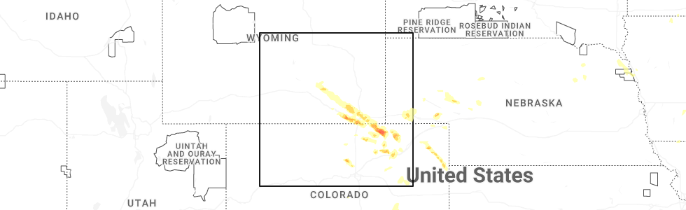
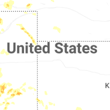
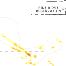
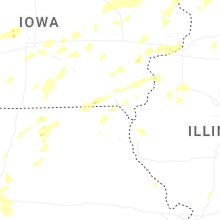
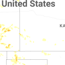
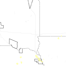
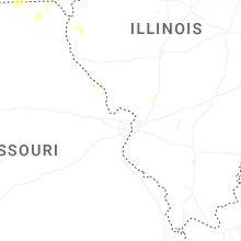
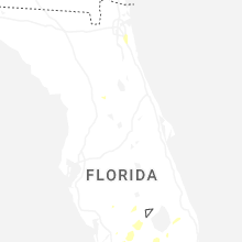
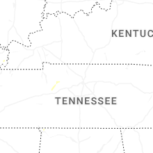
Hail Map for Friday, July 11, 2025
Number of Impacted Households on 7/11/2025
0
Impacted by 1" or Larger Hail
0
Impacted by 1.75" or Larger Hail
0
Impacted by 2.5" or Larger Hail
Square Miles of Populated Area Impacted on 7/11/2025
0
Impacted by 1" or Larger Hail
0
Impacted by 1.75" or Larger Hail
0
Impacted by 2.5" or Larger Hail


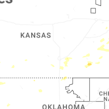
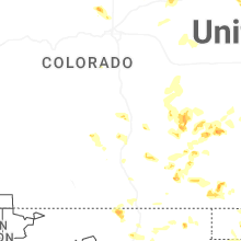

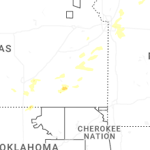

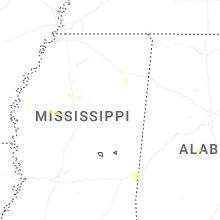

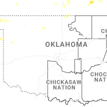
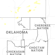
Cities Most Affected by Hail Storms of 7/11/2025
| Hail Size | Demographics of Zip Codes Affected | ||||||
|---|---|---|---|---|---|---|---|
| City | Count | Average | Largest | Pop Density | House Value | Income | Age |
| Grover, CO | 2 | 2.00 | 2.00 | 0 | $74k | $22.7k | 47.9 |
| Augusta, KS | 1 | 1.75 | 1.75 | 132 | $84k | $46.3k | 38.4 |
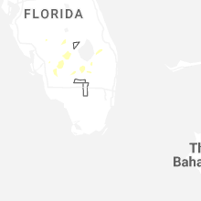
Hail and Wind Damage Spotted on 7/11/2025
Filter by Report Type:Hail ReportsWind Reports
States Impacted
Florida, North Carolina, Minnesota, Alabama, Missouri, Iowa, West Virginia, Wisconsin, Georgia, New Hampshire, South Carolina, Illinois, Wyoming, Massachusetts, Kansas, Virginia, Maryland, Colorado, Texas, New MexicoFlorida
| Local Time | Report Details |
|---|---|
| 1:52 PM EDT | Leon county em reported a transformer down with a line on fire (2 yards on fire) on vassar r in leon county FL, 5.5 miles NE of Tallahassee, FL |
| 2:14 PM EDT | Mping report of power lines torn off power pole in jefferson county FL, 22.1 miles E of Tallahassee, FL |
| 2:15 PM EDT | Mping report of trees uproote in jefferson county FL, 22.7 miles E of Tallahassee, FL |
| 2:22 PM EDT | Florida highway patrol reported a down tree on i-10 eb lamont near mm22 in jefferson county FL, 27 miles E of Tallahassee, FL |
| 3:30 PM EDT | A thunderstorm wind gust of 63 mph/55 knots was recorded at sfwmd site lz40 lake okeechobee center. winds gusted between 50 and 62 mph between 3:15 pm and 4 p in amz610 county FL, 36.8 miles SW of Port Saint Lucie, FL |
| 3:45 PM EDT | Quarter sized hail reported near Labelle, FL, 45.7 miles NNE of Naples, FL, hail of dime to quarter coin size reported around 3 miles south of la belle on sr 29. |
| 7:42 PM CDT | Tree down on power lines on mathews roa in walton county FL, 43 miles NNE of Miramar Beach, FL |
| 7:42 PM CDT | Tree down across the roadway at 1893 mathews roa in walton county FL, 43.6 miles NNE of Miramar Beach, FL |
North Carolina
| Local Time | Report Details |
|---|---|
| 3:20 PM EDT | Two trees down blocking the roadwa in buncombe county NC, 46.9 miles N of Greenville, SC |
| 4:07 PM EDT | Tree down on little river roa in henderson county NC, 31.4 miles NNE of Greenville, SC |
| 4:50 PM EDT | Tree down near gilkey school road and us 22 in rutherford county NC, 54.7 miles NE of Greenville, SC |
| 4:50 PM EDT | Several large trees down from summers road to burke memorial park road to ramblewoods driv in burke county NC, 57.2 miles NW of Charlotte, NC |
| 4:55 PM EDT | Tree down near rock road and oak springs roa in rutherford county NC, 55.7 miles NE of Greenville, SC |
| 5:00 PM EDT | Tree down near indian trail and whitesides roa in rutherford county NC, 54.5 miles NE of Greenville, SC |
| 5:05 PM EDT | Tree down near plantation drive and coxe roa in rutherford county NC, 47.4 miles NE of Greenville, SC |
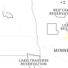
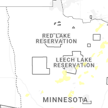
Minnesota
| Local Time | Report Details |
|---|---|
| 2:27 PM CDT | Report of a 5 to 6 foot section of a dock pulled out of the water and some smaller approximately 3 foot in diameter tree branches down from trees due to strong thunders in cass county MN, 76.8 miles SSE of Bemidji, MN |
Alabama
| Local Time | Report Details |
|---|---|
| 2:42 PM CDT | Photo of a large tree limb down on vehicle. time estimated from rada in madison county AL, 67.4 miles E of Florence, AL |
| 3:41 PM CDT | At the lee county farmers market...large sections of metal roofing and trusses blown around. large tree branches dow in lee county AL, 21.4 miles E of Auburn, AL |
| 3:45 PM CDT | Reports of wind damage in the smiths station area involving large limbs... a few trees... and power poles/lines. time of occurrence is a couple minutes either side of 3 in lee county AL, 21.5 miles E of Auburn, AL |
| 5:04 PM CDT | Report of a tree down on county road 6 in lauderdale county. time estimated based on rada in lauderdale county AL, 9.9 miles NW of Florence, AL |
| 5:18 PM CDT | Report of a tree and powerline down on highway 72 in lauderdale county. time estimated based on rada in lauderdale county AL, 10.3 miles ENE of Florence, AL |
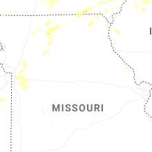
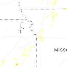
Missouri
| Local Time | Report Details |
|---|---|
| 3:08 PM CDT | Downed tree limbs at a residence. time and location estimated based on social media report and rada in putnam county MO, 78.6 miles W of Kahoka, MO |
| 4:51 PM CDT | Private weather senso in adair county MO, 56.8 miles WSW of Kahoka, MO |
| 6:07 PM CDT | A pivot irrigation system was tipped over. time estimated by rada in mississippi county MO, 48.9 miles SSE of Cape Girardeau, MO |
| 6:36 PM CDT | Social media report. carport and vehicle damaged and multiple trees downed at a residence northeast of kearney. time estimated from rada in clay county MO, 25.2 miles NE of Kansas City, MO |
| 6:36 PM CDT | Downed wires near county line road. time estimated from rada in clinton county MO, 32.3 miles NE of Kansas City, MO |
| 6:38 PM CDT | Downed wires near 228th street. time estimated from rada in ray county MO, 34.9 miles NE of Kansas City, MO |
| 6:38 PM CDT | Social media report of limbs down east of kearney. time and location estimated based on rada in clay county MO, 23.5 miles NE of Kansas City, MO |
| 6:41 PM CDT | Multiple social media reports of downed trees and limbs east of kearney and north of excelsior springs. strong winds also reported in the orrick and wood heights area in clay county MO, 26 miles NE of Kansas City, MO |
| 6:45 PM CDT | Tree limbs dow in ray county MO, 28.5 miles NE of Kansas City, MO |
| 6:45 PM CDT | Quarter sized hail reported near Lawson, MO, 29.1 miles NE of Kansas City, MO, time confirmed from radar. |
| 6:48 PM CDT | Storm damage reported in ray county MO, 28.5 miles NE of Kansas City, MO |
| 7:00 PM CDT | Downed wires near schack creek road. time estimated from rada in ray county MO, 24.4 miles ENE of Kansas City, MO |
| 7:13 PM CDT | Three inch tree branches dow in jackson county MO, 13.8 miles ESE of Kansas City, MO |
| 7:13 PM CDT | Social media report of a downed tree at a residence near highland avenue. time estimated from rada in jackson county MO, 9.2 miles S of Kansas City, MO |
| 7:16 PM CDT | Several social media reports of trees and limbs down in independence. time estimated from rada in jackson county MO, 8.8 miles E of Kansas City, MO |
| 7:16 PM CDT | Downed tree limbs and wires near lentz road. time estimated from rada in jackson county MO, 15 miles ENE of Kansas City, MO |
| 7:29 PM CDT | Multiple social media reports of trees down... including in the vicinity of 55th street. time estimated from rada in jackson county MO, 14.5 miles ESE of Kansas City, MO |
| 7:29 PM CDT | Mping report of tree limbs down near ashford court. tmie estimated from rada in jackson county MO, 15 miles ESE of Kansas City, MO |
| 7:32 PM CDT | Social media report of minor damage and downed limbs at a property in buckner. time estimated from rada in jackson county MO, 20.7 miles E of Kansas City, MO |
| 7:35 PM CDT | Social media report of trees down at a residence. time estimated from rada in jackson county MO, 18.1 miles ESE of Kansas City, MO |
| 7:35 PM CDT | Downed tree limbs and damage to the roof of a building. time estimated from rada in jackson county MO, 17.8 miles ESE of Kansas City, MO |
| 7:40 PM CDT | Downed tree limbs on the road in richmond. power is out in town. time estimated from rada in ray county MO, 35.1 miles ENE of Kansas City, MO |
| 7:43 PM CDT | Multiple reports of tree limbs and wires down in the henrietta area. time estimated from rada in ray county MO, 36.8 miles ENE of Kansas City, MO |
| 7:43 PM CDT | Downed wires near route t. time estimated from rada in ray county MO, 33.6 miles ENE of Kansas City, MO |
| 7:45 PM CDT | Three inch branches dow in jackson county MO, 18.7 miles ESE of Kansas City, MO |
| 7:45 PM CDT | Private weather senso in jackson county MO, 14.5 miles ESE of Kansas City, MO |
| 7:46 PM CDT | Mping report of tree limbs down on the south side of blue springs. time confirmed from rada in jackson county MO, 18.1 miles ESE of Kansas City, MO |
| 7:46 PM CDT | Downed tree limbs and wires near route bb. time estimated from rada in jackson county MO, 20.8 miles E of Kansas City, MO |
| 7:53 PM CDT | Downed tree limbs and wires near pryor road. time estimated from rada in ray county MO, 34.1 miles ENE of Kansas City, MO |
| 7:56 PM CDT | Downed tree limbs three inches in diameter on route h north of oak grove. time estimated from rada in jackson county MO, 24.6 miles E of Kansas City, MO |
| 8:02 PM CDT | Downed wires near webb road. time estimated from rada in jackson county MO, 25.5 miles E of Kansas City, MO |
| 8:06 PM CDT | Downed wires near hardsaw road. time estimated from rada in jackson county MO, 23.3 miles ESE of Kansas City, MO |
| 8:09 PM CDT | Downed tree limbs and wires perdue road. time estimated from rada in jackson county MO, 22.4 miles ESE of Kansas City, MO |
| 8:10 PM CDT | Quarter sized hail reported near Oak Grove, MO, 26 miles ESE of Kansas City, MO, time confirmed from radar. |
| 8:10 PM CDT | Downed tree limbs and wires near lone jack lees summit road. time estimated from rada in jackson county MO, 24.5 miles SE of Kansas City, MO |
| 8:14 PM CDT | Downed wires and several power outages in the bates city area. time based on dispatch report and confirmed from rada in lafayette county MO, 27.5 miles ESE of Kansas City, MO |
| 8:21 PM CDT | Downed wires near route ww. time estimated from rada in lafayette county MO, 36.2 miles E of Kansas City, MO |
| 8:26 PM CDT | Downed wires near dillon road. time estimated from rada in cass county MO, 34 miles SE of Kansas City, MO |
| 8:26 PM CDT | Downed wires near route f. time estimated from rada in jackson county MO, 26.6 miles ESE of Kansas City, MO |
| 8:37 PM CDT | Downed wires near maple leaf lake conservation area. time estimated from rada in lafayette county MO, 44.3 miles E of Kansas City, MO |
| 8:52 PM CDT | Downed wires near 300th road. time estimated from rada in johnson county MO, 44.5 miles SE of Kansas City, MO |
| 8:55 PM CDT | Downed tree limbs and wires near route e. time estimated from rada in cass county MO, 30.2 miles SE of Kansas City, MO |
| 8:58 PM CDT | Downed wires near 1225th road. time estimated from rada in johnson county MO, 45.1 miles SE of Kansas City, MO |
| 9:01 PM CDT | Downed wires and power outages near 100th road. time estimated from rada in johnson county MO, 33.4 miles SE of Kansas City, MO |
| 9:30 PM CDT | Tree down due to winds. tree approximately 2.5 feet in diamete in marion county MO, 44.1 miles SSE of Kahoka, MO |
| 10:02 PM CDT | Multiple reports of wires down and power outages in sedalia. time estimated from rada in pettis county MO, 53.1 miles WSW of Columbia, MO |
Iowa
| Local Time | Report Details |
|---|---|
| 3:25 PM CDT | Photo of tree snapped near the base. time estimated by rada in washington county IA, 52.1 miles S of Cedar Rapids, IA |
| 3:31 PM CDT | From pw in benton county IA, 22 miles WNW of Cedar Rapids, IA |
| 3:39 PM CDT | Storm damage reported in benton county IA, 15.3 miles W of Cedar Rapids, IA |
| 3:42 PM CDT | Power out with damage to trees and a gazebo. tree branches dow in linn county IA, 16.6 miles NNW of Cedar Rapids, IA |
| 3:44 PM CDT | Half of a maple tree down in the cit in benton county IA, 19.9 miles NNW of Cedar Rapids, IA |
| 3:45 PM CDT | Top half of a very large tree dow in linn county IA, 15.7 miles NNW of Cedar Rapids, IA |
| 3:46 PM CDT | Some trees snapped. a mobile home damaged. time estimate in linn county IA, 22.3 miles NNW of Cedar Rapids, IA |
| 3:54 PM CDT | Estimated wind gusts of 60 to 70 mph. na damage reporte in linn county IA, 2.4 miles NNE of Cedar Rapids, IA |
| 3:56 PM CDT | Half inch tree limbs coming dow in linn county IA, 1.8 miles NNE of Cedar Rapids, IA |
| 3:58 PM CDT | Semi blown over on i-380. also widespread reports of trees down across the northern part of the count in linn county IA, 14.3 miles NNW of Cedar Rapids, IA |
| 3:58 PM CDT | Widespread reports across the northern part of the county of trees dow in linn county IA, 12.7 miles N of Cedar Rapids, IA |
| 4:00 PM CDT | Very large tree snapped off 10 feet above the ground blocking the roa in linn county IA, 2.3 miles N of Cedar Rapids, IA |
| 4:00 PM CDT | 3 trees blown down within the city limit in clayton county IA, 56.8 miles NNE of Cedar Rapids, IA |
| 4:12 PM CDT | Nws cooperative observer relayed damage photos of a large tree that was split near the base. time estimated by rada in linn county IA, 22.3 miles NE of Cedar Rapids, IA |
| 4:13 PM CDT | Storm damage reported in linn county IA, 7.3 miles NE of Cedar Rapids, IA |
| 4:17 PM CDT | Photos and video relayed on x of a large tree uprooted at a farmstead along with a blown down shed. time estimated by rada in delaware county IA, 28.8 miles NE of Cedar Rapids, IA |
| 4:35 PM CDT | Possible gusts to 90 mp in jones county IA, 40 miles ENE of Cedar Rapids, IA |
| 4:46 PM CDT | Numerous trees down with main road in town blocked. delayed repor in dubuque county IA, 49.1 miles ENE of Cedar Rapids, IA |
| 4:50 PM CDT | Several 4 to 6 inch tree limbs down in maquoketa. time of the event was estimated using rada in jackson county IA, 52.1 miles E of Cedar Rapids, IA |
| 4:56 PM CDT | Damage to swing se in dubuque county IA, 62.5 miles NE of Cedar Rapids, IA |
| 4:56 PM CDT | Large tree snapped near base. time estimated from rada in dubuque county IA, 55.3 miles ENE of Cedar Rapids, IA |
| 4:56 PM CDT | Several outbuildings destroyed along d55 between la motte and hwy 52. power poles leaning as well along road. time estimated from rada in jackson county IA, 61.2 miles ENE of Cedar Rapids, IA |
| 4:58 PM CDT | Storm damage reported in dubuque county IA, 57.5 miles ENE of Cedar Rapids, IA |
| 5:04 PM CDT | Storm damage reported in dubuque county IA, 63.7 miles NE of Cedar Rapids, IA |
| 5:07 PM CDT | Delayed report. large tree branch down... with several smaller tree limbs broken as well. time estimated from rada in jackson county IA, 52.1 miles E of Cedar Rapids, IA |
| 5:26 PM CDT | From aso in scott county IA, 61.4 miles ESE of Cedar Rapids, IA |
| 5:32 PM CDT | Several large tree limbs down at 3200 n harriso in scott county IA, 63.7 miles ESE of Cedar Rapids, IA |
| 5:35 PM CDT | Several trees down in leclaire time estimated using rada in scott county IA, 72.7 miles ESE of Cedar Rapids, IA |
| 5:50 PM CDT | Quarter sized hail reported near Davenport, IA, 62.8 miles ESE of Cedar Rapids, IA, occurring right now. |
| 5:55 PM CDT | Delayed report. 12 inch diameter tree dow in van buren county IA, 20.2 miles NW of Kahoka, MO |
| 6:31 PM CDT | Storm damage reported in scott county IA, 72.7 miles ESE of Cedar Rapids, IA |
| 6:39 PM CDT | Reported goose creek out of its banks on west 61st street. report of basements flooding in the are in scott county IA, 62.8 miles ESE of Cedar Rapids, IA |
| 6:45 PM CDT | As storm and winds moved in... top of tree knocked over. time of the event estimated using rada in lee county IA, 15.7 miles NNE of Kahoka, MO |
| 9:25 PM CDT | Storm damage reported in clay county IA, 23 miles NNE of Storm Lake, IA |
West Virginia
| Local Time | Report Details |
|---|---|
| 4:44 PM EDT | Two reports of trees down in keyse in mineral county WV, 58.5 miles NE of Elkins, WV |
| 5:15 PM EDT | Tree down in the 1600 block of ebert roa in mineral county WV, 59.1 miles ENE of Elkins, WV |
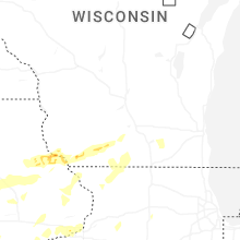
Wisconsin
| Local Time | Report Details |
|---|---|
| 3:55 PM CDT | Wisconet station reported 62 mph gust at 355 p in lafayette county WI, 53.3 miles WSW of Madison, WI |
| 5:00 PM CDT | Tree branch down on a garage in tow in grant county WI, 68.8 miles WSW of Madison, WI |
| 5:04 PM CDT | Storm damage reported in grant county WI, 69.3 miles WSW of Madison, WI |
| 5:05 PM CDT | Storm damage reported in grant county WI, 69.7 miles NE of Cedar Rapids, IA |
| 5:14 PM CDT | Quite a few trees down on power line in grant county WI, 65.4 miles SW of Madison, WI |
| 5:26 PM CDT | Winds reported from home weather station. trees dow in lafayette county WI, 58.2 miles SW of Madison, WI |
| 6:06 PM CDT | Time estimated from rada in green county WI, 32.9 miles SSW of Madison, WI |
| 6:14 PM CDT | Widespread tree damag in green county WI, 30.9 miles SSW of Madison, WI |
| 6:26 PM CDT | Storm damage reported in green county WI, 22.8 miles SW of Madison, WI |
| 6:31 PM CDT | Trees down and across roadway. time estimated from rada in rock county WI, 23 miles S of Madison, WI |
| 6:36 PM CDT | Storm damage reported in rock county WI, 22 miles SSE of Madison, WI |
| 7:15 PM CDT | Minor tree damag in walworth county WI, 36.5 miles ESE of Madison, WI |
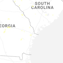
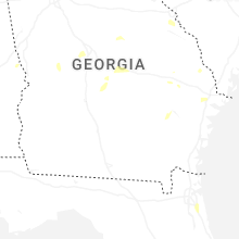
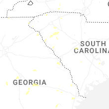
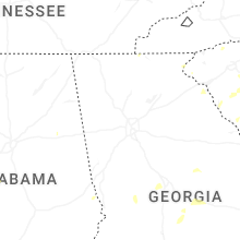
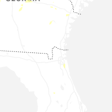
Georgia
| Local Time | Report Details |
|---|---|
| 5:01 PM EDT | Emergency manager reported a tree blocking roadway at the 7900 block of abercorn stree in chatham county GA, 6 miles SSW of Savannah, GA |
| 5:09 PM EDT | Tree down at the 6100 block of rocky ford road. time estimated by rada in screven county GA, 55.3 miles S of Augusta, GA |
| 5:18 PM EDT | Tree down on the paved portion of jenk hill road. exact location had to be estimated. time estimated by rada in screven county GA, 53.9 miles NW of Savannah, GA |
| 5:34 PM EDT | Emergency manager reported one large tree down on ga-204 near montgomery cross roa in chatham county GA, 1.5 miles SSW of Savannah, GA |
| 5:54 PM EDT | Emergency manager reported trees blocking half the roadway at the block of 7600 central avenu in chatham county GA, 7.2 miles SSE of Savannah, GA |
| 6:25 PM EDT | Trees down in the shoal creek are in hart county GA, 36.4 miles SW of Greenville, SC |
New Hampshire
| Local Time | Report Details |
|---|---|
| 5:38 PM EDT | Quarter sized hail reported near Brookline, NH, 63.1 miles NNW of Providence, RI, reported by weather spotter. time estimated by radar. |
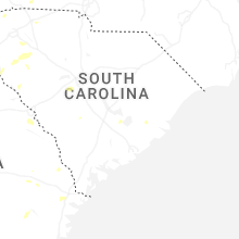
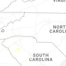
South Carolina
| Local Time | Report Details |
|---|---|
| 6:03 PM EDT | Lexington county em reported a couple of trees down near swansea blocking the roadway. time estimated by rada in lexington county SC, 53 miles ENE of Augusta, GA |
| 6:15 PM EDT | Multiple reports of trees and power lines down across northeastern spartanburg count in spartanburg county SC, 40.7 miles ENE of Greenville, SC |
| 6:16 PM EDT | Tall pine tree blown over along with numerous sticks and branches along boiling springs rd near sheallys pond heritage preserve. time estimated by rada in lexington county SC, 49.8 miles ENE of Augusta, GA |
| 6:27 PM EDT | Emergency manager reported tree down on i-26 near the 203 exit in the emergency lan in charleston county SC, 14.9 miles SSW of Charleston, SC |
| 6:35 PM EDT | Multiple trees down on hillcrest farm r in greenwood county SC, 50.6 miles SE of Greenville, SC |
| 6:35 PM EDT | Multiple trees down on parkland place roa in greenwood county SC, 50.8 miles N of Augusta, GA |
| 6:44 PM EDT | Tree down along ladson road near the intersection of lincolnville road. time based on repor in charleston county SC, 15.3 miles SSW of Charleston, SC |
| 6:45 PM EDT | Tree down on i-26 wb near college park road. time estimated by rada in berkeley county SC, 14.3 miles SSW of Charleston, SC |
| 6:51 PM EDT | *** 1 inj *** emergency manager reported a tree on a vehicle near the 700 block of highway 61. it did cause an injur in dorchester county SC, 22.8 miles SW of Charleston, SC |
| 7:00 PM EDT | Tree down at the intersection of orangeburg road and old parsonage road. time estimated by rada in dorchester county SC, 17.9 miles SW of Charleston, SC |
| 7:02 PM EDT | Tree down at the traffic circle along orangeburg road and w butternut road. time estimated by rada in dorchester county SC, 17.9 miles SW of Charleston, SC |
| 7:20 PM EDT | Tree down on roseville road. time estimated based on rada in charleston county SC, 41.6 miles SSW of Charleston, SC |
| 8:07 PM EDT | Orangeburg dispatch reported a tree down near the intersection of bamberg rd and slab landing rd. time estimated by rada in orangeburg county SC, 56.9 miles E of Augusta, GA |
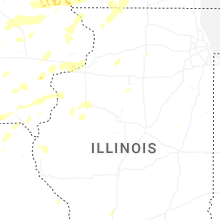
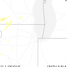
Illinois
| Local Time | Report Details |
|---|---|
| 5:09 PM CDT | 1 to 2 inch tree limbs dow in warren county IL, 57.2 miles WNW of Peoria, IL |
| 5:34 PM CDT | Large trees dow in jo daviess county IL, 50.8 miles SSW of Madison, WI |
| 6:20 PM CDT | Trees and wires downed at the intersection of algonquin road and lakewood boulevard. time estimated from rada in mchenry county IL, 43.6 miles WNW of Chicago, IL |
| 8:00 PM CDT | Reports of several trees and power lines down throughout the count in bureau county IL, 47.9 miles N of Peoria, IL |
| 8:07 PM CDT | 2 inch diameter tree limbs dow in putnam county IL, 40.5 miles NNE of Peoria, IL |
| 8:38 PM CDT | Power wires reported down on taylorville road approximately one mile north of the christian-montgomery county line. time estimated by rada in christian county IL, 49.5 miles W of Mattoon, IL |
| 9:15 PM CDT | Multiple reports of wires and trees down in quinc in adams county IL, 38.1 miles SSE of Kahoka, MO |
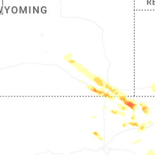
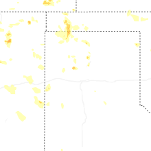
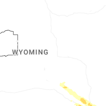
Wyoming
| Local Time | Report Details |
|---|---|
| 4:10 PM MDT | Ping Pong Ball sized hail reported near Buford, WY, 19.2 miles SE of Laramie, WY, public report of accumulating dime size hail along interstate 80. hail about 1 to 3 inches deep in some areas. a few estimated ping pong ball sized hailstones mixed in |
| 4:35 PM MDT | Ping Pong Ball sized hail reported near Granite Canon, WY, 26.7 miles SE of Laramie, WY, public reports ping pong ball size hail. |
| 4:40 PM MDT | Quarter sized hail reported near Rock River, WY, 40.8 miles NNW of Laramie, WY, spotter drove through the area after the storm. noted that snow plow was clearing away accumulated hail on us-287. saw a few quarter size hailstones on the side of the |
| 5:00 PM MDT | Quarter sized hail reported near Cheyenne, WY, 41.2 miles ESE of Laramie, WY, report from mping: quarter (1.00 in.). |
| 6:45 PM MDT | Quarter sized hail reported near Horse Creek, WY, 25.6 miles E of Laramie, WY |
| 7:10 PM MDT | Half Dollar sized hail reported near Cheyenne, WY, 40.8 miles ESE of Laramie, WY, report from mping: half dollar (1.25 in.). |
| 7:12 PM MDT | Half Dollar sized hail reported near Cheyenne, WY, 41.1 miles ESE of Laramie, WY, report from mping: half dollar (1.25 in.). |
| 7:15 PM MDT | Ping Pong Ball sized hail reported near Cheyenne, WY, 39.4 miles ESE of Laramie, WY |
| 7:17 PM MDT | Quarter sized hail reported near Cheyenne, WY, 44.1 miles ESE of Laramie, WY, report from mping: quarter (1.00 in.). |
| 7:18 PM MDT | Quarter sized hail reported near Cheyenne, WY, 44.3 miles ESE of Laramie, WY, report from mping: quarter (1.00 in.). |
| 7:18 PM MDT | Half Dollar sized hail reported near Cheyenne, WY, 42.8 miles ESE of Laramie, WY |
| 7:20 PM MDT | Quarter sized hail reported near Cheyenne, WY, 44.7 miles ESE of Laramie, WY, report of quarter size hail. |
| 7:20 PM MDT | Quarter sized hail reported near Cheyenne, WY, 46.2 miles ESE of Laramie, WY |
| 7:21 PM MDT | Quarter sized hail reported near Cheyenne, WY, 45.3 miles ESE of Laramie, WY, report from mping: quarter (1.00 in.). |
| 7:31 PM MDT | Quarter sized hail reported near Cheyenne, WY, 44.3 miles ESE of Laramie, WY, report from mping: quarter (1.00 in.). |
| 7:40 PM MDT | Quarter sized hail reported near Carpenter, WY, 56.6 miles ESE of Laramie, WY, public reports quarter size hail. |
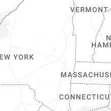
Massachusetts
| Local Time | Report Details |
|---|---|
| 6:30 PM EDT | Powerline wires downed on route 9 near williamsburg. relayed by amateur radi in hampshire county MA, 66.3 miles ESE of Schenectady, NY |
| 6:55 PM EDT | Corrects previous tstm wnd dmg report from 1 n northampton. tree down near greeley ave in northampton. relayed by amateur radi in hampshire county MA, 72.1 miles ESE of Schenectady, NY |
| 6:55 PM EDT | Tree down near greeley ave in northampto in hampshire county MA, 72.1 miles ESE of Schenectady, NY |
| 6:55 PM EDT | Multiple trees downed from burts pitt rd to ryan rd in northampton. relayed by amateur radi in hampshire county MA, 72.2 miles ESE of Schenectady, NY |
| 6:56 PM EDT | A tree... powerline wires and a utility pole were downed on sylvester rd in northampton. time estiamted by radar. relayed by amateur radi in hampshire county MA, 71 miles ESE of Schenectady, NY |
| 7:00 PM EDT | Tree down on i-91 southbound side near northampton. time estimated from rada in hampshire county MA, 70.6 miles WNW of Providence, RI |
| 7:00 PM EDT | Corrects previous tstm wnd dmg report from 3 ese northampton. tree down on i-91 southbound side near northampton. time estimated from radar. relayed by amateur radi in hampshire county MA, 70.6 miles WNW of Providence, RI |
Kansas
| Local Time | Report Details |
|---|---|
| 5:38 PM CDT | Quarter sized hail reported near Arkansas City, KS, 46.8 miles SSE of Wichita, KS, kake storm spotter reported a few quarter size hail stones in south part of arkansas city. |
| 5:55 PM CDT | 2 foot diameter tree limb took down powerlines & power pol in cowley county KS, 46.2 miles SSE of Wichita, KS |
| 6:55 PM CDT | Quarter sized hail reported near Augusta, KS, 15.2 miles E of Wichita, KS, emergency manager reported quarter size hail at stanta fe lake. |
| 6:59 PM CDT | Quarter sized hail reported near Augusta, KS, 18.9 miles E of Wichita, KS |
| 7:11 PM CDT | Half Dollar sized hail reported near Augusta, KS, 19.5 miles E of Wichita, KS |
| 7:20 PM CDT | Golf Ball sized hail reported near Augusta, KS, 19.5 miles E of Wichita, KS |
| 7:23 PM CDT | Downed wires near 319th street. time estimated from rada in miami county KS, 39.9 miles SSW of Kansas City, MO |
| 7:45 PM CDT | Social media report of multiple trees downed at a property southeast of paola. minor property damage also occurred. time estimated from rada in miami county KS, 43 miles SSW of Kansas City, MO |
| 8:13 PM CDT | Quarter sized hail reported near Belle Plaine, KS, 20 miles S of Wichita, KS |
| 8:29 PM CDT | Multiple reports of wires down and power outages in eastern linn county. time estimated from rada in linn county KS, 51.5 miles NE of Chanute, KS |
| 8:38 PM CDT | Multiple reports of downed limbs and wires in the pleasanton area. time estimated from rada in linn county KS, 52.7 miles NE of Chanute, KS |
| 8:39 PM CDT | Social media report. time estimated from rada in linn county KS, 53.1 miles NE of Chanute, KS |
| 8:48 PM CDT | The mesonet site 3nw of uniontown recorded a wind gust of 58mp in bourbon county KS, 27.8 miles ENE of Chanute, KS |
| 9:06 PM CDT | Large tree was reported down blocking the southbound lane of national avenue in tow in bourbon county KS, 41.9 miles ENE of Chanute, KS |
| 9:45 PM CDT | Quarter sized hail reported near Fall River, KS, 32.9 miles WSW of Chanute, KS |
| 9:55 PM CDT | Storm damage reported in elk county KS, 32.9 miles WSW of Chanute, KS |
| 11:25 PM MDT | Storm damage reported in hamilton county KS, 62.2 miles W of Garden City, KS |
Virginia
| Local Time | Report Details |
|---|---|
| 6:56 PM EDT | Tree down near texas roadhous in rockingham county VA, 64 miles ESE of Elkins, WV |
| 7:06 PM EDT | Broadcast media relayed report of a tree down on main street in dayton. time estimated from rada in rockingham county VA, 60 miles SE of Elkins, WV |
| 7:14 PM EDT | Tree down on liskey roa in rockingham county VA, 60 miles SE of Elkins, WV |
Maryland
| Local Time | Report Details |
|---|---|
| 7:14 PM EDT | Tree down on liskey roa in howard county MD, 19.6 miles W of Baltimore, MD |
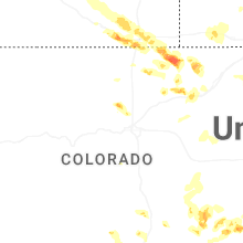
Colorado
| Local Time | Report Details |
|---|---|
| 5:20 PM MDT | Quarter sized hail reported near Carr, CO, 47.7 miles ESE of Laramie, WY |
| 5:30 PM MDT | Quarter sized hail reported near Iliff, CO, 47.9 miles NNW of Yuma, CO, time estimated. |
| 5:58 PM MDT | Hen Egg sized hail reported near Grover, CO, 77.9 miles SSW of Scottsbluff, NE |
| 6:15 PM MDT | Hen Egg sized hail reported near Grover, CO, 75.2 miles SSW of Scottsbluff, NE |
| 6:27 PM MDT | Quarter sized hail reported near Louisville, CO, 19.2 miles NNW of Denver, CO |
| 6:27 PM MDT | Quarter sized hail reported near Fort Morgan, CO, 58.7 miles W of Yuma, CO, report from mping: quarter (1.00 in.). |
| 6:45 PM MDT | Half Dollar sized hail reported near Westcliffe, CO, 38.6 miles WSW of Pueblo, CO |
| 7:04 PM MDT | Quarter sized hail reported near Stoneham, CO, 60.8 miles NW of Yuma, CO, report from mping: quarter (1.00 in.). |
| 7:08 PM MDT | Half Dollar sized hail reported near Wray, CO, 21.4 miles E of Yuma, CO, facebook report and video of long duration of quarter to half dollar hail; estimated around 20 minutes. video does show accumulating hail around a half inch deep but so |
| 7:16 PM MDT | Kcowray on weatherunderground reported the gus in yuma county CO, 23.6 miles E of Yuma, CO |
| 7:38 PM MDT | Quarter sized hail reported near Wray, CO, 27.3 miles ESE of Yuma, CO, hail ranged from pea to quarter in size. winds were 40+ mph. |
| 7:41 PM MDT | Weatherlink site osmus farm reports the gus in yuma county CO, 29.3 miles ESE of Yuma, CO |
| 8:03 PM MDT | Weatherlink site lazy_td_far in yuma county CO, 33.3 miles ESE of Yuma, CO |
| 8:48 PM MDT | Half Dollar sized hail reported near Las Animas, CO, 77 miles E of Pueblo, CO, report from mping: half dollar (1.25 in.). |
Texas
| Local Time | Report Details |
|---|---|
| 7:45 PM MDT | Texas water development board station pgf faben in el paso county TX, 27.2 miles SE of El Paso, TX |
| 11:08 PM CDT | Corrects previous non-tstm wnd gst report from 11 wnw bootle in deaf smith county TX, 46.2 miles ESE of Tucumcari, NM |
| 11:12 PM CDT | Storm damage reported in moore county TX, 43.2 miles N of Amarillo, TX |
| 11:13 PM CDT | Storm damage reported in moore county TX, 43.2 miles N of Amarillo, TX |
| 11:20 PM CDT | Two semis blown over at the rest stop on highway 287 south of dumas. report via facebook messag in moore county TX, 32.7 miles NNW of Amarillo, TX |
| 12:00 AM CDT | Quarter sized hail reported near Fritch, TX, 32.9 miles NNE of Amarillo, TX, the hail with some up to the size of quarters lasted for maybe 5 minutes. |
| 12:22 AM CDT | Storm damage reported in potter county TX, 6.5 miles E of Amarillo, TX |
| 12:25 AM CDT | Storm damage reported in carson county TX, 22.3 miles ENE of Amarillo, TX |
| 12:35 AM CDT | Mesonet measured gusts between 58 and 69 mph from 0034cdt and 0043cdt with the peak gust of 69 mph occurring at 0035cd in carson county TX, 17.8 miles ENE of Amarillo, TX |
| 12:38 AM CDT | The mesonet station measured gusts 58 to 65 mph between 0034cdt and 0042cdt with the peak gust of 65 mph occurring at 0038cd in carson county TX, 13.1 miles ENE of Amarillo, TX |
New Mexico
| Local Time | Report Details |
|---|---|
| 9:00 PM MDT | Trained spotter reports 60 mph wind gust from personal weather station. lost power shortly afte in quay county NM, 20.8 miles NE of Tucumcari, NM |
| 9:01 PM MDT | Mesonet station up363 logan 2.2 se (upr in quay county NM, 21.4 miles NE of Tucumcari, NM |
| 9:07 PM MDT | Asos station ktcc tucumcari muni airpor in quay county NM, 7.1 miles E of Tucumcari, NM |
| 9:40 PM MDT | Mesonet station 107 endee 2 s in quay county NM, 34.6 miles E of Tucumcari, NM |
Connect with Interactive Hail Maps