

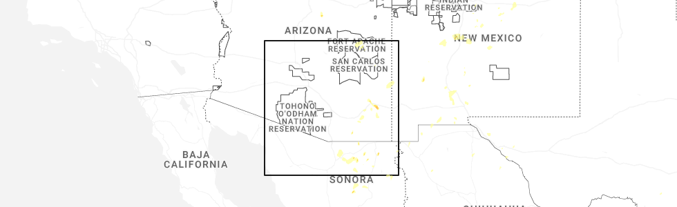
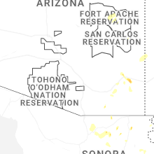
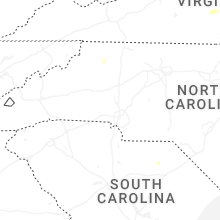
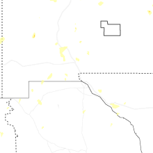
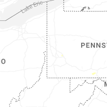
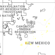
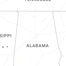
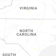
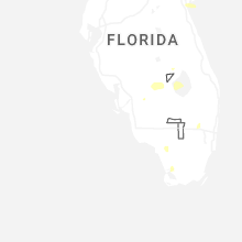
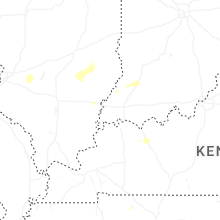
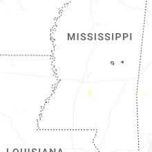
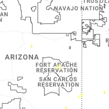
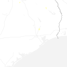
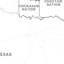
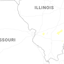
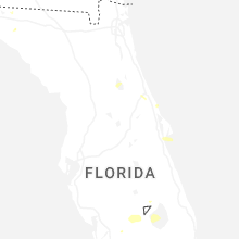
Hail Map for Sunday, July 13, 2025
Number of Impacted Households on 7/13/2025
0
Impacted by 1" or Larger Hail
0
Impacted by 1.75" or Larger Hail
0
Impacted by 2.5" or Larger Hail
Square Miles of Populated Area Impacted on 7/13/2025
0
Impacted by 1" or Larger Hail
0
Impacted by 1.75" or Larger Hail
0
Impacted by 2.5" or Larger Hail


Cities Most Affected by Hail Storms of 7/13/2025
| Hail Size | Demographics of Zip Codes Affected | ||||||
|---|---|---|---|---|---|---|---|
| City | Count | Average | Largest | Pop Density | House Value | Income | Age |
Hail and Wind Damage Spotted on 7/13/2025
Filter by Report Type:Hail ReportsWind Reports
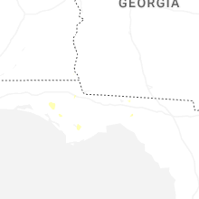
States Impacted
North Carolina, Florida, New York, Mississippi, Alabama, Illinois, Kentucky, Texas, Virginia, Arizona, Minnesota, Louisiana, MontanaNorth Carolina
| Local Time | Report Details |
|---|---|
| 12:25 PM EDT | Tree down on power line in franklin county NC, 22.6 miles NE of Raleigh, NC |
| 12:27 PM EDT | Tree down on powerline in franklin county NC, 24.4 miles NNE of Raleigh, NC |
| 12:35 PM EDT | Tree down on driveway near cedar creek roa in franklin county NC, 23.4 miles NNE of Raleigh, NC |
| 1:40 PM EDT | Tree down on utility lines resulting in power outag in wake county NC, 12.5 miles E of Raleigh, NC |
| 1:55 PM EDT | Tree down on utility lines causing power outag in johnston county NC, 16.2 miles ESE of Raleigh, NC |
| 7:45 PM EDT | Trees reported down on a few home in moore county NC, 63.4 miles SW of Raleigh, NC |
| 9:00 PM EDT | Several trees reported down and around 1000 power outage in guilford county NC, 69.5 miles WNW of Raleigh, NC |
Florida
| Local Time | Report Details |
|---|---|
| 2:08 PM EDT | The orlando/sanford airport measured a peak wind gust of 58mph/50kt from the west at 2:08 p in seminole county FL, 18.6 miles NNE of Orlando, FL |
| 3:57 PM EDT | The weatherflow station at banana river - 520 measured a peak wind gust of 59mph/51kt from the west at 3:57 pm. earlier... a gust to 44mph/38kt occurred at 3:07 p in amz552 county FL, 45.9 miles ESE of Orlando, FL |
| 3:15 PM CDT | Tree down on magnolia r in walton county FL, 28.9 miles NE of Miramar Beach, FL |
| 3:15 PM CDT | Tree down on w c currington r in walton county FL, 28.8 miles NE of Miramar Beach, FL |
| 6:36 PM EDT | Tree down and power pole down due to thunderstorm wind damag in glades county FL, 52.9 miles WSW of Port Saint Lucie, FL |
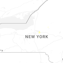
New York
| Local Time | Report Details |
|---|---|
| 2:25 PM EDT | Downed trees on county route 24... southwest of fullervill in st. lawrence county NY, 30.7 miles SSE of Ogdensburg, NY |
| 3:55 PM EDT | Tree down on road. time approximated by rada in oneida county NY, 38 miles ENE of Syracuse, NY |
| 4:02 PM EDT | Tree downed on route 177 in copenhagen blocking the road near river roa in lewis county NY, 55.5 miles NNE of Syracuse, NY |
| 4:42 PM EDT | Report of downed trees with one laying on utility wires on county rd 77. time estimated by rada in st. lawrence county NY, 35.9 miles SSE of Ogdensburg, NY |
| 5:28 PM EDT | Trees and power lines down on maggy roa in clinton county NY, 28.1 miles WNW of Burlington, VT |
| 5:42 PM EDT | Tree down in power lines. time estimated by rada in essex county NY, 43.1 miles WSW of Burlington, VT |
| 5:55 PM EDT | Trees and power lines down on campsite roa in clinton county NY, 21.2 miles WNW of Burlington, VT |
Mississippi
| Local Time | Report Details |
|---|---|
| 2:01 PM CDT | Image shared of a large semi trailer overturned in a parking lot adjacent to stateline roa in desoto county MS, 11.5 miles SSE of Memphis, TN |
| 2:01 PM CDT | Multiple trees reported to be down across southave in desoto county MS, 11.4 miles SSE of Memphis, TN |
| 2:41 PM CDT | Report of downed tree along the natchez trace near lorman... m in jefferson county MS, 61 miles WSW of Jackson, MS |
| 2:55 PM CDT | Scattered trees and power lines were blown down in the brookhaven are in lincoln county MS, 52 miles SSW of Jackson, MS |
| 4:00 PM CDT | A tree was blown down on barnett bend circle. the tree blocked both lanes of the roa in rankin county MS, 9.1 miles ENE of Jackson, MS |
| 4:08 PM CDT | A tree was blown down outside of the star community... and blocked both lanes of hwy 49 sout in rankin county MS, 15.1 miles SSE of Jackson, MS |
| 4:38 PM CDT | A tree was blown down on rankin county line roa in scott county MS, 26.5 miles E of Jackson, MS |
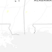
Alabama
| Local Time | Report Details |
|---|---|
| 2:03 PM CDT | Em reported several trees down/uprooted in downtown dotha in houston county AL, 82 miles NE of Miramar Beach, FL |
| 4:29 PM CDT | A tree was knocked down at 13800 cr 33. time estimated by rada in lauderdale county AL, 16.9 miles NE of Florence, AL |
| 5:49 PM CDT | A large tree limb was knocked down into the roadway at 6230 tammy little drive in section. time estimated by radar of the gust front passag in jackson county AL, 50.3 miles SW of Chattanooga, TN |
| 6:47 PM CDT | A tree was knocked down into the roadway at 6779 cr 63 in woodville. time estimated by rada in jackson county AL, 61.7 miles WSW of Chattanooga, TN |
Illinois
| Local Time | Report Details |
|---|---|
| 2:28 PM CDT | Tree down near the intersection of levee and branch roads. time estimated from rada in marion county IL, 66.2 miles E of Saint Louis, MO |
Kentucky
| Local Time | Report Details |
|---|---|
| 4:50 PM CDT | Power lines down on ft. campbell blv in christian county KY, 61.5 miles NW of Nashville, TN |
| 4:55 PM CDT | Power lines down on n. jessup street in hopkinsville. tree also partially blocking the roa in christian county KY, 62.6 miles NW of Nashville, TN |
Texas
| Local Time | Report Details |
|---|---|
| 4:51 PM CDT | Report of a large tree down in hughes springs from nws employee on social medi in cass county TX, 61.3 miles WNW of Shreveport, LA |
| 5:02 PM CDT | The west texas mesonet station 123 1nw castolon bbnp measured a 64 mph thunderstorm wind gus in brewster county TX, 83.6 miles S of Alpine, TX |
| 5:35 PM CDT | Reports of trees and powerlines down across the county... especially near hooks and leary... t in bowie county TX, 41.7 miles SW of Nashville, AR |
| 5:50 PM CDT | Report of a tree down on a powerline near hwy 59 southwest of domin in cass county TX, 51.2 miles SSW of Nashville, AR |
| 5:50 PM CDT | Report of a tree down on fm 31 south of i-2 in harrison county TX, 31.2 miles W of Shreveport, LA |
| 5:50 PM CDT | Report of a tree down on fm 2199 just north of i-2 in harrison county TX, 28.8 miles W of Shreveport, LA |
| 5:55 PM CDT | Several trees and powerlines downed... especially near and north of carthage texa in panola county TX, 42.1 miles WSW of Shreveport, LA |
| 5:55 PM CDT | Large tree down on the attoyac river bridge. a vehicle hit the tree but no injuries were reporte in nacogdoches county TX, 27.7 miles ENE of Lufkin, TX |
Virginia
| Local Time | Report Details |
|---|---|
| 6:32 PM EDT | Tree down across hollins roa in roanoke county VA, 4.8 miles N of Roanoke, VA |
| 7:00 PM EDT | A large tree was blown down near the 6500 block of jubal early highway by thunderstorm wind in franklin county VA, 7.4 miles SSE of Roanoke, VA |
| 7:16 PM EDT | Tree down across jubal early highway in hardy of franklin count in franklin county VA, 7.4 miles SSE of Roanoke, VA |
| 7:56 PM EDT | Tree and large branches and limbs downed by thunderstorm winds in the 6300 block of jubal early highwa in franklin county VA, 6.5 miles SSE of Roanoke, VA |
Arizona
| Local Time | Report Details |
|---|---|
| 3:52 PM MST | Quarter sized hail reported near Sierra Vista, AZ, 46.3 miles WNW of Douglas, AZ, trained spotter reports 1 inch hail lasting for approximately 5 minutes. |
| 5:50 PM MST | Corrects time of previous tstm wnd dmg report damage to roof due to thunderstorm wind in cochise county AZ, 30 miles WNW of Douglas, AZ |
| 6:33 PM MST | Awos station kalk measured wind gust of 58 mp in cochise county AZ, 52.8 miles SE of Tucson, AZ |
| 6:56 PM MST | Awos station kalk measured wind gust of 62 mp in cochise county AZ, 52.8 miles SE of Tucson, AZ |
| 7:52 PM MST | Damage to roof due to thunderstorm wind in cochise county AZ, 30 miles WNW of Douglas, AZ |
Minnesota
| Local Time | Report Details |
|---|---|
| 6:17 PM CDT | Trained spotter reported 61mph wind gust from a rooftop anemometer at the intersection of mn-28 and big stone county road 59 in a wet microburst. crop damage was also r in big stone county MN, 60.1 miles NW of Montevideo, MN |
| 6:19 PM CDT | 6-10 diameter tree branches snapped at the intersection of mn-28 and big stone county road 59. image sent via in big stone county MN, 60.1 miles NW of Montevideo, MN |
| 6:28 PM CDT | Image sent via x of trees down in the town of barr in big stone county MN, 58.8 miles NW of Montevideo, MN |
| 6:28 PM CDT | Corrects previous tstm wnd dmg report from 1 w barry. trained spotter sent images of numerous tree limbs down... up to 18 in diameter... as well as small trees snapped in big stone county MN, 59.8 miles NW of Montevideo, MN |
Louisiana
| Local Time | Report Details |
|---|---|
| 6:26 PM CDT | Large tree down near hwy 169 and blanchard latex roa in caddo county LA, 14.5 miles WNW of Shreveport, LA |
| 6:26 PM CDT | Trees down on sartor road and pearce lane near gilliam... louisian in caddo county LA, 22.4 miles NNW of Shreveport, LA |
| 6:28 PM CDT | Trees downed near adger road and eclipse road just northeast of gilliam... louisian in caddo county LA, 22.4 miles NNW of Shreveport, LA |
Montana
| Local Time | Report Details |
|---|---|
| 9:59 PM MDT | Ambient weather station in sweet grass measured a 61 mph gus in toole county MT, 107.6 miles NNW of Great Falls, MT |
| 10:35 PM MDT | Mesonet station gw3546 whitlash seven south. more exact timing estimated based on rada in liberty county MT, 74.8 miles WNW of Havre, MT |
| 10:54 PM MDT | Ambient weather statio in liberty county MT, 61.8 miles WNW of Havre, MT |
| 10:57 PM MDT | Mesonet station gw0637 bears den 9 en in liberty county MT, 58.9 miles WNW of Havre, MT |
| 11:40 PM MDT | Mesonet station gw6392 gildford 15 in hill county MT, 31.6 miles WNW of Havre, MT |
Connect with Interactive Hail Maps