

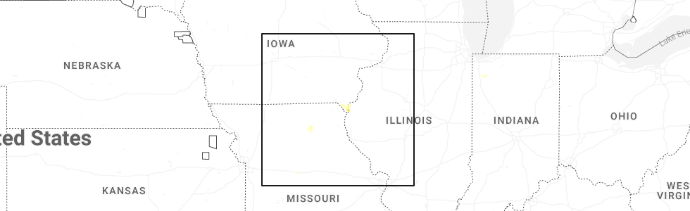
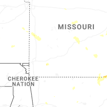
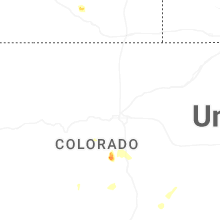
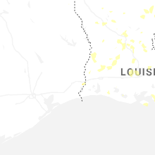
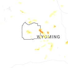
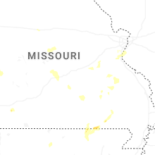
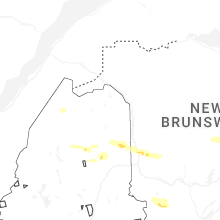
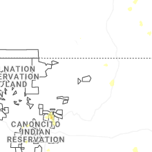
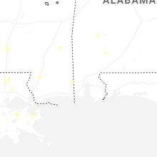
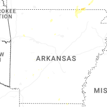
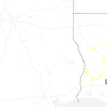
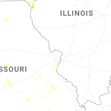
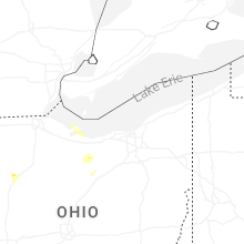
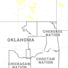
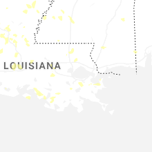
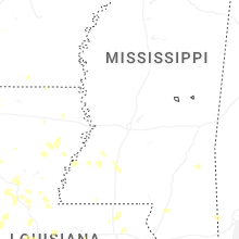
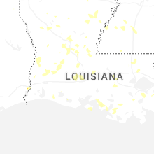
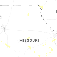
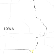
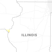
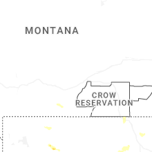
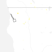
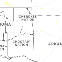
Hail Map for Wednesday, July 30, 2025
Number of Impacted Households on 7/30/2025
0
Impacted by 1" or Larger Hail
0
Impacted by 1.75" or Larger Hail
0
Impacted by 2.5" or Larger Hail
Square Miles of Populated Area Impacted on 7/30/2025
0
Impacted by 1" or Larger Hail
0
Impacted by 1.75" or Larger Hail
0
Impacted by 2.5" or Larger Hail
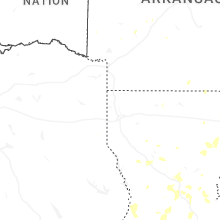
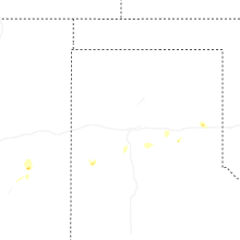

Cities Most Affected by Hail Storms of 7/30/2025
| Hail Size | Demographics of Zip Codes Affected | ||||||
|---|---|---|---|---|---|---|---|
| City | Count | Average | Largest | Pop Density | House Value | Income | Age |
Hail and Wind Damage Spotted on 7/30/2025
Filter by Report Type:Hail ReportsWind Reports
States Impacted
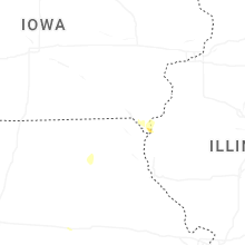
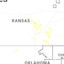
Iowa, Louisiana, Missouri, Connecticut, Alabama, Indiana, Kansas, Florida, New Mexico, Arizona, Nevada, Ohio, CaliforniaIowa
| Local Time | Report Details |
|---|---|
| 7:56 AM CDT | Quarter sized hail reported near Keokuk, IA, 14.3 miles E of Kahoka, MO |
Louisiana
| Local Time | Report Details |
|---|---|
| 1:56 PM CDT | Powerline knocked over by thunderstorm winds in marrero relayed by broadcast medi in jefferson county LA, 3.9 miles SSW of New Orleans, LA |
| 4:37 PM CDT | Tree limbs down and signs blown of in rapides county LA, 82.1 miles NNW of Lafayette, LA |
| 4:42 PM CDT | Asos station kaex alexandri in rapides county LA, 83.2 miles NNW of Lafayette, LA |
| 4:59 PM CDT | Asos station klch lake charle in calcasieu county LA, 31 miles E of Beaumont, TX |
| 5:00 PM CDT | Car cover destroyed along with limbs dow in acadia county LA, 23.5 miles WSW of Lafayette, LA |
| 5:15 PM CDT | Picture of large tree branches dow in rapides county LA, 64.2 miles NNW of Lafayette, LA |
| 5:30 PM CDT | Picture of tress down across highway 7 in rapides county LA, 64.1 miles NNW of Lafayette, LA |
| 5:40 PM CDT | Picture of large trees down across roa in rapides county LA, 57.7 miles NNW of Lafayette, LA |
| 6:30 PM CDT | Received photo of large tree limbs and power lines down at this locatio in st. landry county LA, 30.8 miles NW of Lafayette, LA |
| 7:15 PM CDT | Corrects previous tstm wnd dmg report from 3 n iowa. reports of down trees at the intersection of la hwy 383 and go racca roa in jefferson davis county LA, 45.4 miles ENE of Beaumont, TX |
| 8:15 PM CDT | Reports of down trees at the intersection of la hwy 383 and go racca roa in jefferson davis county LA, 45.4 miles ENE of Beaumont, TX |
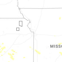
Missouri
| Local Time | Report Details |
|---|---|
| 3:20 PM CDT | Trees dow in wright county MO, 39.9 miles E of Springfield, MO |
| 4:10 PM CDT | A lot of tree limbs and tree debris dow in wright county MO, 44 miles ENE of Springfield, MO |
| 7:44 PM CDT | Tree dow in lawrence county MO, 35.4 miles WSW of Springfield, MO |
Connecticut
| Local Time | Report Details |
|---|---|
| 4:34 PM EDT | Quarter sized hail reported near Washington, CT, 73.8 miles NNE of Brooklyn, NY, report of quarter size hail in washington... ct. |
| 4:40 PM EDT | Report of tree down on us 202. time estimated from rada in litchfield county CT, 71.3 miles NNE of Brooklyn, NY |
| 4:45 PM EDT | Numerous reports of downed trees and wires across new milford. time estimated from rada in litchfield county CT, 68.9 miles NNE of Brooklyn, NY |
| 4:55 PM EDT | Large tree down in roxbury. social media report. time estimated from rada in litchfield county CT, 69.6 miles NNE of Brooklyn, NY |
| 5:30 PM EDT | Corrects time of previous tstm wnd dmg report from 2 sw middlebury. transformer and wires down on christian road in middlebury c in new haven county CT, 71.8 miles NE of Brooklyn, NY |
| 5:32 PM EDT | Tree down on wires... road impassabl in new haven county CT, 71.8 miles NE of Brooklyn, NY |
| 5:32 PM EDT | Tree down on wires blocking driveway on hill road in middlebury c in new haven county CT, 72.6 miles NE of Brooklyn, NY |
| 5:32 PM EDT | Tree down on walkwood road in middlebury c in new haven county CT, 73.2 miles NE of Brooklyn, NY |
| 5:36 PM EDT | Several downed trees across town in naugatuc in new haven county CT, 73.7 miles NE of Brooklyn, NY |
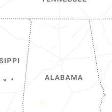
Alabama
| Local Time | Report Details |
|---|---|
| 4:00 PM CDT | Several trees and power lines down in coffee county... especially in the elba are in coffee county AL, 73.9 miles NNE of Miramar Beach, FL |
| 7:02 PM CDT | Tree down... blocking both lanes. time of event estimated from rada in lauderdale county AL, 17.4 miles NE of Florence, AL |
| 7:40 PM CDT | Tree downe in morgan county AL, 53.4 miles ESE of Florence, AL |
Indiana
| Local Time | Report Details |
|---|---|
| 5:01 PM EDT | Emergency manager reports a tree down onto powerlines in the 6700 block of logansport road. time estimated via rada in cass county IN, 63.8 miles WSW of Fort Wayne, IN |
Kansas
| Local Time | Report Details |
|---|---|
| 4:24 PM CDT | Delayed report from a personal weather statio in butler county KS, 17.2 miles ENE of Wichita, KS |
| 4:53 PM CDT | Quarter sized hail reported near Hamilton, KS, 43.8 miles WNW of Chanute, KS |
| 5:29 PM CDT | Quarter sized hail reported near Andover, KS, 15 miles ENE of Wichita, KS, most hailstones were less than quarter size hail... but a few were quarter sized. |
| 5:40 PM CDT | Road signs were blown down along with 2-to-3-inch diameter limbs broke in greenwood county KS, 45.8 miles WNW of Chanute, KS |
| 6:10 PM CDT | Storm damage reported in mcpherson county KS, 58.3 miles NNW of Wichita, KS |
| 6:41 PM CDT | Measured via a personal weather statio in mcpherson county KS, 48.4 miles N of Wichita, KS |
| 6:44 PM CDT | Quarter sized hail reported near Newton, KS, 19.6 miles N of Wichita, KS, mostly nickel size hail but a few quarters. |
| 9:24 PM CDT | 50-60 mph wind estimate in greenwood county KS, 44.7 miles WNW of Chanute, KS |
Florida
| Local Time | Report Details |
|---|---|
| 6:20 PM EDT | Photo shared from broadcast media of a shed that was picked up and destroyed on saint johns bluff road due to strong winds. time estimated via radar and measured wind g in duval county FL, 8.2 miles E of Jacksonville, FL |
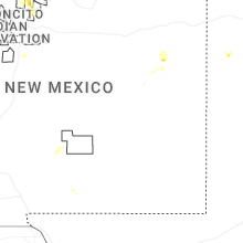
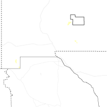
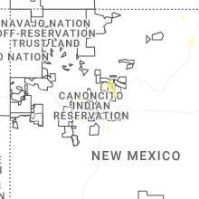
New Mexico
| Local Time | Report Details |
|---|---|
| 4:50 PM MDT | Asos station kgup gallup airport. likely caused by a virga bom in mckinley county NM, 89.7 miles SSW of Farmington, NM |
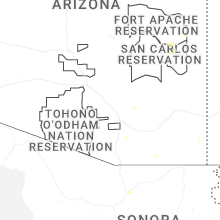
Arizona
| Local Time | Report Details |
|---|---|
| 4:00 PM MST | Personal weather station measured gust of 58 mp in cochise county AZ, 39.6 miles WNW of Douglas, AZ |
Nevada
| Local Time | Report Details |
|---|---|
| 4:37 PM PDT | Asos station krno ren in washoe county NV, 3 miles SE of Reno, NV |
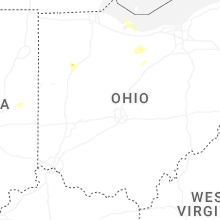
Ohio
| Local Time | Report Details |
|---|---|
| 8:20 PM EDT | Delayed report. photo of large tree down. reports of multiple trees down in this are in allen county OH, 55.9 miles ESE of Fort Wayne, IN |
| 12:23 AM EDT | Multiple 58 mph wind gusts at kbjj between 1223 and 1228 am ed in wayne county OH, 45 miles SSW of Cleveland, OH |
| 12:28 AM EDT | Tree downed in smithville... with a separate report of downed powerlines in smithville. time estimated via rada in wayne county OH, 45.3 miles SSW of Cleveland, OH |
California
| Local Time | Report Details |
|---|---|
| 6:29 PM PDT | Quarter sized hail reported near Trinity Center, CA, 26.3 miles NW of Redding, CA, report of half inch to quarter sized hail near trinity lake. |
Connect with Interactive Hail Maps