

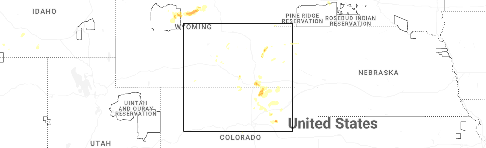
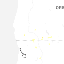
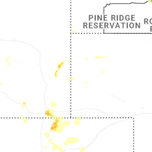
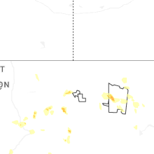
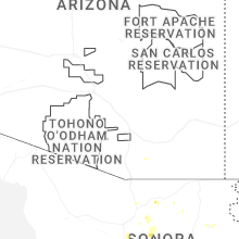
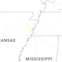
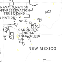
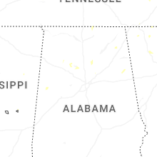
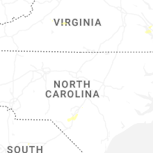
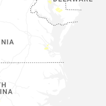
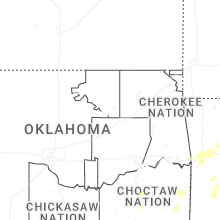
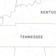
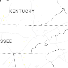
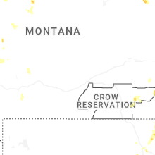
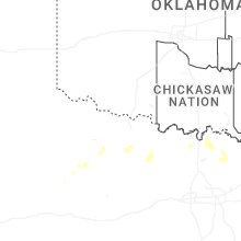
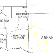
Hail Map for Thursday, July 31, 2025
Number of Impacted Households on 7/31/2025
0
Impacted by 1" or Larger Hail
0
Impacted by 1.75" or Larger Hail
0
Impacted by 2.5" or Larger Hail
Square Miles of Populated Area Impacted on 7/31/2025
0
Impacted by 1" or Larger Hail
0
Impacted by 1.75" or Larger Hail
0
Impacted by 2.5" or Larger Hail

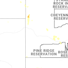
Cities Most Affected by Hail Storms of 7/31/2025
| Hail Size | Demographics of Zip Codes Affected | ||||||
|---|---|---|---|---|---|---|---|
| City | Count | Average | Largest | Pop Density | House Value | Income | Age |
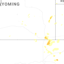
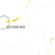
| Cheyenne, WY | 1 | 1.75 | 1.75 | 26 | $135k | $54.6k | 42.7 |
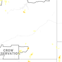
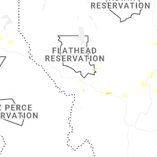
| Lolo, MT | 1 | 1.75 | 1.75 | 13 | $119k | $44.7k | 36.5 |
| Jordan, MT | 1 | 1.75 | 1.75 | 0 | $36k | $25.3k | 47.4 |
Hail and Wind Damage Spotted on 7/31/2025
Filter by Report Type:Hail ReportsWind Reports
States Impacted
Pennsylvania, Maryland, New Jersey, Delaware, Virginia, Florida, North Carolina, West Virginia, Alabama, Arkansas, District of Columbia, Kentucky, Louisiana, Utah, South Carolina, Wyoming, Idaho, Texas, Colorado, Montana, South DakotaPennsylvania
| Local Time | Report Details |
|---|---|
| 11:47 AM EDT | Wires dow in lancaster county PA, 54.6 miles NNE of Baltimore, MD |
| 11:50 AM EDT | Tree blocking roa in lancaster county PA, 54.6 miles NNE of Baltimore, MD |
| 12:23 PM EDT | Berks 911 call center reported a tree down on conrad weiser pkwy. time estimated from rada in berks county PA, 76.9 miles SSW of Scranton, PA |
| 12:30 PM EDT | Multiple trees down on wires at the intersection of elizabeth ave and chestnut street. time estimated from rada in berks county PA, 71.6 miles S of Scranton, PA |
| 12:30 PM EDT | Trees and wires down. time estimated from rada in berks county PA, 72.5 miles SSW of Scranton, PA |
| 12:33 PM EDT | Trees and wires down. time estimated from rada in berks county PA, 76.2 miles SSW of Scranton, PA |
| 12:38 PM EDT | Trees and wires down. time estimated from rada in berks county PA, 75.8 miles S of Scranton, PA |
| 12:40 PM EDT | Tree down on wires. time estimated from rada in berks county PA, 75.5 miles S of Scranton, PA |
| 12:42 PM EDT | Tree branch through a house window. time estimated from rada in berks county PA, 76 miles S of Scranton, PA |
| 1:09 PM EDT | Tree down blocking both lanes of new geneva roa in fayette county PA, 45.6 miles S of Pittsburgh, PA |
| 1:12 PM EDT | Wires down at the intersection of longview drive and barley sheaf road. wires also down at the intersection of kings highway and n longview drive. time estimated from r in chester county PA, 67.1 miles NE of Baltimore, MD |
| 1:12 PM EDT | Broadcast news report footage showed a tree fallen onto a car in caln twp. exact road unknown. time estimated from rada in chester county PA, 65.5 miles NE of Baltimore, MD |
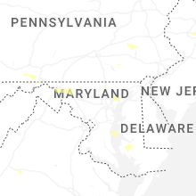
Maryland
| Local Time | Report Details |
|---|---|
| 1:41 PM EDT | A few trees were down around hancoc in washington county MD, 64.1 miles WNW of Baltimore, MD |
| 3:00 PM EDT | A few trees were down around hancoc in washington county MD, 76.7 miles SSW of State College, PA |
| 3:55 PM EDT | A couple of trees down along dam number 4 rd. and also on scrabble r in washington county MD, 66.4 miles WNW of Baltimore, MD |
| 4:08 PM EDT | Multiple trees down. time estimated from rada in talbot county MD, 46.2 miles SE of Baltimore, MD |
| 4:24 PM EDT | Trees down. time estimated from rada in caroline county MD, 45.2 miles ESE of Baltimore, MD |
| 4:26 PM EDT | Several trees down around myersvill in frederick county MD, 53.6 miles WNW of Baltimore, MD |
| 4:26 PM EDT | Several trees were down in middletow in frederick county MD, 44.5 miles WNW of Baltimore, MD |
| 4:56 PM EDT | Several trees down around ijamsville in frederick county MD, 40 miles W of Baltimore, MD |
| 5:15 PM EDT | Several trees down around monrovi in frederick county MD, 35.6 miles W of Baltimore, MD |
| 5:28 PM EDT | Several trees down around monrovi in frederick county MD, 44.5 miles WNW of Baltimore, MD |
| 5:45 PM EDT | Several trees down along egypt r in dorchester county MD, 56 miles W of Ocean City, MD |
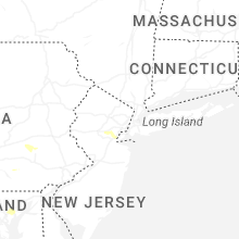
New Jersey
| Local Time | Report Details |
|---|---|
| 1:45 PM EDT | Trees and wires down. time estimated from rada in somerset county NJ, 29.8 miles WSW of Brooklyn, NY |
| 1:50 PM EDT | Trees down. time estimated from rada in somerset county NJ, 23.6 miles WSW of Brooklyn, NY |
| 3:34 PM EDT | Wires down. time estimated from rada in gloucester county NJ, 84 miles ENE of Baltimore, MD |
Delaware
| Local Time | Report Details |
|---|---|
| 2:51 PM EDT | Reported asos measured wind gust of 58 mp in new castle county DE, 59.8 miles ENE of Baltimore, MD |
Virginia
| Local Time | Report Details |
|---|---|
| 2:56 PM EDT | A few reports of downed trees in the city of staunto in city of staunton county VA, 67.4 miles SE of Elkins, WV |
| 3:10 PM EDT | Thunderstorm winds blew down one tree near the intersection with dog creek road and moore lan in campbell county VA, 58.9 miles ESE of Roanoke, VA |
| 3:20 PM EDT | Tree down in the 200 block of dalhousie r in augusta county VA, 76.9 miles SE of Elkins, WV |
| 3:23 PM EDT | Thunderstorm winds blew down one tree along east back street between the intersections of north roanoke street and north church stree in botetourt county VA, 16.1 miles NNE of Roanoke, VA |
| 3:25 PM EDT | Numerous trees down near the intersection of wolfridge rd. and grindstone r in augusta county VA, 55.8 miles SE of Elkins, WV |
| 3:44 PM EDT | A couple of trees down on craigs store rd. near the intersection with castle rock r in albemarle county VA, 68.7 miles WNW of Richmond, VA |
| 3:50 PM EDT | Large tree limb snappe in shenandoah county VA, 61.7 miles E of Elkins, WV |
| 4:03 PM EDT | Tree down near the intersection of crooked run road and senedo r in shenandoah county VA, 61.2 miles E of Elkins, WV |
| 4:07 PM EDT | Tree down near the intersection of back road and chicory lan in shenandoah county VA, 75.8 miles E of Elkins, WV |
| 4:21 PM EDT | Thunderstorm winds blew down one tree near the intersection of joppa mill road and stewartsville roa in bedford county VA, 16.7 miles E of Roanoke, VA |
| 4:26 PM EDT | Tree down near the intersection of elvan rd. and mountain r in loudoun county VA, 56.9 miles W of Baltimore, MD |
| 4:44 PM EDT | A couple of trees down on craigs store rd. near the intersection with castle rock r in albemarle county VA, 68.7 miles WNW of Richmond, VA |
| 4:56 PM EDT | Tree down along u.s. 50 just east of the clarke county and fauquier county lin in fauquier county VA, 75.1 miles WSW of Baltimore, MD |
| 5:07 PM EDT | Vdot reported a tree down across the roadway on route 670 in the vicinity of couches creek road. all north and south lanes were closed. time estimated from rada in lunenburg county VA, 49.6 miles SW of Richmond, VA |
| 5:15 PM EDT | Vdot reported a tree down across the roadway on route 635 in the vicinity of gallion town road. all north and south lanes were closed. time estimated from rada in lunenburg county VA, 48.5 miles SW of Richmond, VA |
| 6:08 PM EDT | Vdot reported a tree across the roadway on us-15 in the vicinity of oak hill drive and whitetail road. all north and south lanes were closed. time estimated from rada in mecklenburg county VA, 62.4 miles N of Raleigh, NC |
Florida
| Local Time | Report Details |
|---|---|
| 3:08 PM EDT | A tree resulted in a power outage via talquin electric outage ma in leon county FL, 13.2 miles ENE of Tallahassee, FL |
| 3:10 PM EDT | A tree resulted in a power outage via talquin electric outage ma in leon county FL, 14.2 miles ENE of Tallahassee, FL |
North Carolina
| Local Time | Report Details |
|---|---|
| 3:31 PM EDT | Wfmy passed along a photo of a tree down on a power line on charlotte dr. event time estimated from rada in montgomery county NC, 46.3 miles ENE of Charlotte, NC |
| 5:30 PM EDT | Tree fell on a house on chickadee lane in savannah community. first responders indicated multiple trees down in vicinity. time approximate. report submitted via in jackson county NC, 49.5 miles NW of Greenville, SC |
| 6:12 PM EDT | Power lines down on the 1700 block of aman dairy rd. radar estimated tim in sampson county NC, 40.5 miles S of Raleigh, NC |
| 6:43 PM EDT | Duke energy outage caused by fallen trees or limbs damaging equipmen in cumberland county NC, 59.2 miles S of Raleigh, NC |
West Virginia
| Local Time | Report Details |
|---|---|
| 3:39 PM EDT | Tree down at the intersection of koonztown rd. and yukon d in berkeley county WV, 71.5 miles WNW of Baltimore, MD |
| 3:40 PM EDT | Tree down around mm 23 on interstate 8 in berkeley county WV, 70.8 miles WNW of Baltimore, MD |
| 3:47 PM EDT | A few trees down along foxcroft ave. in martinsbur in berkeley county WV, 74.7 miles W of Baltimore, MD |
| 4:03 PM EDT | Three trees down around shepherdstow in jefferson county WV, 65 miles W of Baltimore, MD |
| 4:21 PM EDT | Tree down on the 300 block of york stree in jefferson county WV, 60.1 miles W of Baltimore, MD |
| 6:30 PM EDT | Three trees down around shepherdstow in jefferson county WV, 65 miles W of Baltimore, MD |
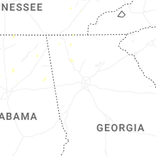
Alabama
| Local Time | Report Details |
|---|---|
| 3:05 PM CDT | Tree down at mulberry hills rd and county road 5. another tree down blocking the road on oscar bradford r in blount county AL, 24.6 miles NNW of Birmingham, AL |
| 3:40 PM CDT | Tree down on county highway 47 and power line down on county highway 2 in blount county AL, 39.5 miles NNE of Birmingham, AL |
| 4:20 PM CDT | A power line downed near the intersection of goosepond drive and berry road. time estimated from rada in jackson county AL, 53.1 miles SW of Chattanooga, TN |
| 4:30 PM CDT | Tree downed at main street and tammy little drive in sectio in jackson county AL, 50.3 miles SW of Chattanooga, TN |
| 4:33 PM CDT | Several large tree limbs downe in jackson county AL, 49.4 miles SW of Chattanooga, TN |
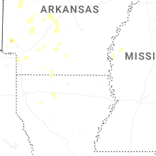
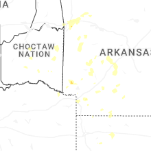
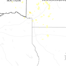
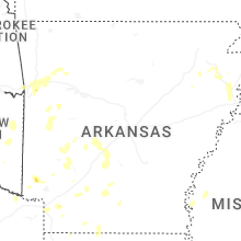
Arkansas
| Local Time | Report Details |
|---|---|
| 3:21 PM CDT | A power line was downed along highway 29 just north of county road 4 in lafayette county AR, 37.6 miles SSE of Nashville, AR |
| 3:23 PM CDT | A large tree limb was downed across highway 41 south between de queen and horati in sevier county AR, 27.8 miles W of Nashville, AR |
| 3:40 PM CDT | Trees down along south stateline avenu in miller county AR, 41.4 miles SSW of Nashville, AR |
| 3:45 PM CDT | Trees down on highway 71 near blackman ferry roa in miller county AR, 40.1 miles SSW of Nashville, AR |
| 3:55 PM CDT | Trees down along county road 1 in miller county AR, 42.2 miles S of Nashville, AR |
District of Columbia
| Local Time | Report Details |
|---|---|
| 4:33 PM EDT | Tree down on an unoccupied vehicle at the intersection of ellicott st. nw and 32nd st. n in district of columb county DC, 34.1 miles SW of Baltimore, MD |
| 4:34 PM EDT | Large tree down near the intersection of connecticut ave and chesapeake st n in district of columb county DC, 34.1 miles SW of Baltimore, MD |
Kentucky
| Local Time | Report Details |
|---|---|
| 4:52 PM EDT | Estill county dispatch reports multiple trees down along white oak road east of ky-89 north of irvine. time provided by dispatc in estill county KY, 2.1 miles N of Irvine, KY |
| 5:25 PM EDT | Lee county 911 received a report of a large downed tree along pine grove road east of ky-11 south. time estimated via rada in lee county KY, 18.2 miles SE of Irvine, KY |
| 6:10 PM EDT | Corrects previous tstm wnd dmg report from 2 n saul. perry county 911 reports downed power lines in the 300 block of abner fork road from the thunderstorm that moved th in perry county KY, 37.5 miles SE of Irvine, KY |
| 6:10 PM EDT | Perry county 911 reports downed power lines on abner branch road from the thunderstorm that moved through the buckhorn area earlier this evening. time estimated via rad in perry county KY, 37.5 miles SE of Irvine, KY |
| 6:15 PM EDT | Perry county 911 reports downed power lines along ky 451 near meteor lane from the thunderstorm that moved through the krypton area earlier this evening. time provided in perry county KY, 43.6 miles SE of Irvine, KY |
| 7:14 PM EDT | Knox county dispatch reports a downed tree on ky 3441 from the thunderstorms earlier this evenin in knox county KY, 58.8 miles S of Irvine, KY |
| 7:30 PM EDT | Knox county dispatch received a report of downed trees off ky-6 and ky-459 near gray lane from a thunderstorm at 7:30p in knox county KY, 57.9 miles S of Irvine, KY |
Louisiana
| Local Time | Report Details |
|---|---|
| 4:06 PM CDT | Multiple trees and power lines down throughout claiborne parish... including near the athens are in claiborne county LA, 44.3 miles ENE of Shreveport, LA |
| 4:10 PM CDT | A tree was downed between cullen and springhil in webster county LA, 36.2 miles NNE of Shreveport, LA |
| 5:15 PM CDT | A small portable building was uplifted and thrown. multiple trees were downed throughout winnfiel in winn county LA, 72.6 miles SW of Bastrop, LA |
Utah
| Local Time | Report Details |
|---|---|
| 3:35 PM MDT | Interstate 80 (dpg17) mesonet sensor recorded a gust to 75 mph as a result of thunderstorm outflo in tooele county UT, 83 miles W of Salt Lake City, UT |
South Carolina
| Local Time | Report Details |
|---|---|
| 5:35 PM EDT | Fairfield electric cooperative reported trees on powerlines on ramsey rd. time estimated by rada in fairfield county SC, 58.1 miles SSW of Charlotte, NC |
| 5:40 PM EDT | Fairfield electric cooperative reported trees on powerlines on adger street. time estimated by rada in fairfield county SC, 57.3 miles SSW of Charlotte, NC |
| 6:35 PM EDT | Lee county dispatch reported trees down on powerlines on main s in lee county SC, 71.9 miles N of Charleston, SC |
| 6:38 PM EDT | Lee county dispatch reported trees down on dogwood dr. time estimated by rada in lee county SC, 71.6 miles N of Charleston, SC |
| 9:18 PM EDT | Storm damage reported in horry county SC, 67.9 miles WSW of Wilmington, NC |
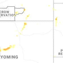
Wyoming
| Local Time | Report Details |
|---|---|
| 4:10 PM MDT | Half Dollar sized hail reported near Cheyenne, WY, 42.1 miles ESE of Laramie, WY |
| 4:12 PM MDT | Golf Ball sized hail reported near Cheyenne, WY, 42.4 miles ESE of Laramie, WY, report from mping: golf ball (1.75 in.). |
| 4:25 PM MDT | Half Dollar sized hail reported near Cheyenne, WY, 43.5 miles E of Laramie, WY, report from mping: half dollar (1.25 in.). |
| 7:37 PM MDT | Mesonet station khld hiland 2.4 se (wydot). associated with an outflow boundar in natrona county WY, 52.9 miles WNW of Casper, WY |
Idaho
| Local Time | Report Details |
|---|---|
| 3:42 PM PDT | Power outage per kootenai electric to over 500 customer in kootenai county ID, 31.6 miles ENE of Spokane, WA |
| 3:42 PM PDT | Quarter sized hail reported near Rathdrum, ID, 29.1 miles ENE of Spokane, WA |
| 6:30 PM MDT | Mesonet station big coxs wel in butte county ID, 59 miles WSW of Idaho Falls, ID |
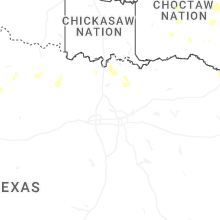
Texas
| Local Time | Report Details |
|---|---|
| 5:45 PM CDT | A 60 mph wind gust was measured at the eastman chemical company southeast of longview... which resulted in some structural damag in harrison county TX, 55.3 miles W of Shreveport, LA |
| 5:48 PM CDT | Quarter sized hail reported near Archer City, TX, 23.2 miles SSW of Wichita Falls, TX |
| 7:55 PM CDT | Facebook photos showed several trees blown down on amen corner off cr 17 in collin county TX, 43.5 miles N of Dallas, TX |
| 8:05 PM CDT | Unconfirmed report of wind damage at a rv park on fox lane with reports of rvs blown over. grayson county ema investigatin in grayson county TX, 43.7 miles N of Dallas, TX |
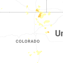
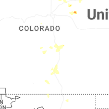
Colorado
| Local Time | Report Details |
|---|---|
| 4:58 PM MDT | Quarter sized hail reported near La Salle, CO, 40.6 miles NNE of Denver, CO |
| 5:12 PM MDT | Loose items blown across yar in weld county CO, 54.5 miles NNE of Denver, CO |
| 5:20 PM MDT | Quarter sized hail reported near Nunn, CO, 60 miles SE of Laramie, WY |
| 5:46 PM MDT | Ping Pong Ball sized hail reported near Briggsdale, CO, 66.6 miles ESE of Laramie, WY, report via spotter network. |
| 6:55 PM MDT | Awos station k1nw 1 nne new rayme in weld county CO, 68.2 miles WNW of Yuma, CO |
Montana
| Local Time | Report Details |
|---|---|
| 5:52 PM MDT | Golf Ball sized hail reported near Lolo, MT, 10.5 miles SSW of Missoula, MT, multiple facebook photos in the southern lolo area depicted up to golf ball sized hail. the photo that showed possible golf ball was wide and flat. |
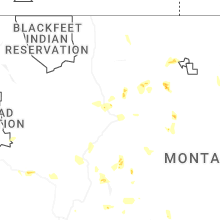
| 5:53 PM MDT | Asos station klvm livingsto in park county MT, 29.2 miles E of Bozeman, MT |
| 8:30 PM MDT | Golf Ball sized hail reported near Jordan, MT, 39.9 miles S of Glasgow, MT, golf ball sized hail. |
| 9:15 PM MDT | Mesonet station mtelm elmo us-93 mp 77. in lake county MT, 40.1 miles S of Whitefish, MT |
| 9:30 PM MDT | Half Dollar sized hail reported near Great Falls, MT, 1.3 miles ESE of Great Falls, MT |
South Dakota
| Local Time | Report Details |
|---|---|
| 1:45 AM MDT | Storm damage reported in jackson county SD, 61.3 miles E of Rapid City, SD |
Connect with Interactive Hail Maps