

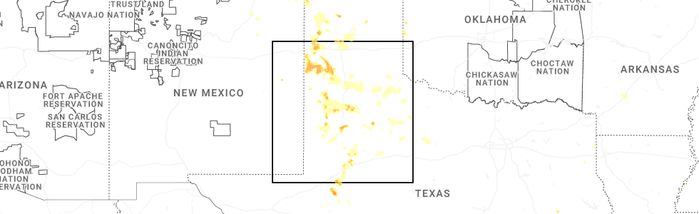
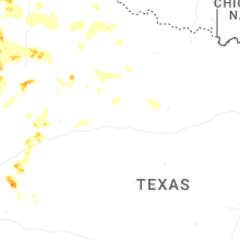
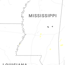
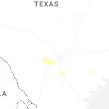
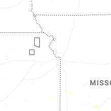
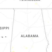
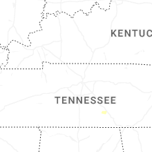
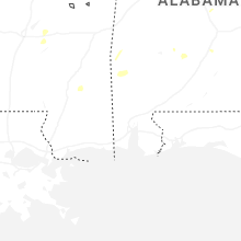
Hail Map for Saturday, May 23, 2026
Number of Impacted Households on 5/23/2026
0
Impacted by 1" or Larger Hail
0
Impacted by 1.75" or Larger Hail
0
Impacted by 2.5" or Larger Hail
Square Miles of Populated Area Impacted on 5/23/2026
0
Impacted by 1" or Larger Hail
0
Impacted by 1.75" or Larger Hail
0
Impacted by 2.5" or Larger Hail
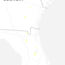
Cities Most Affected by Hail Storms of 5/23/2026
| Hail Size | Demographics of Zip Codes Affected | ||||||
|---|---|---|---|---|---|---|---|
| City | Count | Average | Largest | Pop Density | House Value | Income | Age |
| Stanton, TX | 2 | 1.75 | 1.75 | 2 | $49k | $30.3k | 34.8 |
| Tahoka, TX | 1 | 2.00 | 2.00 | 2 | $42k | $25.9k | 39.2 |
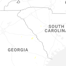
| Saluda, SC | 1 | 1.75 | 1.75 | 48 | $69k | $35.8k | 35.5 |
Hail and Wind Damage Spotted on 5/23/2026
Filter by Report Type:Hail ReportsWind Reports
States Impacted
Texas, Louisiana, Mississippi, Georgia, South Carolina, Nebraska, Florida, New Mexico, TennesseeTexas
| Local Time | Report Details |
|---|---|
| 7:21 AM CDT | Report of a tree down in the scottsville area around fm 1998 and cr 2213 east of marshal in harrison county TX, 28.8 miles W of Shreveport, LA |
| 7:40 AM CDT | Photo received of downed tree in fannett. time estimated by rada in jefferson county TX, 32.8 miles WSW of Beaumont, TX |
| 9:03 AM CDT | Photo of damage to large yucca tree. time estimated by rada in jasper county TX, 50.4 miles SE of Lufkin, TX |
| 9:07 AM CDT | Tree down on fm 705 between broaddus and bronso in san augustine county TX, 33.6 miles E of Lufkin, TX |
| 9:07 AM CDT | Report of widespread damage in the west and northwest portions of jasper... tx. report of roofs with damage... trees down... power lines down. time estimated by damag in jasper county TX, 51.1 miles SE of Lufkin, TX |
| 9:20 AM CDT | Several trees down on fm 1 between pineland and rosevin in sabine county TX, 42.6 miles E of Lufkin, TX |
| 9:20 AM CDT | Several trees down on highway 96 between bronson and pinelan in sabine county TX, 42.5 miles E of Lufkin, TX |
| 9:25 AM CDT | Several trees down on highway 87 between yellowpine and six mil in sabine county TX, 54.7 miles E of Lufkin, TX |
| 9:25 AM CDT | Report of numerous trees down or damaged in the south toledo bend area... particularly near tx 255 and tx 87. time estimated by rada in newton county TX, 61 miles ESE of Lufkin, TX |
| 11:54 AM CDT | Asos station kcrp corpus christ in nueces county TX, 6.2 miles WSW of Corpus Christi, TX |
| 11:56 AM CDT | Picture of one large tree trunk on a v-shape trunk tree snapped/spli in nueces county TX, 4.1 miles W of Corpus Christi, TX |
| 12:05 PM CDT | Awos station kngp c. christi na in nueces county TX, 11.5 miles SE of Corpus Christi, TX |
| 12:10 PM CDT | Large trees down due to thunderstorm wind gust in san patricio county TX, 7.9 miles NE of Corpus Christi, TX |
| 12:45 PM CDT | Several trees down throughout the cit in victoria county TX, 73.2 miles NNE of Corpus Christi, TX |
| 1:27 PM CDT | Pictures of large tree down onto a residents home and vehicles. time estimated by rada in calhoun county TX, 59.8 miles NE of Corpus Christi, TX |
| 2:16 PM CDT | Mesonet station xmgb matagorda ba in gmz350 county TX, 88.6 miles SSW of Houston, TX |
| 3:15 PM CDT | Wind damage to a lowe in brazoria county TX, 49.9 miles S of Houston, TX |
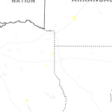
| 5:06 PM CDT | Quarter sized hail reported near Midland, TX, 16.8 miles E of Odessa, TX |
| 5:12 PM CDT | Golf Ball sized hail reported near Stanton, TX, 37.6 miles ENE of Odessa, TX, corrects previous hail report from 2 wsw stanton. |
| 5:41 PM CDT | Quarter sized hail reported near Stanton, TX, 39.4 miles ENE of Odessa, TX |
| 5:50 PM CDT | Golf Ball sized hail reported near Stanton, TX, 37.6 miles ENE of Odessa, TX |
| 7:06 PM CDT | Storm damage reported in moore county TX, 43.2 miles N of Amarillo, TX |
| 7:15 PM CDT | Storm damage reported in sherman county TX, 64.4 miles N of Amarillo, TX |
| 7:48 PM CDT | Storm damage reported in moore county TX, 32.8 miles NNE of Amarillo, TX |
| 7:53 PM CDT | Storm damage reported in hutchinson county TX, 48.7 miles NNE of Amarillo, TX |
| 8:21 PM CDT | Mesonet had a gust of 58 mph at 2021cdt with increasing gust to 75 mph at 2023cd in carson county TX, 13.1 miles ENE of Amarillo, TX |
| 8:40 PM CDT | Quarter sized hail reported near Axtell, TX, 55.2 miles NE of Killeen, TX, reported about 1.5 miles east of tstc. |
| 8:50 PM CDT | Hen Egg sized hail reported near Tahoka, TX, 29.8 miles S of Lubbock, TX, spotter reported 1.5 to 2 inch diameter hail currently falling. spotter was located on highway 380 west of tahoka. location was estimated by radar. |
| 8:55 PM CDT | Storm damage reported in hansford county TX, 78.6 miles NNE of Amarillo, TX |
| 9:04 PM CDT | Quarter sized hail reported near Levelland, TX, 29.1 miles W of Lubbock, TX, hail varying in size from 1/4 inch to 1 inch in levelland. |
| 11:09 PM CDT | Measured by the west texas mesonet. an additional gust to 64 mph occurred at 11:08 p in briscoe county TX, 55.9 miles W of Childress, TX |
| 11:34 PM CDT | Measured by the west texas mesone in motley county TX, 49.7 miles SW of Childress, TX |
| 11:41 PM CDT | Measured by the west texas mesonet. severe gusts from 58 to 61 mph occurred from 11:36 pm to 11:41 p in motley county TX, 49.8 miles SW of Childress, TX |
| 11:44 PM CDT | Quarter sized hail reported near Estelline, TX, 13.4 miles WNW of Childress, TX |
| 11:57 PM CDT | Measured by the west texas mesonet. additional severe gusts occurred from 11:56 pm to 12:05 am on 5/24/202 in cottle county TX, 38.7 miles SSW of Childress, TX |
| 11:59 PM CDT | Measured by the west texas mesone in king county TX, 61.2 miles SSW of Childress, TX |
| 12:19 AM CDT | Measured by the west texas mesonet. severe gusts also occurred at 12:18 and 12:20 a in cottle county TX, 36.8 miles S of Childress, TX |
Louisiana
| Local Time | Report Details |
|---|---|
| 9:15 AM CDT | Local law enforcement reports tree down on hwy 110 approx 3 miles west of hwy 27 junction. time estimated from rada in beauregard county LA, 43.9 miles NNE of Beaumont, TX |
| 9:22 AM CDT | Awos station kcwf chennault airpor in calcasieu county LA, 36.2 miles ENE of Beaumont, TX |
| 9:28 AM CDT | Video received of downed tree near ragley. time estimated by rada in beauregard county LA, 44.9 miles NE of Beaumont, TX |
| 9:33 AM CDT | Downed tree fell on a carport covering a car near toledo bend reservoi in sabine county LA, 63.8 miles E of Lufkin, TX |
| 9:41 AM CDT | Tree reported down on dogwood trail covering 3/4 of the road. time estimated from rada in beauregard county LA, 60.3 miles NNE of Beaumont, TX |
| 9:41 AM CDT | Law enforcement reports tree down on clarks landing rd covering entire road. time estimated from rada in beauregard county LA, 57.8 miles NE of Beaumont, TX |
| 9:43 AM CDT | Tree reported down covering both lanes on hwy 112 3 miles east of us 171 intersection. time estimated by rada in beauregard county LA, 61.5 miles NNE of Beaumont, TX |
| 9:47 AM CDT | Two trees reported down on smyrna rd. time estimated from rada in beauregard county LA, 65.8 miles NE of Beaumont, TX |
| 9:57 AM CDT | Tree reported down south of grant. time estimated from rada in allen county LA, 66.6 miles NE of Beaumont, TX |
| 10:05 AM CDT | Tree reported down on hwy 112 2 miles west of elizabeth. time estimated from rada in allen county LA, 66.5 miles NW of Lafayette, LA |
| 10:13 AM CDT | There are several trees down all throughout the city of many... along with power lines dow in sabine county LA, 66.9 miles SSE of Shreveport, LA |
| 10:15 AM CDT | Several trees and power lines down between many and florie in sabine county LA, 73.9 miles SSE of Shreveport, LA |
| 10:31 AM CDT | Report of numerous trees down in the glenmora area. time estimated by rada in rapides county LA, 64 miles NNW of Lafayette, LA |
| 10:34 AM CDT | Report of trees down on hwy 121 at gardner. time estimated by rada in rapides county LA, 82.7 miles NNW of Lafayette, LA |
| 10:44 AM CDT | Tree down in highway 71 between montgomery and colfa in grant county LA, 83.5 miles SE of Shreveport, LA |
| 10:45 AM CDT | Report of trees down in the boyce to flatwoods areas. time estimated by rada in rapides county LA, 88.8 miles NNW of Lafayette, LA |
| 10:52 AM CDT | Tree on a house in alexandria. no injuries. time estimated by rada in rapides county LA, 78.3 miles NNW of Lafayette, LA |
| 10:58 AM CDT | Report of a tree down on west highway to the north of boyce... l in grant county LA, 89.2 miles NNW of Lafayette, LA |
| 11:06 AM CDT | Report of trees down on the east side of the parish. radar estimated winds around 45 mph at the tim in rapides county LA, 75.2 miles NNW of Lafayette, LA |
| 11:07 AM CDT | Report of a tree down on us 167 north of dry prong near willian in grant county LA, 85.5 miles SSW of Bastrop, LA |
| 11:16 AM CDT | Tree damage reported on us 71 south of la 107 intersection near big cane. time estimated from rada in st. landry county LA, 41.5 miles N of Lafayette, LA |
| 11:20 AM CDT | Report of tree down on highway 472 near wilder roa in winn county LA, 72.5 miles SSW of Bastrop, LA |
| 11:30 AM CDT | Report of a tree down on highway 34 near state route 49 in winn county LA, 69.4 miles SW of Bastrop, LA |
| 11:55 AM CDT | Peak gust of 74.5 mph at the jonesville la state mesonet sit in catahoula county LA, 81.9 miles S of Bastrop, LA |
| 11:56 AM CDT | A tree was downed on la hwy 310 in catahoula county LA, 77.8 miles S of Bastrop, LA |
| 11:58 AM CDT | A tree was downed across la hwy 56 in concordia county LA, 87.8 miles N of Lafayette, LA |
| 11:58 AM CDT | A tree and utility pole were downed in jonesvill in catahoula county LA, 79.3 miles S of Bastrop, LA |
| 12:35 PM CDT | Trees were downed on la hwy 568 and on d st in waterproo in tensas county LA, 73.7 miles SSE of Bastrop, LA |
| 12:38 PM CDT | Trees were downed across la hwy 300 in tensas county LA, 68.6 miles SSE of Bastrop, LA |
| 12:57 PM CDT | Trees were downed on la hwy 60 in tensas county LA, 62.7 miles WSW of Jackson, MS |
| 1:00 PM CDT | Trees and utility lines were downed on lombardo s in tensas county LA, 62.8 miles SE of Bastrop, LA |
| 2:00 PM CDT | Multiple trees down across the roa in warren county MS, 42.7 miles W of Jackson, MS |
| 11:40 PM CDT | Koye measured a marine thunderstorm wind gust of 70 knots at 1140 pm. observation reads 21049g70kt. time of ob verified with radar dat in gmz551 county LA, 78.7 miles SSW of New Orleans, LA |
Mississippi
| Local Time | Report Details |
|---|---|
| 12:27 PM CDT | A tree fell on a house along devereaux dr. multiple trees were downed around natche in adams county MS, 86.5 miles SW of Jackson, MS |
| 12:30 PM CDT | Utility poles were downed in the morgantown are in adams county MS, 85.1 miles SW of Jackson, MS |
| 1:02 PM CDT | Lines blown down on meadville gloster rd near the water towe in franklin county MS, 71.8 miles SW of Jackson, MS |
| 1:17 PM CDT | Multiple trees down on ms 550 in union churc in jefferson county MS, 55.7 miles SW of Jackson, MS |
| 1:23 PM CDT | Trees down across lee ave in crystal springs. multiple trees down across count in copiah county MS, 23.2 miles SSW of Jackson, MS |
| 1:58 PM CDT | Entire road blocked by a large tree. multiple large trees down across the entire count in warren county MS, 36.9 miles W of Jackson, MS |
| 2:06 PM CDT | Corrects previous tstm wnd dmg report from 1 e crystal springs. trees down across lee ave in crystal springs. multiple trees down across count in copiah county MS, 23.2 miles SSW of Jackson, MS |
| 2:10 PM CDT | Multiple old/dead trees down across hazelhurst... particularly on w gallma in copiah county MS, 28.7 miles SSW of Jackson, MS |
| 2:13 PM CDT | A tree was downed across raymond rd near will-o-wood blv in hinds county MS, 6.9 miles WSW of Jackson, MS |
| 2:17 PM CDT | Trees and powerlines were downed on coronet plac in hinds county MS, 3 miles SW of Jackson, MS |
| 2:26 PM CDT | Utility pole and lines downed across post rd near overlook point in madison county MS, 10.8 miles NNE of Jackson, MS |
| 2:49 PM CDT | A tree fell across the natchez trace parkway near mile marker 12 in madison county MS, 27.5 miles NE of Jackson, MS |
| 3:08 PM CDT | Tree downed on ms hwy 432 near vaughan r in yazoo county MS, 41.7 miles NNE of Jackson, MS |
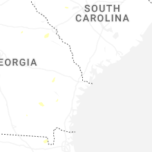
Georgia
| Local Time | Report Details |
|---|---|
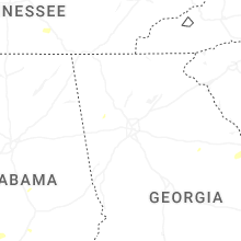
| 2:20 PM EDT | A large pine tree fell on a parked vehicle near the belle meade cc north of thomso in mcduffie county GA, 31.7 miles W of Augusta, GA |
South Carolina
| Local Time | Report Details |
|---|---|
| 3:15 PM EDT | Mccormick county dispatch reported several trees down within the county... including one on hwy 378 wes in mccormick county SC, 34.8 miles NNW of Augusta, GA |
| 4:45 PM EDT | Golf Ball sized hail reported near Saluda, SC, 42.1 miles NNE of Augusta, GA, public report of golf ball size hail highway 378. |
| 5:30 PM EDT | Law enforcement officer reported a tree down with picture of blocking roadway near cedar grove lane and shady grove roa in richland county SC, 63.2 miles NE of Augusta, GA |
Nebraska
| Local Time | Report Details |
|---|---|
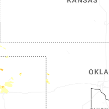
| 4:34 PM CDT | Corrects previous tstm wnd gst report from 2 e mccook. asos station kmck mccook airpor in red willow county NE, 60.7 miles NNE of Colby, KS |
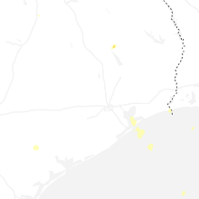
Florida
| Local Time | Report Details |
|---|---|
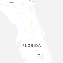
| 6:12 PM EDT | A storm spotter reported a large tree branch snapped off near the base of the trunk west of palatka. time was estimated by rada in putnam county FL, 47 miles S of Jacksonville, FL |
| 8:30 PM EDT | A tree was reported down along sw state road 121. time was estimated by rada in union county FL, 47.6 miles WSW of Jacksonville, FL |
New Mexico
| Local Time | Report Details |
|---|---|
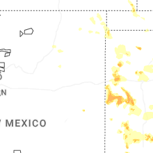
| 6:18 PM MDT | Asos station ktcc tucumcari muni airpor in quay county NM, 7.1 miles E of Tucumcari, NM |
Tennessee
| Local Time | Report Details |
|---|---|
| 10:33 PM CDT | Powerlines dow in marion county TN, 15.9 miles NW of Chattanooga, TN |
Connect with Interactive Hail Maps