

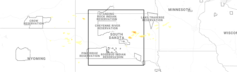
Hail Map for Thursday, June 4, 2026
Number of Impacted Households on 6/4/2026
0
Impacted by 1" or Larger Hail
0
Impacted by 1.75" or Larger Hail
0
Impacted by 2.5" or Larger Hail
Square Miles of Populated Area Impacted on 6/4/2026
0
Impacted by 1" or Larger Hail
0
Impacted by 1.75" or Larger Hail
0
Impacted by 2.5" or Larger Hail
Cities Most Affected by Hail Storms of 6/4/2026
| Hail Size | Demographics of Zip Codes Affected | ||||||
|---|---|---|---|---|---|---|---|
| City | Count | Average | Largest | Pop Density | House Value | Income | Age |
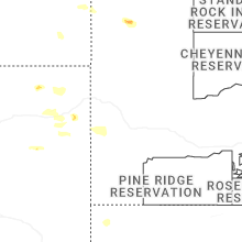
| Iroquois, SD | 1 | 2.75 | 2.75 | 2 | $30k | $31.1k | 42.0 |
| Yale, SD | 1 | 2.00 | 2.00 | 4 | $28k | $36.3k | 38.2 |
| Tulare, SD | 1 | 1.75 | 1.75 | 2 | $28k | $32.0k | 43.8 |
| Hitchcock, SD | 1 | 1.75 | 1.75 | 2 | $18k | $31.1k | 45.4 |
Hail and Wind Damage Spotted on 6/4/2026
Filter by Report Type:Hail ReportsWind Reports
Texas
| Local Time | Report Details |
|---|---|
| 12:46 PM CDT | Gusts of 58 to 65 mph from 12:38 to 12:48 pm. measured by the west texas mesone in hall county TX, 37.7 miles WNW of Childress, TX |
| 1:27 PM CDT | First severe wind gust of 63 mph at 1:27 pm. peak wind gust of 67 mph was measured at 1:30 p in gray county TX, 59.5 miles NNW of Childress, TX |
| 6:45 PM CDT | Quarter sized hail reported near Mason, TX, 93 miles WSW of Killeen, TX, quarter size and slightly larger hail with the 1st wave... then second wave was about dime sized. |
Kansas
| Local Time | Report Details |
|---|---|
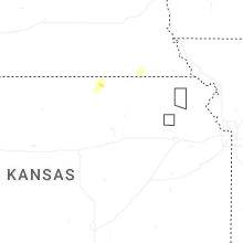
| 12:46 PM CDT | Power poles down with lines down across i-235. i-235 closed both directions. 7000+ customers without power. time estimated based on radar. report from broadcast media a in sedgwick county KS, 4.1 miles W of Wichita, KS |
| 1:05 PM CDT | 50 to 60 mph gust in sedgwick county KS, 4.4 miles N of Wichita, KS |
| 2:59 PM CDT | Report from facebook. time estimated based on rada in sedgwick county KS, 10.3 miles SSE of Wichita, KS |
| 2:59 PM CDT | Corrects previous tstm wnd dmg report from 4 wsw mulvane. several large tree limbs down near 140th ave and hydraulic in mulvan in sumner county KS, 15 miles S of Wichita, KS |
| 3:12 PM CDT | Gusts estimated 50 to 60 mp in sedgwick county KS, 6.6 miles ESE of Wichita, KS |
| 3:55 PM CDT | Tree limb down on power line causing down lin in clay county KS, 33 miles WNW of Manhattan, KS |
| 4:57 PM CDT | Report of wind damage to homestead. em was going to check out damag in marshall county KS, 43.2 miles N of Manhattan, KS |
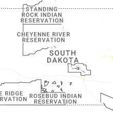
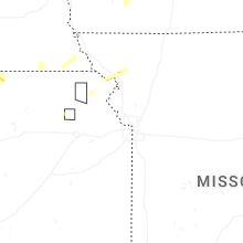
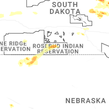
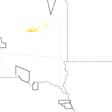
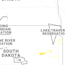
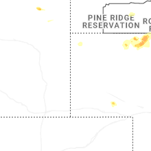
South Dakota
| Local Time | Report Details |
|---|---|
| 2:31 PM CDT | Hen Egg sized hail reported near Yale, SD, 75.1 miles SSE of Aberdeen, SD |
| 2:39 PM CDT | Baseball sized hail reported near Iroquois, SD, 74.6 miles SSE of Aberdeen, SD, various hail size from golf ball to baseball via photo. |
| 2:47 PM CDT | Ping Pong Ball sized hail reported near Iroquois, SD, 76.2 miles SSE of Aberdeen, SD |
| 2:50 PM CDT | Ping Pong Ball sized hail reported near Iroquois, SD, 75.3 miles SSE of Aberdeen, SD |
| 5:26 PM MDT | Quarter sized hail reported near Hill City, SD, 28.4 miles W of Rapid City, SD |
| 6:28 PM CDT | Golf Ball sized hail reported near Tulare, SD, 51.7 miles S of Aberdeen, SD, time estimated. |
| 6:50 PM CDT | Golf Ball sized hail reported near Hitchcock, SD, 57.4 miles S of Aberdeen, SD |
| 6:52 PM CDT | Ping Pong Ball sized hail reported near Miller, SD, 67.9 miles E of Pierre, SD, report from mping: ping pong ball (1.50 in.). |
| 5:59 PM MDT | Quarter sized hail reported near Hill City, SD, 19 miles WSW of Rapid City, SD |
| 7:04 PM CDT | Mesonet station 164 sd rwis wolse in beadle county SD, 69 miles S of Aberdeen, SD |
| 7:27 PM CDT | Quarter sized hail reported near Wessington, SD, 79.5 miles S of Aberdeen, SD, time estimated. also came with brief 50 to 60 mph gusts. |
| 7:31 PM CDT | Quarter sized hail reported near Wessington, SD, 76.1 miles S of Aberdeen, SD, report from mping: quarter (1.00 in.). |
| 7:33 PM CDT | Asos station khon huron regional airpor in beadle county SD, 74.9 miles S of Aberdeen, SD |
| 6:51 PM MDT | Storm damage reported in pennington county SD, 36.4 miles E of Rapid City, SD |
| 6:55 PM MDT | Storm damage reported in meade county SD, 40.1 miles ENE of Rapid City, SD |
| 7:00 PM MDT | Storm damage reported in meade county SD, 40.1 miles ENE of Rapid City, SD |
| 8:34 PM CDT | Mesonet station rhus2 danforth 5 e. time estimated by rada in hand county SD, 78.8 miles E of Pierre, SD |
| 9:31 PM CDT | Quarter sized hail reported near Lane, SD, 92.1 miles WNW of Sioux Falls, SD, em report of quarter sized hail just north of lane... sd. timing confirmed with radar. |
| 9:53 PM CDT | Measured on private weather statio in todd county SD, 21.3 miles NNW of Valentine, NE |
| 9:55 PM CDT | Storm damage reported in todd county SD, 24.1 miles NNW of Valentine, NE |
Wyoming
| Local Time | Report Details |
|---|---|
| 3:32 PM MDT | Half Dollar sized hail reported near Moorcroft, WY, 34.2 miles E of Gillette, WY |
| 5:02 PM MDT | Storm damage reported in weston county WY, 45.2 miles W of Rapid City, SD |
| 5:16 PM MDT | Storm damage reported in weston county WY, 45.2 miles W of Rapid City, SD |
Missouri
| Local Time | Report Details |
|---|---|
| 6:57 PM CDT | Quarter sized hail reported near King City, MO, 65.4 miles N of Kansas City, MO, report relayed via em. |
| 6:57 PM CDT | Law enforcement reported 50-60 mph wind gusts in king city. report relayed by e in gentry county MO, 65.4 miles N of Kansas City, MO |
Nebraska
| Local Time | Report Details |
|---|---|
| 6:42 PM MDT | Quarter sized hail reported near Merriman, NE, 58.5 miles W of Valentine, NE |
| 7:02 PM MDT | Storm damage reported in cherry county NE, 51.3 miles W of Valentine, NE |
| 7:42 PM MDT | Quarter sized hail reported near Merriman, NE, 58.5 miles W of Valentine, NE, corrects previous hail report from 7 s merriman. |
| 8:02 PM MDT | Corrects previous tstm wnd gst report from 6 wsw el in cherry county NE, 51.3 miles W of Valentine, NE |
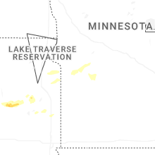
Minnesota
| Local Time | Report Details |
|---|---|
| 8:55 PM CDT | Awos station kvvv ortonville muni a in big stone county MN, 41.9 miles NW of Montevideo, MN |
Connect with Interactive Hail Maps