

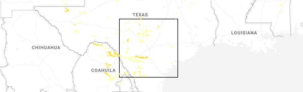
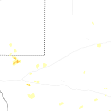
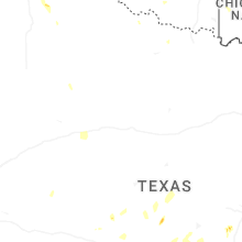
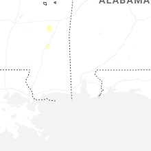
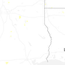
Hail Map for Tuesday, May 26, 2026
Number of Impacted Households on 5/26/2026
0
Impacted by 1" or Larger Hail
0
Impacted by 1.75" or Larger Hail
0
Impacted by 2.5" or Larger Hail
Square Miles of Populated Area Impacted on 5/26/2026
0
Impacted by 1" or Larger Hail
0
Impacted by 1.75" or Larger Hail
0
Impacted by 2.5" or Larger Hail
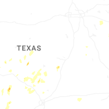
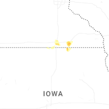
Cities Most Affected by Hail Storms of 5/26/2026
| Hail Size | Demographics of Zip Codes Affected | ||||||
|---|---|---|---|---|---|---|---|
| City | Count | Average | Largest | Pop Density | House Value | Income | Age |
| Stonewall, TX | 1 | 2.00 | 2.00 | 7 | $84k | $35.5k | 47.1 |
| Charlotte, TX | 1 | 2.00 | 2.00 | 1 | $26k | $25.1k | 33.5 |
Hail and Wind Damage Spotted on 5/26/2026
Filter by Report Type:Hail ReportsWind Reports
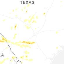
Texas
| Local Time | Report Details |
|---|---|
| 1:20 PM CDT | Measured by the west texas mesone in swisher county TX, 42.2 miles SSE of Amarillo, TX |
| 3:12 PM CDT | Half Dollar sized hail reported near Uvalde, TX, 56 miles E of Del Rio, TX |
| 3:13 PM CDT | Storm damage reported in kent county TX, 72.2 miles NW of Abilene, TX |
| 4:15 PM CDT | Quarter sized hail reported near Pearsall, TX, 51.5 miles SW of San Antonio, TX, 1 inch hail reported via media. |
| 4:30 PM CDT | Half Dollar sized hail reported near Fredonia, TX, 83.6 miles W of Killeen, TX |
| 4:47 PM CDT | Quarter sized hail reported near Fredericksburg, TX, 63.7 miles NNW of San Antonio, TX, report from mping. |
| 5:00 PM CDT | 60mph winds reported 5 miles east of pearsal in frio county TX, 46.9 miles SW of San Antonio, TX |
| 5:25 PM CDT | Ping Pong Ball sized hail reported near Pearsall, TX, 52.9 miles SSW of San Antonio, TX, reported via public. |
| 5:25 PM CDT | Quarter sized hail reported near , , 88.1 miles NW of Alpine, TX, hail report from 13 nne van horn. nws storm spotter sent a report of quarter sized hail observed while on a walking trail off of hwy 54. |
| 5:42 PM CDT | Quarter sized hail reported near Quemado, TX, 36.2 miles SSE of Del Rio, TX, 1 inch hail reported. |
| 6:17 PM CDT | Hen Egg sized hail reported near Stonewall, TX, 57 miles N of San Antonio, TX, 2 inch hail reported via photo on fb. |
| 7:25 PM CDT | Spotter reported 2.5 inch diameter branches down in city uvald in uvalde county TX, 67.8 miles E of Del Rio, TX |
| 7:25 PM CDT | Downed tree in uvalde. time estimated via rada in uvalde county TX, 68.4 miles E of Del Rio, TX |
| 7:38 PM CDT | 79 mph wind gust with a handheld anemomete in zavala county TX, 75.4 miles WSW of San Antonio, TX |
| 7:42 PM CDT | Hen Egg sized hail reported near Charlotte, TX, 38 miles SSW of San Antonio, TX, photo via storm chaser on twitter. |
| 7:45 PM CDT | Em reports a rv pushed on its side from win in williamson county TX, 28 miles SSW of Killeen, TX |
| 8:01 PM CDT | Quarter sized hail reported near Georgetown, TX, 26.1 miles S of Killeen, TX, report from mping quarter inch hail. |
| 8:06 PM CDT | Ping Pong Ball sized hail reported near Center Point, TX, 48.3 miles NW of San Antonio, TX, half dollar to ping pong size hail south of center point. time estimated via radar. |
| 8:23 PM CDT | A large tree was blown down and partly blocking barnard avenue in sabina in uvalde county TX, 59.3 miles W of San Antonio, TX |
| 10:25 PM CDT | Mesonet station twb16 1.1 ne new berlin (twdb in guadalupe county TX, 24.7 miles E of San Antonio, TX |
| 11:06 PM CDT | Smiley fire department responding to possible down power line in gonzales county TX, 52.5 miles E of San Antonio, TX |
| 12:57 AM CDT | Debris in the road near cr 248 and cr 135 in jim wells county TX, 44.1 miles W of Corpus Christi, TX |
| 1:07 AM CDT | Large trees down near cr 1767 and cr 44 in jim wells county TX, 46.8 miles WSW of Corpus Christi, TX |
| 1:24 AM CDT | Awos station knog orange grov in jim wells county TX, 40.2 miles W of Corpus Christi, TX |
| 3:41 AM CDT | Measured by lrd awo in webb county TX, 2.9 miles ENE of Laredo, TX |
| 4:20 AM CDT | Awos station kgvw 21 ese galvesto in gmz355 county TX, 65.8 miles SE of Houston, TX |
Idaho
| Local Time | Report Details |
|---|---|
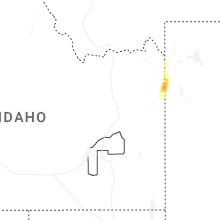
| 3:10 PM MDT | Ping Pong Ball sized hail reported near Tetonia, ID, 54.6 miles ENE of Idaho Falls, ID, half dollar to ping pong size hail near beaver and wolverine way in tetonia. public also reports a broken sky light and windshield. |
Montana
| Local Time | Report Details |
|---|---|
| 3:30 PM MDT | Mesonet station mtlbt lambert mt-200 mp 45. in richland county MT, 60 miles WSW of Williston, ND |
| 4:30 PM MDT | Wind and lightning damaged tree in richland county MT, 62.6 miles WSW of Williston, ND |
| 5:45 PM MDT | Mesonet station mttos toston bridge us-287 mp 87. in broadwater county MT, 39.8 miles NNW of Bozeman, MT |
| 5:53 PM MDT | Asos station kolf wolf point airpor in roosevelt county MT, 49.3 miles E of Glasgow, MT |
| 6:54 PM MDT | Mesonet station ekhm8 elkhorn raws - 8 w townsen in broadwater county MT, 54.1 miles NW of Bozeman, MT |
| 11:15 PM MDT | Awos station ksbx 2 nnw shelb in toole county MT, 76 miles NNW of Great Falls, MT |
Georgia
| Local Time | Report Details |
|---|---|
| 5:45 PM EDT | Georgia department of transportation reports tree down near the intersection of highway 219 and saint anthony driv in troup county GA, 40.9 miles NE of Auburn, AL |
| 7:20 PM EDT | Fire department reports downed power lines near the intersection of 1st street and highway 44 in wilkinson county GA, 83 miles WSW of Augusta, GA |
| 7:20 PM EDT | Fire department reports multiple trees and power lines down along pine circl in wilkinson county GA, 83.5 miles WSW of Augusta, GA |
| 7:20 PM EDT | Fire department reports a downed power pole and lines near the intersection of 1st street and old mcintyre roa in wilkinson county GA, 82.7 miles WSW of Augusta, GA |
| 7:40 PM EDT | Public reports tree down near the intersection of indian island drive and highway 2 in baldwin county GA, 72.3 miles WSW of Augusta, GA |
Florida
| Local Time | Report Details |
|---|---|
| 5:53 PM EDT | Asos station kpgd punta gord in charlotte county FL, 53.3 miles SE of Bradenton, FL |
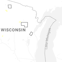
Wisconsin
| Local Time | Report Details |
|---|---|
| 4:54 PM CDT | Trees and power lines dow in langlade county WI, 37.3 miles SSE of Rhinelander, WI |
| 5:21 PM CDT | Quarter sized hail reported near Springbrook, WI, 59.6 miles SSE of Duluth, MN |
| 6:06 PM CDT | Half Dollar sized hail reported near Hayward, WI, 64.4 miles SSE of Duluth, MN, report from mping half dollar. |
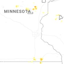
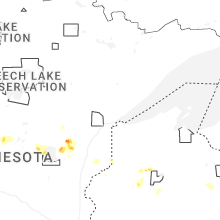
Minnesota
| Local Time | Report Details |
|---|---|
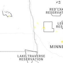
| 4:58 PM CDT | Quarter sized hail reported near Park Rapids, MN, 35.2 miles SSW of Bemidji, MN, report from mping: quarter (1.00 in.). |
| 5:40 PM CDT | Portion of sheet metal ripped off of roof. a tree was also reported to be knocked dow in cass county MN, 72.7 miles S of Bemidji, MN |
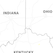
Kentucky
| Local Time | Report Details |
|---|---|
| 7:13 PM EDT | Delayed report. pictures on social media of downed power lines along boone creek road off ky-213 north of stanton. possible tornado. exact time estimated by rada in powell county KY, 14.2 miles NNE of Irvine, KY |
| 7:14 PM EDT | County em reports dozens of large trees down in the hatchers creek rd and lowers hatchers creek rd areas. power lines are also down in this area with power outages. pos in powell county KY, 14.4 miles NNE of Irvine, KY |
| 7:15 PM EDT | County em reports dozens of large trees down in the hatchers creek rd and lowers hatchers creek rd areas. power lines are also down in this area with power outages. pos in powell county KY, 15.6 miles NNE of Irvine, KY |
| 7:18 PM EDT | Delayed report. pictures on social media of downed trees at the end of leach hollow road off of ky-213 and ky-464. exact time estimated by radar. possible tornad in montgomery county KY, 17.3 miles NNE of Irvine, KY |
| 7:20 PM EDT | Social media report with photo of tree down on power line on lower cane creek rd. time and location estimate in powell county KY, 16.2 miles NE of Irvine, KY |
| 7:49 PM EDT | Resends previous tstm wnd dmg report from 1 wsw frenchburg due to iris error message. tree down on power lines along indian creek road. time estimated by rada in menifee county KY, 24.8 miles NE of Irvine, KY |
New Mexico
| Local Time | Report Details |
|---|---|
| 5:29 PM MDT | Quarter sized hail reported near Carlsbad, NM, 83.7 miles S of Roswell, NM, trained spotter found dime to quarter sized hail along u.s. highway 62/180. |
Connect with Interactive Hail Maps