

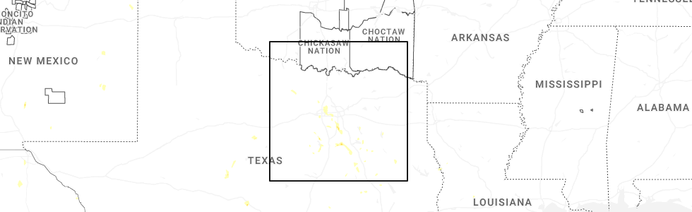
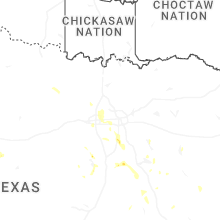
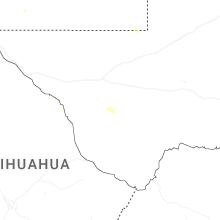
Hail Map for Monday, May 25, 2026
Number of Impacted Households on 5/25/2026
0
Impacted by 1" or Larger Hail
0
Impacted by 1.75" or Larger Hail
0
Impacted by 2.5" or Larger Hail
Square Miles of Populated Area Impacted on 5/25/2026
0
Impacted by 1" or Larger Hail
0
Impacted by 1.75" or Larger Hail
0
Impacted by 2.5" or Larger Hail


Cities Most Affected by Hail Storms of 5/25/2026
| Hail Size | Demographics of Zip Codes Affected | ||||||
|---|---|---|---|---|---|---|---|
| City | Count | Average | Largest | Pop Density | House Value | Income | Age |
Hail and Wind Damage Spotted on 5/25/2026
Filter by Report Type:Hail ReportsWind Reports
Louisiana
| Local Time | Report Details |
|---|---|
| 10:55 AM CDT | Awos station kglx mississippi canyon 724 measured a peak wind gust of 70mph or 61k in gmz575 county LA, 135.7 miles SSE of New Orleans, LA |
Florida
| Local Time | Report Details |
|---|---|
| 12:48 PM EDT | There were a couple of trees down but no other damage reported in gadsden count in gadsden county FL, 30.7 miles WNW of Tallahassee, FL |
| 4:07 PM CDT | Reports of multiple trees and power lines down in villa tasso. possible tornado. time estimated by rada in walton county FL, 6.1 miles NNW of Miramar Beach, FL |
| 6:15 PM CDT | Trees down near new hope and highway 179 in holmes county FL, 48.9 miles NE of Miramar Beach, FL |
Wyoming
| Local Time | Report Details |
|---|---|
| 12:00 PM MDT | Mesonet station bpyw4 snider basin. time estimate in sublette county WY, 91.7 miles NW of Rock Springs, WY |
Georgia
| Local Time | Report Details |
|---|---|
| 2:20 PM EDT | Tree and large limbs reported down. time estimated by rada in terrell county GA, 83.5 miles SE of Auburn, AL |
| 4:10 PM EDT | At least 1 tree down at a residence. nearest intersection is adams road and ga 2 in dooly county GA, 65.1 miles NW of Douglas, GA |
| 4:38 PM EDT | Several tree limbs down and 1-2 trees down near the intersection of magnolia road and red dog farm roa in bleckley county GA, 74 miles NNW of Douglas, GA |
New Mexico
| Local Time | Report Details |
|---|---|
| 1:45 PM MDT | Mesonet station wsm02 wsmr apach in dona ana county NM, 60.3 miles N of El Paso, TX |
| 1:46 PM MDT | Asos station ksaf santa fe muni airpor in santa fe county NM, 48.2 miles NE of Albuquerque, NM |
| 11:40 PM MDT | Half Dollar sized hail reported near Lovington, NM, 74.6 miles ESE of Roswell, NM, half dollar size hail reported approximately 3 blocks away from the fire department. |
Texas
| Local Time | Report Details |
|---|---|
| 3:52 PM CDT | Quarter sized hail reported near North Richland Hills, TX, 25.2 miles WNW of Dallas, TX, report from mping quarter 1.00 in. |
| 4:20 PM CDT | Quarter sized hail reported near Waxahachie, TX, 25.6 miles S of Dallas, TX, report from mping: quarter 1.00 in. |
| 5:00 PM CDT | Quarter sized hail reported near Dawson, TX, 60.7 miles S of Dallas, TX, media reported quarter size hail in dawson. |
Idaho
| Local Time | Report Details |
|---|---|
| 2:55 PM MDT | Mesonet station dvi11593 wendel in gooding county ID, 17.4 miles NNW of Twin Falls, ID |
| 3:45 PM MDT | Mesonet station 2996 d3 - hammett hil in elmore county ID, 49.3 miles SE of Boise, ID |
| 4:10 PM MDT | Alaska airlines cargo roof blew off at boise airport... at least one downed wir in ada county ID, 2.9 miles SSW of Boise, ID |
| 4:15 PM MDT | Large trees down along river greenbel in ada county ID, 2.8 miles NW of Boise, ID |
| 4:28 PM MDT | Crestline raw in ada county ID, 2 miles NE of Boise, ID |
| 5:45 PM MDT | Idaho power site w3t in valley county ID, 60 miles N of Boise, ID |
| 5:58 PM MDT | Idaho power site w3t in valley county ID, 78.5 miles S of Grangeville, ID |
| 6:00 PM MDT | Several trees down in ponderosa state park blocking the roads. via social media. time estimate in valley county ID, 68.8 miles S of Grangeville, ID |
| 6:40 PM MDT | Idaho power site w3t in valley county ID, 77 miles N of Boise, ID |
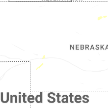
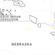
Nebraska
| Local Time | Report Details |
|---|---|
| 9:19 PM CDT | Quarter sized hail reported near Oakdale, NE, 43.9 miles SE of Oneill, NE |
| 9:29 PM CDT | Storm damage reported in antelope county NE, 39 miles SE of Oneill, NE |
| 10:15 PM CDT | Quarter sized hail reported near Clearwater, NE, 32.6 miles SE of Oneill, NE, public report. lots of hail with biggest one being just over 1 inch. |
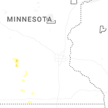
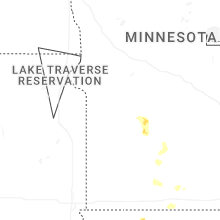
Minnesota
| Local Time | Report Details |
|---|---|
| 5:57 AM CDT | Quarter sized hail reported near Prinsburg, MN, 25.4 miles E of Montevideo, MN, report from mping: quarter (1.00 in.). |
Connect with Interactive Hail Maps