

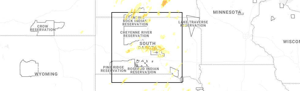
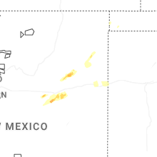
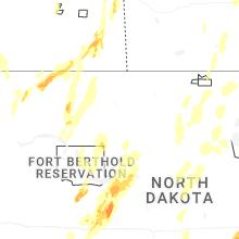
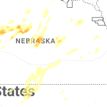
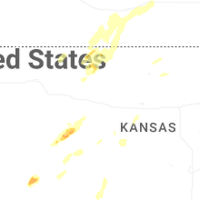
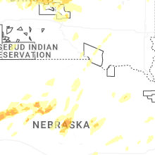
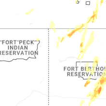
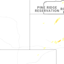
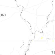
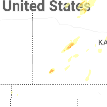
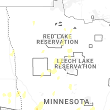
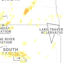
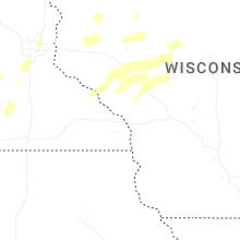
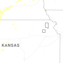
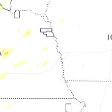
Hail Map for Tuesday, June 9, 2026
Number of Impacted Households on 6/9/2026
0
Impacted by 1" or Larger Hail
0
Impacted by 1.75" or Larger Hail
0
Impacted by 2.5" or Larger Hail
Square Miles of Populated Area Impacted on 6/9/2026
0
Impacted by 1" or Larger Hail
0
Impacted by 1.75" or Larger Hail
0
Impacted by 2.5" or Larger Hail
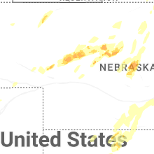
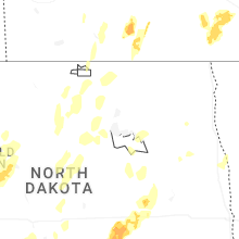
Cities Most Affected by Hail Storms of 6/9/2026
| Hail Size | Demographics of Zip Codes Affected | ||||||
|---|---|---|---|---|---|---|---|
| City | Count | Average | Largest | Pop Density | House Value | Income | Age |
| Fortuna, ND | 2 | 2.38 | 3.00 | 0 | $10k | $26.3k | 50.5 |
| Tryon, NE | 1 | 2.75 | 2.75 | 0 | $42k | $25.2k | 42.8 |
| Alamo, ND | 1 | 2.00 | 2.00 | 1 | $10k | $22.8k | 53.4 |
| Richardton, ND | 1 | 1.75 | 1.75 | 2 | $46k | $32.8k | 46.2 |
| Mullen, NE | 1 | 1.75 | 1.75 | 0 | $41k | $28.7k | 49.6 |
Hail and Wind Damage Spotted on 6/9/2026
Filter by Report Type:Hail ReportsWind Reports
States Impacted
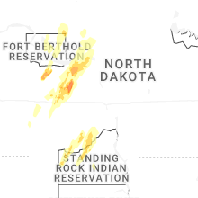
North Dakota, Kentucky, Colorado, New Mexico, Kansas, Tennessee, Indiana, Wyoming, Nebraska, Texas, Illinois, New York, Alabama, South Dakota, MinnesotaNorth Dakota
| Local Time | Report Details |
|---|---|
| 11:23 AM CDT | 10 m wind gust at ndawn site streeter 6 n in kidder county ND, 62.9 miles E of Bismarck, ND |
| 4:57 PM CDT | 59mph at 10m hebron 7s ndaw in morton county ND, 61.7 miles W of Bismarck, ND |
| 5:02 PM CDT | Quarter sized hail reported near Hebron, ND, 60.6 miles W of Bismarck, ND |
| 5:10 PM CDT | Half Dollar sized hail reported near Hebron, ND, 60.6 miles W of Bismarck, ND, half-dollar sized hail. |
| 4:15 PM MDT | Quarter sized hail reported near Beulah, ND, 56.8 miles NW of Bismarck, ND, quarter-inch hail reported in beulah at 5:15 from social media. |
| 4:16 PM MDT | Quarter sized hail reported near Beulah, ND, 56.8 miles NW of Bismarck, ND, quarter-sized measured from bottle cap in beulah. |
| 4:16 PM MDT | Golf Ball sized hail reported near Richardton, ND, 72.7 miles W of Bismarck, ND, broadcast media reported golf ball size hail in richardton. |
| 4:30 PM MDT | Quarter sized hail reported near Beulah, ND, 56.8 miles NW of Bismarck, ND, social media report of quarter size hail at 530 pm in beulah. |
| 4:35 PM MDT | Ping Pong Ball sized hail reported near Beulah, ND, 56.8 miles NW of Bismarck, ND |
| 4:42 PM MDT | 62mph at 10m at 5n halliday ndaw in dunn county ND, 73.8 miles SW of Minot, ND |
| 6:03 PM CDT | Quarter sized hail reported near Alamo, ND, 34.1 miles NNE of Williston, ND, quarter-inch hail reported by williams county em. |
| 6:11 PM CDT | Measured wind gust on private weather statio in mclean county ND, 51.9 miles SW of Minot, ND |
| 6:13 PM CDT | 58mph gust 13nw garrison ndaw in mclean county ND, 40.5 miles SSW of Minot, ND |
| 6:16 PM CDT | Storm damage reported in mclean county ND, 43.5 miles S of Minot, ND |
| 6:19 PM CDT | Em called and report sheets of rain and pea size hail and 60 mph wind in mclean county ND, 40.9 miles S of Minot, ND |
| 6:29 PM CDT | Awos station k1dn 1 s ma in mclean county ND, 30.1 miles S of Minot, ND |
| 6:36 PM CDT | Golf Ball sized hail reported near Fortuna, ND, 53.2 miles N of Williston, ND, mostly smaller hail... but a few as large as golf balls. |
| 6:40 PM CDT | Tea Cup sized hail reported near Fortuna, ND, 53.2 miles N of Williston, ND, emergency manger reported 3 inch hail 6:40pm in fortuna. |
| 6:45 PM CDT | Hen Egg sized hail reported near Alamo, ND, 35.9 miles NNE of Williston, ND, 2 in reported near alamo from williams county em. |
| 6:48 PM CDT | 60mph at 10m 4s minot ndaw in ward county ND, 3.9 miles S of Minot, ND |
| 6:49 PM CDT | Social media reports of downed tree branches in minot from strong wind in ward county ND, 0.5 miles SSW of Minot, ND |
| 6:49 PM CDT | 72mph 10m gust measured at 7s sawyer ndaw in ward county ND, 20.1 miles SSE of Minot, ND |
| 7:01 PM CDT | 59mph gust recorded at 3m at 3s genoa ndaw in mchenry county ND, 15.3 miles ESE of Minot, ND |
| 7:19 PM CDT | 68mph gust reported from 3sw bantry ndawn at 10 in mchenry county ND, 29.7 miles ENE of Minot, ND |
| 7:38 PM CDT | 62mph gust recorded at 3m ndawn 14w of bottinea in bottineau county ND, 47.3 miles NNE of Minot, ND |
| 7:46 PM CDT | Mesonet station jcsn8 j. clark salye in mchenry county ND, 37.2 miles NE of Minot, ND |
| 7:49 PM CDT | Measured wind gust at westhope nddot site. time estimated from rada in bottineau county ND, 42.3 miles NNE of Minot, ND |
| 7:53 PM CDT | 58mph gust recorded at 3m at ndawn 1se porta in burke county ND, 76.1 miles NW of Minot, ND |
| 7:59 PM CDT | Measured wind gust at private weather statio in bottineau county ND, 64.1 miles NE of Minot, ND |
| 8:17 PM CDT | 63mph gust recorded at 3m at 1n bowbells ndaw in burke county ND, 59.2 miles NW of Minot, ND |
| 8:42 PM CDT | 60mph at 10m... 5nw steele ndaw in kidder county ND, 37.8 miles E of Bismarck, ND |
| 8:47 PM CDT | Mesonet station ts633 long lake nw in burleigh county ND, 27 miles ESE of Bismarck, ND |
| 9:16 PM CDT | Awos station k5h4 harvey nd awos. time estimated from rada in wells county ND, 54.8 miles WSW of Devils Lake, ND |
| 9:19 PM CDT | Storm chasers reported 60 mph wind in wells county ND, 57 miles WSW of Devils Lake, ND |
| 9:30 PM CDT | Public report of 1nw of fessenden of estimated 60 mp in wells county ND, 47.6 miles SW of Devils Lake, ND |
| 9:34 PM CDT | Personal weather statio in kidder county ND, 64.7 miles ENE of Bismarck, ND |
| 9:41 PM CDT | Ndawn site at 33 f in benson county ND, 32.3 miles WSW of Devils Lake, ND |
| 9:50 PM CDT | Gust at 10 f in benson county ND, 36.9 miles W of Devils Lake, ND |
| 10:17 PM CDT | Corrects previous tstm wnd gst report from 1 n webster. ndawn site reporting at 33 f in ramsey county ND, 13 miles N of Devils Lake, ND |
| 10:19 PM CDT | Storm damage reported in ramsey county ND, 2.9 miles W of Devils Lake, ND |
| 11:23 PM CDT | Corrects time of previous tstm wnd gst report from 7 nw streeter. 10 m wind gust at ndawn site streeter 6 n in kidder county ND, 62.9 miles E of Bismarck, ND |
| 11:35 PM CDT | 10 m gust at ndawn station ellendale 4 ne. gusts of this magnitude lasted for 10 minute in dickey county ND, 40.8 miles N of Aberdeen, SD |
| 11:51 PM CDT | Asos station kjms jamestown airpor in stutsman county ND, 82.1 miles S of Devils Lake, ND |
| 11:53 PM CDT | Quarter sized hail reported near Jamestown, ND, 83.3 miles S of Devils Lake, ND, quarter size hail falling at time of report. power outage also reported. |
| 12:01 AM CDT | 10 m wind gust at ndawn site marion 2 in lamoure county ND, 76.4 miles N of Aberdeen, SD |
| 12:29 AM CDT | Weather underground station repor in sargent county ND, 61.6 miles NE of Aberdeen, SD |
| 12:42 AM CDT | Weather underground station repor in sargent county ND, 53 miles SSW of Fargo, ND |
| 1:05 AM CDT | Storm damage reported in ransom county ND, 39.2 miles SW of Fargo, ND |
| 1:06 AM CDT | Ndawn site reporting at 33 f in richland county ND, 44.9 miles S of Fargo, ND |
| 1:10 AM CDT | Ndawn site reporting at 10 f in richland county ND, 28.8 miles SW of Fargo, ND |
| 1:43 AM CDT | Storm damage reported in cass county ND, 3.5 miles NNW of Fargo, ND |
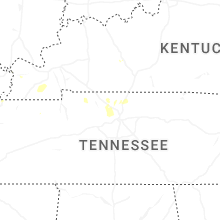
Kentucky
| Local Time | Report Details |
|---|---|
| 2:59 PM CDT | Emergency management reported multiple trees down and power poles snapped between 4500-5000 bowling green rd. southeast of morgantow in butler county KY, 69.3 miles N of Nashville, TN |
Colorado
| Local Time | Report Details |
|---|---|
| 2:23 PM MDT | Pueblo aso in pueblo county CO, 5.8 miles ENE of Pueblo, CO |
| 2:34 PM MDT | Awos station kpub pueblo airpor in pueblo county CO, 6.2 miles E of Pueblo, CO |
| 3:21 PM MDT | Mesonet station co031 025n033 aguila in las animas county CO, 58.2 miles S of Pueblo, CO |
| 3:56 PM MDT | Asos station kspd 8 s springfiel in baca county CO, 107 miles WSW of Garden City, KS |
| 3:58 PM MDT | Awos station ktad trinidad airpor in las animas county CO, 70.3 miles SSE of Pueblo, CO |
| 8:37 PM MDT | Asos station kgjt grand junction rgnl a in mesa county CO, 4.3 miles NNE of Grand Junction, CO |
New Mexico
| Local Time | Report Details |
|---|---|
| 2:45 PM MDT | Pea sized hail as wel in san miguel county NM, 29.7 miles WNW of Tucumcari, NM |
| 2:49 PM MDT | Mesonet station wdrn5 lama 4 nw (wild rivers) from virga shower in taos county NM, 19.9 miles NNW of Taos, NM |
Kansas
| Local Time | Report Details |
|---|---|
| 3:58 PM CDT | Quarter sized hail reported near Ulysses, KS, 43.4 miles SSW of Garden City, KS |
| 4:51 PM CDT | From personal weather statio in thomas county KS, 18 miles W of Colby, KS |
| 4:54 PM CDT | Asos station kgck garden cit in finney county KS, 9 miles ESE of Garden City, KS |
| 4:55 PM CDT | Ambient weather network statio in gray county KS, 23.3 miles SE of Garden City, KS |
| 5:00 PM CDT | Id: wunderground_kksbrews in thomas county KS, 18.3 miles WNW of Colby, KS |
| 5:15 PM CDT | Id: wunderground_kksbrews in thomas county KS, 18.3 miles WNW of Colby, KS |
| 5:15 PM CDT | Asos station kgck garden cit in finney county KS, 9 miles ESE of Garden City, KS |
| 5:20 PM CDT | Picture relayed via social media of multiple large branches of a healthy tree broke in gray county KS, 34.8 miles SE of Garden City, KS |
| 5:30 PM CDT | Kansas state mesone in stevens county KS, 53.9 miles SSW of Garden City, KS |
| 5:35 PM CDT | Davis weatherlink statio in hodgeman county KS, 36 miles E of Garden City, KS |
| 6:15 PM CDT | Kansas state mesone in hodgeman county KS, 53.8 miles E of Garden City, KS |
| 6:20 PM CDT | Storm damage reported in phillips county KS, 67.4 miles N of Hays, KS |
| 6:27 PM CDT | Storm damage reported in phillips county KS, 74.5 miles N of Hays, KS |
| 6:27 PM CDT | Storm damage reported in phillips county KS, 76.6 miles N of Hays, KS |
| 6:28 PM CDT | Social media report with video of estimated 60-70 mph winds gusts in elli in ellis county KS, 13.2 miles WNW of Hays, KS |
| 6:29 PM CDT | Davis weatherlink statio in ellis county KS, 14.5 miles WNW of Hays, KS |
| 6:29 PM CDT | Storm damage reported in phillips county KS, 72.7 miles N of Hays, KS |
| 6:30 PM CDT | Quarter sized hail reported near Norton, KS, 68.8 miles ENE of Colby, KS, report of 1 inch hail in norton. |
| 6:31 PM CDT | Davis weatherlink statio in rush county KS, 12.6 miles S of Hays, KS |
| 6:32 PM CDT | Davis weatherlink statio in ellis county KS, 6.9 miles NW of Hays, KS |
| 6:35 PM CDT | Mesonet station up856 0.8 e yocemento (upr in ellis county KS, 5 miles WNW of Hays, KS |
| 6:39 PM CDT | Davis weatherlink statio in pawnee county KS, 50.6 miles SSW of Hays, KS |
| 6:44 PM CDT | Associated with light shower in rooks county KS, 22.9 miles NW of Hays, KS |
| 6:47 PM CDT | Storm damage reported in pawnee county KS, 50.6 miles SSW of Hays, KS |
| 7:25 PM CDT | Measured at the great bend airpor in barton county KS, 44.7 miles SE of Hays, KS |
| 7:26 PM CDT | Measured on a personal weather statio in barton county KS, 44.3 miles SE of Hays, KS |
| 7:26 PM CDT | Estimated about 60 mph... not much mor in barton county KS, 45 miles SE of Hays, KS |
| 7:41 PM CDT | Asos station kddc dodge city regional airpor in ford county KS, 51.2 miles ESE of Garden City, KS |
| 7:41 PM CDT | Measured on a personal weather statio in barton county KS, 53.8 miles SE of Hays, KS |
| 7:44 PM CDT | Associated with light showers in the are in rooks county KS, 29.2 miles NNE of Hays, KS |
| 7:52 PM CDT | Social media report of power poles broken in western hodgeman county at the intersection of v road and 202 road. time estimated from rada in hodgeman county KS, 41.1 miles ENE of Garden City, KS |
| 8:15 PM CDT | Storm damage reported in osborne county KS, 55.6 miles NE of Hays, KS |
| 9:56 PM CDT | Estimated about 60 mp in barton county KS, 39.2 miles ESE of Hays, KS |
| 10:00 PM CDT | Krsl asos measured 70 mp in russell county KS, 28.2 miles E of Hays, KS |
| 10:24 PM CDT | Semi flipped over on i-70 at mile marker 20 in russell county KS, 44.4 miles E of Hays, KS |
| 11:10 PM CDT | Mesonet station ur445 3.2 e new cambria (upr in saline county KS, 51.8 miles WSW of Manhattan, KS |
| 12:56 AM CDT | Awos station klbl liberal... mesoscale convective vortex wind in seward county KS, 65 miles S of Garden City, KS |
| 12:57 AM CDT | Mesonet station up352 2.7 sw liberal (upr)... mesoscale convective vortex wind in seward county KS, 66.4 miles S of Garden City, KS |
| 1:04 AM CDT | Mesonet station up407 0.6 sw hayne (upr)... mesoscale convective vortex wind in seward county KS, 60 miles S of Garden City, KS |
| 1:05 AM CDT | Mesonet station ur350 kismws... mesoscale convective vortex wind in seward county KS, 56.9 miles S of Garden City, KS |
| 1:55 AM CDT | Mesoscale convective vortex wind in meade county KS, 62.4 miles SSE of Garden City, KS |
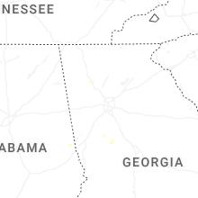
Tennessee
| Local Time | Report Details |
|---|---|
| 4:56 PM CDT | Public reports multiple trees down on logue roa in wilson county TN, 16.7 miles E of Nashville, TN |
| 4:56 PM CDT | Tree down on central pike close to mount juliet road. time estimate in wilson county TN, 15.1 miles E of Nashville, TN |
| 4:56 PM CDT | Tree on fence in charlie daniels park. time estimated from rada in wilson county TN, 15.4 miles ENE of Nashville, TN |
| 4:56 PM CDT | Corrects previous tstm wnd dmg report from 2 s belinda city. a tree has fallen on a home. estimated to be 80 feet tall and 3.5 feet in diameter. relayed via amateur rad in wilson county TN, 16.8 miles E of Nashville, TN |
| 5:07 PM CDT | Off-duty nws employee reports neighbors dogwood tree splits in half during strong winds. estimated 60 mph wind gus in wilson county TN, 20.4 miles E of Nashville, TN |
| 5:12 PM CDT | Awning from gils food mart in smyrna collapsed. time estimated from rada in rutherford county TN, 19.9 miles SE of Nashville, TN |
| 5:12 PM CDT | Corrects previous non-tstm wnd dmg report from 4 ese nolensville. tree on powerline on rocky fork road. time estimated via rada in rutherford county TN, 19.8 miles SE of Nashville, TN |
| 5:15 PM CDT | Split trees on property... estimated 60 mph winds. relayed via amateur radi in wilson county TN, 24 miles ESE of Nashville, TN |
| 5:22 PM CDT | Corrects previous tstm wnd dmg report from 4 nnw walterhill. public reports thunderstorm wind damage. fence down... trees down... lightweight furniture strewn about. al in rutherford county TN, 22.5 miles ESE of Nashville, TN |
| 5:22 PM CDT | Corrects previous tstm wnd dmg report from 4 nnw walterhill. public reports thunderstorm wind damage. fence down... trees down... lightweight furniture strewn about. al in rutherford county TN, 22.5 miles ESE of Nashville, TN |
| 5:35 PM CDT | Multiple trees down in the stone east neighborhood... with possible shingles coming off of home in rutherford county TN, 24.7 miles ESE of Nashville, TN |
| 6:18 PM CDT | A tree has fallen on a home. estimated to be 80 feet tall and 3.5 feet in diameter. relayed via amateur radi in wilson county TN, 16.8 miles E of Nashville, TN |
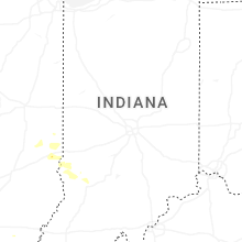
Indiana
| Local Time | Report Details |
|---|---|
| 6:39 PM EDT | Klaf airport aso in tippecanoe county IN, 61.4 miles NW of Indianapolis, IN |
| 7:07 PM EDT | Thunderstorm winds downed a tree. time estimated from rada in tippecanoe county IN, 55.2 miles NW of Indianapolis, IN |
| 8:04 PM EDT | Sporadic tree damag in vigo county IN, 52.2 miles E of Mattoon, IL |
| 8:27 PM EDT | Large trees limbs down. minor flooding on roadwa in clay county IN, 54.4 miles WSW of Indianapolis, IN |
| 8:42 PM EDT | Thunderstorm winds downed tree near bowling green. time estimated from rada in clay county IN, 55.9 miles WSW of Indianapolis, IN |
| 8:56 PM EDT | Large branch snapped blocking rooker roa in morgan county IN, 16.1 miles SW of Indianapolis, IN |
| 9:25 PM EDT | Thunderstorm winds downed trees and pwr lines on in-44 near cope road and old moore road. possible tornado. time estd from rada in morgan county IN, 23.7 miles SSW of Indianapolis, IN |
| 9:27 PM EDT | Kmqj - indianapolis regional airpor in hancock county IN, 14.5 miles ENE of Indianapolis, IN |
| 9:36 PM EDT | Tree down across a road. time estimated from rada in johnson county IN, 20.4 miles SSE of Indianapolis, IN |
| 9:40 PM EDT | Thunderstorm winds downed tree. time estimated from rada in hancock county IN, 17.2 miles ENE of Indianapolis, IN |
| 9:45 PM EDT | Thunderstorm winds downed numerous trees across central and southern johnson county into franklin area. possible tornado. time estiamted from rada in johnson county IN, 20.2 miles SSE of Indianapolis, IN |
Wyoming
| Local Time | Report Details |
|---|---|
| 4:52 PM MDT | Mesonet station kpat wy220 pathfinder (dot in natrona county WY, 33.3 miles SW of Casper, WY |
| 5:00 PM MDT | Asos station kcpr casper airport (asos in natrona county WY, 8 miles WNW of Casper, WY |
| 5:22 PM MDT | Mesonet station ktmh i-25 twenty mile hill (dot in natrona county WY, 18.6 miles N of Casper, WY |
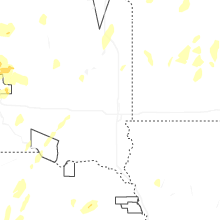
Nebraska
| Local Time | Report Details |
|---|---|
| 4:53 PM MDT | Storm damage reported in dawes county NE, 72.8 miles NNE of Scottsbluff, NE |
| 4:53 PM MDT | Storm damage reported in dawes county NE, 73.6 miles NNE of Scottsbluff, NE |
| 6:33 PM CDT | Storm damage reported in harlan county NE, 85.2 miles N of Hays, KS |
| 6:35 PM CDT | Storm damage reported in harlan county NE, 79.4 miles N of Hays, KS |
| 6:35 PM CDT | Storm damage reported in harlan county NE, 85.7 miles SW of Grand Island, NE |
| 6:36 PM CDT | Storm damage reported in harlan county NE, 85.3 miles SW of Grand Island, NE |
| 6:36 PM CDT | Storm damage reported in harlan county NE, 84 miles SW of Grand Island, NE |
| 6:37 PM CDT | Storm damage reported in harlan county NE, 80.8 miles SW of Grand Island, NE |
| 6:40 PM CDT | Storm damage reported in harlan county NE, 76.9 miles SW of Grand Island, NE |
| 6:44 PM CDT | Storm damage reported in harlan county NE, 74 miles SW of Grand Island, NE |
| 6:44 PM CDT | Storm damage reported in harlan county NE, 80.2 miles SW of Grand Island, NE |
| 6:45 PM CDT | Received photo via email of overturned pivots and snapped power poles. location and time estimate in harlan county NE, 73.4 miles SW of Grand Island, NE |
| 6:48 PM CDT | Report via facebook of significant outbuilding damage on the southeast corner of hwy 183 and hwy 4. nearby pivot also over turne in harlan county NE, 68.8 miles SW of Grand Island, NE |
| 6:48 PM CDT | Ping Pong Ball sized hail reported near Holdrege, NE, 68.8 miles SW of Grand Island, NE |
| 6:52 PM CDT | Storm damage reported in harlan county NE, 71 miles SW of Grand Island, NE |
| 6:58 PM CDT | Storm damage reported in phelps county NE, 61.9 miles WSW of Grand Island, NE |
| 6:58 PM CDT | Storm damage reported in franklin county NE, 60.7 miles SW of Grand Island, NE |
| 7:00 PM CDT | Storm damage reported in harlan county NE, 62.9 miles SW of Grand Island, NE |
| 7:00 PM CDT | Storm damage reported in franklin county NE, 60.4 miles SW of Grand Island, NE |
| 7:00 PM CDT | Storm damage reported in phelps county NE, 56.7 miles SW of Grand Island, NE |
| 7:00 PM CDT | Storm damage reported in phelps county NE, 57.5 miles SW of Grand Island, NE |
| 7:00 PM CDT | Storm damage reported in phelps county NE, 63.2 miles WSW of Grand Island, NE |
| 7:01 PM CDT | Storm damage reported in kearney county NE, 58 miles SW of Grand Island, NE |
| 7:02 PM CDT | Damaged outbuilding and sign in funk. overturned pivots nearb in phelps county NE, 57.6 miles WSW of Grand Island, NE |
| 7:03 PM CDT | Additional reports of a roof blow off of a train utility building... numerous pivots overturn... downed power poles and large tree branches down around tow in phelps county NE, 57.6 miles WSW of Grand Island, NE |
| 7:04 PM CDT | Trees downed onto railroad track. received via x pos in phelps county NE, 55.4 miles SW of Grand Island, NE |
| 7:05 PM CDT | Storm damage reported in kearney county NE, 55.8 miles SW of Grand Island, NE |
| 7:05 PM CDT | Storm damage reported in phelps county NE, 55.1 miles WSW of Grand Island, NE |
| 7:06 PM CDT | Storm damage reported in kearney county NE, 52.9 miles SW of Grand Island, NE |
| 7:08 PM CDT | Storm damage reported in kearney county NE, 50.8 miles SW of Grand Island, NE |
| 7:09 PM CDT | Storm damage reported in franklin county NE, 55.7 miles SW of Grand Island, NE |
| 7:11 PM CDT | Storm damage reported in phelps county NE, 53 miles WSW of Grand Island, NE |
| 7:11 PM CDT | Storm damage reported in kearney county NE, 45.3 miles WSW of Grand Island, NE |
| 7:13 PM CDT | Storm damage reported in kearney county NE, 48.7 miles SW of Grand Island, NE |
| 7:14 PM CDT | Storm damage reported in kearney county NE, 43 miles SW of Grand Island, NE |
| 7:14 PM CDT | Tree damage reported via social medi in kearney county NE, 43.4 miles SW of Grand Island, NE |
| 7:15 PM CDT | Report of snapped tree branches up to a foot and a half in diamete in kearney county NE, 43.4 miles SW of Grand Island, NE |
| 7:15 PM CDT | Storm damage reported in kearney county NE, 46.6 miles SW of Grand Island, NE |
| 7:15 PM CDT | Storm damage reported in buffalo county NE, 49.7 miles WSW of Grand Island, NE |
| 7:15 PM CDT | Storm damage reported in kearney county NE, 49 miles SW of Grand Island, NE |
| 7:15 PM CDT | Storm damage reported in kearney county NE, 44.8 miles WSW of Grand Island, NE |
| 7:15 PM CDT | Storm damage reported in kearney county NE, 52.2 miles SW of Grand Island, NE |
| 7:15 PM CDT | Storm damage reported in phelps county NE, 61 miles WSW of Grand Island, NE |
| 7:15 PM CDT | Storm damage reported in kearney county NE, 42.5 miles SW of Grand Island, NE |
| 7:16 PM CDT | Storm damage reported in phelps county NE, 53.8 miles WSW of Grand Island, NE |
| 7:18 PM CDT | Storm damage reported in kearney county NE, 46.2 miles SW of Grand Island, NE |
| 7:19 PM CDT | Storm damage reported in kearney county NE, 49.3 miles WSW of Grand Island, NE |
| 7:19 PM CDT | Reports of tree damage and some structural damage at el charman lak in kearney county NE, 34 miles SW of Grand Island, NE |
| 7:20 PM CDT | Corrects previous non-tstm wnd gst report from 5 ne axtell. nebraska mesonet. 2-meter wind gust in kearney county NE, 46.2 miles SW of Grand Island, NE |
| 7:20 PM CDT | Storm damage reported in buffalo county NE, 43.3 miles WSW of Grand Island, NE |
| 7:20 PM CDT | Storm damage reported in kearney county NE, 44.3 miles SW of Grand Island, NE |
| 7:20 PM CDT | Storm damage reported in kearney county NE, 38.2 miles WSW of Grand Island, NE |
| 7:20 PM CDT | Personal weather statio in kearney county NE, 48.6 miles SW of Grand Island, NE |
| 7:20 PM CDT | Tree damage in kearney. from faceboo in buffalo county NE, 41.5 miles WSW of Grand Island, NE |
| 7:20 PM CDT | Personal weather statio in phelps county NE, 64.4 miles WSW of Grand Island, NE |
| 7:20 PM CDT | Storm damage reported in kearney county NE, 38.7 miles SW of Grand Island, NE |
| 7:22 PM CDT | Storm damage reported in kearney county NE, 35 miles WSW of Grand Island, NE |
| 7:22 PM CDT | Storm damage reported in buffalo county NE, 38.1 miles WSW of Grand Island, NE |
| 7:23 PM CDT | Storm damage reported in buffalo county NE, 40.4 miles WSW of Grand Island, NE |
| 7:24 PM CDT | Storm damage reported in kearney county NE, 34.8 miles SW of Grand Island, NE |
| 7:25 PM CDT | Storm damage reported in buffalo county NE, 33.3 miles WSW of Grand Island, NE |
| 7:26 PM CDT | Storm damage reported in buffalo county NE, 48.6 miles WSW of Grand Island, NE |
| 7:27 PM CDT | Storm damage reported in buffalo county NE, 25.3 miles WSW of Grand Island, NE |
| 7:27 PM CDT | Storm damage reported in kearney county NE, 36.1 miles SW of Grand Island, NE |
| 7:28 PM CDT | Outflow from thunderstorms. caused blowing dus in dawson county NE, 61.8 miles WSW of Grand Island, NE |
| 7:28 PM CDT | Storm damage reported in kearney county NE, 37.3 miles SW of Grand Island, NE |
| 7:28 PM CDT | Storm damage reported in kearney county NE, 31.2 miles SW of Grand Island, NE |
| 7:28 PM CDT | Storm damage reported in kearney county NE, 31.6 miles SW of Grand Island, NE |
| 7:29 PM CDT | Storm damage reported in buffalo county NE, 45 miles WSW of Grand Island, NE |
| 7:30 PM CDT | Outbuilding damage at farmstead...debris blown out into nearby fiel in adams county NE, 32.3 miles SW of Grand Island, NE |
| 7:30 PM CDT | Several large trees and power poles knocked down around the el charman lak in kearney county NE, 34 miles SW of Grand Island, NE |
| 7:30 PM CDT | Storm damage reported in buffalo county NE, 31.2 miles WSW of Grand Island, NE |
| 7:30 PM CDT | Power line down across road. time est. from other area report in adams county NE, 32.9 miles SW of Grand Island, NE |
| 7:30 PM CDT | Storm damage reported in buffalo county NE, 39.8 miles WSW of Grand Island, NE |
| 7:30 PM CDT | Storm damage reported in kearney county NE, 31.2 miles SW of Grand Island, NE |
| 7:31 PM CDT | Storm damage reported in buffalo county NE, 40.9 miles WSW of Grand Island, NE |
| 7:33 PM CDT | Storm damage reported in adams county NE, 33.8 miles SSW of Grand Island, NE |
| 7:35 PM CDT | Storm damage reported in buffalo county NE, 35.9 miles WSW of Grand Island, NE |
| 7:35 PM CDT | Storm damage reported in hall county NE, 15.4 miles WSW of Grand Island, NE |
| 7:36 PM CDT | Storm damage reported in buffalo county NE, 36.9 miles WSW of Grand Island, NE |
| 7:37 PM CDT | Storm damage reported in adams county NE, 21.9 miles SSW of Grand Island, NE |
| 7:38 PM CDT | Storm damage reported in adams county NE, 20.5 miles SW of Grand Island, NE |
| 7:38 PM CDT | Storm damage reported in adams county NE, 19.3 miles SSW of Grand Island, NE |
| 7:39 PM CDT | Storm damage reported in buffalo county NE, 44.3 miles W of Grand Island, NE |
| 7:40 PM CDT | Image sent in of a collapsed metal carport as well as large tree branches knocked down up to a foot in diamete in adams county NE, 26.9 miles SW of Grand Island, NE |
| 7:41 PM CDT | Storm damage reported in buffalo county NE, 21.2 miles W of Grand Island, NE |
| 7:42 PM CDT | Storm damage reported in hall county NE, 18.4 miles WSW of Grand Island, NE |
| 7:42 PM CDT | Image sent in of a metal roof partially torn off of a buildin in adams county NE, 23.7 miles SW of Grand Island, NE |
| 7:45 PM CDT | Storm damage reported in dawson county NE, 61.2 miles W of Grand Island, NE |
| 7:45 PM CDT | Storm damage reported in hall county NE, 17.4 miles W of Grand Island, NE |
| 7:45 PM CDT | Storm damage reported in hall county NE, 10.5 miles SSW of Grand Island, NE |
| 7:45 PM CDT | Storm damage reported in adams county NE, 22.9 miles SSW of Grand Island, NE |
| 7:47 PM CDT | Corrects previous non-tstm wnd gst report from 2 sse prosser. mesonet station up080 prosser 2.2s (upr in adams county NE, 21.9 miles SSW of Grand Island, NE |
| 7:47 PM CDT | Storm damage reported in hall county NE, 3.6 miles SW of Grand Island, NE |
| 7:48 PM CDT | Storm damage reported in hall county NE, 3.3 miles WSW of Grand Island, NE |
| 7:54 PM CDT | Quarter sized hail reported near Sutherland, NE, 43.9 miles NW of North Platte, NE, report from mping: quarter (1.00 in.). |
| 7:55 PM CDT | Storm damage reported in hall county NE, 3.5 miles NNE of Grand Island, NE |
| 7:57 PM CDT | Storm damage reported in hall county NE, 15.5 miles SW of Grand Island, NE |
| 8:00 PM CDT | Nebraska mesonet. 2-meter wind gus in hall county NE, 15.5 miles SW of Grand Island, NE |
| 8:05 PM CDT | Corrects previous non-tstm wnd gst report from 6 se cairo. nebraska mesonet. 2-meter wind gust in hall county NE, 10 miles W of Grand Island, NE |
| 8:05 PM CDT | Storm damage reported in clay county NE, 18.5 miles S of Grand Island, NE |
| 8:06 PM CDT | Storm damage reported in hall county NE, 11.6 miles WNW of Grand Island, NE |
| 8:07 PM CDT | Image sent in of a blown over pivo in hall county NE, 11.1 miles W of Grand Island, NE |
| 8:10 PM CDT | Storm damage reported in hall county NE, 10.7 miles S of Grand Island, NE |
| 8:10 PM CDT | Storm damage reported in hall county NE, 5.6 miles SSW of Grand Island, NE |
| 8:10 PM CDT | Baseball sized hail reported near Tryon, NE, 44.4 miles NW of North Platte, NE, golf ball to baseball sized reported via picture from social media. |
| 8:12 PM CDT | Storm damage reported in hall county NE, 4.3 miles SSW of Grand Island, NE |
| 8:12 PM CDT | Storm damage reported in hall county NE, 4.4 miles WSW of Grand Island, NE |
| 8:15 PM CDT | Storm damage reported in hall county NE, 2.8 miles WSW of Grand Island, NE |
| 8:15 PM CDT | Storm damage reported in hall county NE, 1.5 miles SW of Grand Island, NE |
| 8:15 PM CDT | Storm damage reported in hall county NE, 1.5 miles SW of Grand Island, NE |
| 8:20 PM CDT | 2 large trees down and a power pole snapped in trumbull. time estimated from rada in clay county NE, 17.3 miles SSE of Grand Island, NE |
| 8:30 PM CDT | Storm damage reported in greeley county NE, 39 miles N of Grand Island, NE |
| 8:35 PM CDT | Storm damage reported in hall county NE, 3.5 miles NNE of Grand Island, NE |
| 7:41 PM MDT | Golf Ball sized hail reported near Mullen, NE, 43.8 miles NNW of North Platte, NE |
| 8:45 PM CDT | Personal weather statio in boone county NE, 42.8 miles N of Grand Island, NE |
| 8:45 PM CDT | Storm damage reported in hamilton county NE, 23 miles E of Grand Island, NE |
| 8:52 PM CDT | Storm damage reported in boone county NE, 57.4 miles NNE of Grand Island, NE |
| 8:55 PM CDT | Spotter estimated 60 mph wind gusts with a kayak blown across the yar in valley county NE, 56.8 miles SSW of Oneill, NE |
| 8:57 PM CDT | Personal weather statio in boone county NE, 56.4 miles NNE of Grand Island, NE |
| 9:00 PM CDT | Personal weather statio in custer county NE, 67.6 miles SW of Oneill, NE |
| 9:01 PM CDT | Personal weather statio in garfield county NE, 52.2 miles SSW of Oneill, NE |
| 9:03 PM CDT | Observer estimated wind gust up to 60 mp in polk county NE, 44.9 miles ENE of Grand Island, NE |
| 9:08 PM CDT | Storm damage reported in antelope county NE, 39.8 miles SE of Oneill, NE |
| 9:12 PM CDT | 5 in tree branch broke of in garfield county NE, 54.8 miles SSW of Oneill, NE |
| 9:35 PM CDT | Several trees down in david city. estimated 60 mph winds. time estimated from rada in butler county NE, 61.9 miles W of Omaha, NE |
| 10:01 PM CDT | Personal weather statio in wayne county NE, 68.7 miles ESE of Oneill, NE |
| 10:04 PM CDT | Personal weather statio in holt county NE, 21.5 miles W of Oneill, NE |
| 10:38 PM CDT | Personal weather statio in boyd county NE, 37.2 miles NNW of Oneill, NE |
| 10:42 PM CDT | Nebraska mesonet sit in keya paha county NE, 40.8 miles NW of Oneill, NE |
| 10:46 PM CDT | Nebraska mesonet sit in boyd county NE, 43.3 miles NW of Oneill, NE |
| 10:51 PM CDT | Nebraska mesonet sit in boyd county NE, 43.3 miles NW of Oneill, NE |
Texas
| Local Time | Report Details |
|---|---|
| 5:56 PM CDT | 63 mph wind gust measured at wt mesonet station 11 miles sw of romero. gusts above 58 mph lasted from 5:56 to 6:00 p in oldham county TX, 50.9 miles ENE of Tucumcari, NM |
| 9:25 PM CDT | 58 mph wind gust measured at wt mesonet station 11 miles ssw of romero. gusts at or above 58 mph lasted from 9:25 to 9:26 p in oldham county TX, 50.9 miles ENE of Tucumcari, NM |
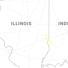
Illinois
| Local Time | Report Details |
|---|---|
| 6:27 PM CDT | [delayed report] - several trees blown down and corn damaged by thunderstorm winds. time estimated by rada in edgar county IL, 37.8 miles E of Mattoon, IL |
New York
| Local Time | Report Details |
|---|---|
| 7:52 PM EDT | Trees and wires reported down along hart... maple and greely streets in hornell. possible tree down on a house on church street. time estimated by rada in steuben county NY, 73 miles ESE of Buffalo, NY |
Alabama
| Local Time | Report Details |
|---|---|
| 6:58 PM CDT | A tree was knocked down at 200 cr 77 in dekalb county AL, 31.6 miles SW of Chattanooga, TN |
| 6:58 PM CDT | A tree was knocked down onto a home at 2000 cr 4 in dekalb county AL, 32.2 miles SW of Chattanooga, TN |
| 6:59 PM CDT | A 4 foot diameter tree was uprooted on cr 771 in ide in dekalb county AL, 31.6 miles SW of Chattanooga, TN |
| 6:59 PM CDT | Corrects previous tstm wnd dmg report from 4 wnw ider. a tree was knocked down on cr 346 near cr 7 in jackson county AL, 33.3 miles SW of Chattanooga, TN |
| 7:08 PM CDT | Several trees were knocked down on cr 147 in ide in dekalb county AL, 32 miles SW of Chattanooga, TN |
| 7:08 PM CDT | A large tree was knocked down at 721 cr 330 in pisgah. also the roadway was flooded but unknown dept in jackson county AL, 32.4 miles SW of Chattanooga, TN |
| 7:08 PM CDT | A tree was knocked down on cr 346 near cr 7 in jackson county AL, 33.3 miles SW of Chattanooga, TN |
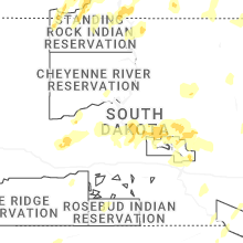
South Dakota
| Local Time | Report Details |
|---|---|
| 6:08 PM MDT | Quarter sized hail reported near Philip, SD, 66.1 miles W of Pierre, SD |
| 6:15 PM MDT | Storm damage reported in haakon county SD, 60 miles WSW of Pierre, SD |
| 6:30 PM MDT | Storm damage reported in bennett county SD, 60 miles WNW of Valentine, NE |
| 6:35 PM MDT | Storm damage reported in bennett county SD, 60 miles WNW of Valentine, NE |
| 6:41 PM MDT | Storm damage reported in bennett county SD, 60 miles WNW of Valentine, NE |
| 7:05 PM MDT | Pea to nickel size hai in corson county SD, 68.8 miles S of Bismarck, ND |
| 8:44 PM CDT | Storm damage reported in mellette county SD, 50.5 miles NNW of Valentine, NE |
| 9:12 PM CDT | Quarter sized hail reported near Fort Pierre, SD, 1.6 miles WSW of Pierre, SD |
| 9:30 PM CDT | Storm damage reported in hughes county SD, 16.5 miles ENE of Pierre, SD |
| 9:35 PM CDT | Mesonet station pims2 pierre 17e (sd mesonet in hughes county SD, 17.4 miles E of Pierre, SD |
| 9:45 PM CDT | Report also includes some pea sized hai in hughes county SD, 25.3 miles E of Pierre, SD |
| 10:05 PM CDT | Mesonet station lbms2 lower brule 2wnw (sd mesonet in lyman county SD, 41.8 miles ESE of Pierre, SD |
| 10:13 PM CDT | Mesonet station 183 macs corner (sddot in hyde county SD, 45.7 miles E of Pierre, SD |
| 10:25 PM CDT | Mesonet station 312 ree heights (sddot in hand county SD, 58 miles ENE of Pierre, SD |
| 10:32 PM CDT | Report also included some small hai in hand county SD, 57.2 miles E of Pierre, SD |
| 10:38 PM CDT | A personal weather station near fairfax recorded a 69 mph wind gus in gregory county SD, 41.1 miles NNW of Oneill, NE |
| 10:43 PM CDT | A personal weather station near bonesteel recorded a 58 mph wind gust in gregory county SD, 44.5 miles NNW of Oneill, NE |
| 10:43 PM CDT | A personal weather station near fairfax recorded a 60 mph wind gus in gregory county SD, 38.3 miles NNW of Oneill, NE |
| 10:43 PM CDT | A personal weather station near fairfax recorded a 72.9 mph wind gus in gregory county SD, 41.4 miles NNW of Oneill, NE |
| 10:44 PM CDT | Mesonet station rhus2 danforth 5 e. time estimate in hand county SD, 78.8 miles E of Pierre, SD |
| 10:44 PM CDT | Storm damage reported in faulk county SD, 42.7 miles SW of Aberdeen, SD |
| 10:45 PM CDT | Mesonet station wgms2 wessington 3w (sd mesonet in hand county SD, 70.3 miles S of Aberdeen, SD |
| 10:49 PM CDT | Mesonet station 158 miranda (sddot in hand county SD, 45.5 miles SSW of Aberdeen, SD |
| 10:50 PM CDT | Mesonet station rhms2 rockham 6sse (sd mesonet in hand county SD, 46.7 miles SSW of Aberdeen, SD |
| 10:54 PM CDT | Mesonet station rhus2 danforth 5 e... time estimated from rada in hand county SD, 78.8 miles E of Pierre, SD |
| 10:56 PM CDT | A personal weather station near lake andes recorded a 59 mph wind gus in charles mix county SD, 54.7 miles N of Oneill, NE |
| 11:01 PM CDT | A personal weather station near herrick recorded a wind gust of 65 mp in gregory county SD, 55.9 miles NNW of Oneill, NE |
| 11:05 PM CDT | Mesonet station 315 cresbard (sddot in faulk county SD, 31.9 miles SW of Aberdeen, SD |
| 11:06 PM CDT | A personal weather station near armour reported a 73 mph wind gus in douglas county SD, 60.1 miles N of Oneill, NE |
| 11:09 PM CDT | The fort randall dam recorded a 65 mph wind gus in gregory county SD, 41.1 miles N of Oneill, NE |
| 11:12 PM CDT | A personal weather station near platte recorded a 67 mph wind gus in charles mix county SD, 63.3 miles N of Oneill, NE |
| 11:14 PM CDT | Mesonet station 175 mellette (sddot in spink county SD, 20.7 miles S of Aberdeen, SD |
| 11:15 PM CDT | Storm damage reported in edmunds county SD, 12.3 miles W of Aberdeen, SD |
| 11:15 PM CDT | Awos station k1d8 redfield muni a in spink county SD, 41.4 miles S of Aberdeen, SD |
| 11:15 PM CDT | Storm damage reported in spink county SD, 37.9 miles S of Aberdeen, SD |
| 11:15 PM CDT | Mesonet station awms2 aberdeen 10wsw (sd mesonet in brown county SD, 10 miles WSW of Aberdeen, SD |
| 11:19 PM CDT | A personal weather station northwest of ethan recorded a 64 mph wind gust in davison county SD, 69.8 miles W of Sioux Falls, SD |
| 11:19 PM CDT | A personal weather station northeast of platte recorded a 76 mph wind gus in aurora county SD, 74.2 miles N of Oneill, NE |
| 11:27 PM CDT | Storm damage reported in brown county SD, 9.7 miles NW of Aberdeen, SD |
| 11:28 PM CDT | A personal weather station just north of mitchell recorded a 67 mph wind gus in davison county SD, 66.6 miles WNW of Sioux Falls, SD |
| 11:31 PM CDT | An sddot site west of plankinton recorded a 67 mph wind gus in aurora county SD, 86.5 miles N of Oneill, NE |
| 11:32 PM CDT | Asos station kabr aberdeen rgnl a in brown county SD, 4 miles ESE of Aberdeen, SD |
| 11:50 PM CDT | Mesonet station gots2 groton 9 nne (sd mesonet in brown county SD, 23.5 miles ENE of Aberdeen, SD |
| 12:09 AM CDT | An sddot site near arlington recorded a 66 mph wind gus in kingsbury county SD, 55.8 miles NNW of Sioux Falls, SD |
| 12:10 AM CDT | An sddot site near alpena recorded a wind gust of 63 mp in sanborn county SD, 85.9 miles WNW of Sioux Falls, SD |
| 12:14 AM CDT | A sddot site near arlington recorded a 68 mph wind gus in kingsbury county SD, 55.8 miles NNW of Sioux Falls, SD |
| 12:15 AM CDT | Mesonet station btms2 britton 7e (sd mesonet in marshall county SD, 47.9 miles ENE of Aberdeen, SD |
| 12:18 AM CDT | Quarter sized hail reported near Aurora, SD, 50.8 miles N of Sioux Falls, SD, received a social media report of quarter sized hail in aurora. time estimated via radar. |
| 12:25 AM CDT | A personal weather station just south of badger recorded a 68 mph wind gus in kingsbury county SD, 67.5 miles NNW of Sioux Falls, SD |
| 12:29 AM CDT | An sddot just south of arlington recorded a 72 mph wind gus in kingsbury county SD, 55.8 miles NNW of Sioux Falls, SD |
| 12:30 AM CDT | Mesonet station fw0832 estellin in hamlin county SD, 71.2 miles NNW of Sioux Falls, SD |
| 12:34 AM CDT | Mesonet station mrls2 hillhead 3 ws in marshall county SD, 55.5 miles ENE of Aberdeen, SD |
| 12:36 AM CDT | Storm damage reported in hamlin county SD, 72.2 miles WSW of Montevideo, MN |
| 12:45 AM CDT | A personal weather station just northeast of volga recorded a wind gust of 68 mp in brookings county SD, 55.6 miles N of Sioux Falls, SD |
| 12:59 AM CDT | Mesonet station 291 altamont 4n (sddot in deuel county SD, 47.4 miles W of Montevideo, MN |
| 1:12 AM CDT | 60-80 mph gust in deuel county SD, 49.1 miles WSW of Montevideo, MN |
| 1:30 AM CDT | Kingsbury county em reported downed powerlines in lake presto in kingsbury county SD, 64.9 miles NNW of Sioux Falls, SD |
| 1:34 AM CDT | Kingsbury county reported multiple trees uprooted and branches down in both de smet and arlingto in kingsbury county SD, 71.2 miles NW of Sioux Falls, SD |
| 1:35 AM CDT | Significant tree damage along 465th avenu in hamlin county SD, 61.1 miles WSW of Montevideo, MN |
| 1:36 AM CDT | The kingsbury county em reported 3 overturned campers in martens campground near lake thompso in kingsbury county SD, 64.7 miles NW of Sioux Falls, SD |
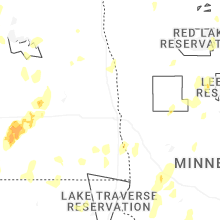
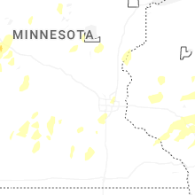
Minnesota
| Local Time | Report Details |
|---|---|
| 1:15 AM CDT | Awos station kdxx madison a in lac qui parle county MN, 22.8 miles W of Montevideo, MN |
| 1:15 AM CDT | Mesonet station av840 madiso in lac qui parle county MN, 30.4 miles W of Montevideo, MN |
| 1:44 AM CDT | 72.4 mph gust on an anemometer. visibility dropped considerably with blowing dust/dirt on the gust front with the initial surg in stevens county MN, 49.7 miles NNW of Montevideo, MN |
| 1:45 AM CDT | Storm damage reported in clay county MN, 6.3 miles ESE of Fargo, ND |
| 1:45 AM CDT | Awos station kbbb benson a in swift county MN, 25.6 miles N of Montevideo, MN |
| 1:50 AM CDT | Ndawn reporting site at 10 f in clay county MN, 9.7 miles ESE of Fargo, ND |
| 2:00 AM CDT | Awos station kmox morris a in stevens county MN, 44.4 miles NNW of Montevideo, MN |
| 2:15 AM CDT | Awos station kghw glenwood a in pope county MN, 50.7 miles NNE of Montevideo, MN |
| 2:19 AM CDT | Asos station kaxn alexandria mn aso in douglas county MN, 65.3 miles NNE of Montevideo, MN |
| 2:50 AM CDT | Ndawn site reporting at 10 f in otter tail county MN, 83.5 miles SE of Fargo, ND |
| 3:30 AM CDT | Quarter sized hail reported near Park Rapids, MN, 30.4 miles SSW of Bemidji, MN |
Connect with Interactive Hail Maps