

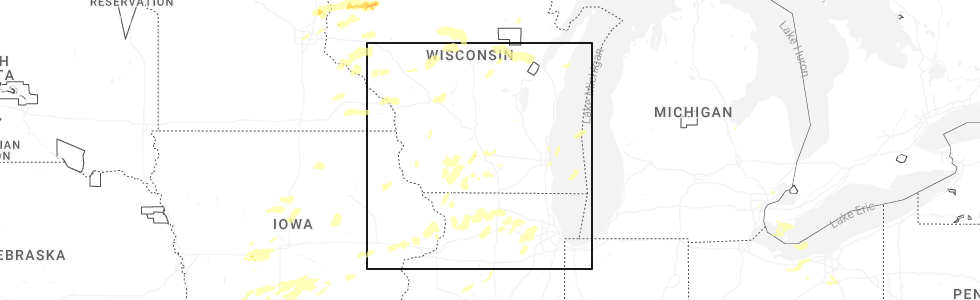
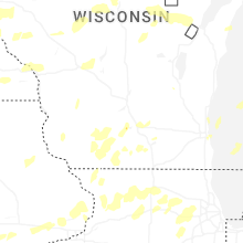
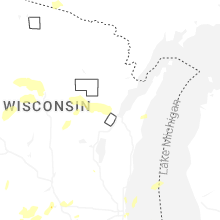
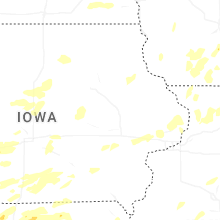
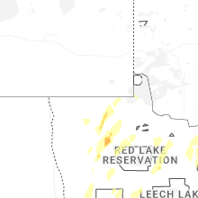
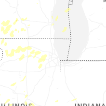
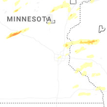
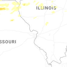
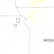
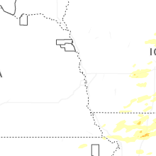
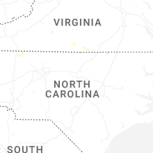
Hail Map for Wednesday, June 10, 2026
Number of Impacted Households on 6/10/2026
0
Impacted by 1" or Larger Hail
0
Impacted by 1.75" or Larger Hail
0
Impacted by 2.5" or Larger Hail
Square Miles of Populated Area Impacted on 6/10/2026
0
Impacted by 1" or Larger Hail
0
Impacted by 1.75" or Larger Hail
0
Impacted by 2.5" or Larger Hail

Cities Most Affected by Hail Storms of 6/10/2026
| Hail Size | Demographics of Zip Codes Affected | ||||||
|---|---|---|---|---|---|---|---|
| City | Count | Average | Largest | Pop Density | House Value | Income | Age |
Hail and Wind Damage Spotted on 6/10/2026
Filter by Report Type:Hail ReportsWind Reports
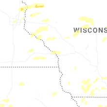
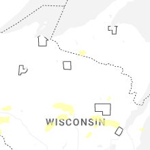
Wisconsin
| Local Time | Report Details |
|---|---|
| 7:04 AM CDT | Oak tree snappe in taylor county WI, 61.3 miles SW of Rhinelander, WI |
| 7:06 AM CDT | Tree down along highway 9 in marathon county WI, 52.9 miles SW of Rhinelander, WI |
| 12:47 PM CDT | Several reports of trees and powerlines down between downsville and menomoni in dunn county WI, 67 miles ESE of Minneapolis, MN |
| 12:49 PM CDT | Storm damage reported in grant county WI, 69 miles NE of Cedar Rapids, IA |
| 12:56 PM CDT | Tree down on a powerline in menomonie. relayed from dispatc in dunn county WI, 65.9 miles E of Minneapolis, MN |
| 1:10 PM CDT | Storm damage reported in grant county WI, 69.7 miles NE of Cedar Rapids, IA |
| 1:15 PM CDT | Delayed report relayed by law enforcement. large tree branch down on the side of a hous in dunn county WI, 76.2 miles NNW of La Crosse, WI |
| 1:17 PM CDT | Storm damage reported in grant county WI, 59.6 miles WSW of Madison, WI |
| 1:19 PM CDT | Also reported some trees down and signs blown aroun in grant county WI, 69.2 miles WSW of Madison, WI |
| 1:21 PM CDT | Storm damage reported in grant county WI, 59.6 miles WSW of Madison, WI |
| 1:27 PM CDT | Storm damage reported in grant county WI, 63.3 miles W of Madison, WI |
| 1:28 PM CDT | Trained spotter measures 88 mph gust on home weather statio in lafayette county WI, 44.8 miles SW of Madison, WI |
| 1:31 PM CDT | Storm damage reported in grant county WI, 54.2 miles WSW of Madison, WI |
| 1:35 PM CDT | Report of a couple trees down in the town of seymou in eau claire county WI, 69.9 miles N of La Crosse, WI |
| 1:35 PM CDT | Storm damage reported in grant county WI, 57.2 miles WSW of Madison, WI |
| 1:40 PM CDT | Report of large tree branch down on home... time estimated from rada in green county WI, 24.6 miles SSW of Madison, WI |
| 1:44 PM CDT | Delayed report... time estimated from radar. tree down near fall cree in eau claire county WI, 65.4 miles N of La Crosse, WI |
| 1:52 PM CDT | 70mph wind gust measured with handheld anemometer - kestrel 250 in dane county WI, 9.7 miles SW of Madison, WI |
| 2:00 PM CDT | Delayed report... time estimated from radar. tree down on hwy g north of august in eau claire county WI, 62.4 miles N of La Crosse, WI |
| 2:10 PM CDT | Trained spotter estimates 80 mph wind gust in rock county WI, 20.9 miles SE of Madison, WI |
| 2:12 PM CDT | 85 mph wind gust estimated from home instrumentatio in rock county WI, 38.7 miles SSE of Madison, WI |
| 2:26 PM CDT | Trained spotter estimates 85 mph wind gust in jefferson county WI, 23.8 miles ESE of Madison, WI |
| 2:30 PM CDT | 2 foot diameter pine tree trunk snapped. picture from social media. time est from rada in marquette county WI, 39.5 miles N of Madison, WI |
| 2:35 PM CDT | Trained spotter estimates 80 mph wind gust in rock county WI, 27.9 miles SE of Madison, WI |
| 2:39 PM CDT | Trained spotter estimates 75 mph wind gust in jefferson county WI, 30.6 miles ESE of Madison, WI |
| 2:50 PM CDT | Large tree trunk snapped. picture from social media. time estimated from rada in green lake county WI, 48.3 miles NNE of Madison, WI |
Missouri
| Local Time | Report Details |
|---|---|
| 8:36 AM CDT | Storm damage reported in caldwell county MO, 53.3 miles NE of Kansas City, MO |
Iowa
| Local Time | Report Details |
|---|---|
| 10:46 AM CDT | Delayed report. peak wind gust from personal weather statio in hardin county IA, 44.2 miles N of Des Moines, IA |
| 10:50 AM CDT | Delayed report. peak wind gust from a personal weather statio in marshall county IA, 46.1 miles NNE of Des Moines, IA |
| 10:57 AM CDT | Delayed report... peak wind gust from the kmiw marshalltown airport aso in marshall county IA, 51.3 miles NE of Des Moines, IA |
| 11:00 AM CDT | Delayed report. peak wind gust from a personal weather statio in hardin county IA, 48.2 miles NNE of Des Moines, IA |
| 11:00 AM CDT | Large tree down in hubbard. time estimated by rada in hardin county IA, 52.3 miles NNE of Des Moines, IA |
| 11:01 AM CDT | Delayed report. peak wind gust from a personal weather statio in hardin county IA, 53.7 miles NNE of Des Moines, IA |
| 11:19 AM CDT | Storm damage reported in johnson county IA, 30.4 miles S of Cedar Rapids, IA |
| 11:25 AM CDT | Large tree split in half... taking down powerline in tama county IA, 35.3 miles WNW of Cedar Rapids, IA |
| 11:30 AM CDT | Wind gust measured by house anemometer and 1 inch tree limbs down. time estimated by rada in johnson county IA, 24.7 miles SSE of Cedar Rapids, IA |
| 11:35 AM CDT | Tree with 4 to 6 inch diameter trunk snapped at the bas in johnson county IA, 23.9 miles SSE of Cedar Rapids, IA |
| 11:44 AM CDT | Delayed report. peak wind gust from a personal weather statio in black hawk county IA, 35.9 miles NW of Cedar Rapids, IA |
| 11:49 AM CDT | Delayed report. peak wind gust from a personal weather statio in black hawk county IA, 37.6 miles NW of Cedar Rapids, IA |
| 12:07 PM CDT | Power lines down over road near intersection of 215th st and nathan bethel ave. time estimated by rada in buchanan county IA, 35.7 miles NNW of Cedar Rapids, IA |
| 12:15 PM CDT | 10 inch tree limbs reported down in eden valley refuge. time estimated by rada in jackson county IA, 42.2 miles E of Cedar Rapids, IA |
| 12:15 PM CDT | Corrects previous tstm wnd gst report from 1 sse stanwoo in cedar county IA, 28.3 miles ESE of Cedar Rapids, IA |
| 12:30 PM CDT | Tree down near the intersection of county rd 64 and 200th ave. time estimated by rada in delaware county IA, 43.2 miles NNE of Cedar Rapids, IA |
| 12:33 PM CDT | Storm damage reported in jones county IA, 35 miles NE of Cedar Rapids, IA |
| 12:40 PM CDT | Peak wind gust at dubuque regional airpor in dubuque county IA, 57.5 miles ENE of Cedar Rapids, IA |
| 12:42 PM CDT | Many small to medium sized branches blown down. a larger size branch causing traffic issues on one downtown street. medium sized tree uprooted in front yard 3 houses fr in dubuque county IA, 61.2 miles NE of Cedar Rapids, IA |
| 12:45 PM CDT | 6 inch tree limbs snapped. time estimated by rada in dubuque county IA, 60.4 miles NE of Cedar Rapids, IA |
| 12:45 PM CDT | Couple trees uprooted along with many branches downed and some fence damage... including along asbury road near bunker hill golf course. time estimated using rada in dubuque county IA, 62.1 miles NE of Cedar Rapids, IA |
| 12:49 PM CDT | Tree branches over a foot in diameter downed. estimated wind gust of 65 mph by car anemomete in clinton county IA, 76.9 miles E of Cedar Rapids, IA |
| 1:04 PM CDT | Spotter estimated winds of 50 to 60 mph with thunderstor in dubuque county IA, 60.4 miles NE of Cedar Rapids, IA |
| 1:11 PM CDT | Widespread large trees dow in dubuque county IA, 56.3 miles NE of Cedar Rapids, IA |
| 2:15 PM CDT | Storm damage reported in cedar county IA, 28.3 miles ESE of Cedar Rapids, IA |
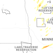
Minnesota
| Local Time | Report Details |
|---|---|
| 12:13 PM CDT | Tree down across the road... with a few other small branches down in the are in goodhue county MN, 52.2 miles SE of Minneapolis, MN |
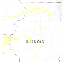
Illinois
| Local Time | Report Details |
|---|---|
| 12:50 PM CDT | Few dozen trees and wires down. a couple houses have been hit by falling tree in jo daviess county IL, 70.1 miles SW of Madison, WI |
| 12:54 PM CDT | Several dozen small branches down... some larg in jo daviess county IL, 69.2 miles SW of Madison, WI |
| 1:06 PM CDT | Peak wind gust measured by coop observer. time estimated by rada in jo daviess county IL, 55.7 miles SSW of Madison, WI |
| 1:39 PM CDT | Large limb came down and is blocking the southbound lan in stephenson county IL, 49.4 miles SSW of Madison, WI |
| 1:53 PM CDT | Storm damage reported in fulton county IL, 21.7 miles W of Peoria, IL |
| 1:53 PM CDT | Power pole and lines dow in fulton county IL, 21.7 miles W of Peoria, IL |
| 2:11 PM CDT | Several trees down... including wires on rice roa in peoria county IL, 16.8 miles NNW of Peoria, IL |
| 2:21 PM CDT | Several trees dow in peoria county IL, 16.5 miles NNE of Peoria, IL |
| 2:21 PM CDT | Large tree downed on north timber circle. time estimated from rada in peoria county IL, 3.4 miles NNE of Peoria, IL |
| 2:24 PM CDT | Storm damage reported in tazewell county IL, 3.6 miles S of Peoria, IL |
| 2:25 PM CDT | Flag pole snappe in marshall county IL, 21 miles NNE of Peoria, IL |
| 2:29 PM CDT | Downed tree limbs in lacon. time estimated by rada in marshall county IL, 25.1 miles NNE of Peoria, IL |
| 2:33 PM CDT | Tree down near pekin country clu in tazewell county IL, 7.7 miles S of Peoria, IL |
| 2:34 PM CDT | Personal weather station measured 60 mph wind gusts as the storms pass throug in lee county IL, 71.2 miles NNE of Peoria, IL |
| 2:39 PM CDT | Personal weather station measured as the line of storms moved throug in boone county IL, 58.2 miles SSE of Madison, WI |
| 2:40 PM CDT | Time estimated by rada in marshall county IL, 32.5 miles NE of Peoria, IL |
| 2:45 PM CDT | Personal weather station 3.8 nnw of leland... il measured wind gust as line of storms moved throug in de kalb county IL, 61.8 miles WSW of Chicago, IL |
| 2:50 PM CDT | Trained spotter measured wind gust at rt 176 and franklinville road east of marengo. time estimated by rada in mchenry county IL, 51.7 miles WNW of Chicago, IL |
| 2:55 PM CDT | Report via social media of a tree branch broken and fell on power lines along walker road north of allen road nw of hampshire. time estimated by rada in kane county IL, 50.7 miles WNW of Chicago, IL |
| 3:07 PM CDT | Large main limb of a tree... at least 12 inches in diameter snapped. time estimated by rada in kane county IL, 40.2 miles W of Chicago, IL |
Virginia
| Local Time | Report Details |
|---|---|
| 1:51 PM EDT | One tree down along cartersville road near its intersection with coles creek lane. time estimated from rada in buckingham county VA, 35.8 miles WNW of Richmond, VA |
| 3:19 PM EDT | Corrects previous tstm wnd dmg report from 5 e keeling. tree down on power lines down along kentuck roa in pittsylvania county VA, 55.6 miles SE of Roanoke, VA |
Connect with Interactive Hail Maps