

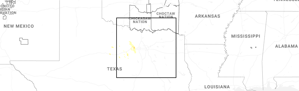
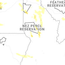
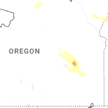
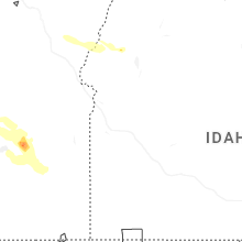
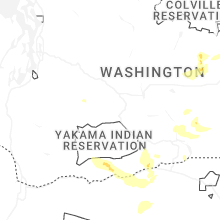
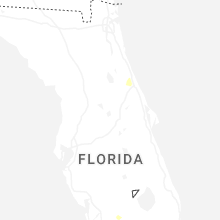
Hail Map for Thursday, May 28, 2026
Number of Impacted Households on 5/28/2026
0
Impacted by 1" or Larger Hail
0
Impacted by 1.75" or Larger Hail
0
Impacted by 2.5" or Larger Hail
Square Miles of Populated Area Impacted on 5/28/2026
0
Impacted by 1" or Larger Hail
0
Impacted by 1.75" or Larger Hail
0
Impacted by 2.5" or Larger Hail
Cities Most Affected by Hail Storms of 5/28/2026
| Hail Size | Demographics of Zip Codes Affected | ||||||
|---|---|---|---|---|---|---|---|
| City | Count | Average | Largest | Pop Density | House Value | Income | Age |
Hail and Wind Damage Spotted on 5/28/2026
Filter by Report Type:Hail ReportsWind Reports
States Impacted
North Carolina, Nevada, Texas, Oregon, Idaho, Colorado, Montana, New Mexico, WashingtonNorth Carolina
| Local Time | Report Details |
|---|---|
| 2:57 PM EDT | Storm damage reported in new hanover county NC, 3.4 miles NNE of Wilmington, NC |
| 3:10 PM EDT | Several power outages in the area resulting from fallen trees and limbs in new hanover county NC, 8 miles NE of Wilmington, NC |
| 3:10 PM EDT | Big tree snapped off in new hanover county NC, 8.1 miles ENE of Wilmington, NC |
Nevada
| Local Time | Report Details |
|---|---|
| 12:40 PM PDT | Measured 52 knots at wfo elk in elko county NV, 2.2 miles NE of Elko, NV |
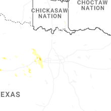
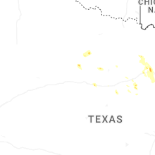
Texas
| Local Time | Report Details |
|---|---|
| 3:55 PM CDT | Quarter sized hail reported near Weatherford, TX, 52.2 miles W of Dallas, TX, report from mping. |
| 4:02 PM CDT | Half Dollar sized hail reported near Weatherford, TX, 49.8 miles W of Dallas, TX, report from mping. |
| 4:06 PM CDT | Quarter sized hail reported near Weatherford, TX, 49.8 miles W of Dallas, TX |
| 5:12 PM CDT | Quarter sized hail reported near Baird, TX, 20.2 miles E of Abilene, TX, there was pea to quarter size hail in baird. |
Oregon
| Local Time | Report Details |
|---|---|
| 2:04 PM PDT | Mesonet station od102 riley (odot in harney county OR, 22.6 miles W of Burns, OR |
| 2:14 PM PDT | Mesonet station od102 riley (odot in harney county OR, 22.6 miles W of Burns, OR |
| 2:34 PM PDT | Mesonet station od152 2.6 ne burns (odot in harney county OR, 2.4 miles NE of Burns, OR |
| 2:53 PM PDT | Asos station kbno burn in harney county OR, 5.4 miles E of Burns, OR |
| 3:50 PM PDT | Ping Pong Ball sized hail reported near Mount Vernon, OR, 54.3 miles N of Burns, OR, spotter with photo provided. time estimated from radar. |
| 5:13 PM PDT | Quarter sized hail reported near Bend, OR, 30.8 miles SSW of Bend, OR, report from mping: quarter (1.00 in.). |
| 5:15 PM PDT | Quarter sized hail reported near Mitchell, OR, 39 miles ENE of Bend, OR, social media with photo. |
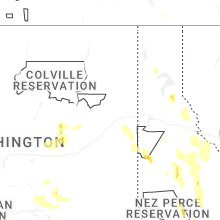
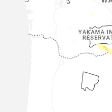
Idaho
| Local Time | Report Details |
|---|---|
| 3:28 PM MDT | Storm damage reported in elmore county ID, 41.8 miles SSE of Boise, ID |
| 3:45 PM MDT | Quarter sized hail reported near Council, ID, 78.4 miles N of Boise, ID, a member of the public posted a photo of quarter size hail on social media. |
| 3:50 PM MDT | Storm damage reported in ada county ID, 10.9 miles SW of Boise, ID |
| 4:00 PM MDT | Itd03 broadway i-84 interchang in ada county ID, 2.6 miles S of Boise, ID |
| 4:00 PM MDT | Itd03 broadway i-84 interchang in ada county ID, 2.6 miles S of Boise, ID |
| 4:04 PM MDT | Thunderstorm wind gust measured at boise airpor in ada county ID, 1.9 miles S of Boise, ID |
| 4:20 PM MDT | Time estimated from radar. location approximate. tree had 2 main branches 1 foot in diameter snap due to outflow wind in ada county ID, 4 miles WNW of Boise, ID |
| 4:30 PM MDT | A member of the public reported on social media that a large poplar tree and root system was brought down from the gust front. a trampoline was displaced into their yar in ada county ID, 14 miles SW of Boise, ID |
| 4:35 PM MDT | An outflow boundary with wind gusts of 61-72 mph brought blowing dust and less than 100 feet of visibility to the boise metropolitan area. currently seeing at least 15 in ada county ID, 1.9 miles W of Boise, ID |
| 4:45 PM MDT | 15...000 without power in ada county... roughly 130f the count in ada county ID, 1.9 miles WSW of Boise, ID |
| 4:45 PM MDT | 15...000 without power in ada county... roughly 130f the count in ada county ID, 1.9 miles WSW of Boise, ID |
| 4:50 PM MDT | 3...800 without power in boise county... 200f the population. location generalize in boise county ID, 23.4 miles NE of Boise, ID |
| 4:50 PM MDT | 3...800 without power in boise county... 200f the population. location generalize in boise county ID, 23.4 miles NE of Boise, ID |
| 5:00 PM MDT | A member of the public reported a photo on social media of multiple stalls in an outdoor market destroye in ada county ID, 14 miles SW of Boise, ID |
| 5:30 PM MDT | Over 10 reports compiled from social media of pine trees and their root systems brought dow in ada county ID, 10.5 miles WNW of Boise, ID |
| 4:49 PM PDT | Quarter sized hail reported near Fernwood, ID, 60.3 miles SE of Spokane, WA |
| 5:58 PM PDT | Quarter sized hail reported near Kamiah, ID, 21.5 miles NNE of Grangeville, ID, report from mping: quarter (1.00 in.). |
| 6:00 PM PDT | Half Dollar sized hail reported near Kamiah, ID, 26.8 miles N of Grangeville, ID |
| 8:05 PM PDT | Tree damage... downed trees blocking the road... torrential rainfall leading to blocked roads... and pea sized hai in benewah county ID, 41.2 miles SSE of Spokane, WA |
| 9:03 PM PDT | Corrects previous tstm wnd dmg report from naples. reported trees through houses... fires... power outages... and highways blocked due to downed trees and power line in boundary county ID, 78.8 miles NE of Spokane, WA |
| 11:32 PM PDT | Reported trees through houses... fires... power outages... and highways blocked due to downed trees and power line in boundary county ID, 78.8 miles NE of Spokane, WA |
Colorado
| Local Time | Report Details |
|---|---|
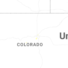
| 5:55 PM MDT | Quarter sized hail reported near Grant, CO, 46.2 miles WSW of Denver, CO |
Montana
| Local Time | Report Details |
|---|---|
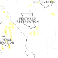
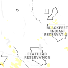
| 6:25 PM MDT | Quarter sized hail reported near Kalispell, MT, 11.4 miles SSE of Whitefish, MT |
| 6:30 PM MDT | Quarter sized hail reported near Kalispell, MT, 14.6 miles S of Whitefish, MT |
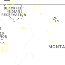
| 8:00 PM MDT | Report relayed via social medi in madison county MT, 40.8 miles WSW of Bozeman, MT |
| 10:49 PM MDT | Multiple downed trees reported along highway 2 between mm 3 and in lincoln county MT, 76.4 miles W of Whitefish, MT |
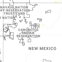
New Mexico
| Local Time | Report Details |
|---|---|
| 6:30 PM MDT | Ping Pong Ball sized hail reported near Des Moines, NM, 113.6 miles SSE of Pueblo, CO, report from mping: ping pong ball (1.50 in.). |
| 9:15 PM MDT | Half Dollar sized hail reported near Des Moines, NM, 108.8 miles ENE of Taos, NM, time estimated based on radar. |
Washington
| Local Time | Report Details |
|---|---|
| 8:10 PM PDT | Corrects previous tstm wnd dmg report from eagle ridge. small ponderosa lost in eagle ridge... 10 inches in diamete in spokane county WA, 4 miles SSW of Spokane, WA |
| 8:35 PM PDT | Measurement on personal weather station. also thunderstorm wind damage - 60 ft maple tree damage in grant county WA, 66.7 miles ENE of Yakima, WA |
| 8:40 PM PDT | Large poplar tree snappe in grant county WA, 72.9 miles ENE of Yakima, WA |
| 8:51 PM PDT | Storm damage reported in grant county WA, 69.3 miles NE of Yakima, WA |
| 9:48 PM PDT | Storm damage reported in grant county WA, 67.5 miles NE of Yakima, WA |
| 9:50 PM PDT | Gold mountain raws saw a 58 mph wind gust between 9:11 and 10:11 pm. radar analysis indicates it occurred around 9:50 p in ferry county WA, 51.3 miles ESE of Omak, WA |
| 9:55 PM PDT | Grand coulee dam airport aso in grant county WA, 40.7 miles SE of Omak, WA |
| 10:00 PM PDT | Agrimet site for chief joseph da in douglas county WA, 29.5 miles S of Omak, WA |
| 11:00 PM PDT | Multiple trees down... damaged homes... and some fire starts that were 75-100 acres. radar analysis showed the strongest winds over the area around 11p in okanogan county WA, 23.8 miles SSW of Omak, WA |
Connect with Interactive Hail Maps