

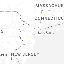
Hail Map for Saturday, September 6, 2025

Number of Impacted Households on 9/6/2025
0
Impacted by 1" or Larger Hail
0
Impacted by 1.75" or Larger Hail
0
Impacted by 2.5" or Larger Hail
Square Miles of Populated Area Impacted on 9/6/2025
0
Impacted by 1" or Larger Hail
0
Impacted by 1.75" or Larger Hail
0
Impacted by 2.5" or Larger Hail

Cities Most Affected by Hail Storms of 9/6/2025
| Hail Size | Demographics of Zip Codes Affected | ||||||
|---|---|---|---|---|---|---|---|
| City | Count | Average | Largest | Pop Density | House Value | Income | Age |
Hail and Wind Damage Spotted on 9/6/2025
Filter by Report Type:Hail ReportsWind Reports
States Impacted
New York, North Carolina, Connecticut, Alabama, Massachusetts, New Jersey, Georgia, New Hampshire, Maryland, Virginia, Maine, South Carolina, Florida, ArizonaNew York
| Local Time | Report Details |
|---|---|
| 1:20 PM EDT | A tree was downed on u.s. route 9 at amherst road in red hoo in dutchess county NY, 56.8 miles S of Schenectady, NY |
| 1:37 PM EDT | A tree was down on power lines with another power pole snapped on route 11 just north of barnett road in gallati in columbia county NY, 55.4 miles SSE of Schenectady, NY |
| 1:37 PM EDT | A tree was down on power lines with another power pole snapped on route 11 just north of barnett road in gallati in columbia county NY, 55.4 miles SSE of Schenectady, NY |
| 1:37 PM EDT | Tree down in a yard along route 11 north of barnett roa in columbia county NY, 54.7 miles SSE of Schenectady, NY |
| 1:45 PM EDT | Twitter/ report: large tree branch blocking the road near over mtn rd and east ancram r in columbia county NY, 57.4 miles SSE of Schenectady, NY |
| 1:46 PM EDT | Tree through roof of house. ancram fire dept dispatched and enroute to locatio in columbia county NY, 58.3 miles SSE of Schenectady, NY |
| 1:54 PM EDT | Multiple trees down per 911 dispatch near state route 82 and wiltsie bridge rd in town on ancra in columbia county NY, 55.1 miles SSE of Schenectady, NY |
| 2:06 PM EDT | Tree down over the roadway near intersection of county road 7 and hall hill r in columbia county NY, 55.5 miles SSE of Schenectady, NY |
| 2:15 PM EDT | Tree and wires down across the roadwa in columbia county NY, 54.5 miles SSE of Schenectady, NY |
| 3:06 PM EDT | Trees and wires down on a vehicle on hardscrabble road and reed roa in westchester county NY, 48.7 miles NNE of Brooklyn, NY |
| 3:10 PM EDT | Tree down on androvette stree in richmond county NY, 16.8 miles SW of Brooklyn, NY |
| 3:10 PM EDT | Downed tree blocking storer avenue near carlin stree in richmond county NY, 16.4 miles SW of Brooklyn, NY |
| 3:17 PM EDT | Mesonet station xlar larchmont harbo in anz335 county NY, 20.8 miles NE of Brooklyn, NY |
| 3:26 PM EDT | Mesonet station xbay bayvill in nassau county NY, 23.7 miles NE of Brooklyn, NY |
North Carolina
| Local Time | Report Details |
|---|---|
| 1:53 PM EDT | Asos station reported peak gust of 61 mph at 1:53 p in guilford county NC, 76.4 miles WNW of Raleigh, NC |
| 2:12 PM EDT | Tree down on bearhollow r in guilford county NC, 72.4 miles WNW of Raleigh, NC |
| 2:16 PM EDT | Power outage reported by duke energy caused by fallen trees or limbs damaging equipmen in guilford county NC, 73 miles WNW of Raleigh, NC |
| 2:30 PM EDT | Powerline knocked off house on powell r in davie county NC, 48.8 miles NNE of Charlotte, NC |
| 2:57 PM EDT | Tree down on fraternity church r in forsyth county NC, 62.3 miles NNE of Charlotte, NC |
| 3:03 PM EDT | Power outage due to fallen trees per duke energy websit in forsyth county NC, 72.2 miles NNE of Charlotte, NC |
| 3:17 PM EDT | Tree fell on powerline near new prospect rd and carson rd. time estimated from rada in cleveland county NC, 37.8 miles WNW of Charlotte, NC |
| 3:25 PM EDT | Tree fell on car. no injuries. time estimate in davie county NC, 50.1 miles NNE of Charlotte, NC |
| 3:30 PM EDT | Tree fell on a house on windward circl in davie county NC, 49.8 miles NNE of Charlotte, NC |
Connecticut
| Local Time | Report Details |
|---|---|
| 1:58 PM EDT | *** 1 inj *** tree fell on car injuring an occupant. fire department dispatche in litchfield county CT, 59.8 miles SSE of Schenectady, NY |
| 2:00 PM EDT | Tree and wires down on wires. tree is on fire and fire is threatening structur in litchfield county CT, 59.8 miles SSE of Schenectady, NY |
| 2:20 PM EDT | Social media and photo report of a tree town and a power line on fire at the intersection of route 112 and route 7 south of falls villag in litchfield county CT, 67.8 miles SSE of Schenectady, NY |
| 2:30 PM EDT | Trees and wires down over roadway. roadway closed. time radar estimate in litchfield county CT, 71.2 miles SE of Schenectady, NY |
| 2:40 PM EDT | Corrects previous tstm wnd dmg report from 1 s new preston with correct time. several trees uprooted and downed near schofield hill rd in washington depo in litchfield county CT, 74.4 miles NNE of Brooklyn, NY |
| 2:40 PM EDT | Received report of trees down on a building as well as in the roadway and on wires along route 202... south and near the town of new preston. from a broadcast media par in litchfield county CT, 74.2 miles NNE of Brooklyn, NY |
| 2:54 PM EDT | Quarter sized hail reported near Bantam, CT, 81 miles NNE of Brooklyn, NY, social media report of hail estimated to be at least 1 inch in diameter. time estimated from radar. |
| 3:15 PM EDT | Received report of tree down on wires from 911 call center near the intersection of 202 and 47. time based on rada in litchfield county CT, 76.3 miles NNE of Brooklyn, NY |
| 3:18 PM EDT | Several trees uprooted and downed near schofield hill rd in washington depo in litchfield county CT, 74.4 miles NNE of Brooklyn, NY |
| 3:20 PM EDT | 60 mph wind gust measured at 50 ft at the riverside yacht clu in anz335 county CT, 30.8 miles NE of Brooklyn, NY |
| 3:25 PM EDT | Eversource reports a power outage due to tree damage on mill hill road in fairfield county CT, 60.8 miles NE of Brooklyn, NY |
| 3:37 PM EDT | 60 mph measured at greens ledge ligh in anz335 county CT, 37.5 miles NE of Brooklyn, NY |
| 3:55 PM EDT | Eversource reports a power outage caused by tree damage on val court in wolcot in new haven county CT, 80.3 miles NE of Brooklyn, NY |
| 4:05 PM EDT | Power lines and tree down through a house (relayed via ar in hartford county CT, 72.3 miles W of Providence, RI |
Alabama
| Local Time | Report Details |
|---|---|
| 1:02 PM CDT | Several trees down near the intersection of cr45 and cr4 near hamburg in perry county. law enforcement on scene with the road blocked. time estimated by rada in perry county AL, 38.4 miles N of Camden, AL |
Massachusetts
| Local Time | Report Details |
|---|---|
| 2:04 PM EDT | Corrects previous tstm wnd dmg report from sheffield. multiple trees down in sheffiel in berkshire county MA, 57.1 miles SSE of Schenectady, NY |
| 2:04 PM EDT | Corrects previous tstm wnd dmg report from 4 ene sheffield. tree down over roadwa in berkshire county MA, 57.4 miles SE of Schenectady, NY |
| 2:04 PM EDT | Corrects previous tstm wnd dmg report from 4 e sheffield. tree down on wire in berkshire county MA, 59.4 miles SE of Schenectady, NY |
| 2:06 PM EDT | Multiple trees down along old stockbridge r in berkshire county MA, 47 miles SE of Schenectady, NY |
| 2:07 PM EDT | Ping Pong Ball sized hail reported near Sheffield, MA, 56.3 miles SSE of Schenectady, NY, report from mping: ping pong ball (1.50 in.). |
| 2:25 PM EDT | Numerous trees dow in berkshire county MA, 63.5 miles SE of Schenectady, NY |
| 2:25 PM EDT | Trees and wires down block entrance to tolland state fores in berkshire county MA, 60 miles SE of Schenectady, NY |
| 2:26 PM EDT | Multiple trees down in sheffiel in berkshire county MA, 57.1 miles SSE of Schenectady, NY |
| 2:28 PM EDT | Tree down on wire in berkshire county MA, 59.4 miles SE of Schenectady, NY |
| 2:35 PM EDT | Tree down over roadwa in berkshire county MA, 57.4 miles SE of Schenectady, NY |
| 2:50 PM EDT | Video confirmation of wires down and on fire (relayed via amateur radio in hampden county MA, 71.9 miles WNW of Providence, RI |
| 2:55 PM EDT | Tree down on house (relayed via ar in hampshire county MA, 72.1 miles ESE of Schenectady, NY |
| 2:56 PM EDT | Storm damage reported in hampden county MA, 71.5 miles WNW of Providence, RI |
| 2:57 PM EDT | Route 10 closed due to downed trees (relayed via amateur radio in hampshire county MA, 73.4 miles WNW of Providence, RI |
| 2:57 PM EDT | Multiple large trees down on power lines near clark street in southampton (relayed via amateur radio in hampshire county MA, 73.1 miles WNW of Providence, RI |
| 3:05 PM EDT | Several large trees down on i-91 (relayed via ar in hampden county MA, 67.4 miles WNW of Providence, RI |
| 3:10 PM EDT | Storm damage reported in hampshire county MA, 64.5 miles WNW of Providence, RI |
| 3:15 PM EDT | Trees and powerlines down along norcross hill road and highland avenue. relayed by amateur radi in worcester county MA, 60.4 miles NNW of Providence, RI |
| 3:25 PM EDT | Quarter sized hail reported near Ashburnham, MA, 65 miles NNW of Providence, RI |
| 3:30 PM EDT | Tree down on a car on nelson street (relayed via ar in worcester county MA, 48.1 miles NW of Providence, RI |
| 3:30 PM EDT | Several trees and power lines down (relayed via ar in hampshire county MA, 56.8 miles WNW of Providence, RI |
| 3:30 PM EDT | Multiple tree branches down along rt 19 near the mass pike. relayed by amateur radi in worcester county MA, 47.8 miles WNW of Providence, RI |
| 3:30 PM EDT | Reports of several trees down across town... including washington street... crescent st and old west brookfield rd. time estimated from rada in worcester county MA, 47.7 miles NW of Providence, RI |
| 3:50 PM EDT | Tree... power pole and wires down on hastings rd. time estimated from radar. relayed by amateur radi in worcester county MA, 43.3 miles NW of Providence, RI |
| 4:05 PM EDT | Trees down on bailey rd. time estimated from rada in worcester county MA, 41.8 miles NNW of Providence, RI |
| 4:06 PM EDT | Tree down on a house (relayed via ar in worcester county MA, 43.9 miles NW of Providence, RI |
| 4:10 PM EDT | Tree down with partial road blockage (relayed via ar). time estimated from rada in worcester county MA, 36.4 miles NW of Providence, RI |
| 4:10 PM EDT | Large tree down on bailey rd making it impassabl in worcester county MA, 41.8 miles NNW of Providence, RI |
| 4:11 PM EDT | Corrects previous tstm wnd dmg report from 1 s worcester for time. trees downed on chandler st in worcester. time estimated by rada in worcester county MA, 36.4 miles NW of Providence, RI |
| 4:11 PM EDT | Large tree on powerlines on beverly rd in worcester. time estimated by rada in worcester county MA, 37.3 miles NNW of Providence, RI |
| 4:11 PM EDT | Trees downed on ruthven av in worcester county MA, 37.9 miles NNW of Providence, RI |
| 4:15 PM EDT | Numerous trees and wires down and roads blocked. time estimated from rada in worcester county MA, 41.3 miles NNW of Providence, RI |
| 4:20 PM EDT | Several reports of trees/wires down across town. relayed by amateur radio. time estimated from rada in middlesex county MA, 41.2 miles N of Providence, RI |
| 4:20 PM EDT | Downed tree limbs on route 62 in sto in middlesex county MA, 40.8 miles N of Providence, RI |
| 4:38 PM EDT | Trees downed on chandler st in worcester. time estimated by rada in worcester county MA, 36.4 miles NW of Providence, RI |
| 4:40 PM EDT | Multiple trees down on oxbow rd. relayed by amateur radio. time estimated from rada in middlesex county MA, 40.5 miles N of Providence, RI |
| 4:45 PM EDT | Tree down partially blocking martin street. relayed by amateur radio. time estimated from rada in middlesex county MA, 44 miles N of Providence, RI |
| 4:50 PM EDT | Tree down across highland s in middlesex county MA, 36.6 miles N of Providence, RI |
| 4:52 PM EDT | Tree down on a house on appletree lane in bedford. time estimated by rada in middlesex county MA, 48.5 miles N of Providence, RI |
| 4:55 PM EDT | Trees/wires down. relayed by amateur radi in middlesex county MA, 45.7 miles N of Providence, RI |
| 4:58 PM EDT | Storm damage reported in middlesex county MA, 45 miles N of Providence, RI |
| 5:15 PM EDT | Tree down... partially on a house... another tree down on a vehicle on congress street. time estimated from rada in essex county MA, 51.9 miles NNE of Providence, RI |
| 5:20 PM EDT | Tree/wires down on a car. relayed by amateur radio. time estimated from rada in essex county MA, 52.8 miles NNE of Providence, RI |
New Jersey
| Local Time | Report Details |
|---|---|
| 2:21 PM EDT | Trees and wires down. time estimated from rada in hunterdon county NJ, 47.3 miles WSW of Brooklyn, NY |
| 2:34 PM EDT | Numerous trees and wires down. time estimated from rada in somerset county NJ, 38.7 miles WSW of Brooklyn, NY |
| 2:34 PM EDT | Trees and wires down. time estimated from rada in somerset county NJ, 38.1 miles WSW of Brooklyn, NY |
| 2:44 PM EDT | Several trees down at amwell rd and elizabeth ave. time estimated from rada in somerset county NJ, 33.7 miles WSW of Brooklyn, NY |
| 2:46 PM EDT | Tree down blocking road at south middlebash rd near blackwells mills rd. time estimated from rada in somerset county NJ, 32.4 miles WSW of Brooklyn, NY |
| 2:52 PM EDT | Large tree fell... knocking down power poles. picture relayed on social media. time estimated from rada in middlesex county NJ, 29.1 miles WSW of Brooklyn, NY |
| 3:05 PM EDT | Social media report of snapped trees and branches in the olde forge section of shamong. time estimated by rada in burlington county NJ, 71.8 miles SSW of Brooklyn, NY |
| 4:10 PM EDT | Weatherflow station in seaside park gusted to 51 knots (59 mph in ocean county NJ, 52.8 miles S of Brooklyn, NY |
Georgia
| Local Time | Report Details |
|---|---|
| 2:25 PM EDT | Quarter sized hail reported near Acworth, GA, 25.9 miles NNW of Atlanta, GA, several reports of dime to quarter sized hail along hwy 92 from acworth to west of woodstock. |
| 2:34 PM EDT | Quarter sized hail reported near Acworth, GA, 25.2 miles NNW of Atlanta, GA, report from mping: quarter (1.00 in.). |
New Hampshire
| Local Time | Report Details |
|---|---|
| 2:40 PM EDT | Off-duty firefighter reported a tree down on wires along nh-175. time estimated by rada in grafton county NH, 70.1 miles W of Portland, ME |
| 2:40 PM EDT | Three trees down on north ashland road in plymouth. largest was about 10 inches. time estimated by rada in grafton county NH, 70.5 miles W of Portland, ME |
| 3:05 PM EDT | Ping Pong Ball sized hail reported near Winchester, NH, 79.4 miles NW of Providence, RI, hail as large as ping pong balls fell for almost 10 mins. time estimated by radar. |
| 3:15 PM EDT | Numerous trees down in richmond--observed at least 10. largest trees were about 16 inches in diameter. time estimated by rada in cheshire county NH, 77 miles NW of Providence, RI |
| 3:20 PM EDT | Observed numerous trees downed in the town of fitzwilliam. time estimated by rada in cheshire county NH, 76.1 miles NNW of Providence, RI |
| 3:25 PM EDT | Quarter sized hail reported near Hooksett, NH, 72.5 miles SW of Portland, ME, hail observed in a food store parking lot. most stones were quarter-sized. time estimated by radar. |
| 3:25 PM EDT | Large tree down on a car in hooksett. time estimated by rada in merrimack county NH, 71.8 miles WSW of Portland, ME |
| 3:35 PM EDT | Reports of downed trees and wires on west side of henniker. time estimated by rada in merrimack county NH, 88.5 miles WSW of Portland, ME |
| 3:40 PM EDT | Allenstown fire reports a tree down onto wires and house on deerfield rd. no injuries. time estimated by rada in merrimack county NH, 64.9 miles WSW of Portland, ME |
| 3:40 PM EDT | Merrimack fire reported a tree down on a house on kinsman ln. no injuries. time estimated by rada in hillsborough county NH, 74.3 miles N of Providence, RI |
| 3:40 PM EDT | Quarter sized hail reported near New Ipswich, NH, 66 miles NNW of Providence, RI, measured quarter-sized hail which lasted for 8 minutes. hail accumulated in areas of lawn. leaves and a few branches knocked down. time estimated by radar. |
| 3:42 PM EDT | Ping Pong Ball sized hail reported near Manchester, NH, 75.7 miles SW of Portland, ME, hail as big as 1.5 inches fell southeast of manchester. hail began at 3:42pm and lasted for up to 10 mins. cracked a windshield. observed shredded leaves and branches a |
| 3:52 PM EDT | Ping Pong Ball sized hail reported near Manchester, NH, 75.7 miles SW of Portland, ME, corrects previous hail report from 4 se manchester. hail as big as 1.5 inches fell southeast of manchester. hail began at 3:52pm and lasted for up to 10 mins. cracked a |
| 4:05 PM EDT | Trees and large branches downed across the south side of milford. time estimated by rada in hillsborough county NH, 69.8 miles N of Providence, RI |
| 4:05 PM EDT | Barrington fire reporting a tree down on a house on small rd. time estimated by rada in strafford county NH, 48.5 miles SW of Portland, ME |
| 4:09 PM EDT | Corrects previous tstm wnd dmg report from 3 n nashua. social media photo of a toppled large tree partially blocking vespa lane. time estimated from rada in hillsborough county NH, 66.8 miles N of Providence, RI |
| 4:10 PM EDT | Off-duty firefighter reports a large tree downed partially blocking epping st. time estimated by rada in rockingham county NH, 63.2 miles SW of Portland, ME |
| 4:12 PM EDT | Large oak tree down on a house. several other large trees are also down in the area. time estimated from rada in hillsborough county NH, 73.1 miles N of Providence, RI |
| 4:15 PM EDT | Tree down on nh-3 in litchfield. time estimated by rada in hillsborough county NH, 70.9 miles N of Providence, RI |
| 4:17 PM EDT | Two mature trees down. time estimated from rada in rockingham county NH, 68.8 miles N of Providence, RI |
| 4:20 PM EDT | Quarter sized hail reported near Merrimack, NH, 72.3 miles N of Providence, RI, quarter-sized hail fell for 5-6 min. time estimated by radar. |
| 4:55 PM EDT | Social media photo of a toppled large tree partially blocking vespa lan in hillsborough county NH, 66.8 miles N of Providence, RI |
Maryland
| Local Time | Report Details |
|---|---|
| 2:58 PM EDT | Quarter sized hail reported near Bel Air, MD, 20.9 miles NE of Baltimore, MD |
| 2:59 PM EDT | One tree down on powerlines due to thunderstorm winds at the intersection of west heather road and wakefield driv in harford county MD, 21.6 miles NE of Baltimore, MD |
| 3:03 PM EDT | Ping Pong Ball sized hail reported near Bel Air, MD, 20.4 miles NE of Baltimore, MD |
| 3:07 PM EDT | One tree down on powerlines due to thunderstorm winds along the 400 block of shucks roa in harford county MD, 21.6 miles NE of Baltimore, MD |
| 3:33 PM EDT | One tree down due to thunderstorm winds along rock springs roa in cecil county MD, 36 miles NE of Baltimore, MD |
Virginia
| Local Time | Report Details |
|---|---|
| 3:31 PM EDT | Tree down on alton post office road... east of its intersection with emergency roa in halifax county VA, 58.1 miles NNW of Raleigh, NC |
| 3:37 PM EDT | Tree reported down on lee highway near shenandoah national par in rappahannock county VA, 87.7 miles NNW of Richmond, VA |
| 3:45 PM EDT | Tree down on south terrys bridge road near the intersection with james d hagood highwa in halifax county VA, 66.6 miles N of Raleigh, NC |
| 4:06 PM EDT | Two trees reported down in amissville... v in rappahannock county VA, 83.2 miles NNW of Richmond, VA |
| 4:25 PM EDT | One tree down along walker drive due to thunderstorm wind in fauquier county VA, 75.2 miles WSW of Baltimore, MD |
| 4:25 PM EDT | One tree down near eva walker park due to thunderstorm wind in fauquier county VA, 74.7 miles WSW of Baltimore, MD |
| 4:26 PM EDT | One tree down at the intersection lee street and ashby street due to thunderstorm wind in fauquier county VA, 75.6 miles WSW of Baltimore, MD |
| 4:26 PM EDT | Several powerlines down due to thunderstorm winds along john e mann stree in fauquier county VA, 82.2 miles WSW of Baltimore, MD |
| 4:26 PM EDT | One tree down along alexadria pike and moorehead drive due to thunderstorm wind in fauquier county VA, 75.2 miles WSW of Baltimore, MD |
| 5:00 PM EDT | Storm damage reported in arlington county VA, 37.9 miles SW of Baltimore, MD |
Maine
| Local Time | Report Details |
|---|---|
| 3:50 PM EDT | Bridgton fire reports a large pine tree and powerlines down blocking highland rd. time estimated by rada in cumberland county ME, 36.6 miles NW of Portland, ME |
South Carolina
| Local Time | Report Details |
|---|---|
| 4:13 PM EDT | Snapped power pole on hwy 183 at county lin in oconee county SC, 16.1 miles W of Greenville, SC |
| 4:15 PM EDT | Large tree down near intersection of keowee school rd and old walhalla hw in oconee county SC, 23.4 miles WSW of Greenville, SC |
| 4:18 PM EDT | Large tree blocking roadway at intersection of lawrence bridge rd and alpine d in oconee county SC, 18.2 miles WSW of Greenville, SC |
| 4:25 PM EDT | Facebook user reports trees down behind their house on six mile hwy north of central. time estimate in pickens county SC, 14.8 miles WSW of Greenville, SC |
| 6:23 PM EDT | Tree down at friendship church rd and wofford rd. time estimate in spartanburg county SC, 42.3 miles E of Greenville, SC |
| 6:50 PM EDT | Tree down near intersection of toney rd and meansville r in union county SC, 54.4 miles E of Greenville, SC |
| 6:55 PM EDT | Two trees down near intersection of pineland rd and kelly r in union county SC, 55.1 miles SW of Charlotte, NC |
| 6:56 PM EDT | Tree down on ingle ave at duncan bypas in union county SC, 55.9 miles E of Greenville, SC |
| 6:56 PM EDT | Tree down at intersection of barnado rd and woodberry d in union county SC, 54.6 miles SW of Charlotte, NC |
| 6:58 PM EDT | Tree down at intersection of pineland rd and timberlake r in union county SC, 53.9 miles SW of Charlotte, NC |
| 7:13 PM EDT | Tree down in roadway on center r in chester county SC, 41.5 miles SW of Charlotte, NC |
Florida
| Local Time | Report Details |
|---|---|
| 7:00 PM EDT | Marion county dispatch reported a tree was blown down into power lines in the juniper court are in marion county FL, 57.1 miles NW of Orlando, FL |
| 7:00 PM EDT | Wires were blown down near the intersection of highway 316 and nw 145th avenu in marion county FL, 78 miles NW of Orlando, FL |
Arizona
| Local Time | Report Details |
|---|---|
| 6:45 PM MST | Report of power poles down near san joaquin rd and neal av in pima county AZ, 11.5 miles WSW of Tucson, AZ |
Connect with Interactive Hail Maps