

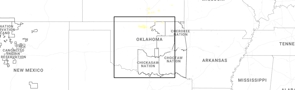
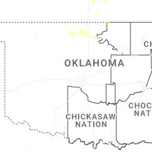
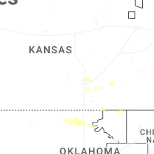
Hail Map for Thursday, June 18, 2026
Number of Impacted Households on 6/18/2026
0
Impacted by 1" or Larger Hail
0
Impacted by 1.75" or Larger Hail
0
Impacted by 2.5" or Larger Hail
Square Miles of Populated Area Impacted on 6/18/2026
0
Impacted by 1" or Larger Hail
0
Impacted by 1.75" or Larger Hail
0
Impacted by 2.5" or Larger Hail
Cities Most Affected by Hail Storms of 6/18/2026
| Hail Size | Demographics of Zip Codes Affected | ||||||
|---|---|---|---|---|---|---|---|
| City | Count | Average | Largest | Pop Density | House Value | Income | Age |
Hail and Wind Damage Spotted on 6/18/2026
Filter by Report Type:Hail ReportsWind Reports
West Virginia
| Local Time | Report Details |
|---|---|
| 8:00 AM EDT | Tree in roadway on wv-41 (5034 stanaford road in fayette county WV, 46.2 miles SE of Charleston, WV |
| 8:05 AM EDT | Several trees down in harman are in randolph county WV, 17.5 miles E of Elkins, WV |
| 8:08 AM EDT | Tree down blocking river roa in summers county WV, 57.2 miles SE of Charleston, WV |
| 8:20 AM EDT | Multiple trees down in sophia... helen and coal city communitie in raleigh county WV, 48.3 miles SSE of Charleston, WV |
| 8:30 AM EDT | Tree down covering anvil rock lan in greenbrier county WV, 48.1 miles NW of Roanoke, VA |
| 8:35 AM EDT | Trees and lines down on farley branch r in raleigh county WV, 58 miles SSE of Charleston, WV |
| 8:47 AM EDT | Large tree down on matoaka roa in mercer county WV, 68.9 miles W of Roanoke, VA |
| 8:49 AM EDT | Tree down on athens roa in mercer county WV, 61.3 miles W of Roanoke, VA |
| 9:04 AM EDT | Power line down along wolfe bottom roa in mercer county WV, 69.9 miles NE of Bristol, TN |
| 9:17 AM EDT | Tree down blocking one lane of traffic near the intersection of new hope and surface hill roa in mercer county WV, 71.2 miles W of Roanoke, VA |
Kansas
| Local Time | Report Details |
|---|---|
| 7:10 AM CDT | Half Dollar sized hail reported near Iola, KS, 17.3 miles N of Chanute, KS, report via social media. |
Louisiana
| Local Time | Report Details |
|---|---|
| 7:14 AM CDT | Social media report of powerlines... trees and fences down in lakeshore village. possible tornad in st. tammany county LA, 26.9 miles NE of New Orleans, LA |
| 8:24 AM CDT | Picture on social media showed water in cars parked along brownswitch in slidel in st. tammany county LA, 31.4 miles NE of New Orleans, LA |
| 8:26 AM CDT | Significant flooding in crossgates neighborhood in slidell. water encroaching on home in st. tammany county LA, 31.5 miles NE of New Orleans, LA |
Kentucky
| Local Time | Report Details |
|---|---|
| 9:05 AM EDT | West of intersection wires completely down obstructing the roa in jefferson county KY, 24.1 miles N of Louisville, KY |
| 9:09 AM EDT | Trees downed from thunderstorm winds. delayed report. time estimated from rada in shelby county KY, 30.4 miles NE of Louisville, KY |
New York
| Local Time | Report Details |
|---|---|
| 9:30 AM EDT | Downed tree causing the road to be closed on ny 19 near canal street in the town of belfas in allegany county NY, 51.8 miles SE of Buffalo, NY |
Connect with Interactive Hail Maps