

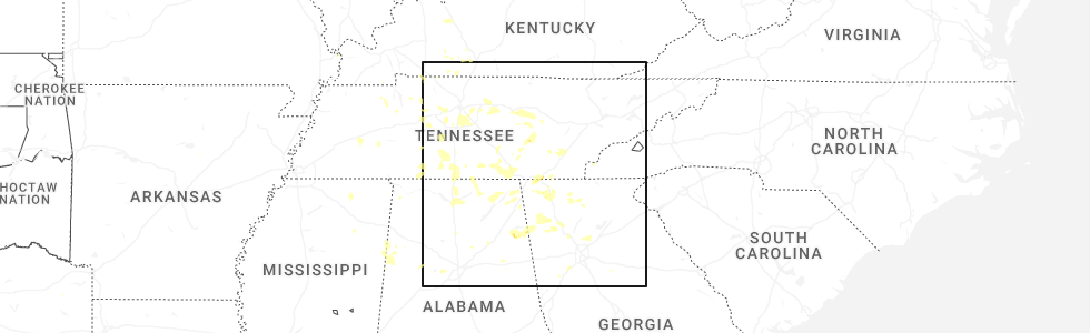
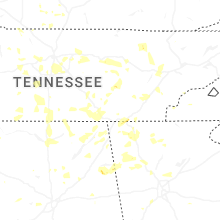
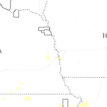
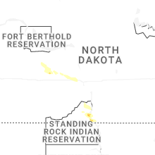
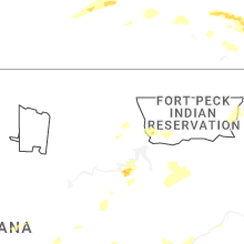
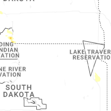
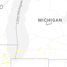
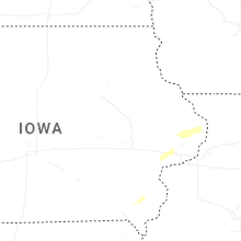
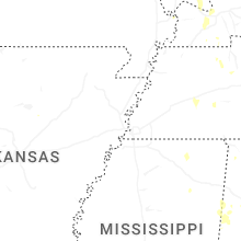
Hail Map for Friday, July 3, 2026
Number of Impacted Households on 7/3/2026
0
Impacted by 1" or Larger Hail
0
Impacted by 1.75" or Larger Hail
0
Impacted by 2.5" or Larger Hail
Square Miles of Populated Area Impacted on 7/3/2026
0
Impacted by 1" or Larger Hail
0
Impacted by 1.75" or Larger Hail
0
Impacted by 2.5" or Larger Hail

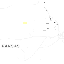
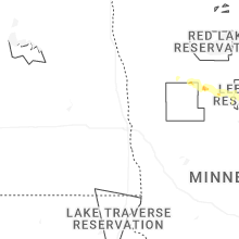
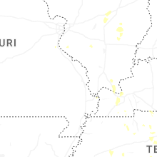

Cities Most Affected by Hail Storms of 7/3/2026
| Hail Size | Demographics of Zip Codes Affected | ||||||
|---|---|---|---|---|---|---|---|
| City | Count | Average | Largest | Pop Density | House Value | Income | Age |
| Osage, WY | 1 | 2.00 | 2.00 | 0 | $29k | $28.1k | 48.0 |
| Wakeeney, KS | 1 | 1.75 | 1.75 | 7 | $49k | $30.4k | 49.0 |
| Edgemont, SD | 1 | 1.75 | 1.75 | 0 | $29k | $30.1k | 50.0 |
| Palmyra, NE | 1 | 1.75 | 1.75 | 15 | $79k | $43.6k | 39.7 |
| Roca, NE | 1 | 1.75 | 1.75 | 29 | $138k | $54.4k | 41.6 |
Hail and Wind Damage Spotted on 7/3/2026
Filter by Report Type:Hail ReportsWind Reports
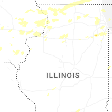
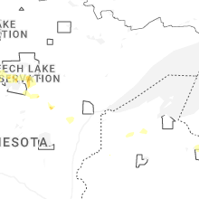
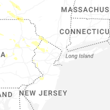
States Impacted
Iowa, Illinois, Wisconsin, South Dakota, Mississippi, Kansas, Indiana, Kentucky, Georgia, Tennessee, Pennsylvania, Missouri, North Carolina, New York, Wyoming, Michigan, Alabama, Nebraska, Minnesota, North Dakota, New Mexico, Montana, Ohio, New Jersey, ColoradoIowa
| Local Time | Report Details |
|---|---|
| 9:30 AM CDT | Quarter sized hail reported near Durant, IA, 47.2 miles ESE of Cedar Rapids, IA, 40 to 45 mph winds also. |
| 10:38 AM CDT | Delayed report...large tree limbs up to 10 inch in diameter were snapped. sent via faceboo in des moines county IA, 45.7 miles NE of Kahoka, MO |
| 7:57 PM CDT | Large tree downed on 12th and main street. time estimated based on rada in scott county IA, 64.4 miles ESE of Cedar Rapids, IA |
| 10:28 PM CDT | Quarter sized hail reported near Sidney, IA, 39 miles SSE of Omaha, NE |
Illinois
| Local Time | Report Details |
|---|---|
| 10:57 AM CDT | Delayed report...tree limbs up to 6 inches in diameter snapped and a power pole blown over. sent via facebook. time estimated by rada in carroll county IL, 80.4 miles SSW of Madison, WI |
| 11:41 AM CDT | Photos relayed by broadcast media show large trees snapped in the vicinity of williamson parkway and s blackhawk blv in winnebago county IL, 45.7 miles SSE of Madison, WI |
| 11:43 AM CDT | Multiple photos and reports of downed trees and power lines in and around rockton including near mactown forest preserve and settlers park. time estimated by rada in winnebago county IL, 45.9 miles SSE of Madison, WI |
| 12:37 PM CDT | Personal weather station measured a peak wind gust of 67.3 mp in lee county IL, 72.9 miles NNE of Peoria, IL |
| 12:38 PM CDT | Utility poles down at peace road and fairview drive in dekalb. time estimated by rada in de kalb county IL, 56.1 miles W of Chicago, IL |
| 12:40 PM CDT | Report of downed power lines near peace road and fairview drive. time estimated by rada in de kalb county IL, 56.1 miles W of Chicago, IL |
| 12:47 PM CDT | Social media post of a photo of a tree on power line in big rock. time estimated by rada in kane county IL, 48.1 miles W of Chicago, IL |
| 12:49 PM CDT | Measured wind gust of 58.2 mp in de kalb county IL, 51.4 miles W of Chicago, IL |
| 12:54 PM CDT | Measured wind gust of 51.2 knot in kane county IL, 43.9 miles W of Chicago, IL |
| 12:58 PM CDT | Peak measured wind gust of 60 mph with numerous tree branches larger than 6 inches in diameter downe in kane county IL, 37.4 miles W of Chicago, IL |
| 1:04 PM CDT | Tree roughly 2 feet in diameter snapped about 15 feet above the ground. several other large branches in excess of 12 inches in diameter snapped in the regio in kane county IL, 38 miles WSW of Chicago, IL |
| 1:10 PM CDT | Large section of tree broken off and dropped straight dow in dupage county IL, 20.5 miles WNW of Chicago, IL |
| 1:15 PM CDT | Social media report of several tree limbs ranging in diameter between 8 and 12 inches downed in lombard. time estimated by rada in dupage county IL, 20 miles W of Chicago, IL |
| 1:17 PM CDT | Report of a tree branch that fell on power lines. time estimated by rada in cook county IL, 21.6 miles NW of Chicago, IL |
| 1:17 PM CDT | Peak wind gust of 55 kt measured at runway sensor 27 left. peak gust of 47 kt at aso in cook county IL, 15.8 miles WNW of Chicago, IL |
| 1:20 PM CDT | Social media post with photo of multiple large limbs covering the entire block. time estimated by rada in dupage county IL, 22.1 miles W of Chicago, IL |
| 1:23 PM CDT | Multiple reports of branches as well as power lines down in the mount prospect area. time estimated by rada in cook county IL, 20.4 miles NW of Chicago, IL |
| 1:23 PM CDT | Photo shared on social media of 4 inch diameter tree limb snapped in southern des plaine in cook county IL, 16.7 miles NW of Chicago, IL |
| 1:25 PM CDT | Peak wind gust of 70 mp in cook county IL, 15.1 miles SW of Chicago, IL |
| 1:26 PM CDT | Personal weather station peak wind gust of 59.8 mp in cook county IL, 23.1 miles NW of Chicago, IL |
| 1:28 PM CDT | Several trees down in the vicinity. time estimated based on rada in cook county IL, 12.5 miles SW of Chicago, IL |
| 1:30 PM CDT | Peak wind gust of 53 k in cook county IL, 20.8 miles NW of Chicago, IL |
| 1:30 PM CDT | Photo shared on social media of a tree snapped blocking a roadway near w marquette rd and s keeler av in cook county IL, 11.3 miles SSE of Chicago, IL |
| 1:32 PM CDT | Peak wind gust of 63 k in cook county IL, 9.4 miles SW of Chicago, IL |
| 1:40 PM CDT | Numerous large branches down all along mlk dr from 2500 south to 3900 sout in cook county IL, 3.1 miles SSE of Chicago, IL |
| 1:42 PM CDT | Peak wind gust of 66.2 mph measured on personal weather statio in cook county IL, 0.8 miles ENE of Chicago, IL |
| 1:42 PM CDT | Measured at the harrison dever cri in lmz741 county IL, 4.1 miles NE of Chicago, IL |
| 1:43 PM CDT | Peak wind gust of 64 mph measured on a personal weather statio in cook county IL, 3.9 miles N of Chicago, IL |
| 1:44 PM CDT | Peak wind gust of 71 mph measured on personal weather statio in cook county IL, 1.4 miles NW of Chicago, IL |
| 2:12 PM CDT | Measured wind gust of 57.6 mp in kendall county IL, 46 miles SW of Chicago, IL |
| 2:12 PM CDT | Spotter called in a tree that was split in half and caused downed power lines and is laying across the road in rockdale. time estimated by rada in will county IL, 35.4 miles SW of Chicago, IL |
| 2:12 PM CDT | Reports of about a dozen large trees down in channahon. time estimated by rada in will county IL, 44 miles SW of Chicago, IL |
| 2:19 PM CDT | Spotter reported trees down in rockdale of at least 5 inches in diameter. time estimated by rada in will county IL, 35.2 miles SW of Chicago, IL |
| 2:20 PM CDT | Quarter sized hail reported near Joliet, IL, 35.7 miles SW of Chicago, IL, quarter size hail. time estimated. |
| 2:20 PM CDT | Estimated winds to 60 mph. time estimate in will county IL, 35.7 miles SW of Chicago, IL |
| 2:22 PM CDT | Quarter sized hail reported near Joliet, IL, 34.7 miles SW of Chicago, IL, 1 hail reported via trained weather spotter. |
| 2:30 PM CDT | Measured gust to 67 mph. tree limbs blown dow in will county IL, 27.6 miles SSW of Chicago, IL |
| 2:33 PM CDT | Trees down at halsted near glenwood estate in cook county IL, 24.3 miles SSW of Chicago, IL |
| 2:38 PM CDT | Photo shared of a large tree about 12 inches in diameter that landed on a car in tinley park. time estimated by rada in cook county IL, 23.2 miles SSW of Chicago, IL |
| 2:41 PM CDT | Numerous 1.5 foot diameter tree limbs snapped in the vicinity of cicero and 183r in cook county IL, 22.9 miles SSW of Chicago, IL |
| 2:45 PM CDT | Large tree branch downed in roadwa in cook county IL, 21.9 miles SSW of Chicago, IL |
| 3:01 PM CDT | Personal weather station 1.3 miles wsw of lynwoo in cook county IL, 25.6 miles S of Chicago, IL |
| 4:03 PM CDT | Large tree limbs blown down. three limbs were 5-6 inches in diameter with a number of small limbs down. time estimated by rada in fayette county IL, 51.9 miles SW of Mattoon, IL |
| 4:08 PM CDT | 3-5 inch tree limbs dow in fayette county IL, 45.1 miles SW of Mattoon, IL |
| 5:38 PM CDT | Tree fell and took down power line in stephenson county IL, 52.9 miles SSW of Madison, WI |
| 6:30 PM CDT | Numerous tree limbs down and one power pole down in tow in clay county IL, 56.3 miles S of Mattoon, IL |
| 7:51 PM CDT | Storm damage reported in ogle county IL, 76.1 miles S of Madison, WI |
| 7:51 PM CDT | Tent and other structural damage at the petunia festival. time estimated from rada in lee county IL, 79.4 miles N of Peoria, IL |
| 9:10 PM CDT | Public report of tree branch downed along of il-47 north of us-34 in yorkville. time estimated by rada in kendall county IL, 44.5 miles WSW of Chicago, IL |
| 9:40 PM CDT | Measured at pws westc5 in cook county IL, 13.4 miles W of Chicago, IL |
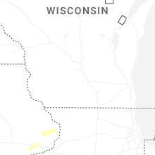
Wisconsin
| Local Time | Report Details |
|---|---|
| 12:00 PM CDT | Reports of trees and powerlines down in beloit. time estimated from rada in rock county WI, 42.5 miles SSE of Madison, WI |
| 12:02 PM CDT | Reports of trees and powerlines down in clinton. time estimated from rada in rock county WI, 44.1 miles SE of Madison, WI |
| 12:02 PM CDT | Damaged outbuilding near sharon. time estimated from rada in walworth county WI, 51.2 miles SE of Madison, WI |
| 12:09 PM CDT | Reports of multiple trees and powerlines down near delavan lake. time estimated from rada in walworth county WI, 50.8 miles SE of Madison, WI |
| 12:10 PM CDT | Few tree limbs down and flag pole down. time estimated from rada in walworth county WI, 54.3 miles SE of Madison, WI |
| 12:13 PM CDT | Private weather statio in walworth county WI, 48.4 miles SE of Madison, WI |
| 12:22 PM CDT | Multiple large limbs down and a few trees snapped near the top in lyons. time estimated from rada in walworth county WI, 59.8 miles ESE of Madison, WI |
| 12:26 PM CDT | Large tree down springfield rd and highway 120. time estimated from rada in walworth county WI, 57.9 miles ESE of Madison, WI |
| 12:28 PM CDT | 2 foot diameter tree dow in walworth county WI, 58.9 miles SE of Madison, WI |
| 12:29 PM CDT | Repots of tree branches down. time estimated from rada in walworth county WI, 58.4 miles NW of Chicago, IL |
| 12:36 PM CDT | Trees and powerlines down. time estimated from rada in racine county WI, 62.4 miles ESE of Madison, WI |
| 12:49 PM CDT | Private weather statio in racine county WI, 60.1 miles NNW of Chicago, IL |
| 12:53 PM CDT | Asos measure 50 kt in kenosha county WI, 51.2 miles NNW of Chicago, IL |
| 1:00 PM CDT | Several tree limbs down a half foot or less in diamete in racine county WI, 58.1 miles N of Chicago, IL |
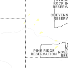
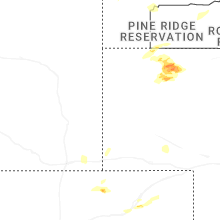
South Dakota
| Local Time | Report Details |
|---|---|
| 11:03 AM MDT | Ping Pong Ball sized hail reported near Spearfish, SD, 44.1 miles NW of Rapid City, SD |
| 11:05 AM MDT | Half Dollar sized hail reported near Spearfish, SD, 42.5 miles NW of Rapid City, SD, photo of multiple 1-1.25 inch hailstones submitted via facebook. |
| 11:06 AM MDT | Quarter sized hail reported near Spearfish, SD, 42.5 miles NW of Rapid City, SD, reported on the northwest side of spearfish |
| 11:10 AM MDT | Quarter sized hail reported near Spearfish, SD, 43 miles NW of Rapid City, SD, picture showed several quarter-to-dime sized hailstones. photo submitted via facebook comment. |
| 11:13 AM MDT | Quarter sized hail reported near Spearfish, SD, 42.1 miles NW of Rapid City, SD, mping report |
| 11:50 AM MDT | Quarter sized hail reported near Newell, SD, 43.1 miles NNW of Rapid City, SD |
| 4:17 PM MDT | Quarter sized hail reported near Hill City, SD, 27.4 miles WSW of Rapid City, SD |
| 4:22 PM MDT | Quarter sized hail reported near Hill City, SD, 30.6 miles W of Rapid City, SD, picture submitted via facebook. |
| 4:22 PM MDT | Half Dollar sized hail reported near Hill City, SD, 30.6 miles W of Rapid City, SD, picture submitted via facebook. |
| 4:45 PM MDT | Half Dollar sized hail reported near Hill City, SD, 19.9 miles WSW of Rapid City, SD, photo submitted via facebook. |
| 5:00 PM MDT | Quarter sized hail reported near Fairburn, SD, 33 miles SSE of Rapid City, SD |
| 5:50 PM MDT | Quarter sized hail reported near Custer, SD, 23.1 miles SSW of Rapid City, SD |
| 6:32 PM MDT | Storm damage reported in custer county SD, 32 miles SE of Rapid City, SD |
| 6:43 PM MDT | Ping Pong Ball sized hail reported near Edgemont, SD, 55.9 miles SW of Rapid City, SD |
| 6:45 PM MDT | Golf Ball sized hail reported near Edgemont, SD, 56.1 miles SW of Rapid City, SD |
| 7:35 PM MDT | Storm damage reported in bennett county SD, 80.4 miles WNW of Valentine, NE |
Mississippi
| Local Time | Report Details |
|---|---|
| 12:07 PM CDT | Multiple trees dow in lee county MS, 44.7 miles NNE of Starkville, MS |
| 12:40 PM CDT | Tree snapped in half and fallen on manufactured home near mill creek rd in greenwood springs... m in monroe county MS, 46.2 miles NE of Starkville, MS |
Kansas
| Local Time | Report Details |
|---|---|
| 12:54 PM CDT | Private weather senso in atchison county KS, 49.3 miles NW of Kansas City, MO |
| 7:24 PM CDT | Half Dollar sized hail reported near Ellis, KS, 23.4 miles NW of Hays, KS |
| 7:50 PM CDT | Half Dollar sized hail reported near Jewell, KS, 78.5 miles NE of Hays, KS |
| 7:56 PM CDT | Quarter sized hail reported near Ogallah, KS, 28.4 miles NW of Hays, KS |
| 8:28 PM CDT | Half Dollar sized hail reported near Morrowville, KS, 56.7 miles NW of Manhattan, KS |
| 8:28 PM CDT | Golf Ball sized hail reported near Wakeeney, KS, 32 miles WNW of Hays, KS |
| 8:30 PM CDT | Storm damage reported in trego county KS, 26.7 miles WNW of Hays, KS |
| 8:49 PM CDT | Storm damage reported in washington county KS, 43 miles NW of Manhattan, KS |
| 8:51 PM CDT | Storm damage reported in washington county KS, 48.4 miles NNW of Manhattan, KS |
Indiana
| Local Time | Report Details |
|---|---|
| 1:57 PM EDT | Tree down over roadway. delayed report. time estimated from rada in dubois county IN, 50.5 miles NE of Evansville, IN |
| 2:36 PM CDT | Several large tree branches snapped at n 50 w and w 400 n... just south of the toll road. time estimated via rada in la porte county IN, 49.9 miles ESE of Chicago, IL |
| 2:36 PM CDT | Video shows tree down on powerlines in michigan cit in la porte county IN, 40.7 miles ESE of Chicago, IL |
| 3:45 PM EDT | A few medium sized tree branches snapped in bristol. time estimated via rada in elkhart county IN, 58.2 miles NW of Fort Wayne, IN |
| 2:52 PM CDT | Social media post showing pictures of a large tree that fell on a vehicle in munster... in. time estimated by rada in lake county IN, 23.5 miles SSE of Chicago, IL |
| 3:59 PM EDT | Two trees downed onto a house by thunderstorm wind gusts. multiple nearby trees also downe in johnson county IN, 15.4 miles SSE of Indianapolis, IN |
| 4:03 PM EDT | Several trees down onto powerlines on brick road in south bend. road is blocked. time estimated via rada in st. joseph county IN, 68.5 miles E of Chicago, IL |
| 4:05 PM EDT | Tree down near the intersection of claffey street and kenilworth road near the indiana michigan state line. time estimated via rada in st. joseph county IN, 71.4 miles E of Chicago, IL |
| 4:18 PM EDT | Large tree limbs down at the intersection of bittersweet and day in mishawaka. time estimated via rada in st. joseph county IN, 68 miles NW of Fort Wayne, IN |
| 4:18 PM EDT | Trees snapped in granger. photo on facebook. time estimated via rada in st. joseph county IN, 70.9 miles NW of Fort Wayne, IN |
| 4:24 PM EDT | Minor siding damage to a home in osceola. time estimated via rada in st. joseph county IN, 65.4 miles NW of Fort Wayne, IN |
| 5:16 PM EDT | Multiple powerlines downed by thunderstorm wind gusts between lapel and anderso in madison county IN, 30.9 miles NE of Indianapolis, IN |
| 5:34 PM EDT | Trained spotter reported estimated wind gusts up to 60 mp in madison county IN, 42.3 miles NE of Indianapolis, IN |
| 5:39 PM EDT | Tree downed and fell through a hous in delaware county IN, 46.4 miles NE of Indianapolis, IN |
| 5:44 PM EDT | A few trees and powerlines downe in delaware county IN, 49 miles NE of Indianapolis, IN |
| 4:54 PM CDT | Power lines blown down along an outflow boundary on the southeast side of evansville with multiple trees on fire near garvin street and covert avenu in vanderburgh county IN, 1.2 miles S of Evansville, IN |
| 6:12 PM EDT | Multiple reports of trees down throughout the southern part of jay county. 400+ without powe in jay county IN, 49.8 miles S of Fort Wayne, IN |
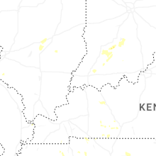
Kentucky
| Local Time | Report Details |
|---|---|
| 1:08 PM CDT | Reports of trees down in adairville by dispatc in logan county KY, 34.9 miles N of Nashville, TN |
| 1:57 PM CDT | Reports of trees down in lewisburg from dispatc in logan county KY, 57.5 miles N of Nashville, TN |
| 3:07 PM CDT | Tree down that had to be removed from rochester road. morgantown dispatch. time estimated from radar. call came in 20 minutes late in butler county KY, 70.2 miles SE of Evansville, IN |
| 3:20 PM CDT | Numerous trees downed in cromwell and prentiss. delayed report. time estimated from rada in ohio county KY, 59.4 miles SE of Evansville, IN |
| 3:50 PM CDT | Numerous trees downed by thunderstorm winds. delayed report. time estimated from rada in ohio county KY, 51.8 miles SE of Evansville, IN |
| 4:11 PM CDT | Corrects previous tstm wnd dmg report from utica. large tree blown onto a house in utica. time estimated from rada in daviess county KY, 40.8 miles SE of Evansville, IN |
| 4:29 PM CDT | Large tree blown onto a house in utica. time estimated from rada in daviess county KY, 36 miles SE of Evansville, IN |
| 5:55 PM CDT | Business with wind damage on the south side of murray. time estimated by rada in calloway county KY, 34.3 miles NNE of Mc Kenzie, TN |
| 5:55 PM CDT | Tree blown down across erwin roa in calloway county KY, 31.5 miles NNE of Mc Kenzie, TN |
| 6:14 PM CDT | Quarter sized hail reported near Murray, KY, 36.2 miles NNE of Mc Kenzie, TN, dime to quarter size hail on northwood avenue in murray. |
| 6:15 PM CDT | Tree blown down across highway 8 in graves county KY, 31 miles N of Mc Kenzie, TN |
| 6:55 PM CDT | Quarter sized hail reported near Hickory, KY, 53 miles N of Mc Kenzie, TN, nickle to quarter sized hail along hwy 45 north of ky 849. |
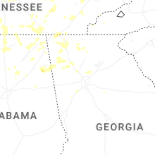
Georgia
| Local Time | Report Details |
|---|---|
| 2:10 PM EDT | At least one tree down at the intersection of glenlake parkway northeast and glenridge driv in fulton county GA, 13.3 miles N of Atlanta, GA |
| 2:10 PM EDT | At least one tree down at the intersection of barfield road and hammond drive northeas in fulton county GA, 12 miles N of Atlanta, GA |
| 2:10 PM EDT | At least one tree down at the intersection of crestline parkway and peachtree dunwoody road northeas in fulton county GA, 12.7 miles N of Atlanta, GA |
| 2:20 PM EDT | Several trees downed along roundtop road... specifically near the intersection of old highway 5 sout in gilmer county GA, 54 miles ESE of Chattanooga, TN |
| 2:30 PM EDT | Tree down on powerline near the intersection of bohannon rd and howell av in fulton county GA, 17.8 miles SW of Atlanta, GA |
| 2:50 PM EDT | Public reports several trees down along nettles lan in gordon county GA, 49.9 miles SE of Chattanooga, TN |
| 3:00 PM EDT | Public reports a tree and power lines down near the intersection of jones street and richardson stree in whitfield county GA, 26.2 miles SE of Chattanooga, TN |
| 3:05 PM EDT | Public reports tree down across brickyard roa in whitfield county GA, 29.1 miles SE of Chattanooga, TN |
| 3:05 PM EDT | Tree down along the 300 block of kelly farm roa in coweta county GA, 25.3 miles SW of Atlanta, GA |
| 3:10 PM EDT | Tree down near the 200 block of country club roa in coweta county GA, 31.9 miles SW of Atlanta, GA |
| 3:10 PM EDT | Public reports tree down across road near the 3000 block of south dixie roa in whitfield county GA, 30 miles SE of Chattanooga, TN |
| 3:20 PM EDT | Public reports trees down along mars hill roa in cobb county GA, 24.8 miles NW of Atlanta, GA |
| 3:30 PM EDT | Public reports two large trees down in yard along the 4300 block of park stree in cobb county GA, 26.8 miles NW of Atlanta, GA |
| 3:30 PM EDT | Department of transportation reports tree down along highway 136 near the intersection with smith driv in walker county GA, 29.3 miles SSE of Chattanooga, TN |
| 3:45 PM EDT | Public reports tree down near the intersection of welcome road and sheppard driv in coweta county GA, 36.6 miles SW of Atlanta, GA |
| 3:55 PM EDT | Public reports a large tree down across lakeview driv in catoosa county GA, 5.7 miles SE of Chattanooga, TN |
| 4:00 PM EDT | Tree down near the intersection willow bend dr nw and weeping willow lane n in bartow county GA, 43 miles NW of Atlanta, GA |
| 4:03 PM EDT | Public reports power lines down near the intersection of spring creek road and ridge roa in chattooga county GA, 35 miles S of Chattanooga, TN |
| 4:05 PM EDT | Power line down near the intersection of gaddis rd nw and joe frank harris pkwy n in bartow county GA, 44.4 miles NW of Atlanta, GA |
| 4:10 PM EDT | Tree down on powerline. cassville rd near the intersection of north erwin s in bartow county GA, 37.7 miles NW of Atlanta, GA |
| 4:10 PM EDT | Department of transportation reports downed power lines near the intersection of highway 136 and highway 34 in walker county GA, 17.8 miles S of Chattanooga, TN |
| 4:15 PM EDT | Power lines down along the 100 block of harrison roa in floyd county GA, 52.3 miles S of Chattanooga, TN |
| 4:15 PM EDT | Power lines down along the 100 block of harrison roa in floyd county GA, 52.3 miles S of Chattanooga, TN |
| 4:22 PM EDT | Public reports trees and power lines down along mission ridge roa in walker county GA, 7.4 miles S of Chattanooga, TN |
| 4:35 PM EDT | Tree down near the intersection of horseleg creek road and huntington roa in floyd county GA, 56.5 miles S of Chattanooga, TN |
| 4:50 PM EDT | Tree and power lines down along rehobeth road near the intersection with highway 41 in floyd county GA, 62 miles WNW of Atlanta, GA |
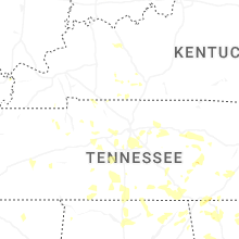
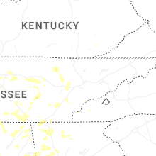
Tennessee
| Local Time | Report Details |
|---|---|
| 1:21 PM CDT | Multiple trees down in fall creek falls par in van buren county TN, 43.1 miles N of Chattanooga, TN |
| 2:31 PM CDT | Part of tin roof on warehouse uplifted on hillsboro blvd. time is radar estimate in coffee county TN, 52 miles NW of Chattanooga, TN |
| 2:36 PM CDT | Tree knocked down power pole and lines near mcdonalds. time estimated from rada in hickman county TN, 42.9 miles WSW of Nashville, TN |
| 3:43 PM EDT | Quarter sized hail reported near Chattanooga, TN, 7.6 miles ESE of Chattanooga, TN, delayed report: three amateur radio stations... trained spotters reported quarter size hail near the intersection of i75 and tn 320 in chattanooga area. |
| 3:55 PM EDT | Facebook image of a split tree with a partial lane blockage in east ridge are in hamilton county TN, 5.2 miles ESE of Chattanooga, TN |
| 4:02 PM EDT | Delayed report. wdef live broadcast with tree and utility pole down on georgia av in hamilton county TN, 0.2 miles N of Chattanooga, TN |
| 3:11 PM CDT | Tree down on bay view drive south of cookevill in putnam county TN, 72.2 miles E of Nashville, TN |
| 3:18 PM CDT | Tree fell on home on burgess school road. time estimated from rada in putnam county TN, 68.9 miles E of Nashville, TN |
| 3:23 PM CDT | Tree on home on fox hill road. time estimated from rada in putnam county TN, 61.9 miles E of Nashville, TN |
| 3:30 PM CDT | Measured from the putnam ema weather statio in putnam county TN, 63.6 miles E of Nashville, TN |
| 3:39 PM CDT | Multiple reports of trees down across central and southern putnam count in putnam county TN, 69.8 miles E of Nashville, TN |
| 3:48 PM CDT | Trees down on york road. time estimated from rada in williamson county TN, 17.5 miles SSE of Nashville, TN |
| 4:01 PM CDT | Tree snapped on amos hamlet and stovall roa in giles county TN, 46.6 miles ENE of Florence, AL |
| 4:05 PM CDT | Trees down on sparta pik in wilson county TN, 33.8 miles E of Nashville, TN |
| 4:24 PM CDT | Two trees down in del web in wilson county TN, 16.7 miles E of Nashville, TN |
| 4:26 PM CDT | Tree branches down across mack hatcher parkway. time estimated from rada in williamson county TN, 18.9 miles SSW of Nashville, TN |
| 4:28 PM CDT | Tree down in a front yard near jim warren par in williamson county TN, 17.5 miles SSW of Nashville, TN |
| 4:29 PM CDT | Trees down on africa roa in wilson county TN, 29.5 miles ENE of Nashville, TN |
| 5:35 PM EDT | Facebook report of tree falling onto a house in decatu in meigs county TN, 43.4 miles NE of Chattanooga, TN |
| 4:42 PM CDT | Tree down on duncan s in sumner county TN, 22.6 miles NE of Nashville, TN |
| 4:48 PM CDT | Tree down across riverwood driv in davidson county TN, 4.9 miles NE of Nashville, TN |
| 4:49 PM CDT | A large section of a tree snapped and fell onto a house on pace s in sumner county TN, 23.9 miles NE of Nashville, TN |
| 4:49 PM CDT | A tree was uprooted and fell onto the roof of an apartmen in sumner county TN, 21.3 miles NE of Nashville, TN |
| 5:50 PM EDT | Delayed report: at least 3 reports of downed trees in tellico plain in monroe county TN, 46.6 miles SSW of Knoxville, TN |
| 4:51 PM CDT | Trees down in winding way neighborhoo in sumner county TN, 13.7 miles NE of Nashville, TN |
| 4:53 PM CDT | Lots of trees and lines down in and around gallati in sumner county TN, 23.9 miles NE of Nashville, TN |
| 5:02 PM CDT | Large tree down on hous in madison county TN, 35.2 miles SSW of Mc Kenzie, TN |
| 6:12 PM EDT | Delayed report. monroe county dispatch reports a few trees and utility poles down in madisonville area. time estimated by rada in monroe county TN, 39.5 miles SW of Knoxville, TN |
| 6:54 PM EDT | Numerous reports of trees down across county. 911 dispatch quoted they do not believe there was a single road without a tree down on it somewher in roane county TN, 33.6 miles W of Knoxville, TN |
| 7:10 PM EDT | Several reports of trees down across oak ridge with facebook pictures of multiple trees down. multiple trees are on houses. small hail also occurred during the strong w in anderson county TN, 19.9 miles W of Knoxville, TN |
| 7:15 PM EDT | Tree landed on a home in oliver springs resulting in an entrapment at the tim in anderson county TN, 22.9 miles WNW of Knoxville, TN |
| 6:20 PM CDT | Report of small outbuilding blown ove in morgan county TN, 44.2 miles W of Knoxville, TN |
| 7:20 PM EDT | Carport partially collapsed on nesper road in oak ridge... with large tree blown down in backyar in anderson county TN, 18.9 miles WNW of Knoxville, TN |
| 7:30 PM EDT | Morgan county dispatch report numerous reports of downed trees and powerlines across county. time estimated by rada in morgan county TN, 39.2 miles WNW of Knoxville, TN |
| 7:35 PM EDT | Large tree branch down on shetterly road in clinto in anderson county TN, 17.7 miles WNW of Knoxville, TN |
| 7:40 PM EDT | Quarter sized hail reported near Clinton, TN, 17.3 miles NW of Knoxville, TN, two separate facebook reports of large hail in clinton... no ruler or measurement but both look to be at least quarter sized. |
| 6:52 PM CDT | Trees down in the allardt are in fentress county TN, 60.3 miles WNW of Knoxville, TN |
| 8:15 PM EDT | Facebook report of a fireworks tent collapsing in maryvill in blount county TN, 14 miles S of Knoxville, TN |
| 8:45 PM EDT | Wvlt facebook commenter reported very large tree branch down in backyard near rocky to in anderson county TN, 22.3 miles NW of Knoxville, TN |
| 9:10 PM EDT | County dispatch reports several trees down across portions of campbell county... time estimated by rada in campbell county TN, 31.3 miles NNW of Knoxville, TN |
| 9:30 PM EDT | Report of a downed tree across paint rock rd passed along by 911 dispatch center. time estimated by rada in scott county TN, 47 miles NW of Knoxville, TN |
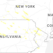
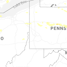
Pennsylvania
| Local Time | Report Details |
|---|---|
| 2:48 PM EDT | Trees down on wires along two mile roa in mckean county PA, 76.5 miles SSE of Buffalo, NY |
| 3:58 PM EDT | Trees and wires down across north williamson road in covington townshi in tioga county PA, 76.3 miles NNE of State College, PA |
| 4:24 PM EDT | Tree down on rte 41 in lycoming county PA, 45.9 miles NNE of State College, PA |
| 4:30 PM EDT | Multiple trees down in halstead-great bend are in susquehanna county PA, 38.9 miles N of Scranton, PA |
| 4:41 PM EDT | Tre and wires down on state line road near germantown roa in susquehanna county PA, 38.8 miles N of Scranton, PA |
| 4:42 PM EDT | Tree down on rte 1 in lycoming county PA, 62.8 miles NE of State College, PA |
| 4:51 PM EDT | Tree down on hancock hw in wayne county PA, 34.7 miles NE of Scranton, PA |
| 4:54 PM EDT | Tree on chapel hill r in lycoming county PA, 48.8 miles NE of State College, PA |
| 4:58 PM EDT | Tree down on river r in lycoming county PA, 48.2 miles NE of State College, PA |
| 5:00 PM EDT | Trees dow in lycoming county PA, 52 miles NE of State College, PA |
| 5:00 PM EDT | Tree down on rte 8 in lycoming county PA, 62.8 miles NE of State College, PA |
| 5:00 PM EDT | Tree down on liberty lan in lycoming county PA, 56.2 miles NE of State College, PA |
| 5:02 PM EDT | Tree on wire in lycoming county PA, 52 miles NE of State College, PA |
| 5:10 PM EDT | Wires down along rte 42 between eagles mere and laport in sullivan county PA, 45.7 miles W of Scranton, PA |
| 5:13 PM EDT | Wires down in montgomer in lycoming county PA, 57.9 miles ENE of State College, PA |
| 5:18 PM EDT | Two trees down on pa-37 in wayne county PA, 28.9 miles NE of Scranton, PA |
| 5:24 PM EDT | Multiple additional trees down around hallstead from a second storm that moved through. downed trees are mainly along main street/us 1 in susquehanna county PA, 38.2 miles N of Scranton, PA |
| 5:29 PM EDT | Tree down on fowlersville r in columbia county PA, 42.8 miles SW of Scranton, PA |
| 5:34 PM EDT | Multiple trees down along cochecton turnpike between rileyville and damascu in wayne county PA, 33.6 miles NE of Scranton, PA |
| 5:35 PM EDT | A few trees down... photo sent in from spotte in wayne county PA, 31.6 miles ENE of Scranton, PA |
| 5:35 PM EDT | Two trees down on great bend turnpik in susquehanna county PA, 26.4 miles N of Scranton, PA |
| 5:37 PM EDT | Pole down on dickinson roa in wyoming county PA, 8.3 miles NW of Scranton, PA |
| 5:45 PM EDT | Estimated 60 mph winds... 15 to 17 inch diameter tree downed... smaller limbs carried down the street. winds ahead of stor in luzerne county PA, 17.6 miles SW of Scranton, PA |
| 5:49 PM EDT | Tree down on pole... tree partially blocking sutton creek roa in luzerne county PA, 10.4 miles W of Scranton, PA |
| 5:55 PM EDT | Tree down over road... and wires down... spruce court and vicinity as per county dispatch feed. radar-estimated tim in pike county PA, 33.1 miles ENE of Scranton, PA |
| 5:55 PM EDT | Corrects previous tstm wnd dmg report from 1 n ashley. estimated 60 mph winds... 15-17 inch diameter tree downed... smaller limbs carried down the street. radar-estimat in luzerne county PA, 17.6 miles SW of Scranton, PA |
| 5:57 PM EDT | Tree down blocking both lanes... chase road of jackson township... as per dispatch fee in luzerne county PA, 18.4 miles WSW of Scranton, PA |
| 6:00 PM EDT | Tree down blocking cahoonzie road in walker lake community... shohola. reported directly to nw in pike county PA, 39 miles E of Scranton, PA |
| 6:01 PM EDT | Storm damage reported in lackawanna county PA, 4 miles SSW of Scranton, PA |
| 6:01 PM EDT | Wilkes-barre scranton airport aso in luzerne county PA, 6.3 miles SSW of Scranton, PA |
| 6:03 PM EDT | Multiple trees down on twin lakes road near shohola township building as per dispatch feed. radar-estimated tim in pike county PA, 38.6 miles E of Scranton, PA |
| 6:04 PM EDT | Tree down on wires... dogwood drive... as per dispatch feed. radar-estimated tim in pike county PA, 39.1 miles E of Scranton, PA |
| 6:09 PM EDT | 75 mph gust extended to 6:09 p in luzerne county PA, 6.4 miles SW of Scranton, PA |
| 6:16 PM EDT | Multiple trees down as per dispatch feed... vicinity of riverview terrace. radar-estimated tim in pike county PA, 47.5 miles E of Scranton, PA |
| 6:20 PM EDT | Multiple trees down across the city of pottsvill in schuylkill county PA, 57.7 miles SSW of Scranton, PA |
| 6:20 PM EDT | Trees and wires dow in schuylkill county PA, 58.7 miles SSW of Scranton, PA |
| 6:22 PM EDT | Wires down. time estimated by rada in schuylkill county PA, 57.3 miles SSW of Scranton, PA |
| 6:28 PM EDT | Trees down in sand spring parking lot. time estimated from rada in carbon county PA, 26.3 miles S of Scranton, PA |
| 6:31 PM EDT | Trees and wires down in coolbaugh township. time estimated from rada in monroe county PA, 22.3 miles SE of Scranton, PA |
| 6:33 PM EDT | Trees and wires down in franklin township. time estimated from rada in carbon county PA, 38.7 miles S of Scranton, PA |
| 6:33 PM EDT | Several trees down around lehighton. time estimated from rada in carbon county PA, 40.1 miles S of Scranton, PA |
| 6:35 PM EDT | Several trees down around weissport. time estimated from rada in carbon county PA, 40.7 miles S of Scranton, PA |
| 6:40 PM EDT | Trees and wires down in polk township. time estimated from rada in monroe county PA, 31.4 miles SSE of Scranton, PA |
| 6:40 PM EDT | Building collapse on n reeser s in schuylkill county PA, 52.8 miles SSW of Scranton, PA |
| 6:43 PM EDT | Mount pocono gusted to 53 k in monroe county PA, 23.7 miles SE of Scranton, PA |
| 6:45 PM EDT | Wires down on milford road... as per dispatch feed. radar-estimated tim in pike county PA, 41.2 miles ESE of Scranton, PA |
| 6:55 PM EDT | Tree down on house... hilltop drive... as per dispatch feed. radar-estimated tim in pike county PA, 38.5 miles ESE of Scranton, PA |
| 6:55 PM EDT | Tree down on house... canterbury road area... as per dispatch feed. radar-estimated tim in pike county PA, 36.9 miles ESE of Scranton, PA |
| 6:56 PM EDT | Tree on house... sandstone drive... as per dispatch feed. radar-estimated tim in pike county PA, 39.5 miles ESE of Scranton, PA |
| 6:56 PM EDT | Trees and wires down in middle smithfield township. time estimated from rada in monroe county PA, 36.6 miles SE of Scranton, PA |
| 6:57 PM EDT | Multiple trees on wires... east sugar mountain road closed for response as per dispatch feed. radar-estimated time of impac in pike county PA, 40.1 miles ESE of Scranton, PA |
| 6:58 PM EDT | Trees and wires down in stroud township. time estimated from rada in monroe county PA, 37 miles SE of Scranton, PA |
| 7:00 PM EDT | Trees and wires down along stagecoach road. time estimated from rada in berks county PA, 56.2 miles S of Scranton, PA |
| 7:00 PM EDT | Trees down blocking the roadway along route 33 near saylorsburg. time estimated from rada in monroe county PA, 40.3 miles SSE of Scranton, PA |
| 7:03 PM EDT | Wires down along kutztown road. time estimated from rada in berks county PA, 60.2 miles S of Scranton, PA |
| 7:07 PM EDT | Trees down around fleetwood. time estimated from rada in berks county PA, 65.2 miles S of Scranton, PA |
| 7:11 PM EDT | Downed trees into houses. time estimated from rada in lehigh county PA, 62.2 miles S of Scranton, PA |
| 7:13 PM EDT | Trees and wires down along fairchild street in alburtis with a transformer on fire. time estimated from rada in berks county PA, 63.5 miles S of Scranton, PA |
| 7:17 PM EDT | Wires down on kimberly road and bentley av in mercer county PA, 61 miles NNW of Pittsburgh, PA |
| 7:17 PM EDT | Lehigh valley international airport gusted to 51 k in lehigh county PA, 53.7 miles SSE of Scranton, PA |
| 7:22 PM EDT | Tree down blocking the roadway in earl township... likely knocked down from outflow producing severe-level winds. time estimated from rada in berks county PA, 72.5 miles S of Scranton, PA |
| 7:23 PM EDT | Trees down blocking the roadway in palm township. time estimated from rada in berks county PA, 67.8 miles S of Scranton, PA |
| 7:23 PM EDT | Several trees down around easton. time estimated from rada in northampton county PA, 54.8 miles SSE of Scranton, PA |
| 7:23 PM EDT | Trees down on wires in bechtelsville... likely from outflow producing severe-level gusts. time estimated from rada in berks county PA, 71.8 miles S of Scranton, PA |
| 7:37 PM EDT | Between george jr rd to the railroad tracks (crossing cranberry rd) there are wires down and trees all along the road. time based on radar estimat in mercer county PA, 52.2 miles N of Pittsburgh, PA |
| 7:37 PM EDT | Wires down on george junior roa in mercer county PA, 52.1 miles N of Pittsburgh, PA |
| 7:44 PM EDT | Tree down into a house. time estimated from rada in bucks county PA, 71.1 miles WSW of Brooklyn, NY |
| 8:15 PM EDT | Tree down into a house. time estimated from rada in bucks county PA, 57.6 miles SW of Brooklyn, NY |
| 8:16 PM EDT | Trees down on clark road in shippenville (near soap fat rd too). time based on radar estimat in clarion county PA, 64.5 miles NNE of Pittsburgh, PA |
| 8:21 PM EDT | Tree down on parker pike road (1 mile north of water tower). time based on radar estimat in butler county PA, 49.2 miles NNE of Pittsburgh, PA |
| 8:27 PM EDT | Trees down on wire. near 2028 community rd. time based on radar estimat in clarion county PA, 59.1 miles NNE of Pittsburgh, PA |
| 8:33 PM EDT | Wire down in driveway at 250 hazelnut rd... fairview twp... pa. time based on radar estimat in butler county PA, 38.9 miles NNE of Pittsburgh, PA |
| 8:38 PM EDT | Couple of trees down on whitehill rd in knox. time based on radar estimat in clarion county PA, 61.9 miles NNE of Pittsburgh, PA |
| 8:38 PM EDT | Tree down on 68. time based on radar estimat in armstrong county PA, 41.4 miles NNE of Pittsburgh, PA |
| 8:40 PM EDT | Multiple trees down on rte 268 in armstrong county. time based on radar estimat in armstrong county PA, 39.3 miles NNE of Pittsburgh, PA |
| 8:43 PM EDT | Tree down. time based on radar estimat in jefferson county PA, 62.9 miles NE of Pittsburgh, PA |
| 9:11 PM EDT | Tree with wires involved... power out. near moravia rd / petersburg rd... north beaver twp. time based on radar estimat in lawrence county PA, 41.6 miles NW of Pittsburgh, PA |
| 9:14 PM EDT | Tree and lines down across the road. reported near 553 n enterline road... perry... pa. time based on radar estimat in jefferson county PA, 60.1 miles NE of Pittsburgh, PA |
| 9:14 PM EDT | Down tree near 2162 state route 351... little beaver twp. time based on radar estimat in lawrence county PA, 40.7 miles NW of Pittsburgh, PA |
| 9:17 PM EDT | Tree blocking the road and cable line along side of the road. report near 107 geno ln... winslow. time based on radar estimat in jefferson county PA, 57.5 miles WNW of State College, PA |
| 9:29 PM EDT | Tree down... wires down. reported near 782 wampum new galilee rd... new beaver boro. time based on radar estimat in lawrence county PA, 35.4 miles NNW of Pittsburgh, PA |
| 9:30 PM EDT | Trees down. time est by rada in clearfield county PA, 45.2 miles W of State College, PA |
| 9:35 PM EDT | Numerous trees down near johnson hill. time from rada in clearfield county PA, 45.1 miles W of State College, PA |
| 9:40 PM EDT | Power lines down on treasure lake r in clearfield county PA, 51.6 miles WNW of State College, PA |
| 9:43 PM EDT | Trees down everywhere in the linesville... pa are in crawford county PA, 66.7 miles E of Cleveland, OH |
| 9:45 PM EDT | Trees down on martin st... lawrence tw in clearfield county PA, 35.4 miles WNW of State College, PA |
| 9:52 PM EDT | Wire down and power out. located on saranac dr after colt rd. time based on radar estimat in mercer county PA, 65.4 miles E of Cleveland, OH |
| 9:55 PM EDT | Truck drove into a tree down on the road. injuries unknown. reported near 668 redbank road... madison township. time based on radar estimat in armstrong county PA, 43.9 miles NNE of Pittsburgh, PA |
| 10:05 PM EDT | Tree down blocking road in front of west branch h in clearfield county PA, 21.9 miles NW of State College, PA |
| 10:09 PM EDT | Tree down on power lines. reported near 4721 w main st... mahoning twp... pa. time based on radar estimat in lawrence county PA, 48.3 miles NNW of Pittsburgh, PA |
| 10:10 PM EDT | Trees down on keewaydin r in clearfield county PA, 26.3 miles NW of State College, PA |
| 10:15 PM EDT | Trees dow in clearfield county PA, 19.9 miles NW of State College, PA |
| 10:30 PM EDT | Trees down on main s in centre county PA, 8.1 miles N of State College, PA |
| 10:32 PM EDT | Trees dow in centre county PA, 12.2 miles N of State College, PA |
| 10:35 PM EDT | Trees down blocking roa in centre county PA, 5.7 miles NE of State College, PA |
| 10:37 PM EDT | Trees down blocking rishel hill r in centre county PA, 7.6 miles NE of State College, PA |
| 10:37 PM EDT | Trees and wires dow in centre county PA, 8.5 miles NNE of State College, PA |
| 10:38 PM EDT | Tree down on johnson rd near walton s in clearfield county PA, 21 miles WNW of State College, PA |
| 10:40 PM EDT | Trees down on buffalo run rd at lower gyp r in centre county PA, 6.1 miles N of State College, PA |
| 10:40 PM EDT | Tree blocking roopsburg r in centre county PA, 8 miles NNE of State College, PA |
| 10:55 PM EDT | Tree down blocking kline r in centre county PA, 16.4 miles ENE of State College, PA |
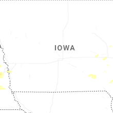
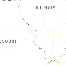
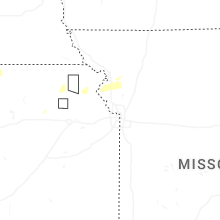
Missouri
| Local Time | Report Details |
|---|---|
| 1:49 PM CDT | Private weather senso in clinton county MO, 26 miles N of Kansas City, MO |
| 1:57 PM CDT | Thunderstorm outflow resulted in minor property damage and several downed tree limbs in plattsburg. time estimated from rada in clinton county MO, 32.2 miles NNE of Kansas City, MO |
| 2:27 PM CDT | Downed trees and limbs near price drive between prairie ridge road and knutter road along the ray/caldwell county line. time estimated from rada in ray county MO, 38.5 miles NE of Kansas City, MO |
North Carolina
| Local Time | Report Details |
|---|---|
| 3:00 PM EDT | Social media report of trees down on lower burningtown r in macon county NC, 55 miles WNW of Greenville, SC |
| 3:15 PM EDT | Social media report of tree down at intersection of wide horizon dr and hwy 441. time estimate in macon county NC, 49.9 miles WNW of Greenville, SC |
| 3:41 PM EDT | Dispatcher indicates multiple trees down between the communities of almond and wesser in the vicinity of highway 19. power outages reported by utility company in same a in swain county NC, 47.3 miles SSE of Knoxville, TN |
| 3:46 PM EDT | Power outage attributed to fallen trees or limbs south of panther branch rd. time estimated from rada in swain county NC, 47.6 miles SSE of Knoxville, TN |
| 3:57 PM EDT | Tree down in roadwa in graham county NC, 43.3 miles SSE of Knoxville, TN |
| 4:11 PM EDT | Trees down on roadwa in graham county NC, 45.5 miles S of Knoxville, TN |
| 4:11 PM EDT | Trees down on powerlines on airport rd... possible fire developed as a resul in graham county NC, 45.4 miles S of Knoxville, TN |
| 4:11 PM EDT | Trees down in roadwa in graham county NC, 45.3 miles S of Knoxville, TN |
| 5:45 PM EDT | Tree reported down on lake tahoma rd. time estimated from rada in mcdowell county NC, 61.4 miles S of Bristol, TN |
| 5:59 PM EDT | Tree completely blocking snowy owl lane. time estimated based on radar and time of power outage reported in same location by utility compan in jackson county NC, 48.9 miles SE of Knoxville, TN |
| 5:59 PM EDT | Power outage near intersection of shoal creek rd and bob hall rd attributed to fallen trees or limb in jackson county NC, 48.5 miles SE of Knoxville, TN |
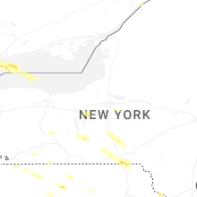
New York
| Local Time | Report Details |
|---|---|
| 3:06 PM EDT | Multiple trees down along ny-36 south of troupsbur in steuben county NY, 86.4 miles NNE of State College, PA |
| 3:31 PM EDT | Corrects previous tstm wnd dmg report from 2 sse troupsburg. multiple trees down along ny-36 south of troupsbur in steuben county NY, 86.4 miles NNE of State College, PA |
| 3:36 PM EDT | Tree down on upper glen ave in hornel in steuben county NY, 73.9 miles ESE of Buffalo, NY |
| 4:20 PM EDT | Tree down on unoccupied vehicle on roosevelt ave as per dispatch feed. also pea-sized hail nearby as per social media and spotter repor in broome county NY, 51.5 miles NNW of Scranton, PA |
| 4:20 PM EDT | Relayed via nws employee. 6 power poles down in kirkwood area. radar-estimated time with downburst signature reaching vicinity at 420p in broome county NY, 44.1 miles N of Scranton, PA |
| 4:48 PM EDT | Tree down on wires on melboure street as per dispatch feed. radar-estimated tim in broome county NY, 50.4 miles NNW of Scranton, PA |
| 4:57 PM EDT | Several trees down in greec in monroe county NY, 63.7 miles ENE of Buffalo, NY |
| 4:58 PM EDT | Tree down on house on hilltop roa in monroe county NY, 67.3 miles ENE of Buffalo, NY |
| 5:01 PM EDT | Tree and wires down on north lane d in monroe county NY, 68.3 miles ENE of Buffalo, NY |
| 5:01 PM EDT | Tree and wires down on cole av in monroe county NY, 62.4 miles ENE of Buffalo, NY |
| 5:01 PM EDT | Tree down on saranac stree in monroe county NY, 66.9 miles ENE of Buffalo, NY |
| 5:04 PM EDT | Large tree down on shorewood d in monroe county NY, 69.7 miles ENE of Buffalo, NY |
| 5:08 PM EDT | Report of several trees and branches down onshore near lake shore drive and great lakes seaway trai in loz043 county NY, 67.1 miles WNW of Syracuse, NY |
| 5:08 PM EDT | Report of several trees and branches down near lake shore drive and great lakes seaway trai in monroe county NY, 66.9 miles WNW of Syracuse, NY |
| 5:09 PM EDT | Corrects previous tstm wnd dmg report from kirkwood. 6 power poles down in kirkwood area. based on timing of response and the more concentrated downburst signature on r in broome county NY, 44.1 miles N of Scranton, PA |
| 5:15 PM EDT | Trees down on holt roa in monroe county NY, 67.3 miles WNW of Syracuse, NY |
| 5:26 PM EDT | Tree... wires and a couple poles down on wilcox road... just north of quaker roa in wayne county NY, 60.4 miles W of Syracuse, NY |
| 5:30 PM EDT | Tree down on canal stree in wayne county NY, 54.8 miles W of Syracuse, NY |
| 5:31 PM EDT | Trees and wires down on jackson street and washington s in wayne county NY, 55.3 miles W of Syracuse, NY |
| 5:38 PM EDT | Tree down on bloom roa in wayne county NY, 47.2 miles W of Syracuse, NY |
| 5:55 PM EDT | *** 1 inj *** updates previous tstm wnd dmg report. photo sent by public of a tree that fell onto a tent at a campground... which injured one person as confirmed by cou in sullivan county NY, 37.2 miles E of Scranton, PA |
| 6:18 PM EDT | Around 5-6 reports of trees and/or wires down around moravi in cayuga county NY, 26.7 miles SSW of Syracuse, NY |
| 6:45 PM EDT | Tree down on route 392 and tone street... town of virgil. radar-estimated tim in cortland county NY, 38 miles S of Syracuse, NY |
| 6:46 PM EDT | Tree and wires down on hoxie gorge road... tree on fir in cortland county NY, 34.6 miles S of Syracuse, NY |
| 6:53 PM EDT | Tree and wires down on maricle roa in cortland county NY, 38.4 miles SSE of Syracuse, NY |
| 7:55 PM EDT | Mesonet station stat college of staten islan in richmond county NY, 10.5 miles SW of Brooklyn, NY |
| 8:00 PM EDT | Mesonet station robn4 robbins reef... n in anz338 county NY, 4.3 miles WSW of Brooklyn, NY |
| 8:00 PM EDT | Mesonet station mhrn6 2 se elizabet in richmond county NY, 9.6 miles WSW of Brooklyn, NY |
| 8:10 PM EDT | Mesonet station bkln brooklyn colleg in kings county NY, 4.8 miles SSE of Brooklyn, NY |
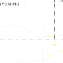
Wyoming
| Local Time | Report Details |
|---|---|
| 1:35 PM MDT | Quarter sized hail reported near Sundance, WY, 56.7 miles E of Gillette, WY |
| 1:36 PM MDT | Half Dollar sized hail reported near Sundance, WY, 56.7 miles E of Gillette, WY, mping report |
| 1:40 PM MDT | Quarter sized hail reported near Sundance, WY, 56.7 miles E of Gillette, WY |
| 2:15 PM MDT | Quarter sized hail reported near Hulett, WY, 51.1 miles ENE of Gillette, WY |
| 2:45 PM MDT | Quarter sized hail reported near Devils Tower, WY, 44.3 miles ENE of Gillette, WY |
| 2:47 PM MDT | Quarter sized hail reported near Osage, WY, 56.7 miles W of Rapid City, SD |
| 3:05 PM MDT | Half Dollar sized hail reported near Devils Tower, WY, 46.3 miles ENE of Gillette, WY |
| 3:22 PM MDT | Hen Egg sized hail reported near Osage, WY, 56.7 miles W of Rapid City, SD, been hailing non-stop since 2 pm |
| 7:23 PM MDT | Quarter sized hail reported near Sheridan, WY, 81.5 miles NW of Gillette, WY |
Michigan
| Local Time | Report Details |
|---|---|
| 3:41 PM EDT | Small and medium branches down. 2 miles se of shoreham... south st. joseph... mi. time provided with repor in berrien county MI, 60.3 miles E of Chicago, IL |
| 3:48 PM EDT | Trees and powerlines down. time estimated via rada in berrien county MI, 60.7 miles ENE of Chicago, IL |
| 3:50 PM EDT | Corrects previous non-tstm wnd gst report from 4 sse south haven. awos station klwa south haven rgnl arp in van buren county MI, 51.8 miles SW of Grand Rapids, MI |
| 3:50 PM EDT | Very large tree snapped in baroda. some rot visible in photo. time estimated via rada in berrien county MI, 59.1 miles E of Chicago, IL |
| 3:50 PM EDT | Several trees down in sodus... mi. time estimated via rada in berrien county MI, 65.9 miles E of Chicago, IL |
| 3:55 PM EDT | Numerous tents blown over at the red bud pro motocross national event in buchanan. time estimated via rada in berrien county MI, 65.2 miles E of Chicago, IL |
| 3:55 PM EDT | Powerlines down on hollywood road. time estimated via rada in berrien county MI, 60.7 miles E of Chicago, IL |
| 3:56 PM EDT | Reports of trees down in portag in kalamazoo county MI, 51.7 miles S of Grand Rapids, MI |
| 3:57 PM EDT | Photos of a very large tree snapped in bainbridge township south of watervliet. time estimated via rada in berrien county MI, 63.3 miles SSW of Grand Rapids, MI |
| 3:58 PM EDT | Report on facebook of live powerlines down in watervliet. time estimated via rada in berrien county MI, 61.4 miles SSW of Grand Rapids, MI |
| 4:00 PM EDT | Large tree down and power is ou in berrien county MI, 69 miles E of Chicago, IL |
| 4:00 PM EDT | Mesonet station miswm 2.0 w spinks corners (mawn in berrien county MI, 66.9 miles ENE of Chicago, IL |
| 4:05 PM EDT | Several reports of trees down in niles... mi. time estimated via rada in berrien county MI, 71.4 miles E of Chicago, IL |
| 4:05 PM EDT | Asos station kazo kalamazoo/bc intl airpor in kalamazoo county MI, 51.2 miles S of Grand Rapids, MI |
| 4:10 PM EDT | Trees down blocking road. time estimated via rada in van buren county MI, 55.7 miles S of Grand Rapids, MI |
| 4:12 PM EDT | Multiple trees and limbs down in the are in van buren county MI, 43.2 miles SSW of Grand Rapids, MI |
| 4:21 PM EDT | Reports of trees and large branches down on road in allegan county MI, 35.7 miles S of Grand Rapids, MI |
| 4:23 PM EDT | Photos on facebook show several trees down on m40 in marcellus. time estimated via rada in cass county MI, 65 miles S of Grand Rapids, MI |
| 4:25 PM EDT | Large tree limb down from leading thunderstorm. time estimated via rada in jackson county MI, 63.9 miles SE of Grand Rapids, MI |
| 4:29 PM EDT | Quarter sized hail reported near Augusta, MI, 47.5 miles SSE of Grand Rapids, MI, report from mping: quarter (1.00 in.). |
| 4:30 PM EDT | Large tree limb down on home (part of the garage) in colon... mi. time estimated via rada in st. joseph county MI, 62.1 miles N of Fort Wayne, IN |
| 4:33 PM EDT | County dispatch reports numerous trees and wires down across southern portion of kent county... with caledonia/gaines township hardest hit. time estimated via rada in kent county MI, 11.4 miles SSE of Grand Rapids, MI |
| 4:40 PM EDT | Large tree dow in barry county MI, 27.6 miles SE of Grand Rapids, MI |
| 4:41 PM EDT | Asos station kbtl battle creek executive airpor in calhoun county MI, 50 miles SSE of Grand Rapids, MI |
| 4:45 PM EDT | Will not appear in products. medium-sized healthy tree down on diamond lake in cassopolis... michiga in cass county MI, 73.1 miles NW of Fort Wayne, IN |
| 4:49 PM EDT | Large tree dow in calhoun county MI, 58.5 miles SSE of Grand Rapids, MI |
| 4:50 PM EDT | Awos station klwa south haven rgnl arp in van buren county MI, 51.8 miles SW of Grand Rapids, MI |
| 4:56 PM EDT | Several downed trees and wires. time estimated via rada in ionia county MI, 23.5 miles E of Grand Rapids, MI |
| 4:59 PM EDT | Several large limbs down. time estimated via rada in eaton county MI, 40 miles SE of Grand Rapids, MI |
| 5:14 PM EDT | Large limb down in hanover. time estimated via rada in jackson county MI, 76.2 miles NNE of Fort Wayne, IN |
| 5:17 PM EDT | Report of several downed trees in eaton rapids. time estimated via rada in eaton county MI, 60.3 miles ESE of Grand Rapids, MI |
| 5:19 PM EDT | Report of downed tree partially blocking roadwa in eaton county MI, 54.9 miles WSW of Flint, MI |
| 5:20 PM EDT | Large tree uprooted onto bibbins road northeast of mosco in hillsdale county MI, 74.7 miles NNE of Fort Wayne, IN |
| 5:20 PM EDT | Spotter estimates 60 mph wind gusts occurring. small tree limbs down (1 to 2 inches in diameter in hillsdale county MI, 73.9 miles NNE of Fort Wayne, IN |
| 5:26 PM EDT | Report of tree down on a house along with multiple power lines down in the area in washtenaw county MI, 50.6 miles SSW of Flint, MI |
| 5:31 PM EDT | Tree down on msu campus. time estimated via rada in ingham county MI, 45.7 miles WSW of Flint, MI |
| 5:31 PM EDT | Tree and powerline down in the area. reports of trees down and power outages throughout the count in ingham county MI, 49.3 miles WSW of Flint, MI |
| 5:32 PM EDT | One large tree snapped and another uprooted. time estimated via rada in ingham county MI, 52.2 miles SW of Flint, MI |
| 5:32 PM EDT | Several uprooted trees. time estimated via rada in ingham county MI, 53.4 miles SW of Flint, MI |
| 5:38 PM EDT | Report of multiple trees on roadway around mast rd and joy rd in washtenaw county MI, 47.3 miles SSW of Flint, MI |
| 5:42 PM EDT | Photo showing large tree down in washtenaw county MI, 50.6 miles S of Flint, MI |
| 5:50 PM EDT | Report of a tree down across woodbury and winegar with additional report of downed trees across laingsburg in shiawassee county MI, 35 miles WSW of Flint, MI |
| 5:50 PM EDT | Report of a tree down in washtenaw county MI, 61.8 miles SSW of Flint, MI |
| 5:50 PM EDT | Large tree limbs down and downed power line. time estimated via rada in clinton county MI, 41.2 miles WSW of Flint, MI |
| 5:53 PM EDT | Photo of downed tree causing roof and car damag in lenawee county MI, 70.8 miles S of Flint, MI |
| 5:56 PM EDT | Report of multiple trees down on roadway in washtenaw county MI, 52.1 miles S of Flint, MI |
| 5:59 PM EDT | Storm damage reported in wayne county MI, 53.8 miles S of Flint, MI |
| 6:00 PM EDT | Mesonet station mimht east lansing - 10 in ingham county MI, 47.1 miles WSW of Flint, MI |
| 6:06 PM EDT | Report of multiple trees and powerlines down across plymouth twp in wayne county MI, 45.6 miles SSE of Flint, MI |
| 6:17 PM EDT | Photos of large tree limbs down estimated 8 inches in diameter in monroe county MI, 78.6 miles S of Flint, MI |
| 6:22 PM EDT | Numerous trees down in wyandotte. photo received on social media of a large snapped tree at oak st and 11 mile roa in wayne county MI, 61.8 miles SSE of Flint, MI |
| 6:26 PM EDT | Storm damage reported in wayne county MI, 56.9 miles SSE of Flint, MI |
| 6:36 PM EDT | Storm damage reported in oakland county MI, 28 miles SSE of Flint, MI |
| 6:39 PM EDT | Measured at detroit river light in monroe county MI, 75.1 miles SSE of Flint, MI |
| 6:49 PM EDT | Measured at grosse pointe yacht club in wayne county MI, 57.7 miles SE of Flint, MI |
| 6:52 PM EDT | Measured at peche island light in wayne county MI, 59.8 miles SE of Flint, MI |
| 7:13 PM EDT | Measured on a handheld anemometer in macomb county MI, 49.3 miles ESE of Flint, MI |
| 7:25 PM EDT | Report of several large healthy tree branches down around algonac state park in st. clair county MI, 63.5 miles ESE of Flint, MI |
Alabama
| Local Time | Report Details |
|---|---|
| 2:56 PM CDT | Tree branches in the road at winchester/buckhead ru in madison county AL, 66.7 miles WSW of Chattanooga, TN |
| 3:05 PM CDT | Large tree down on low gap rd. time estimated from rada in madison county AL, 69.4 miles WSW of Chattanooga, TN |
| 3:19 PM CDT | Structures damaged and multiple trees down in the joe quick rd and greenville pike are in madison county AL, 66.3 miles E of Florence, AL |
| 3:24 PM CDT | Powerline down at hwy 431 in hazel gree in madison county AL, 63.9 miles E of Florence, AL |
| 3:24 PM CDT | Powerline down at joe quick rd & 43 in madison county AL, 63.4 miles E of Florence, AL |
| 3:24 PM CDT | Powerline down on sycamore r in madison county AL, 65.5 miles WSW of Chattanooga, TN |
| 3:28 PM CDT | Tree on powerline on south memorial parkwa in madison county AL, 64 miles E of Florence, AL |
| 3:28 PM CDT | Powerline down on weatherly r in madison county AL, 65.4 miles E of Florence, AL |
| 3:42 PM CDT | Powerline down at 5th street & zierdt r in madison county AL, 55.4 miles ESE of Florence, AL |
| 3:47 PM CDT | Power outages reported at pulaski pike and winchester r in madison county AL, 60 miles E of Florence, AL |
| 4:00 PM CDT | Asos station khsv huntsvill in madison county AL, 52 miles ESE of Florence, AL |
| 5:00 PM CDT | Trees down in the oneonta area... some involving power lines and roadway in blount county AL, 35.5 miles NNE of Birmingham, AL |
| 5:23 PM CDT | A few trees down in the blountsville area. one tree fell onto a car; no injurie in blount county AL, 40.6 miles NNE of Birmingham, AL |
| 6:42 PM CDT | A large tree was downed onto a sporty honda civi in jefferson county AL, 0.1 miles ESE of Birmingham, AL |
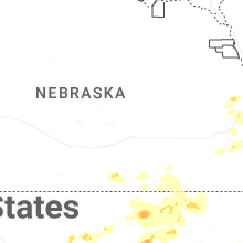
Nebraska
| Local Time | Report Details |
|---|---|
| 3:07 PM MDT | Ping Pong Ball sized hail reported near Hay Springs, NE, 79.1 miles NE of Scottsbluff, NE, mping report. |
| 3:21 PM MDT | Quarter sized hail reported near Hay Springs, NE, 77.4 miles NE of Scottsbluff, NE, report from mping: quarter (1.00 in.). |
| 3:40 PM MDT | Quarter sized hail reported near Rushville, NE, 80.8 miles NE of Scottsbluff, NE, time estimated from radar. |
| 5:39 PM CDT | Social media report of a power outag in douglas county NE, 1.7 miles WSW of Omaha, NE |
| 5:00 PM MDT | Ping Pong Ball sized hail reported near Hay Springs, NE, 68.4 miles NE of Scottsbluff, NE, social media video. |
| 6:34 PM CDT | Half Dollar sized hail reported near Hebron, NE, 62.6 miles SE of Grand Island, NE |
| 5:51 PM MDT | Hay springs 22s mesone in sheridan county NE, 62.8 miles NE of Scottsbluff, NE |
| 7:05 PM CDT | Lost power from an estimated 60 mph wind gus in thayer county NE, 72.4 miles SSE of Grand Island, NE |
| 6:22 PM MDT | Quarter sized hail reported near Lakeside, NE, 76.3 miles ENE of Scottsbluff, NE, time estimated from radar. |
| 7:26 PM CDT | Golf Ball sized hail reported near Palmyra, NE, 45.3 miles SSW of Omaha, NE |
| 7:56 PM CDT | Golf Ball sized hail reported near Roca, NE, 55.8 miles SW of Omaha, NE |
| 7:13 PM MDT | Quarter sized hail reported near Ashby, NE, 80.6 miles WSW of Valentine, NE, time estimated from radar. |
| 8:19 PM CDT | Quarter sized hail reported near Gretna, NE, 16.6 miles WSW of Omaha, NE, hail ranging in size from peas to quarters. time estimated based on radar. |
| 8:19 PM CDT | Quarter sized hail reported near Gretna, NE, 16.4 miles WSW of Omaha, NE, social media report with a photo of quarter sized hail. time estimated based on radar. |
| 8:24 PM CDT | Quarter sized hail reported near Gretna, NE, 17.7 miles WSW of Omaha, NE |
| 8:25 PM CDT | Quarter sized hail reported near Syracuse, NE, 42.6 miles SSW of Omaha, NE, trained spotter reported quarter size hail and estimated wind gusts of 60mph. time estimated based on radar. |
| 7:57 PM MDT | Half Dollar sized hail reported near Hyannis, NE, 76.9 miles NW of North Platte, NE, time estimated from radar. |
| 8:10 PM MDT | Personal weather statio in grant county NE, 70.9 miles NW of North Platte, NE |
Minnesota
| Local Time | Report Details |
|---|---|
| 4:23 PM CDT | Law enforcement officers and dispatch confirms four trees down on east side of big lake. noted as healthy trees. one snapped about 10 feet above base and two uproote in carlton county MN, 25.7 miles WSW of Duluth, MN |
| 6:42 PM CDT | Report and photo of tree down. uprooted tree at base of tree meeting roots. large healthy tree that was at least 18 inch diameter if not more. time estimated off radar in cass county MN, 17.4 miles SE of Bemidji, MN |
| 8:25 PM CDT | Dispatch reports trees down road mn hwy 6. time estimated based on rada in cass county MN, 55.7 miles ESE of Bemidji, MN |
North Dakota
| Local Time | Report Details |
|---|---|
| 4:30 PM CDT | Ping Pong Ball sized hail reported near Fort Yates, ND, 49.9 miles S of Bismarck, ND, broadcast media relayed report of a picture of hail stones next to a quarter. |
New Mexico
| Local Time | Report Details |
|---|---|
| 4:13 PM MDT | Quarter sized hail reported near Mayhill, NM, 68.8 miles WSW of Roswell, NM, relayed by skywarn... with scaled photo. |
| 4:15 PM MDT | Quarter sized hail reported near Mayhill, NM, 68.3 miles WSW of Roswell, NM, relayed by skywarn... with photo. |
Montana
| Local Time | Report Details |
|---|---|
| 4:17 PM MDT | Ggw aso in valley county MT, 1.1 miles NNE of Glasgow, MT |
| 6:40 PM MDT | Corrects previous tstm wnd gst report from 1 nw brockway. brockway... mt (umt - ggw in mccone county MT, 62.5 miles N of Miles City, MT |
| 6:49 PM MDT | Brockway... mt (umt - ggw in mccone county MT, 62.5 miles N of Miles City, MT |
| 7:00 PM MDT | Circle n... mt (umt - ggw in mccone county MT, 61.7 miles SE of Glasgow, MT |
| 7:45 PM MDT | Glendive... dawson community airport... mt (asos/awos - ggw in dawson county MT, 70.5 miles NE of Miles City, MT |
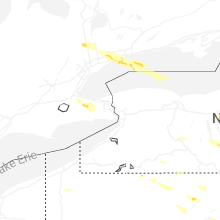
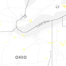
Ohio
| Local Time | Report Details |
|---|---|
| 6:17 PM EDT | Large tree snapped and fell onto a garage. time estimated via rada in lucas county OH, 89.8 miles ENE of Fort Wayne, IN |
| 6:18 PM EDT | Tree damage in various locations throughout the toledo are in lucas county OH, 88.7 miles ENE of Fort Wayne, IN |
| 6:48 PM EDT | Multiple trees and powerlines down around the village. time estimated via rada in sandusky county OH, 85.1 miles W of Cleveland, OH |
| 6:49 PM EDT | Poles and trees down on sr11 in mercer county OH, 47.9 miles SSE of Fort Wayne, IN |
| 6:55 PM EDT | Roof from previously damaged building blew off and destroyed another roof next doo in mercer county OH, 46.6 miles SE of Fort Wayne, IN |
| 7:15 PM EDT | 3 power poles down on mendon road between state road and wren-landeck se of van wer in van wert county OH, 34.1 miles ESE of Fort Wayne, IN |
| 7:18 PM EDT | Tree and wires down at 2nd and ontario stree in erie county OH, 52 miles W of Cleveland, OH |
| 7:47 PM EDT | Tree down across road. time estimated via rada in erie county OH, 50 miles WSW of Cleveland, OH |
| 7:52 PM EDT | Tree down on car on route 6 in lorain county OH, 33.3 miles W of Cleveland, OH |
| 8:04 PM EDT | Large limb and power lines down. time estimated via rada in hancock county OH, 74.9 miles NNW of Columbus, OH |
| 8:08 PM EDT | Large tree limb snapped. time estimated via rada in cuyahoga county OH, 13.6 miles WSW of Cleveland, OH |
| 8:13 PM EDT | Several road closures due to trees and wires down in north ridgevill in lorain county OH, 18.8 miles WSW of Cleveland, OH |
| 8:18 PM EDT | Large branch down and snapped power lines near cr26 and tr17 in hancock county OH, 74.9 miles NNW of Columbus, OH |
| 8:25 PM EDT | Tree down across part of chestnut ridge road in north ridgeville. time estimated via rada in lorain county OH, 19 miles WSW of Cleveland, OH |
| 8:36 PM EDT | Barn blown over. time estimated via rada in medina county OH, 36.3 miles SSW of Cleveland, OH |
| 8:39 PM EDT | Large tree down blocking stone road which also fell on primary power line in cuyahoga county OH, 9.1 miles SSE of Cleveland, OH |
| 8:44 PM EDT | Storm damage reported in summit county OH, 26.1 miles S of Cleveland, OH |
| 8:45 PM EDT | Tree down into a house on summer wind drive. time estimated via rada in cuyahoga county OH, 15.6 miles S of Cleveland, OH |
| 8:53 PM EDT | Asos station kmnn mario in marion county OH, 45.5 miles N of Columbus, OH |
| 8:57 PM EDT | Tree fell through a house on burlington oval. time estimated via rada in geauga county OH, 25.8 miles E of Cleveland, OH |
| 8:59 PM EDT | Several trees and wires down in hambde in geauga county OH, 28.8 miles ENE of Cleveland, OH |
| 9:00 PM EDT | Trees and powerlines down. multiple trees reported down on homes. a metal flagpole was snapped. time estimated via rada in wayne county OH, 45.4 miles SSW of Cleveland, OH |
| 9:01 PM EDT | Large tree uprooted. time estimated via rada in summit county OH, 22.9 miles SSE of Cleveland, OH |
| 9:04 PM EDT | Large tree uprooted near the corner of cleveland and schellin. time estimated via rada in wayne county OH, 45.4 miles SSW of Cleveland, OH |
| 9:15 PM EDT | Several trees dow in portage county OH, 30.1 miles SE of Cleveland, OH |
| 9:15 PM EDT | Tree down on road. time estimated via rada in portage county OH, 42.2 miles SE of Cleveland, OH |
| 9:19 PM EDT | Trees and wires down in the harpersfield to andover/bloomfield are in ashtabula county OH, 46.1 miles ENE of Cleveland, OH |
| 9:19 PM EDT | Large tree down on barclay messerly between state route 305 and warren burto in trumbull county OH, 42.2 miles ESE of Cleveland, OH |
| 9:24 PM EDT | Several trees down. time estimated via rada in portage county OH, 43.5 miles SE of Cleveland, OH |
| 9:29 PM EDT | Tree down. time estimated via rada in stark county OH, 47.2 miles SSE of Cleveland, OH |
| 9:37 PM EDT | Multiple trees down. time estimated via rada in mahoning county OH, 53.4 miles SE of Cleveland, OH |
| 9:49 PM EDT | Multiple trees down around the city of youngstown. time estimated via rada in mahoning county OH, 57.1 miles NW of Pittsburgh, PA |
New Jersey
| Local Time | Report Details |
|---|---|
| 6:43 PM EDT | Several trees down on wantage blocking roadways. time estimated from rada in sussex county NJ, 50.1 miles NW of Brooklyn, NY |
| 6:56 PM EDT | Trees down around highland lakes. time estimated from rada in sussex county NJ, 41.1 miles NW of Brooklyn, NY |
| 7:07 PM EDT | Several trees and wires down around stillwater. time estimated from rada in sussex county NJ, 48 miles ESE of Scranton, PA |
| 7:17 PM EDT | Trees and wires down in green township. time estimated from rada in sussex county NJ, 46 miles WNW of Brooklyn, NY |
| 7:21 PM EDT | Tree down into a house in byram township. time estimated from rada in sussex county NJ, 41.4 miles WNW of Brooklyn, NY |
| 7:27 PM EDT | Several trees and wires down around hackettstown. a shed was also destroyed by the high winds. time estimated from rada in warren county NJ, 45.4 miles WNW of Brooklyn, NY |
| 7:27 PM EDT | Pictures of large trees down in hopatcong. time estimated from rada in sussex county NJ, 38.7 miles WNW of Brooklyn, NY |
| 7:30 PM EDT | Several trees and wires down around roxbury township. time estimated from rada in morris county NJ, 36.9 miles WNW of Brooklyn, NY |
| 7:33 PM EDT | Several trees and wires down around mount arlington. time estimated from rada in morris county NJ, 37.3 miles WNW of Brooklyn, NY |
| 7:33 PM EDT | Trained spotter measured gusts over 60 mph in holland townsihp. time estimate in hunterdon county NJ, 59.7 miles W of Brooklyn, NY |
| 7:33 PM EDT | Trees down blocking route 10. time estimated from rada in morris county NJ, 33 miles WNW of Brooklyn, NY |
| 7:34 PM EDT | Several large 4 inch diameter tree branches down. time estimated from rada in somerset county NJ, 34.1 miles W of Brooklyn, NY |
| 7:35 PM EDT | Several trees down around chatham. video shows high winds likely from the outflow boundary. time estimated from rada in morris county NJ, 20.7 miles W of Brooklyn, NY |
| 7:36 PM EDT | 5 inch diameter tree branch downed. time estimated from rada in hunterdon county NJ, 41.3 miles W of Brooklyn, NY |
| 7:37 PM EDT | Numerous reports of downed trees blocking roads with some reports of wires down. some roads include madison st... priscilla st... and rock hill r in bergen county NJ, 12.8 miles NNW of Brooklyn, NY |
| 7:37 PM EDT | Downed tree on i-80 eastbound at exit 61 - cr 507/river r in bergen county NJ, 16.1 miles NNW of Brooklyn, NY |
| 7:38 PM EDT | Several downed trees blocking all or part of nj in passaic county NJ, 13.5 miles NW of Brooklyn, NY |
| 7:40 PM EDT | Several trees down on route 287 around mile marker 31 blocking the road. time estimated from rada in morris county NJ, 28.5 miles W of Brooklyn, NY |
| 7:40 PM EDT | Picture of a large amount of trees down... completely blocking a roadway. time estimated from rada in morris county NJ, 26.6 miles WNW of Brooklyn, NY |
| 7:42 PM EDT | Several trees and wires down around morristown. time estimated from rada in morris county NJ, 26.7 miles WNW of Brooklyn, NY |
| 7:44 PM EDT | Downed tree on nj 21 southbound north of exit 7 - main s in essex county NJ, 10.3 miles NW of Brooklyn, NY |
| 7:44 PM EDT | Downed tree on garden state parkway southbound north of exit 142 - i-7 in essex county NJ, 13.2 miles W of Brooklyn, NY |
| 7:45 PM EDT | Downed tree on nj 82 both directions east of garden state parkwa in union county NJ, 14.2 miles W of Brooklyn, NY |
| 7:45 PM EDT | Numerous public reports of trees down in nutle in essex county NJ, 12 miles NW of Brooklyn, NY |
| 7:47 PM EDT | Several trees reported blocking roads in fanwood n in union county NJ, 20.8 miles W of Brooklyn, NY |
| 7:48 PM EDT | Tree on top of car on bearbrook l in essex county NJ, 17.6 miles WNW of Brooklyn, NY |
| 7:48 PM EDT | Downed tree on garden state parkway southbound exit ramp exit 136 - stiles s in union county NJ, 16.2 miles WSW of Brooklyn, NY |
| 7:48 PM EDT | Pictures sent in of several large trees down around pittstown. time estimated from rada in hunterdon county NJ, 50.9 miles W of Brooklyn, NY |
| 7:50 PM EDT | Numerous reports of trees down on homes and cars in westfield nj. several reports of trees blocking roads and wires down. some reports come near springfield ave and mou in union county NJ, 17.9 miles W of Brooklyn, NY |
| 7:53 PM EDT | Asos station kewr newark liberty airpor in union county NJ, 9.5 miles W of Brooklyn, NY |
| 7:55 PM EDT | Awos station kldj linden airpor in union county NJ, 14.5 miles WSW of Brooklyn, NY |
| 7:56 PM EDT | Numerous reports of trees down with wires and blocked roadways in union cit in hudson county NJ, 6.2 miles NNW of Brooklyn, NY |
| 7:57 PM EDT | Trees & wires dow in passaic county NJ, 13.4 miles NW of Brooklyn, NY |
| 7:59 PM EDT | Perth amboy mesonet gusted to 61 k in middlesex county NJ, 19.4 miles SW of Brooklyn, NY |
| 8:01 PM EDT | Corrects previous non-tstm wnd gst report from 1 ene bayonne. mesonet station xbyo bayonn in hudson county NJ, 5.5 miles WSW of Brooklyn, NY |
| 8:02 PM EDT | Tree into hous in passaic county NJ, 13.4 miles NW of Brooklyn, NY |
| 8:02 PM EDT | Public videos of tree fallen on house in linde in union county NJ, 14.3 miles WSW of Brooklyn, NY |
| 8:05 PM EDT | Wires down on shed... causing the shed to catch on fire. time estimated from rada in monmouth county NJ, 22.7 miles SSW of Brooklyn, NY |
| 8:05 PM EDT | Tree dow in hudson county NJ, 9.7 miles WNW of Brooklyn, NY |
| 8:08 PM EDT | Trees and wires down around matawan. time estimated from rada in monmouth county NJ, 23.2 miles SSW of Brooklyn, NY |
| 8:15 PM EDT | Several trees and wires down around atlantic highlands. time estimated from rada in monmouth county NJ, 19.7 miles S of Brooklyn, NY |
| 8:15 PM EDT | Several wires down around freehold township. time estimated from rada in monmouth county NJ, 33.3 miles SSW of Brooklyn, NY |
| 8:20 PM EDT | Report of medium to large trees down. time estimated from rada in monmouth county NJ, 33.9 miles SSW of Brooklyn, NY |
| 8:22 PM EDT | Several wires down around delanco and riverside along fairview road. time estimated from rada in burlington county NJ, 68.2 miles SW of Brooklyn, NY |
| 8:24 PM EDT | Several wires down around cinnaminson. time estimated from rada in burlington county NJ, 71.2 miles SW of Brooklyn, NY |
| 8:34 PM EDT | Tree down into a house. time estimated from rada in monmouth county NJ, 39.6 miles S of Brooklyn, NY |
| 8:35 PM EDT | Bradley beach mesonet gusted to 58 k in anz450 county NJ, 34 miles S of Brooklyn, NY |
| 8:35 PM EDT | Bradley beach mesonet gusted to 67 mp in monmouth county NJ, 33.3 miles S of Brooklyn, NY |
| 8:35 PM EDT | Trees and wires down around mount holly. time estimated from rada in burlington county NJ, 64.3 miles SW of Brooklyn, NY |
| 8:40 PM EDT | Sea girt mesonet gusted to 64 mp in monmouth county NJ, 38.9 miles S of Brooklyn, NY |
| 8:40 PM EDT | Sea girt mesone in anz450 county NJ, 38.8 miles S of Brooklyn, NY |
| 8:48 PM EDT | Several wires down around new hanover. time estimated from rada in burlington county NJ, 54.8 miles SW of Brooklyn, NY |
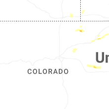
Colorado
| Local Time | Report Details |
|---|---|
| 6:20 PM MDT | Half Dollar sized hail reported near New Raymer, CO, 77.3 miles WNW of Yuma, CO |
| 7:46 PM MDT | Quarter sized hail reported near Snyder, CO, 46.3 miles WNW of Yuma, CO, time estimated from radar. |
| 8:05 PM MDT | Half Dollar sized hail reported near Sterling, CO, 31.3 miles NW of Yuma, CO, time estimated from radar. |
Connect with Interactive Hail Maps