

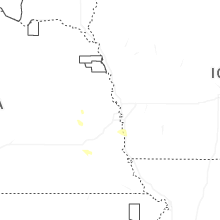
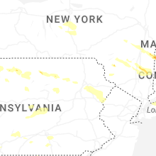
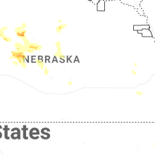
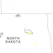
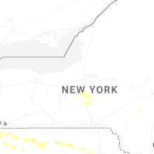
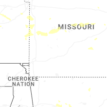
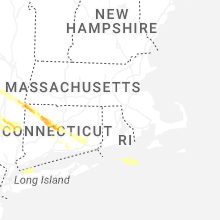
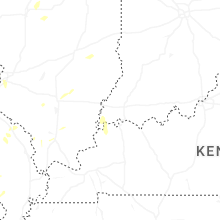
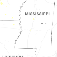
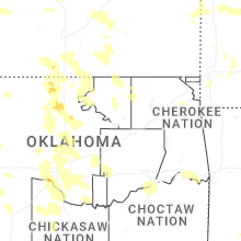
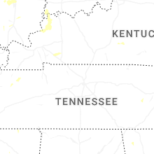
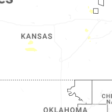
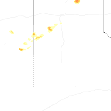
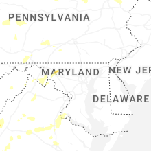
Hail Map for Saturday, July 4, 2026

Number of Impacted Households on 7/4/2026
0
Impacted by 1" or Larger Hail
0
Impacted by 1.75" or Larger Hail
0
Impacted by 2.5" or Larger Hail
Square Miles of Populated Area Impacted on 7/4/2026
0
Impacted by 1" or Larger Hail
0
Impacted by 1.75" or Larger Hail
0
Impacted by 2.5" or Larger Hail
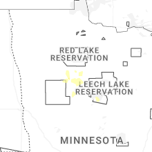
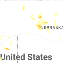
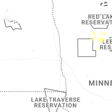
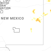

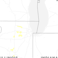
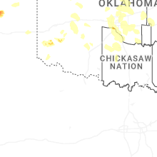
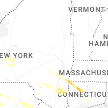
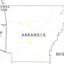

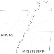
Cities Most Affected by Hail Storms of 7/4/2026
| Hail Size | Demographics of Zip Codes Affected | ||||||
|---|---|---|---|---|---|---|---|
| City | Count | Average | Largest | Pop Density | House Value | Income | Age |
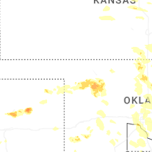
| Custer, SD | 3 | 2.00 | 2.25 | 8 | $92k | $36.7k | 51.5 |
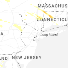
| Bristol, CT | 2 | 2.38 | 3.00 | 2347 | $129k | $47.5k | 40.3 |
| Paxton, NE | 2 | 2.13 | 2.50 | 2 | $55k | $30.8k | 43.4 |
| Hereford, TX | 1 | 2.25 | 2.25 | 15 | $46k | $29.6k | 30.9 |
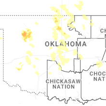
| Argonia, KS | 1 | 2.25 | 2.25 | 5 | $42k | $35.1k | 41.1 |
| Mullen, NE | 1 | 1.75 | 1.75 | 0 | $41k | $28.7k | 49.6 |
| Terryville, CT | 1 | 1.75 | 1.75 | 688 | $123k | $54.0k | 41.4 |
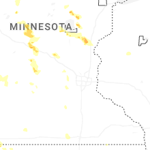
| Mc Grath, MN | 1 | 1.75 | 1.75 | 2 | $53k | $24.0k | 49.7 |
| Aitkin, MN | 1 | 1.75 | 1.75 | 24 | $96k | $33.4k | 52.3 |
| Borger, TX | 1 | 1.75 | 1.75 | 336 | $43k | $36.0k | 36.1 |
| New Britain, CT | 1 | 1.75 | 1.75 | 4036 | $96k | $37.2k | 32.7 |
Hail and Wind Damage Spotted on 7/4/2026
Filter by Report Type:Hail ReportsWind Reports
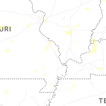
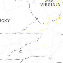
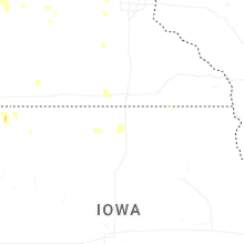
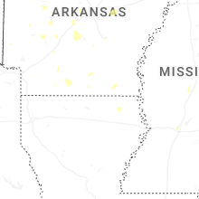
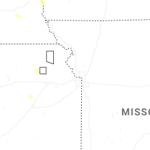
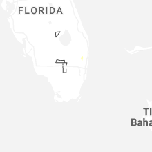
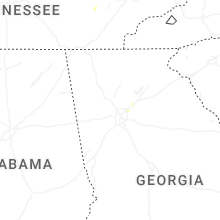
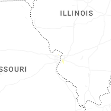
States Impacted
Kansas, Tennessee, Iowa, West Virginia, Missouri, Virginia, Arkansas, Minnesota, Pennsylvania, Ohio, Illinois, New York, South Dakota, North Carolina, Florida, Texas, Mississippi, Michigan, Nebraska, Indiana, Georgia, Maryland, Kentucky, Louisiana, Oklahoma, Connecticut, New Jersey, Delaware, Rhode IslandKansas
| Local Time | Report Details |
|---|---|
| 7:01 AM CDT | A personal weather station recorded a 68 mph wind gus in stafford county KS, 65.2 miles SSE of Hays, KS |
| 7:30 AM CDT | A personal weather station recorded a 58 mph wind gust. time estimated via rada in stafford county KS, 68.4 miles SE of Hays, KS |
| 7:33 AM CDT | A personal weather station recorded a 58 mph wind gus in pratt county KS, 76.6 miles W of Wichita, KS |
| 8:22 AM CDT | Measured at the hutchinson airpor in reno county KS, 38.5 miles NW of Wichita, KS |
| 8:24 AM CDT | Measured at the hutchinson airpor in reno county KS, 38.5 miles NW of Wichita, KS |
| 8:48 AM CDT | Estimating 50 to 60 mph gusts for the past 10 to 15 minute in mcpherson county KS, 44.3 miles NNW of Wichita, KS |
| 8:50 AM CDT | One to two inch diameter branches breakin in harvey county KS, 29.4 miles NNW of Wichita, KS |
| 9:05 AM CDT | Street light blown dow in mcpherson county KS, 36.8 miles NNW of Wichita, KS |
| 9:05 AM CDT | Carport blown from its locatio in harvey county KS, 25 miles N of Wichita, KS |
| 9:07 AM CDT | Small limbs blown dow in marion county KS, 38.8 miles N of Wichita, KS |
| 9:10 AM CDT | Powerline down and on fire one-half mile south of goessel on highway 1 in marion county KS, 38.1 miles N of Wichita, KS |
| 9:20 AM CDT | Storm damage reported in marion county KS, 46.3 miles N of Wichita, KS |
| 9:20 AM CDT | Kansas dot senso in marion county KS, 34 miles NNE of Wichita, KS |
| 9:20 AM CDT | Reports from the lyon county fire district 5 facebook page... confirmed by the county emergency manager... of roof partially removed and windows broken at city hall. nu in lyon county KS, 51.4 miles NNW of Chanute, KS |
| 9:35 AM CDT | Power pole broken on the west side of marion county lake. time is estimated from rada in marion county KS, 47.6 miles NNE of Wichita, KS |
| 9:53 AM CDT | City of el dorado found a tree trunk broken near ground level which fell onto a vehicl in butler county KS, 27.8 miles ENE of Wichita, KS |
| 10:08 AM CDT | Reports to kvoe radio of 60 mph winds with many branches down in the cit in chase county KS, 55.8 miles S of Manhattan, KS |
| 10:30 AM CDT | Small tree branches down with strong wind gus in lyon county KS, 57 miles NW of Chanute, KS |
| 11:59 AM CDT | Downed power lines near 327th and old kansas city road. time estimated from rada in miami county KS, 42.9 miles SSW of Kansas City, MO |
| 12:00 PM CDT | Downed wires near 335th street. time estimated from rada in miami county KS, 41.6 miles SSW of Kansas City, MO |
| 12:00 PM CDT | Downed wires near 353rd street. time estimated from rada in miami county KS, 42.9 miles S of Kansas City, MO |
| 12:08 PM CDT | Large tree downed across the road near 271st and mission bellevue. time estimated from rada in miami county KS, 32.8 miles S of Kansas City, MO |
| 12:09 PM CDT | Multiple reports of wires down and power outages in the bucyrus area. time estimated from rada in miami county KS, 26.8 miles SSW of Kansas City, MO |
| 12:11 PM CDT | Large tree split at a residence southeast of louisburg. time estimated from rada in miami county KS, 35.6 miles S of Kansas City, MO |
| 12:11 PM CDT | Multiple reports of wires down and power outages in louisburg. time estimated from rada in miami county KS, 33.7 miles S of Kansas City, MO |
| 12:18 PM CDT | Downed wires near 263rd street. time estimated from rada in miami county KS, 31.3 miles S of Kansas City, MO |
| 12:20 PM CDT | Downed wires near metcalf road. time estimated from rada in miami county KS, 26.8 miles S of Kansas City, MO |
| 1:03 PM CDT | Quarter sized hail reported near Moundridge, KS, 38.1 miles NNW of Wichita, KS |
| 1:28 PM CDT | Quarter sized hail reported near Halstead, KS, 28 miles NNW of Wichita, KS, picture sent via x of quarter sized hail. |
| 4:30 PM CDT | Hen Egg sized hail reported near Argonia, KS, 36 miles SW of Wichita, KS, time is estimated from radar. picture sent comparing to golf ball. |
| 5:15 PM CDT | Tree limbs down bigger than three inches in diamete in sumner county KS, 47.8 miles SSW of Wichita, KS |
| 5:20 PM CDT | Quarter sized hail reported near Wellington, KS, 37.3 miles SSW of Wichita, KS, lasted for the past five minutes. |
| 5:32 PM CDT | Ping Pong Ball sized hail reported near Caldwell, KS, 47.8 miles SSW of Wichita, KS, lasted for the last 5 minutes and still ongoing. |
| 5:45 PM CDT | Power was knocked out briefly. no damage seen so fa in cowley county KS, 44.3 miles SSE of Wichita, KS |
| 5:45 PM CDT | 11 power poles snapped or leaning between 202nd and 212th roads on highway 77. time is based on previous report and rada in cowley county KS, 39.7 miles SSE of Wichita, KS |
| 7:00 PM CDT | Time is estimate in chautauqua county KS, 60.4 miles SE of Wichita, KS |
| 7:27 PM CDT | Storm damage reported in chautauqua county KS, 60.8 miles SW of Chanute, KS |
Tennessee
| Local Time | Report Details |
|---|---|
| 11:54 AM EDT | Several trees dow in sullivan county TN, 16.1 miles W of Bristol, TN |
| 3:19 PM CDT | Large tree over the road on hwy 19 in fayette county TN, 31.3 miles ENE of Memphis, TN |
| 3:20 PM CDT | Large tree down over the road near the intersection of macon road and cully roa in shelby county TN, 15.2 miles E of Memphis, TN |
| 11:25 PM EDT | Corrects previous tstm wnd dmg report from 1 nne johnson city. report of trees and large branches down in northern johnson city near interstate 2 in washington county TN, 18.4 miles SSW of Bristol, TN |
Iowa
| Local Time | Report Details |
|---|---|
| 12:00 PM CDT | Local em reports large branches dow in palo alto county IA, 41.5 miles NE of Storm Lake, IA |
| 11:57 PM CDT | Several large tree branches down and pine tree snapped ~15 feet above ground. damage occurred sporadically from 11:57 pm and 12:06 am. times estimated based on radar an in o'brien county IA, 44.1 miles NNW of Storm Lake, IA |
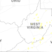
West Virginia
| Local Time | Report Details |
|---|---|
| 1:00 PM EDT | Tree down on coal river rd in comfort. time estimated by rada in boone county WV, 14.5 miles S of Charleston, WV |
| 1:10 PM EDT | Tree down blocking one lane of traffic at the trussel hummingbird ln. also... tree down hensley hollow rd blocking one lan in mcdowell county WV, 60 miles S of Charleston, WV |
| 1:10 PM EDT | Tree down blocking one lane on coal river rd. time estimated by rada in boone county WV, 14.5 miles S of Charleston, WV |
| 1:10 PM EDT | Tree down blocking one lane on daniel boone pkwy in foster. time estimated by rada in boone county WV, 18.7 miles SSW of Charleston, WV |
| 1:11 PM EDT | Trees dow in marion county WV, 46.2 miles NNW of Elkins, WV |
| 1:15 PM EDT | Tree dow in wyoming county WV, 44.9 miles S of Charleston, WV |
| 1:20 PM EDT | Tree dow in wyoming county WV, 45.5 miles S of Charleston, WV |
| 1:20 PM EDT | Down tree in marion county WV, 45.7 miles NNW of Elkins, WV |
| 1:30 PM EDT | Trees dow in marion county WV, 44.3 miles NNW of Elkins, WV |
| 1:30 PM EDT | Tree down across marshall highway in jolo. time estimated by rada in mcdowell county WV, 55.1 miles NNE of Bristol, TN |
| 1:34 PM EDT | Trees dow in marion county WV, 43.5 miles NNW of Elkins, WV |
| 1:36 PM EDT | Trees uprooted and snappe in monongalia county WV, 43.2 miles NNW of Elkins, WV |
| 1:39 PM EDT | Trees dow in monongalia county WV, 44.3 miles NNW of Elkins, WV |
| 1:44 PM EDT | Tree blocking big ben curve in davy. time estimated by rada in mcdowell county WV, 60.8 miles S of Charleston, WV |
| 1:44 PM EDT | Trees dow in monongalia county WV, 44.6 miles N of Elkins, WV |
| 1:44 PM EDT | Tree down on the tracks near the fire dept. time estimated by rada in mcdowell county WV, 60 miles S of Charleston, WV |
| 1:45 PM EDT | Tree down before kimball school on coal heritage rd. time estimated by rada in mcdowell county WV, 63.9 miles S of Charleston, WV |
| 1:49 PM EDT | Trees dow in monongalia county WV, 44.6 miles N of Elkins, WV |
| 1:49 PM EDT | Tree down along southern galloway l in monongalia county WV, 45.2 miles N of Elkins, WV |
| 1:50 PM EDT | Trees dow in monongalia county WV, 45.2 miles N of Elkins, WV |
| 1:54 PM EDT | Trees dow in monongalia county WV, 46.1 miles N of Elkins, WV |
| 1:54 PM EDT | Trees dow in monongalia county WV, 47.6 miles N of Elkins, WV |
| 1:54 PM EDT | Multiple trees down at mile marker 3 westboun in monongalia county WV, 46.9 miles N of Elkins, WV |
| 1:59 PM EDT | Trees dow in monongalia county WV, 47.5 miles N of Elkins, WV |
| 1:59 PM EDT | Limbs dow in monongalia county WV, 36.6 miles N of Elkins, WV |
| 1:59 PM EDT | Tree down across eastgate drive... blocking acces in monongalia county WV, 46.8 miles N of Elkins, WV |
| 2:05 PM EDT | Trees dow in preston county WV, 46 miles N of Elkins, WV |
| 2:10 PM EDT | Tree down blocking both lanes on n street car way in lost creek. one foot in diameter. time estimated by rada in harrison county WV, 32.5 miles WNW of Elkins, WV |
| 2:14 PM EDT | Large tree down blocking roadway on kincheloe and turkey pen rd. 2 to 3 foot in diameter. time estimated by rada in harrison county WV, 38.1 miles WNW of Elkins, WV |
| 2:15 PM EDT | Tree down blocking road on duck creek rd in weston. time estimated by rada in harrison county WV, 32.9 miles WNW of Elkins, WV |
| 2:15 PM EDT | Trees dow in marion county WV, 41.9 miles NNW of Elkins, WV |
| 2:17 PM EDT | Tree down blocking both lanes of traffic at the intersection of lorton lick and skating rink hollow roa in mercer county WV, 71.7 miles W of Roanoke, VA |
| 2:23 PM EDT | Downed power lines in the bluewell are in mercer county WV, 72.7 miles NE of Bristol, TN |
| 2:30 PM EDT | Tree dow in harrison county WV, 32.4 miles WNW of Elkins, WV |
| 2:33 PM EDT | Tree down on rockhouse rd. blocking one lane in fairdal in raleigh county WV, 42.8 miles SSE of Charleston, WV |
| 2:35 PM EDT | Tree down on lines on mcwhorter rd. time estimated from rada in harrison county WV, 31.8 miles WNW of Elkins, WV |
| 2:36 PM EDT | Tree down blocking both lanes near jimmy lewis lak in mercer county WV, 72.3 miles NE of Bristol, TN |
| 2:36 PM EDT | Significant tree damage across mare run rd in westo in lewis county WV, 39.3 miles WNW of Elkins, WV |
| 2:36 PM EDT | Tree down at intersection of kinchelow rd. and turkey pen rd. in jam le in harrison county WV, 38.1 miles WNW of Elkins, WV |
| 2:37 PM EDT | Tree down at intersection n streetcar way in lost cree in harrison county WV, 32.1 miles WNW of Elkins, WV |
| 2:37 PM EDT | Trees dow in preston county WV, 56.3 miles SSE of Pittsburgh, PA |
| 2:40 PM EDT | Lines down on loofboro l in harrison county WV, 32.1 miles WNW of Elkins, WV |
| 2:40 PM EDT | Tree down on power lines on freemans creek rd in weston. time estimated by rada in lewis county WV, 39.4 miles WNW of Elkins, WV |
| 2:42 PM EDT | Tree down at mm 108.5 i79 in harrison county WV, 31.8 miles WNW of Elkins, WV |
| 2:45 PM EDT | Tree dow in gilmer county WV, 49.3 miles W of Elkins, WV |
| 2:55 PM EDT | Tree down at the intersection of leivasy road and gary roa in nicholas county WV, 53.4 miles ESE of Charleston, WV |
| 2:56 PM EDT | Tree down on wv hwy 5 e and copen rd in burnsville. time estimated by rada in gilmer county WV, 46.8 miles W of Elkins, WV |
| 3:00 PM EDT | Numerous trees down across cheat mountain in randolph and valley head. time estimated by rada in randolph county WV, 22.3 miles SSW of Elkins, WV |
| 3:08 PM EDT | Large tree limbs blew down along us-220 petersburg pike near frankli in pendleton county WV, 31 miles ESE of Elkins, WV |
| 3:08 PM EDT | Tree down across roadway and power lines are down. intersection dusk camp run rd and lick run rd. time estimated by rada in gilmer county WV, 48.8 miles W of Elkins, WV |
| 3:12 PM EDT | 911 call center reported multiple trees and power lines down along highway 20 in summers county west virginia near the high school leading to the roadway to be close in summers county WV, 60.2 miles SE of Charleston, WV |
| 3:14 PM EDT | Tree on power lin in taylor county WV, 31.6 miles NNW of Elkins, WV |
| 3:15 PM EDT | Tree fell on a power lin in harrison county WV, 30.2 miles NW of Elkins, WV |
| 3:20 PM EDT | Corrects previous tstm wnd dmg report from 7 s spencer. at least 700 customers out of power due to tree damag in roane county WV, 28.5 miles NNE of Charleston, WV |
| 3:20 PM EDT | Downed power lines off temple stree in summers county WV, 60.2 miles SE of Charleston, WV |
| 3:22 PM EDT | Tree down across duck creek rd in lost cree in harrison county WV, 32.9 miles WNW of Elkins, WV |
| 3:23 PM EDT | One tree down blocking roadwa in greenbrier county WV, 54.4 miles NW of Roanoke, VA |
| 3:27 PM EDT | Emergency manager reported a road closure at craig road and old kanawha turnpike in greenbrier county west virginia due to a tree coming dow in greenbrier county WV, 56.7 miles ESE of Charleston, WV |
| 3:35 PM EDT | Tree dow in upshur county WV, 27.3 miles WSW of Elkins, WV |
| 3:39 PM EDT | Tree down across little bull run road in glenvill in gilmer county WV, 53.3 miles W of Elkins, WV |
| 3:41 PM EDT | Tree on power lin in webster county WV, 40.8 miles SW of Elkins, WV |
| 3:42 PM EDT | Tree down on charleston rd in spencer. power lines down as wel in roane county WV, 32.4 miles NNE of Charleston, WV |
| 3:50 PM EDT | Tree dow in webster county WV, 39.6 miles SW of Elkins, WV |
| 3:55 PM EDT | Tree down partially blocking the intersection of old powell road and rambler roa in greenbrier county WV, 45.9 miles NW of Roanoke, VA |
| 3:55 PM EDT | Tree dow in upshur county WV, 26 miles W of Elkins, WV |
| 4:00 PM EDT | Tree down on centerville rd. time estimated from rada in upshur county WV, 27.7 miles W of Elkins, WV |
| 4:05 PM EDT | Tree down blocking the roa in ritchie county WV, 60.3 miles WNW of Elkins, WV |
| 4:15 PM EDT | Tree down on alton ridge r in upshur county WV, 20.1 miles WSW of Elkins, WV |
| 4:15 PM EDT | Tree down blocking the roa in upshur county WV, 29 miles WSW of Elkins, WV |
| 4:15 PM EDT | Tree dow in webster county WV, 37.4 miles SW of Elkins, WV |
| 4:18 PM EDT | Trees were down along morgantown roa in grant county WV, 43.7 miles ENE of Elkins, WV |
| 4:20 PM EDT | Tree dow in upshur county WV, 29 miles WSW of Elkins, WV |
| 4:20 PM EDT | Power line dow in upshur county WV, 21.1 miles WSW of Elkins, WV |
| 4:20 PM EDT | Power line dow in upshur county WV, 16.2 miles WSW of Elkins, WV |
| 4:24 PM EDT | Tree was down along cunningham lan in hardy county WV, 49.1 miles ENE of Elkins, WV |
| 4:25 PM EDT | Tree down blocking the roa in ritchie county WV, 65.8 miles WNW of Elkins, WV |
| 4:25 PM EDT | Tree down on the road blocking both lane in ritchie county WV, 58.4 miles WNW of Elkins, WV |
| 4:30 PM EDT | Tree down on wv 74 near haymond ridge. time estimated from rada in tyler county WV, 63.2 miles WNW of Elkins, WV |
| 4:32 PM EDT | Line dow in upshur county WV, 21.1 miles WSW of Elkins, WV |
| 4:35 PM EDT | Power line dow in upshur county WV, 16.2 miles WSW of Elkins, WV |
| 4:36 PM EDT | Tree down on wv 18 between county route 28 and tyler county line. time estimated from rada in doddridge county WV, 59.3 miles WNW of Elkins, WV |
| 4:44 PM EDT | At least 300 power outages from tree damag in barbour county WV, 10.3 miles NW of Elkins, WV |
| 4:55 PM EDT | Tree on lines on new river rd. time estimated from rada in raleigh county WV, 56.3 miles SE of Charleston, WV |
| 4:55 PM EDT | Tree down along shortline hwy near timber trai in wetzel county WV, 70.5 miles NW of Elkins, WV |
| 4:56 PM EDT | Tree on power lin in tyler county WV, 74.6 miles NW of Elkins, WV |
| 4:59 PM EDT | Tree on power lin in tyler county WV, 68.3 miles NW of Elkins, WV |
| 5:04 PM EDT | Power lines dow in wirt county WV, 55.3 miles NNE of Charleston, WV |
| 5:05 PM EDT | At least 100 customers out of power due to tree damag in tyler county WV, 65.9 miles WNW of Elkins, WV |
| 5:05 PM EDT | Trees blew down in the 1200 block of cr-7/5 mack roa in hampshire county WV, 68 miles ENE of Elkins, WV |
| 5:06 PM EDT | Tree down along shortline hwy just west of reade in wetzel county WV, 65.5 miles NW of Elkins, WV |
| 5:10 PM EDT | Trees blew down in the 1800 block of cr-7 ford hill roa in hampshire county WV, 68.5 miles ENE of Elkins, WV |
| 5:10 PM EDT | Trees blew down on cr-8 south branch river roa in hampshire county WV, 60.5 miles ENE of Elkins, WV |
| 5:12 PM EDT | Tree in roadway along mountaineer hw in wetzel county WV, 63.7 miles NW of Elkins, WV |
| 5:18 PM EDT | Tree down along proctor creek r in wetzel county WV, 61.6 miles SSW of Pittsburgh, PA |
| 5:30 PM EDT | Numerous trees down at a property along hornet hw in wetzel county WV, 57 miles SSW of Pittsburgh, PA |
| 5:30 PM EDT | Tree on power lin in tyler county WV, 65.7 miles NW of Elkins, WV |
| 5:31 PM EDT | Tree down along hornet hwy near rush run r in wetzel county WV, 58.2 miles SSW of Pittsburgh, PA |
| 5:36 PM EDT | Trees were down across the are in jefferson county WV, 69.4 miles W of Baltimore, MD |
| 5:40 PM EDT | Multiple reports of trees down across jefferson county. several towns with damag in jefferson county WV, 67 miles W of Baltimore, MD |
| 5:54 PM EDT | Trees were down in charles town. about 35 to 50 trees were down across all of jefferson county as wel in jefferson county WV, 67 miles W of Baltimore, MD |
| 7:20 PM EDT | At least 700 customers out of power due to tree damag in roane county WV, 28.5 miles NNE of Charleston, WV |
| 8:55 PM EDT | Tree down on big branch roa in mingo county WV, 51.2 miles SW of Charleston, WV |
| 8:59 PM EDT | Corrects previous tstm wnd dmg report from 6 nne chattaroy. tree down on big branch roa in mingo county WV, 51.2 miles SW of Charleston, WV |
| 9:25 PM EDT | Tree on power lin in logan county WV, 41.6 miles SW of Charleston, WV |
| 9:33 PM EDT | Tree on power lin in logan county WV, 37.3 miles SW of Charleston, WV |
| 9:45 PM EDT | Tree on power lin in logan county WV, 35.1 miles SW of Charleston, WV |
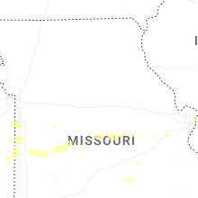
Missouri
| Local Time | Report Details |
|---|---|
| 12:11 PM CDT | Downed wires near southfork drive. time estimated from rada in cass county MO, 38.9 miles S of Kansas City, MO |
| 12:15 PM CDT | Barn damaged... multiple trees down... and power poles snapped between cleveland and drexel. time estimated from rada in cass county MO, 31.3 miles S of Kansas City, MO |
| 12:15 PM CDT | Tree uprooted and several trees downed near cleveland. time estimated from rada in cass county MO, 29.2 miles S of Kansas City, MO |
| 12:17 PM CDT | Several reports of downed trees in freeman. time estimated from rada in cass county MO, 33.5 miles S of Kansas City, MO |
| 12:19 PM CDT | Large tree onto a house near 271st street. time estimated from rada in cass county MO, 33.7 miles SSE of Kansas City, MO |
| 12:20 PM CDT | Camper awning ripped off and downed tree limbs near route c. time estimated from rada in cass county MO, 33.2 miles S of Kansas City, MO |
| 12:21 PM CDT | Downed trees at a residence near route 2 west of harrisonville. time estimated from rada in cass county MO, 33.1 miles SSE of Kansas City, MO |
| 12:23 PM CDT | Multiple reports of trees down in butler. time estimated from rada in bates county MO, 59.6 miles SSE of Kansas City, MO |
| 12:25 PM CDT | Blown over street sign on i-49 and route 7. time estimated from rada in cass county MO, 33.3 miles SSE of Kansas City, MO |
| 12:25 PM CDT | Tree and property damage at a residence west of harrisonville. time estimated from rada in cass county MO, 32.1 miles SSE of Kansas City, MO |
| 12:25 PM CDT | Downed tree and flag pole at a residence south of harrisonville. time estimated from rada in cass county MO, 35.6 miles SSE of Kansas City, MO |
| 12:25 PM CDT | Several reports of trees and wires down between archie and garden city. time estimated from rada in cass county MO, 44.3 miles SSE of Kansas City, MO |
| 12:29 PM CDT | Modot sensor at butler regional airpor in bates county MO, 62.2 miles SSE of Kansas City, MO |
| 12:30 PM CDT | Roof damage reported in the downtown butler area. time estimated from rada in bates county MO, 59.7 miles SSE of Kansas City, MO |
| 12:30 PM CDT | Multiple reports of trees and wires down between peculiar and harrisonville. time estimated from rada in cass county MO, 29 miles SSE of Kansas City, MO |
| 12:30 PM CDT | Trees and limbs down in harrisonville. time estimated from rada in cass county MO, 33.7 miles SSE of Kansas City, MO |
| 12:30 PM CDT | Multiple social media reports of downed or uprooted trees in harrisonville. time estimated from rada in cass county MO, 33.7 miles SSE of Kansas City, MO |
| 12:32 PM CDT | Downed tree limbs and wires near route bb. time estimated from rada in bates county MO, 56.7 miles SSE of Kansas City, MO |
| 12:32 PM CDT | Power poles leaned over and numerous power outages near 273rd street. time estimated from rada in cass county MO, 36.4 miles SSE of Kansas City, MO |
| 12:32 PM CDT | Downed wires near carter road. time estimated from rada in cass county MO, 28 miles SSE of Kansas City, MO |
| 12:34 PM CDT | Tree uprooted near the cass/johnson county line east of garden city. time estimated from rada in cass county MO, 44.5 miles SE of Kansas City, MO |
| 12:35 PM CDT | Several social media reports and videos of trees blown down from a microburst. street flooding was also reported. time estimated from rada in cass county MO, 33.9 miles SSE of Kansas City, MO |
| 12:35 PM CDT | Large tree uprooted at a residence east of harrisonville. street flooding also reporte in cass county MO, 34.8 miles SSE of Kansas City, MO |
| 12:36 PM CDT | Damage to trees due to eddies from strong wind in vernon county MO, 62.3 miles ENE of Chanute, KS |
| 12:36 PM CDT | Downed or snapped trees in latour. time estimated from rada in cass county MO, 43.3 miles SSE of Kansas City, MO |
| 12:36 PM CDT | Downed tree on route 291. time estimated from rada in cass county MO, 29.4 miles SSE of Kansas City, MO |
| 12:38 PM CDT | Several trees and wires down just north of route 2. time estimated from rada in johnson county MO, 41.2 miles SE of Kansas City, MO |
| 12:38 PM CDT | Multiple trees down near route m north of gunn city. time estimated from rada in cass county MO, 36.4 miles SE of Kansas City, MO |
| 12:38 PM CDT | Multiple trees and limbs down in east lynne. time estimated from rada in cass county MO, 35.4 miles SSE of Kansas City, MO |
| 12:38 PM CDT | Several trees and limbs downed between harrisonville and pleasant hill. time estimated from rada in cass county MO, 31.1 miles SSE of Kansas City, MO |
| 12:38 PM CDT | Several large trees downed or snapped near orient cemetery road. time estimated from rada in cass county MO, 33.7 miles SSE of Kansas City, MO |
| 12:39 PM CDT | Downed tree and wires near dickerson road. time estimated from rada in cass county MO, 27.9 miles SSE of Kansas City, MO |
| 12:40 PM CDT | Several reports of downed tree limbs and wires in the urich area. time estimated from rada in henry county MO, 54.4 miles SE of Kansas City, MO |
| 12:40 PM CDT | Public report of barn damaged by strong winds. time estimated from rada in cass county MO, 37 miles SE of Kansas City, MO |
| 12:40 PM CDT | Tree down on wires near route k. time estimated from rada in henry county MO, 55 miles SE of Kansas City, MO |
| 12:40 PM CDT | Several trees down and a roof blown off an outbuilding near gunn city road. time estimated from rada in cass county MO, 38.2 miles SE of Kansas City, MO |
| 12:40 PM CDT | Several reports of trees and wires down south of route 2. time estimated from rada in johnson county MO, 43.3 miles SE of Kansas City, MO |
| 12:45 PM CDT | Report of downed tree limbs and debris on route 2. time estimated from rada in johnson county MO, 44.2 miles SE of Kansas City, MO |
| 12:47 PM CDT | Vernon county is reporting damage to a roof and utility poles on rt c near walker m in vernon county MO, 68.5 miles ENE of Chanute, KS |
| 12:48 PM CDT | Downed tree into wires on 1821 road. time estimated from rada in johnson county MO, 38 miles SE of Kansas City, MO |
| 12:48 PM CDT | Several trees down near route t. time estimated from rada in johnson county MO, 39.2 miles SE of Kansas City, MO |
| 12:49 PM CDT | Several downed trees near route 2 east of route 131. time estimated from rada in johnson county MO, 46.2 miles SE of Kansas City, MO |
| 12:49 PM CDT | Shed damaged and several trees downed near the medford area. time estimated from rada in johnson county MO, 43.9 miles SE of Kansas City, MO |
| 12:50 PM CDT | Tress down and powerline in vernon county MO, 72.1 miles NW of Springfield, MO |
| 12:50 PM CDT | Chicken coop blown over and tree limbs down at a residence south of kingsville. time estimated from rada in johnson county MO, 37.8 miles SE of Kansas City, MO |
| 12:51 PM CDT | Garage blown over and a wall caved in from a building near holden. time estimated from rada in johnson county MO, 41.5 miles SE of Kansas City, MO |
| 12:54 PM CDT | Downed tree limbs in multiple areas of clinton. time estimated from rada in henry county MO, 66.6 miles SE of Kansas City, MO |
| 12:55 PM CDT | Several downed trees reported southeast of holden. time estimated from rada in johnson county MO, 46.6 miles SE of Kansas City, MO |
| 12:55 PM CDT | Tree uprooted at a residence in holden. time estimated from rada in johnson county MO, 41.9 miles SE of Kansas City, MO |
| 12:55 PM CDT | Several trees downed or snapped in chilhowee. time estimated from rada in johnson county MO, 52.7 miles SE of Kansas City, MO |
| 12:57 PM CDT | Several trees downed and a fence blown over in kingsville. time estimated from rada in johnson county MO, 37.3 miles SE of Kansas City, MO |
| 12:58 PM CDT | Multiple reports of downed tree limbs and wires in the deepwater area. time estimated from rada in henry county MO, 72.9 miles SE of Kansas City, MO |
| 12:59 PM CDT | Trees downed or snapped at camp palestine. time estimated from rada in johnson county MO, 50.8 miles SE of Kansas City, MO |
| 12:59 PM CDT | Private weather senso in henry county MO, 63.6 miles SE of Kansas City, MO |
| 1:04 PM CDT | Several downed trees and blown over property and equipment in clinton. time estimated from rada in henry county MO, 68 miles SE of Kansas City, MO |
| 1:04 PM CDT | Downed trees at a residence near quarles. time estimated from rada in henry county MO, 63.2 miles SE of Kansas City, MO |
| 1:06 PM CDT | Large tree downed at a residence on route 7. time estimated from rada in henry county MO, 67.7 miles SE of Kansas City, MO |
| 1:07 PM CDT | Downed wires near 261 road. time estimated from rada in henry county MO, 72.9 miles SE of Kansas City, MO |
| 1:09 PM CDT | Private weather senso in johnson county MO, 61.9 miles SE of Kansas City, MO |
| 1:14 PM CDT | Mesonet station gw3465 osceol in st. clair county MO, 62.5 miles NNW of Springfield, MO |
| 1:15 PM CDT | Several trees and limbs down in leeton. time confirmed from rada in johnson county MO, 60.2 miles SE of Kansas City, MO |
| 1:15 PM CDT | Several reports of downed limbs and wires south of warrensburg. time estimated from rada in johnson county MO, 53 miles ESE of Kansas City, MO |
| 1:15 PM CDT | Storm damage reported in johnson county MO, 59.8 miles SE of Kansas City, MO |
| 1:15 PM CDT | Lass report with pictures of a trailer tipped over and broken apart. osage beach development office for topsiders. time based on rada in camden county MO, 58.4 miles SSW of Columbia, MO |
| 1:18 PM CDT | Downed wires and power outages in windsor. time estimated from rada in henry county MO, 69.7 miles SE of Kansas City, MO |
| 1:24 PM CDT | Several large tree limbs down in knob knoster. time estimated from rada in johnson county MO, 59.7 miles ESE of Kansas City, MO |
| 1:24 PM CDT | Corrects previous flash flood report from 3 sse warrensburg. downed trees in several locations southeast of warrensburg. time estimated from rada in johnson county MO, 53.6 miles ESE of Kansas City, MO |
| 1:30 PM CDT | Roof is off the house - house is currently vacan in benton county MO, 71.2 miles N of Springfield, MO |
| 1:38 PM CDT | Several downed trees and limbs south of sedalia. time estimated from rada in pettis county MO, 53.3 miles WSW of Columbia, MO |
| 1:44 PM CDT | Downed tree limbs and wires near route v. time estimated from rada in pettis county MO, 51.3 miles WSW of Columbia, MO |
| 1:46 PM CDT | Several downed trees at a residence near lone star road. time estimated from rada in pettis county MO, 50.8 miles WSW of Columbia, MO |
| 1:48 PM CDT | Downed tree limbs and wires near echo road. time estimated from rada in pettis county MO, 49.9 miles WSW of Columbia, MO |
| 1:50 PM CDT | Downed wires on route m and whiteman road. time estimated from rada in pettis county MO, 49.7 miles SW of Columbia, MO |
| 1:51 PM CDT | 3-4 foot oak trees snapped 6 feet off ground. 2-3 foot sycamore snapped 25 feet off the ground. time based on rada in morgan county MO, 51.1 miles SW of Columbia, MO |
| 1:55 PM CDT | Major tree damage and people that can’t get out without tree removal. time based on rada in benton county MO, 59.3 miles N of Springfield, MO |
| 1:55 PM CDT | Bleachers at baseball field damaged. time based on rada in morgan county MO, 45.6 miles SW of Columbia, MO |
| 1:58 PM CDT | Ambient weather networ in dallas county MO, 48.7 miles NNE of Springfield, MO |
| 2:00 PM CDT | Large limbs down and power ou in morgan county MO, 51.8 miles SSW of Columbia, MO |
| 2:00 PM CDT | Tree down on county rd ra. 12 diameter trunk... 1/2 mi east of boy scout reservation... power lines down across the roa in camden county MO, 60.4 miles SSW of Columbia, MO |
| 2:00 PM CDT | Trees broke down and damages west of versailles. (currently out of power in morgan county MO, 47.3 miles SW of Columbia, MO |
| 2:02 PM CDT | Storm damage reported in morgan county MO, 44.5 miles SW of Columbia, MO |
| 2:02 PM CDT | Lots of damage around the lake coming out on scanne in camden county MO, 65.2 miles NNE of Springfield, MO |
| 2:03 PM CDT | Many 5 inch trees down all over sunrise beac in camden county MO, 58.5 miles SSW of Columbia, MO |
| 2:06 PM CDT | A few limbs and trees on city streets and one on a hous in miller county MO, 43.6 miles SSW of Columbia, MO |
| 2:06 PM CDT | Tree on house trapping an individua in morgan county MO, 44.1 miles SW of Columbia, MO |
| 2:08 PM CDT | Downed trees in otterville. time estimated from rada in cooper county MO, 39.9 miles WSW of Columbia, MO |
| 2:10 PM CDT | Outdoor shop blown over from severe wind gusts near route j. time estimated from rada in pettis county MO, 47.6 miles W of Columbia, MO |
| 2:12 PM CDT | Report of trees down due to thunderstorm winds near maine drive and highway a in laclede county MO, 47.8 miles NE of Springfield, MO |
| 2:13 PM CDT | 6 inch tree limb snapped on west side of california with the gust front passag in moniteau county MO, 25.9 miles SSW of Columbia, MO |
| 2:15 PM CDT | Large trees dow in camden county MO, 62.9 miles NNE of Springfield, MO |
| 2:15 PM CDT | 3.5 mm off horseshoe bend... huge dock broke loose. boats starting to come loose and float away as wel in camden county MO, 57.1 miles SSW of Columbia, MO |
| 2:15 PM CDT | Corrects previous tstm wnd dmg report from 1 sw osage beach for time. lass report with pictures of a trailer tipped over and broken apart. osage beach development offic in camden county MO, 58.4 miles SSW of Columbia, MO |
| 2:15 PM CDT | Powerlines down in olea in miller county MO, 38.9 miles SSW of Columbia, MO |
| 2:15 PM CDT | Lass report and video of trees down and 70 mph winds estimate in camden county MO, 58.9 miles SSW of Columbia, MO |
| 2:16 PM CDT | Tree limbs and wires down near route 5. time estimated from rada in cooper county MO, 32.9 miles WSW of Columbia, MO |
| 2:27 PM CDT | Tree limbs and wires down near moniteau county drive. time estimated from rada in cooper county MO, 24.1 miles SW of Columbia, MO |
| 2:30 PM CDT | Large branch broken off tre in miller county MO, 60.1 miles S of Columbia, MO |
| 2:30 PM CDT | Report of a tree on house. time based on radar estimat in miller county MO, 51.8 miles NW of Salem, MO |
| 2:30 PM CDT | Large tree branches broken off tree. trees fallen. via social media pics. time based on rada in miller county MO, 40.7 miles SSW of Columbia, MO |
| 2:35 PM CDT | Emergency management stated that there is extensive tree damage across the county and noted wardsville and osage city as being especially hard hit. time estimated by ra in cole county MO, 33.1 miles SSE of Columbia, MO |
| 2:40 PM CDT | Downd tree along route b south of wardsville. 6-8 inches in diameter. time estimated from radar/repor in cole county MO, 32.8 miles SSE of Columbia, MO |
| 2:42 PM CDT | There is debris from trees all the way down hwy 17 between tuscumbia to iberi in miller county MO, 52.7 miles S of Columbia, MO |
| 2:43 PM CDT | Peak wind gust of 61 mph at kje in callaway county MO, 25.9 miles SSE of Columbia, MO |
| 2:46 PM CDT | Emergency management provided an update with additional reports of extensive tree damage around osage city. time estimated by radar. winds were estimated around 70 mph in cole county MO, 32.2 miles SSE of Columbia, MO |
| 2:47 PM CDT | Corrects previous tstm wnd dmg report from 2 ssw wainwright. upr weather station measured multiple 80 mph wind gusts between 2:47 and 2:50 pm... and sustained wind as h in cole county MO, 31 miles SSE of Columbia, MO |
| 2:50 PM CDT | Via social media. uprooted trees and big tree totally snapped in hal in pulaski county MO, 39.6 miles WNW of Salem, MO |
| 2:52 PM CDT | Numerous large trees down around the area. the spotter also noted multiple trees down on their drive through osage and cole counties on their way to loose creek. tome e in osage county MO, 36.6 miles SSE of Columbia, MO |
| 3:00 PM CDT | Large tree fell in the village of hartsburg... damaged the roof of a hom in boone county MO, 17.4 miles S of Columbia, MO |
| 3:00 PM CDT | 10 inch diameter tree down. time estimated from rada in boone county MO, 12.5 miles SSE of Columbia, MO |
| 3:00 PM CDT | Rolla had multiple calls of wires down trees down on power lines... and trees and limbs down on houses. one large tree down fell on top of a house on south cedar street in phelps county MO, 24.2 miles NNW of Salem, MO |
| 3:00 PM CDT | Tree limbs down in roll in phelps county MO, 24 miles NNW of Salem, MO |
| 3:00 PM CDT | Wind caused damage in rolla. branches down on bishop street... power lines affected. lightning caused structure fire in town. time based on rada in phelps county MO, 25.4 miles NNW of Salem, MO |
| 3:02 PM CDT | Storm damage reported in maries county MO, 36.3 miles NNW of Salem, MO |
| 3:05 PM CDT | Transmission pole damag in phelps county MO, 23.7 miles NNW of Salem, MO |
| 3:06 PM CDT | Large tree down on roadwa in boone county MO, 14.7 miles S of Columbia, MO |
| 3:06 PM CDT | 10-12 inch diameter tree blown over onto roadwa in boone county MO, 17.4 miles S of Columbia, MO |
| 3:15 PM CDT | Several trees down around the area. power lines down near hwy tt and tree down on hwy 19. time estimated by rada in crawford county MO, 24.9 miles NNE of Salem, MO |
| 3:15 PM CDT | Highway 8 is blocked due to thunderstorm winds downing tree in phelps county MO, 21.6 miles N of Salem, MO |
| 3:15 PM CDT | Power lines dow in st. charles county MO, 22.6 miles WNW of Saint Louis, MO |
| 3:33 PM CDT | Emergency management reported severe large trees down within the washington city limits. time estimated by rada in franklin county MO, 44.2 miles W of Saint Louis, MO |
| 3:34 PM CDT | Branches blown off tree into internet utility line. line downed into roadway. time estimated from security camera footag in dent county MO, 1 miles NNE of Salem, MO |
| 3:36 PM CDT | Corrects previous tstm wnd dmg report from 1 ese washington. numerous reports of tree damage throughout the city of washington... mo... including some trees blown ove in franklin county MO, 43.2 miles W of Saint Louis, MO |
| 3:48 PM CDT | Multiple limbs down. limbs are 3-4 inches in diameter. time estimated by rada in montgomery county MO, 44.9 miles E of Columbia, MO |
| 4:05 PM CDT | Several trees reported down along hwy 47 west of bonne terre... m in st. francois county MO, 52.8 miles SSW of Saint Louis, MO |
| 4:08 PM CDT | 12 inch tree down. time estimated from radar/repor in st. louis county MO, 21.2 miles W of Saint Louis, MO |
| 4:24 PM CDT | Multiple trees limbs down west of potosi in the area around hwy aa through mo 185. gust occurred behind the initial outflo in washington county MO, 39.2 miles ENE of Salem, MO |
| 4:29 PM CDT | 3-4 inch tree limbs broken. time estimated from rada in st. francois county MO, 58.2 miles NW of Cape Girardeau, MO |
| 4:30 PM CDT | Large tree down. time estimated from radar/repor in st. louis county MO, 12.7 miles WNW of Saint Louis, MO |
| 4:36 PM CDT | Numerous reports of tree damage throughout the city of washington... mo... including some trees blown over. at this location... a tree was blown over and through the ro in franklin county MO, 43.2 miles W of Saint Louis, MO |
| 6:37 PM CDT | Powerlines down near the intersection of highway b and in pemiscot county MO, 72.9 miles SSW of Cape Girardeau, MO |
| 9:42 PM CDT | Mping of 3 inch limbs broke in newton county MO, 66.2 miles WSW of Springfield, MO |
| 10:20 PM CDT | Apple rd / cr 80 (jasper co) - large trees down... porch items blown awa in jasper county MO, 50.5 miles W of Springfield, MO |
| 10:25 PM CDT | 10th st and bendita ln (sarcoxie) - top of tree snapped onto power line in jasper county MO, 46.6 miles W of Springfield, MO |
| 10:28 PM CDT | Tree across the road near 14426 lawr co 101 in lawrence county MO, 42.4 miles WSW of Springfield, MO |
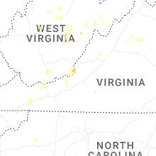
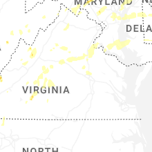
Virginia
| Local Time | Report Details |
|---|---|
| 1:15 PM EDT | Large limb downe in smyth county VA, 37.2 miles ENE of Bristol, TN |
| 1:33 PM EDT | Tree down on power line near the magic mart in tazewell... and caused a fir in tazewell county VA, 53.3 miles NE of Bristol, TN |
| 1:33 PM EDT | Tree down near the intersection of lake witten road and state route 64 in tazewell county VA, 55.2 miles NE of Bristol, TN |
| 2:01 PM EDT | Tree down on greystone roa in smyth county VA, 36.3 miles ENE of Bristol, TN |
| 2:02 PM EDT | Tree down on power lin in smyth county VA, 39.1 miles ENE of Bristol, TN |
| 2:45 PM EDT | Several trees and wires blew down near broadway. a large tree blew down in the 12000 block of daphna road. a couple of large trees blew down on us-11 lee highway/north in rockingham county VA, 63.5 miles ESE of Elkins, WV |
| 2:55 PM EDT | A tree blew down in the 300 block of hickory hill roa in augusta county VA, 76 miles SE of Elkins, WV |
| 3:04 PM EDT | Trees down along the intersection of glade road and mt zion roa in montgomery county VA, 31 miles W of Roanoke, VA |
| 3:09 PM EDT | Multiple trees down at the intersection of mount zion road and keisters branch road per nws employe in montgomery county VA, 31.5 miles W of Roanoke, VA |
| 3:15 PM EDT | Trees and wires blew down in the 6800 block of new haven roa in rockingham county VA, 70.6 miles SE of Elkins, WV |
| 3:20 PM EDT | Tree down along eggleston roa in giles county VA, 35.3 miles W of Roanoke, VA |
| 3:22 PM EDT | Tree down near the intersection of bobcat lane and glade roa in montgomery county VA, 30.4 miles W of Roanoke, VA |
| 3:25 PM EDT | Trees and wires blew down in the 8600 block of us-340 east side highway... and in the 5100 block of berrytown roa in rockingham county VA, 74.4 miles ESE of Elkins, WV |
| 3:30 PM EDT | Several large tree limbs blew down along va-810 dyke roa in greene county VA, 71.2 miles NW of Richmond, VA |
| 3:35 PM EDT | Several trees down in the parking lot of the blacksburg nws offic in montgomery county VA, 26.4 miles W of Roanoke, VA |
| 3:38 PM EDT | Numerous trees were down near madiso in madison county VA, 66.6 miles NNW of Richmond, VA |
| 3:44 PM EDT | Tree down in the 700 block of east dolly ann road... near veterans avenu in alleghany county VA, 35.1 miles N of Roanoke, VA |
| 3:50 PM EDT | Trees down along highway 311 near paint ban in craig county VA, 26.2 miles NW of Roanoke, VA |
| 3:50 PM EDT | Tree down at the intersection of rich patch road and white rock gap roa in alleghany county VA, 34.5 miles N of Roanoke, VA |
| 3:58 PM EDT | Tree down on road on rt. 626 in the county of hanover... in the vicinity of old elmont rd; rt. 816n/s (hanover county).. in hanover county VA, 17.1 miles NNE of Richmond, VA |
| 3:58 PM EDT | Reports of multiple trees down in southwest culpeper count in culpeper county VA, 66.4 miles NNW of Richmond, VA |
| 4:01 PM EDT | Tree down on lusters gate roa in montgomery county VA, 23.2 miles W of Roanoke, VA |
| 4:04 PM EDT | Tree down along gravel ridge driv in alleghany county VA, 30.9 miles NNW of Roanoke, VA |
| 4:10 PM EDT | Large tree limbs fell onto power lines in the 200 block of honeyville avenu in page county VA, 76.1 miles ESE of Elkins, WV |
| 4:10 PM EDT | Quarter sized hail reported near Charlottesville, VA, 60 miles NW of Richmond, VA, quarter sized hail. |
| 4:10 PM EDT | Multiple trees down on elmont rd near ashlan in hanover county VA, 19.5 miles NNE of Richmond, VA |
| 4:10 PM EDT | Public reported numerous trees down blocking roads... south side of ashlan in hanover county VA, 20 miles NNE of Richmond, VA |
| 4:15 PM EDT | Numerous trees and wires blew down near and north of charlottesvill in albemarle county VA, 58.8 miles NW of Richmond, VA |
| 4:15 PM EDT | Dozens of trees and wires down widespread across eastern albemarle county. 37 percent of the city of charlottesville is without powe in albemarle county VA, 51.3 miles NW of Richmond, VA |
| 4:23 PM EDT | Numerous trees down across the count in bath county VA, 48.4 miles N of Roanoke, VA |
| 4:28 PM EDT | Several trees down across the count in rockbridge county VA, 53.4 miles NNE of Roanoke, VA |
| 4:33 PM EDT | Tree down on franklin street near the roanoke county/salem city lin in roanoke county VA, 6.8 miles WSW of Roanoke, VA |
| 4:40 PM EDT | Multiple trees knocked down powerlines on tyler station r in hanover county VA, 28.7 miles N of Richmond, VA |
| 4:45 PM EDT | Several trees blew down in buffalo ga in augusta county VA, 60.6 miles SSE of Elkins, WV |
| 4:45 PM EDT | Trees down on rt. 715 in the county of hanover... in the vicinity of tyler station r in hanover county VA, 28.7 miles N of Richmond, VA |
| 4:47 PM EDT | Tree down on sweet hollow roa in bedford county VA, 33.3 miles ENE of Roanoke, VA |
| 4:47 PM EDT | Multiple trees knocked down powerlines down along beaverdam school r in hanover county VA, 29.4 miles N of Richmond, VA |
| 4:50 PM EDT | Tree dow in city of roanoke county VA, 1.8 miles SW of Roanoke, VA |
| 4:50 PM EDT | Multiple trees and powerlines were knocked down on hickory creek r in louisa county VA, 46.6 miles NNW of Richmond, VA |
| 4:57 PM EDT | Numerous trees blew down across nelson count in nelson county VA, 70.9 miles WNW of Richmond, VA |
| 5:00 PM EDT | Trees down on rt. 1020 in the county of caroline... in the vicinity of tanglewood dr; tumbleweed pl; rt. 1021e/w (caroline county in caroline county VA, 46.6 miles NNE of Richmond, VA |
| 5:00 PM EDT | A couple of trees down in the northwest corner of fluvanna county... near keswick. time estimated from rada in fluvanna county VA, 49.7 miles NW of Richmond, VA |
| 5:03 PM EDT | Tree down on elon roa in amherst county VA, 39.7 miles ENE of Roanoke, VA |
| 5:05 PM EDT | Reports of several trees down in the vicinity of oakland road and kents mill road. time estimated from rada in louisa county VA, 45.7 miles NNW of Richmond, VA |
| 5:06 PM EDT | Tree down on skimming creek roa in bedford county VA, 36.9 miles ENE of Roanoke, VA |
| 5:06 PM EDT | Trained spotter reported a tree down in the partridge creek area in amherst count in amherst county VA, 51.7 miles ENE of Roanoke, VA |
| 5:10 PM EDT | Additional report of numerous trees on powerlines and down power poles on route-17 in caroline county and into spotsylvania count in caroline county VA, 53.1 miles NNE of Richmond, VA |
| 5:10 PM EDT | Trees down on us-17 in the county of caroline... in the vicinity of pepmeier hill rd; rt. 610n/s (caroline county in caroline county VA, 53.1 miles NNE of Richmond, VA |
| 5:12 PM EDT | Tree down on power line along stone mill roa in pittsylvania county VA, 38.6 miles ESE of Roanoke, VA |
| 5:12 PM EDT | Tree down blocking rockford school r in pittsylvania county VA, 34.7 miles ESE of Roanoke, VA |
| 5:14 PM EDT | Tree down on mercury roa in pittsylvania county VA, 35 miles ESE of Roanoke, VA |
| 5:15 PM EDT | Dozens of trees down across several locations in the count in augusta county VA, 60.9 miles SE of Elkins, WV |
| 5:15 PM EDT | Tree down reported by a spotter at the high school in amherst county virgini in amherst county VA, 53.4 miles ENE of Roanoke, VA |
| 5:22 PM EDT | Multiple trees blown down completely blocking route 60 in amherst county reported by a spotte in amherst county VA, 50.6 miles ENE of Roanoke, VA |
| 5:23 PM EDT | Multiple reports of trees down in western augusta county. several roads close in augusta county VA, 58.5 miles SE of Elkins, WV |
| 5:25 PM EDT | Tree down across dews road near renan roa in pittsylvania county VA, 43.2 miles ESE of Roanoke, VA |
| 5:26 PM EDT | Quarter sized hail reported near Altavista, VA, 36.8 miles ESE of Roanoke, VA |
| 5:28 PM EDT | Spotter reported multiple trees down across campbell county virginia... and pea to dime size hail at his location at brownsville road and stone roa in campbell county VA, 43.7 miles E of Roanoke, VA |
| 5:30 PM EDT | A tree was down along prince edward street and amelia stree in city of fredericks county VA, 55.9 miles N of Richmond, VA |
| 5:35 PM EDT | Trees blew down on i-95 at mile marker 14 in stafford county VA, 60.6 miles N of Richmond, VA |
| 5:37 PM EDT | Numerous trees blew down across nelson count in nelson county VA, 70.9 miles WNW of Richmond, VA |
| 5:42 PM EDT | Tree down on richmond highway near spout sprin in appomattox county VA, 57 miles E of Roanoke, VA |
| 5:42 PM EDT | Tree down on little dogwood roa in appomattox county VA, 56.6 miles E of Roanoke, VA |
| 5:45 PM EDT | Numerous trees were down around charlottesville and albemarle county. the hardest hit areas were across charlottesville as well as the eastern part of the county. there in albemarle county VA, 59 miles NW of Richmond, VA |
| 5:50 PM EDT | Tree down near intersection of richmond hwy and depot lan in appomattox county VA, 58.2 miles E of Roanoke, VA |
| 5:50 PM EDT | Quarter sized hail reported near Spotsylvania, VA, 43.6 miles NNW of Richmond, VA, quarter size hail was reported in lake anna state park. |
| 5:53 PM EDT | Trees blew down on eastbound va-676 in the vicinity of va-678 lutheran church roa in loudoun county VA, 55.3 miles W of Baltimore, MD |
| 5:54 PM EDT | About 45 to 50 trees were down across harrisonbur in rockingham county VA, 62.4 miles ESE of Elkins, WV |
| 5:55 PM EDT | A wind gust of 55 knots (63 mph) was measured by a cwop station in broadway (gw5695 in rockingham county VA, 60.7 miles ESE of Elkins, WV |
| 6:00 PM EDT | Tree down on blue ridge driv in appomattox county VA, 59.2 miles E of Roanoke, VA |
| 6:06 PM EDT | Tree down on quail ru in appomattox county VA, 61 miles E of Roanoke, VA |
| 6:06 PM EDT | A wind gust of 53 knots (61 mph) was measured by the awos at quantico marine base (knyg in prince william county VA, 65.5 miles SW of Baltimore, MD |
| 6:07 PM EDT | Trees blew down on eastbound va-600 gunston road in the vicinity of delphinium trai in fairfax county VA, 52.9 miles SSW of Baltimore, MD |
| 6:34 PM EDT | Tree down on saint andrews roa in buckingham county VA, 50.5 miles W of Richmond, VA |
| 6:40 PM EDT | Two trees down on mount rush highwa in buckingham county VA, 54.9 miles W of Richmond, VA |
| 6:45 PM EDT | Tree down on rock island roa in buckingham county VA, 50.7 miles WNW of Richmond, VA |
| 6:47 PM EDT | Broadcast media relayed information of multiple large pine trees fell near scottsvill in fluvanna county VA, 49.8 miles WNW of Richmond, VA |
| 6:50 PM EDT | Tree down on bridge roa in buckingham county VA, 51.6 miles W of Richmond, VA |
| 6:52 PM EDT | Tree down on dixie hill roa in buckingham county VA, 50.5 miles W of Richmond, VA |
| 6:55 PM EDT | Tree knocked down powerline near lake monticell in fluvanna county VA, 46.1 miles NW of Richmond, VA |
| 6:55 PM EDT | Tree down on east anderson highwa in buckingham county VA, 41.7 miles W of Richmond, VA |
| 7:05 PM EDT | Multiple trees and trees on powerlines in the northern portion of the count in cumberland county VA, 29.4 miles W of Richmond, VA |
| 7:06 PM EDT | Tree down on back mountain roa in buckingham county VA, 41.3 miles W of Richmond, VA |
| 8:05 PM EDT | Corrects time from previous tstm wnd dmg report from 4 ese aspen. about 10 trees down on aspen wall roa in charlotte county VA, 66.9 miles ESE of Roanoke, VA |
| 8:52 PM EDT | About 10 trees down on aspen wall roa in charlotte county VA, 66.9 miles ESE of Roanoke, VA |
| 10:45 PM EDT | Reports of widespread trees down along lee highway... weaver pike... and several other roads in and around bristo in city of bristol county VA, 5.7 miles ENE of Bristol, TN |
| 11:20 PM EDT | Reports of trees down along interstate 81 near and east of abingdo in washington county VA, 21.4 miles ENE of Bristol, TN |
| 11:42 PM EDT | One tree down across carlock creek r in smyth county VA, 34.2 miles ENE of Bristol, TN |
| 11:49 PM EDT | Tree down across roadwa in smyth county VA, 36.7 miles ENE of Bristol, TN |
Arkansas
| Local Time | Report Details |
|---|---|
| 12:29 PM CDT | Wind gust estimated to be 60 mph within the chenal are in pulaski county AR, 8.4 miles W of Little Rock, AR |
| 2:58 PM CDT | Multiple trees reported down in hattieville along ar-highway 21 in conway county AR, 47.4 miles NW of Little Rock, AR |
| 3:25 PM CDT | A large tree was reported uprooted in the town of morrilton via social media pictur in conway county AR, 39.1 miles NW of Little Rock, AR |
| 3:29 PM CDT | Tree blown down onto b street near ar hwy in perry county AR, 34.5 miles WNW of Little Rock, AR |
| 4:50 PM CDT | Law enforcement was notified of downed trees along shuler rd west of el dorad in union county AR, 63 miles WNW of Bastrop, LA |
| 4:55 PM CDT | Union county dispatch received a report of a downed tree on east 12th street in smackove in union county AR, 61.5 miles NW of Bastrop, LA |
| 5:16 PM CDT | Media partner shared report of gas station canopy blown off at the exxon on us 82 at forest hill ln... west of el dorad in union county AR, 55.9 miles WNW of Bastrop, LA |
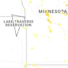
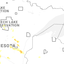
Minnesota
| Local Time | Report Details |
|---|---|
| 1:24 PM CDT | Quarter sized hail reported near New York Mills, MN, 70.3 miles SSW of Bemidji, MN, storm spotter reports quarter sized hail southeast of new york mills... mn. |
| 1:56 PM CDT | Quarter sized hail reported near Menahga, MN, 58.7 miles SSW of Bemidji, MN, time estimated via radar. |
| 3:05 PM CDT | Downed birch tree from thunderstor in todd county MN, 89.5 miles NNE of Montevideo, MN |
| 3:05 PM CDT | Quarter sized hail reported near Clarissa, MN, 89.5 miles NNE of Montevideo, MN |
| 3:30 PM CDT | Quarter sized hail reported near Sauk Centre, MN, 69.8 miles NNE of Montevideo, MN |
| 3:35 PM CDT | Quarter sized hail reported near Long Prairie, MN, 83.9 miles NNE of Montevideo, MN |
| 3:38 PM CDT | Law enforcement reported trees and powerlines down west of long prairie. time estimated via rada in todd county MN, 77.3 miles NNE of Montevideo, MN |
| 3:40 PM CDT | Quarter sized hail reported near Aitkin, MN, 76.6 miles SE of Bemidji, MN, time estimated from radar. report with photo from social media. |
| 3:46 PM CDT | Golf Ball sized hail reported near Aitkin, MN, 76.5 miles WSW of Duluth, MN, report of golf ball size hail 3 miles from aitkin on highway 47. location is approximate. time estimated by radar. |
| 3:54 PM CDT | Half Dollar sized hail reported near Isle, MN, 76.6 miles WSW of Duluth, MN, cocorahs observer measured half-dollar size hail. time estimated via radar. |
| 3:55 PM CDT | Quarter sized hail reported near Aitkin, MN, 76 miles WSW of Duluth, MN |
| 3:57 PM CDT | Quarter sized hail reported near Aitkin, MN, 76.8 miles WSW of Duluth, MN |
| 3:57 PM CDT | Quarter sized hail reported near Sauk Centre, MN, 65.8 miles NE of Montevideo, MN, quarter size hail measured in sauk centre. |
| 3:57 PM CDT | Ping Pong Ball sized hail reported near Aitkin, MN, 76.8 miles WSW of Duluth, MN, facebook video. |
| 4:16 PM CDT | Half Dollar sized hail reported near Isle, MN, 73.8 miles WSW of Duluth, MN, facebook video. |
| 4:20 PM CDT | Golf Ball sized hail reported near Mc Grath, MN, 71.4 miles WSW of Duluth, MN |
| 4:34 PM CDT | Quarter sized hail reported near New Munich, MN, 66.5 miles NE of Montevideo, MN |
| 4:44 PM CDT | Ping Pong Ball sized hail reported near Freeport, MN, 66.3 miles NE of Montevideo, MN, photo measurement provided via nwschat. |
| 5:03 PM CDT | Ping Pong Ball sized hail reported near Saint Cloud, MN, 59.2 miles NW of Minneapolis, MN |
| 5:04 PM CDT | Ping Pong Ball sized hail reported near Saint Cloud, MN, 59.8 miles NW of Minneapolis, MN, first reported quarter sized hail around 4:58pm... then half dollar at 5:02pm... then ping pong at 5:04pm. |
| 5:26 PM CDT | Quarter sized hail reported near Saint Cloud, MN, 59.9 miles NW of Minneapolis, MN, a lot of half inch to one inch half falling and shredding the trees. |
| 5:33 PM CDT | Quarter sized hail reported near Saint Cloud, MN, 59.2 miles NW of Minneapolis, MN |
| 6:18 PM CDT | Video of strong winds that blew over a large tree onto a truck. report received via facebook. location is approximate on the southwest corner of lake pokegama in pine c in pine county MN, 59.6 miles N of Minneapolis, MN |
| 6:18 PM CDT | Report of high winds... treed down... and power lines hanging on the road off pokegama lake. report received via facebook. location is approximate. time estimated from in pine county MN, 60.5 miles N of Minneapolis, MN |
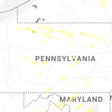
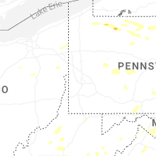
Pennsylvania
| Local Time | Report Details |
|---|---|
| 2:50 PM EDT | Tree down in southbound lane of route 1 in lawrence county PA, 38.8 miles NNW of Pittsburgh, PA |
| 2:50 PM EDT | Trees down on wires along pleasant driv in warren county PA, 79.2 miles SSW of Buffalo, NY |
| 2:55 PM EDT | Trees down across shenango townshi in lawrence county PA, 39.1 miles NNW of Pittsburgh, PA |
| 2:55 PM EDT | Trees down across perry townshi in lawrence county PA, 34.6 miles NNW of Pittsburgh, PA |
| 3:00 PM EDT | Garage roof blown off on sunrise ridge roa in potter county PA, 66.3 miles N of State College, PA |
| 3:00 PM EDT | Trees down in little beaver townshi in lawrence county PA, 41.2 miles NW of Pittsburgh, PA |
| 3:01 PM EDT | Tree down on house along cornell av in lawrence county PA, 39.3 miles NNW of Pittsburgh, PA |
| 3:10 PM EDT | Tree down along scott wallace r in lawrence county PA, 36.9 miles NW of Pittsburgh, PA |
| 3:22 PM EDT | Tree down along fairlane blv in beaver county PA, 34.8 miles NW of Pittsburgh, PA |
| 3:26 PM EDT | Tree down on wires along ball l in butler county PA, 37.1 miles NNE of Pittsburgh, PA |
| 3:27 PM EDT | Tree down on wires along center d in butler county PA, 36.8 miles NNE of Pittsburgh, PA |
| 3:28 PM EDT | Trees down on wires on lamont roa in mckean county PA, 76.5 miles S of Buffalo, NY |
| 3:28 PM EDT | Trees down on wires along rout in mckean county PA, 74.8 miles S of Buffalo, NY |
| 3:35 PM EDT | Tree fell on unoccupied vehicle near 900 darlington road... brighton twp. live wires on the ground as well. time based on radar estimat in beaver county PA, 29.1 miles NW of Pittsburgh, PA |
| 3:35 PM EDT | Trees down near 200 block of lihi road. time based on radar estimat in beaver county PA, 33.2 miles NW of Pittsburgh, PA |
| 3:35 PM EDT | Large tree fell on wires and was on fire. near moore rd and lime kiln rd. time based on radar estimat in beaver county PA, 33.3 miles NW of Pittsburgh, PA |
| 3:44 PM EDT | Trees and wires down along upper portage roa in mckean county PA, 68.4 miles NNW of State College, PA |
| 3:47 PM EDT | Tree down at oak grove cemetery from outflow win in beaver county PA, 21.6 miles NW of Pittsburgh, PA |
| 3:49 PM EDT | Trees down on wires west of covingto in tioga county PA, 74.1 miles NNE of State College, PA |
| 4:02 PM EDT | Limb down on power lines on constitution av in butler county PA, 26.3 miles N of Pittsburgh, PA |
| 4:05 PM EDT | Trees down on stony fork road blocking traffi in tioga county PA, 61.5 miles NNE of State College, PA |
| 4:10 PM EDT | Trees down on wires on summit driv in tioga county PA, 72.9 miles WNW of Scranton, PA |
| 4:23 PM EDT | Multiple trees down around canton townshi in bradford county PA, 64 miles WNW of Scranton, PA |
| 4:30 PM EDT | Trees down on wires along millers corner roa in bedford county PA, 73.6 miles SSW of State College, PA |
| 4:30 PM EDT | Trees down on wires along route 15 in cameron county PA, 54 miles NNW of State College, PA |
| 4:30 PM EDT | Pole poles snapped... wires down on five forks roa in bedford county PA, 70.4 miles SSW of State College, PA |
| 4:39 PM EDT | Tree down near allshouse rd and sky meadow l in armstrong county PA, 29.5 miles ENE of Pittsburgh, PA |
| 4:43 PM EDT | Large trees down on wires lake road and north stree in sullivan county PA, 53.5 miles WNW of Scranton, PA |
| 4:47 PM EDT | Multiple trees down in an area around wible run rd... anderson rd and wetzel rd. some falling trees caused damage to structure in allegheny county PA, 5.7 miles N of Pittsburgh, PA |
| 4:47 PM EDT | Tree down on marsh roa in bradford county PA, 39.9 miles WNW of Scranton, PA |
| 4:58 PM EDT | Tree down on chambersville road near johnson roa in indiana county PA, 50.1 miles ENE of Pittsburgh, PA |
| 5:13 PM EDT | Trees down along rt 287 just north of english center. one tree landed on a cabin causing extensive damag in lycoming county PA, 53.9 miles NE of State College, PA |
| 5:15 PM EDT | Large limbs snapped off live hardwood trees by thunderstorm win in indiana county PA, 51.3 miles W of State College, PA |
| 5:17 PM EDT | Trees down blocking long view roa in fulton county PA, 63 miles S of State College, PA |
| 5:21 PM EDT | Tree and wires down blocking residence on keiper roa in wyoming county PA, 21.3 miles W of Scranton, PA |
| 5:28 PM EDT | Trees dow in franklin county PA, 66.5 miles S of State College, PA |
| 5:29 PM EDT | Tree down on state route 9 in wyoming county PA, 15.6 miles WNW of Scranton, PA |
| 5:35 PM EDT | Trees down on wires along covered bridge roa in huntingdon county PA, 41 miles S of State College, PA |
| 5:37 PM EDT | Tree down on ned ridge r in greene county PA, 54.1 miles SSW of Pittsburgh, PA |
| 5:38 PM EDT | Tree down on rte 217 in bradenville. time based on radar estimat in westmoreland county PA, 36.7 miles ESE of Pittsburgh, PA |
| 5:39 PM EDT | Tree and wires down on lockville roa in luzerne county PA, 11.9 miles W of Scranton, PA |
| 5:40 PM EDT | Trees dow in cambria county PA, 44.8 miles WSW of State College, PA |
| 5:40 PM EDT | Trees down on buckwheat hill r in cambria county PA, 49.7 miles WSW of State College, PA |
| 5:45 PM EDT | Tree down on wire in cambria county PA, 45.3 miles WSW of State College, PA |
| 5:46 PM EDT | Tree down near the intersection of reynolds road and seamans roa in wyoming county PA, 12.4 miles NNW of Scranton, PA |
| 5:49 PM EDT | Tree down along browns creek rd at 4th s in greene county PA, 38.8 miles SSW of Pittsburgh, PA |
| 5:50 PM EDT | Tree down along east roy e. furman hwy near elm driv in greene county PA, 38 miles SSW of Pittsburgh, PA |
| 5:50 PM EDT | Trees down. time est by rada in cambria county PA, 35.5 miles WSW of State College, PA |
| 5:50 PM EDT | Tree down blocking roa in franklin county PA, 53.7 miles SSE of State College, PA |
| 5:56 PM EDT | Tree down blocking the road along roy e. furman hwy near whiteman r in greene county PA, 41.1 miles SSW of Pittsburgh, PA |
| 5:58 PM EDT | Tree down in kirby park... reported via social media with photo. time estimated by rada in luzerne county PA, 16.3 miles SW of Scranton, PA |
| 5:59 PM EDT | Tree down at roy e. furman hwy and jensen hollow r in greene county PA, 38 miles S of Pittsburgh, PA |
| 6:00 PM EDT | Trees down along kennel r in greene county PA, 35.7 miles S of Pittsburgh, PA |
| 6:00 PM EDT | Trees down blocking beaver valley r in cambria county PA, 38.2 miles WSW of State College, PA |
| 6:01 PM EDT | Tree down into power lines along country club r in greene county PA, 35.5 miles S of Pittsburgh, PA |
| 6:06 PM EDT | Tree down on wires near brinkerton road. time based on radar estimat in westmoreland county PA, 30.3 miles ESE of Pittsburgh, PA |
| 6:10 PM EDT | Tree on hous in centre county PA, 14.7 miles W of State College, PA |
| 6:11 PM EDT | Tree down on s lincoln s in blair county PA, 21.4 miles WSW of State College, PA |
| 6:15 PM EDT | Tree down blocking polk l in fayette county PA, 32.7 miles S of Pittsburgh, PA |
| 6:17 PM EDT | Tree down on main stree in lackawanna county PA, 14.9 miles SE of Scranton, PA |
| 6:20 PM EDT | Power pole down along walnut s in washington county PA, 25.8 miles SSE of Pittsburgh, PA |
| 6:20 PM EDT | Amends previous tstm wnd dmg report from 2 ene pine grove furnace. trees down on tent in mountain creek campground... killing tw in cumberland county PA, 60.6 miles SSE of State College, PA |
| 6:20 PM EDT | Trees down on wires along hall roa in lycoming county PA, 44.5 miles WSW of Scranton, PA |
| 6:20 PM EDT | Tree damage all along route 74 between waggoners gap and marysville valle in perry county PA, 47.2 miles SE of State College, PA |
| 6:21 PM EDT | Trees and wires down near lake wallenpaupac in wayne county PA, 18.3 miles E of Scranton, PA |
| 6:22 PM EDT | Tree down onto brownsville r in fayette county PA, 26.1 miles SSE of Pittsburgh, PA |
| 6:22 PM EDT | Trees down on wires along route 23 in columbia county PA, 41.5 miles WSW of Scranton, PA |
| 6:25 PM EDT | Tree down blocking rr tracks s eagle valley rd between bald eagle and tyron in blair county PA, 19.2 miles WSW of State College, PA |
| 6:25 PM EDT | Time estimated from rada in cumberland county PA, 54 miles SE of State College, PA |
| 6:26 PM EDT | Storm damage reported in cumberland county PA, 59 miles SE of State College, PA |
| 6:26 PM EDT | Steeple ripped from the top of church on 200 block of w butler st. numerous trees down in mount holly spring in cumberland county PA, 58.1 miles SE of State College, PA |
| 6:29 PM EDT | Tree down blocking curfew r in fayette county PA, 30.2 miles SSE of Pittsburgh, PA |
| 6:30 PM EDT | Tree down blocking part of flatwoods rd near wingrove wa in fayette county PA, 30.7 miles SSE of Pittsburgh, PA |
| 6:31 PM EDT | Tree down blocking lake rd near flatwoods r in fayette county PA, 31.8 miles SSE of Pittsburgh, PA |
| 6:35 PM EDT | Tree down onto virgin run rd near dickerson run r in fayette county PA, 31.9 miles SSE of Pittsburgh, PA |
| 6:40 PM EDT | Tree down on cold springs r in york county PA, 61.2 miles NNW of Baltimore, MD |
| 6:48 PM EDT | Chimney knocked down off of a hous in york county PA, 38.5 miles NNW of Baltimore, MD |
| 6:49 PM EDT | Reports of trees... wires down... and buildings damaged around a campground in the east stroudsburg area. time estimated from rada in monroe county PA, 33.8 miles SE of Scranton, PA |
| 6:51 PM EDT | Trees down blocking hanover pik in adams county PA, 39.4 miles NW of Baltimore, MD |
| 6:51 PM EDT | Tree on hous in york county PA, 60.8 miles NNW of Baltimore, MD |
| 6:51 PM EDT | Tree down on garag in york county PA, 49.3 miles NNW of Baltimore, MD |
| 6:52 PM EDT | Kcxy 55kt gus in york county PA, 65.4 miles N of Baltimore, MD |
| 6:52 PM EDT | Multiple trees down around marshalls creek. time estimated by rada in monroe county PA, 37.6 miles SE of Scranton, PA |
| 6:53 PM EDT | Kmdt 57kt gus in dauphin county PA, 62.6 miles N of Baltimore, MD |
| 6:55 PM EDT | Trees dow in greene county PA, 42.5 miles SSW of Pittsburgh, PA |
| 6:55 PM EDT | Several trees down along and around frutchey dr in middle smithfield twp. time estimated by rada in monroe county PA, 38.8 miles SE of Scranton, PA |
| 6:55 PM EDT | Several trees down across milford rd near middle smithfield elementary school. time estimated by rada in monroe county PA, 39.1 miles SE of Scranton, PA |
| 6:55 PM EDT | Trees blocking nyes r in dauphin county PA, 67.1 miles ESE of State College, PA |
| 7:00 PM EDT | Perryopolis rd closed due to flooding between rathway rd and rehoboth church rd. likely caused from mill ru in fayette county PA, 25.2 miles SSE of Pittsburgh, PA |
| 7:10 PM EDT | Numerous power poles downe in dauphin county PA, 66.9 miles N of Baltimore, MD |
| 7:10 PM EDT | Trees dow in greene county PA, 35.9 miles SSW of Pittsburgh, PA |
| 7:10 PM EDT | Trees dow in greene county PA, 33.4 miles S of Pittsburgh, PA |
| 7:15 PM EDT | Tree down on structure. through roof to first floo in york county PA, 47 miles N of Baltimore, MD |
| 7:15 PM EDT | Several trees down. time est from rada in dauphin county PA, 67.6 miles N of Baltimore, MD |
| 7:15 PM EDT | Trees dow in greene county PA, 39 miles SSW of Pittsburgh, PA |
| 7:15 PM EDT | Trees dow in greene county PA, 35.5 miles S of Pittsburgh, PA |
| 7:15 PM EDT | Numerous trees... wires... and utility poles down on cape horn rd near belle r in york county PA, 44.9 miles N of Baltimore, MD |
| 7:16 PM EDT | Trees dow in greene county PA, 38.1 miles SSW of Pittsburgh, PA |
| 7:18 PM EDT | Trees dow in greene county PA, 38 miles S of Pittsburgh, PA |
| 7:18 PM EDT | Doors blown in at rutter's stor in york county PA, 50.5 miles N of Baltimore, MD |
| 7:20 PM EDT | Trees dow in greene county PA, 34.4 miles S of Pittsburgh, PA |
| 7:23 PM EDT | Trees dow in juniata county PA, 26.5 miles ESE of State College, PA |
| 7:30 PM EDT | 3 trees dow in lancaster county PA, 57.9 miles NNE of Baltimore, MD |
| 7:34 PM EDT | 52kt gus in lancaster county PA, 59.6 miles NNE of Baltimore, MD |
| 7:42 PM EDT | Numerous reports of trees and wires down across lancaste in lancaster county PA, 56.1 miles NNE of Baltimore, MD |
| 7:45 PM EDT | Widespread large trees down around lancaster country clu in lancaster county PA, 56.7 miles NNE of Baltimore, MD |
| 7:45 PM EDT | Widespread trees and lines down near eden. time est by rada in lancaster county PA, 57.4 miles NNE of Baltimore, MD |
| 7:58 PM EDT | Trees dow in snyder county PA, 40.3 miles E of State College, PA |
| 8:00 PM EDT | Tree down on cindalyn dr and siding ripped off a residenc in lancaster county PA, 61.3 miles NNE of Baltimore, MD |
| 8:02 PM EDT | Trees down along goldfinch drive in wyomissing... likely from outflow boundary producing 60 mph gusts. time estimated from rada in berks county PA, 77.6 miles SSW of Scranton, PA |
| 8:05 PM EDT | Wires down along madison street in mohnton. time estimated from rada in berks county PA, 76.4 miles NNE of Baltimore, MD |
| 8:05 PM EDT | Trees down on wires around cumru township. time estimated from rada in berks county PA, 76.3 miles NNE of Baltimore, MD |
| 8:12 PM EDT | Wires down in mount penn borough. time estimated from rada in berks county PA, 75.5 miles S of Scranton, PA |
| 8:12 PM EDT | Wires down around zion road and golf course road... resulting in an ongoing fire. time estimated from rada in berks county PA, 77.1 miles NNE of Baltimore, MD |
| 8:14 PM EDT | Tree down into a house resulting in damage to the residence. no injuries reported. time estimated from rada in berks county PA, 78.5 miles NNE of Baltimore, MD |
| 8:15 PM EDT | Storm damage reported in chester county PA, 61.8 miles NE of Baltimore, MD |
| 8:15 PM EDT | Trained spotter reports several trees and wires down around coatesville. time estimated from rada in chester county PA, 63.5 miles NE of Baltimore, MD |
| 8:15 PM EDT | Westwood mesonet gusted to 58 mp in chester county PA, 62.8 miles NE of Baltimore, MD |
| 8:17 PM EDT | Social media photo showed snapped tree branches. time estimated by rada in chester county PA, 66.6 miles NNE of Baltimore, MD |
| 8:18 PM EDT | Several trees down on sr 14 in northumberland county PA, 53.6 miles E of State College, PA |
| 8:20 PM EDT | West grove deos mesone in chester county PA, 56.8 miles NE of Baltimore, MD |
| 8:20 PM EDT | Widespread trees and wires down across snyder county. numerous reports received from various source in snyder county PA, 49.9 miles E of State College, PA |
| 8:25 PM EDT | Trees down around houck road. time estimated from rada in berks county PA, 70.1 miles S of Scranton, PA |
| 8:27 PM EDT | Measured from anemometer. reported from spotter networ in chester county PA, 72 miles NE of Baltimore, MD |
| 8:28 PM EDT | Trees and wires down along powerline road. time estimated from rada in berks county PA, 73.9 miles S of Scranton, PA |
| 8:35 PM EDT | Widespread reports of trees and wires down across northumberland county. numerous reports received from various source in northumberland county PA, 62.5 miles E of State College, PA |
| 8:38 PM EDT | Trees down along south grims mill road and west philadelphia avenue. time estimated from rada in berks county PA, 74.5 miles S of Scranton, PA |
| 8:43 PM EDT | Trees down on wires around the huffs church area. time estimated from rada in berks county PA, 66.3 miles S of Scranton, PA |
| 8:45 PM EDT | Trees on wires down on schoolhouse r in northumberland county PA, 63.7 miles SW of Scranton, PA |
| 8:50 PM EDT | Several reports of trees and wires down all around montgomery county. the hatfield area was hit particularly hard. time estimated from rada in montgomery county PA, 74.6 miles WSW of Brooklyn, NY |
| 9:00 PM EDT | Several reports of trees and wires down around bucks county. the chalfont area was reported to have a high number of calls. time estimated from rada in bucks county PA, 70 miles WSW of Brooklyn, NY |
| 9:00 PM EDT | Several reports of trees and wires down all around montgomery county. lower merion area was hit particularly hard. time estimated from rada in montgomery county PA, 82 miles WSW of Brooklyn, NY |
| 9:03 PM EDT | Pictures sent in of trees down around new britain. report also mentioned wires down around the township as well. time estimated from rada in bucks county PA, 68.3 miles WSW of Brooklyn, NY |
| 9:03 PM EDT | Several reports of trees and wires down all around montgomery county. the lansdale area was hit particularly hard. time estimated from rada in montgomery county PA, 74.8 miles WSW of Brooklyn, NY |
| 9:06 PM EDT | Several reports of trees and wires down around bucks county. the warminster area was reported to have a high number of calls. time estimated from rada in bucks county PA, 67.3 miles WSW of Brooklyn, NY |
| 9:18 PM EDT | Several trees and wires down around the hellertown and lower saucon township area. time estimated from rada in northampton county PA, 59.3 miles SSE of Scranton, PA |
| 9:20 PM EDT | Several trees and wires down around the delaware river area of northampton. time estimated from radar. some damage likely came from the outflow producing severe-level g in northampton county PA, 56.9 miles SSE of Scranton, PA |
| 9:24 PM EDT | Several reports of trees and wires down around the langhorne area. time estimated from rada in bucks county PA, 60.4 miles SW of Brooklyn, NY |
| 9:30 PM EDT | Report of wires down across the roadway. time estimated from rada in bucks county PA, 61.1 miles WSW of Brooklyn, NY |
| 10:18 PM EDT | Trees down around the plainfield township area. time estimated from rada in northampton county PA, 48 miles SSE of Scranton, PA |
Ohio
| Local Time | Report Details |
|---|---|
| 2:51 PM EDT | Trees down along eagleton r in columbiana county OH, 49.4 miles WNW of Pittsburgh, PA |
| 2:52 PM EDT | Trees down along kelch r in columbiana county OH, 49.6 miles WNW of Pittsburgh, PA |
| 2:52 PM EDT | Also reported small hai in columbiana county OH, 52.7 miles WNW of Pittsburgh, PA |
| 3:07 PM EDT | Trees down along lusk lock r in columbiana county OH, 41.7 miles WNW of Pittsburgh, PA |
| 3:58 PM EDT | Tree down along waynesburg rd at june r in carroll county OH, 64.3 miles SSE of Cleveland, OH |
| 3:58 PM EDT | Tree down near june rd and bark r in carroll county OH, 63.9 miles SSE of Cleveland, OH |
| 4:12 PM EDT | Tree down into wires along abbey r in carroll county OH, 57.3 miles WNW of Pittsburgh, PA |
| 4:22 PM EDT | A couple branches fell on a house. photo verifie in champaign county OH, 49.7 miles W of Columbus, OH |
| 5:00 PM EDT | Large tree down on power line on spence road. photo verifie in clark county OH, 50.8 miles W of Columbus, OH |
| 5:00 PM EDT | Small branches down on sunrise drive and north hampton road. photo verifie in clark county OH, 50.3 miles W of Columbus, OH |
| 6:48 PM EDT | Several trees down around the coolville are in athens county OH, 60.5 miles N of Charleston, WV |
| 6:48 PM EDT | Large tree took out transformer and lines. lines landed on camper and vehicle in athens county OH, 60.5 miles N of Charleston, WV |
| 10:50 PM EDT | Tree downed on a car on north bend roa in hamilton county OH, 6.7 miles NNW of Cincinnati, OH |
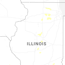
Illinois
| Local Time | Report Details |
|---|---|
| 2:10 PM CDT | Photo shared to social media shows a few branches downed near lucinda avenue and russell road in dekalb. time estimated by rada in de kalb county IL, 58.8 miles W of Chicago, IL |
| 2:25 PM CDT | Healthy trees snapped near their base and flattened corn in the region. spotter estimated 70 mph wind in kane county IL, 45.9 miles WNW of Chicago, IL |
| 2:26 PM CDT | Reports of a tree down on oak grove... fences down in sun city... wires and trees down south of dhamer drive... and trees down on cold springs in huntley. time estimate in kane county IL, 44.7 miles WNW of Chicago, IL |
| 2:27 PM CDT | Large huntley exit sign on i-90 snapped and blown ove in kane county IL, 44.2 miles WNW of Chicago, IL |
| 2:30 PM CDT | Corrects previous tstm wnd dmg report from beason. several trees and large branches knocked down. damage to powerlines... fences... and a carport from fallen trees and in logan county IL, 43.5 miles SSE of Peoria, IL |
| 2:45 PM CDT | Large tree down in west frankfort. time estimated by rada in franklin county IL, 53.2 miles NE of Cape Girardeau, MO |
| 3:00 PM CDT | Corn flattened in fields from 1450 n rd west to jamesburg. time estimated from rada in vermilion county IL, 65.5 miles NE of Mattoon, IL |
| 3:01 PM CDT | *** 1 fatal *** updates previous tstm wnd dmg report from 1 ese millbrook. a tree fell on a camper trailer off millbrook road in fox townshi in kendall county IL, 51.1 miles WSW of Chicago, IL |
| 3:04 PM CDT | 6" diameter tree branch broke off and came down on power lines. time estimated from rada in woodford county IL, 16.8 miles E of Peoria, IL |
| 3:04 PM CDT | Report of trees down in millbrook. time estimated by rada in kendall county IL, 51.3 miles WSW of Chicago, IL |
| 3:05 PM CDT | Power pole down at franklin and williams streets in danville. time estimated from rada in vermilion county IL, 59.8 miles NE of Mattoon, IL |
| 3:38 PM CDT | Estimated 50 to 60 mph winds with damage to trees reported. time estimated by rada in will county IL, 35.7 miles SW of Chicago, IL |
| 3:40 PM CDT | Personal weather station measured a wind gust of 68 mp in will county IL, 37.3 miles SW of Chicago, IL |
| 3:45 PM CDT | Estimated 50 to 60 mph winds at the chicagoland speedwa in will county IL, 36.1 miles SW of Chicago, IL |
| 4:05 PM CDT | Personal weather station kilpeoto29 reported a wind gust of 59 mp in will county IL, 39.3 miles SSW of Chicago, IL |
| 4:10 PM CDT | Delayed report. trees down. carport blown onto vehicle. time estimated from rada in moultrie county IL, 20.8 miles NW of Mattoon, IL |
| 4:35 PM CDT | Video shared to social media shows branch downed onto shoulder and part of one lane of il-394 southbound. time estimated by rada in cook county IL, 22.5 miles S of Chicago, IL |
| 5:07 PM CDT | Nws employee submitted pictures of a large tree down in sparta. time estimated by rada in randolph county IL, 42 miles SE of Saint Louis, MO |
| 5:20 PM CDT | Corrects previous tstm wnd dmg report from hazel dell. large tree branch snapped and roofing material peeled up on home. report from social media. time estimated from r in cumberland county IL, 26.5 miles SE of Mattoon, IL |
| 5:38 PM CDT | Large tree branch snapped and roofing material peeled up on home. report from social medi in cumberland county IL, 26.5 miles SE of Mattoon, IL |
New York
| Local Time | Report Details |
|---|---|
| 3:16 PM EDT | Tree down on power equipment causing an outage around park lane. time based on rada in monroe county NY, 69.7 miles W of Syracuse, NY |
| 3:16 PM EDT | Tree down on power equipment causing an outage around park lane. time based on rada in monroe county NY, 69.7 miles W of Syracuse, NY |
| 3:58 PM EDT | Tree down on carver roa in cayuga county NY, 19.6 miles SSW of Syracuse, NY |
| 4:32 PM EDT | Tree down on cold brook road near the intersection of sevens roa in cortland county NY, 24.2 miles S of Syracuse, NY |
| 4:46 PM EDT | Tree down blocking much of state highway 2 in chenango county NY, 31.5 miles SE of Syracuse, NY |
| 4:51 PM EDT | Tree on wires on center roa in cortland county NY, 35.1 miles S of Syracuse, NY |
| 5:18 PM EDT | Tree down blocking all of state highway 22 in chenango county NY, 48.5 miles SSE of Syracuse, NY |
| 5:23 PM EDT | Tree blocking county highway 18 between law road and nelson roa in otsego county NY, 53.5 miles SE of Syracuse, NY |
| 5:24 PM EDT | Downed tree and downed wires on ny state route 990v both directions area of flat creek rd (gilboa). all lanes of 2 lanes blocke in schoharie county NY, 38.5 miles SW of Schenectady, NY |
| 5:25 PM EDT | Tree and power line down in the roadwa in chenango county NY, 54.5 miles SSE of Syracuse, NY |
| 5:25 PM EDT | Tree down on flat creek roa in schoharie county NY, 35.3 miles SW of Schenectady, NY |
| 5:27 PM EDT | Utility pole snapped in morri in otsego county NY, 57.2 miles SE of Syracuse, NY |
| 5:41 PM EDT | Tree down on oak av in delaware county NY, 63.5 miles NNE of Scranton, PA |
| 5:49 PM EDT | Large tree down on a vehicle on county club driv in greene county NY, 32.3 miles SSW of Schenectady, NY |
| 5:54 PM EDT | Tree and wires down on state route 2 in delaware county NY, 65 miles WSW of Schenectady, NY |
| 6:30 PM EDT | Tree and wires down on stickles road in livingston... n in columbia county NY, 45.2 miles S of Schenectady, NY |
| 6:36 PM EDT | Multiple trees down on state route 9 just south of treeland farm driv in columbia county NY, 45.9 miles S of Schenectady, NY |
| 6:36 PM EDT | Tree down and road closure on ny 82 both directions near new forge rd (ancram). all lanes of 2 lanes blocke in columbia county NY, 51.6 miles SSE of Schenectady, NY |
| 6:38 PM EDT | Tree and wires down on county route 10 in the town of livingsto in columbia county NY, 47.1 miles S of Schenectady, NY |
| 6:39 PM EDT | Multiple large tree branches snapped near county route 19 and route in columbia county NY, 46.4 miles S of Schenectady, NY |
| 6:39 PM EDT | Tree down on county route 19 near intersection with church roa in columbia county NY, 47.1 miles S of Schenectady, NY |
| 6:47 PM EDT | Tree and wires down on lake shore drive in ancram... n in columbia county NY, 54.3 miles SSE of Schenectady, NY |
| 6:48 PM EDT | Tree and wires down at intersection of wiltsie bridge road and ny state route 82 in ancram... n in columbia county NY, 55.1 miles SSE of Schenectady, NY |
| 6:48 PM EDT | Tree down and road closure on ny 199 both directions between winchell mountain road (northeast) and us-44 all lanes of 2 lane in dutchess county NY, 62.1 miles SSE of Schenectady, NY |
| 6:50 PM EDT | Two trees and a set of wires down around monticell in sullivan county NY, 53 miles ENE of Scranton, PA |
| 6:51 PM EDT | Large tree down on home with structural damage at 16 town roa in columbia county NY, 57.6 miles SSE of Schenectady, NY |
| 6:55 PM EDT | Tree and wires downed at the intersection of route 55a and lackawack hill road in napanoc in ulster county NY, 68 miles ENE of Scranton, PA |
| 6:57 PM EDT | Tree down and road closure on ny 22 both directions at white house crossing rd (ancram) all lanes of 2 lanes close in columbia county NY, 57.9 miles SSE of Schenectady, NY |
| 7:00 PM EDT | Trees and wires downed at 559 upper cherrytown road in accor in ulster county NY, 69 miles SSW of Schenectady, NY |
| 7:08 PM EDT | Tree and wires downed on rochester center road in accor in ulster county NY, 70.8 miles SSW of Schenectady, NY |
| 7:15 PM EDT | Multiple reports of trees down around neversin in sullivan county NY, 59.5 miles ENE of Scranton, PA |
| 7:15 PM EDT | Tree and wires downed on huguenot road in tillso in ulster county NY, 68.2 miles S of Schenectady, NY |
| 7:15 PM EDT | Tree and wires downed at route 32 at grove stree in ulster county NY, 68.1 miles S of Schenectady, NY |
| 7:15 PM EDT | Tree and wires downed at route 32 at grove stree in ulster county NY, 68.1 miles S of Schenectady, NY |
| 7:20 PM EDT | Large tree limbs and branches down. multiple staked canopy tents moved 50 yards. 1 injury due to fallen tree lim in ulster county NY, 71.2 miles N of Brooklyn, NY |
| 7:24 PM EDT | Multiple reports of trees dow in sullivan county NY, 58.3 miles ENE of Scranton, PA |
| 7:24 PM EDT | Trees down on jansen road in new paltz. social media repor in ulster county NY, 71.1 miles N of Brooklyn, NY |
| 7:27 PM EDT | Trees down on bedell rd in poughkeepsie. social media repor in dutchess county NY, 71.1 miles N of Brooklyn, NY |
| 7:27 PM EDT | Multiple large trees uprooted or snapped on ridge roa in dutchess county NY, 70.5 miles N of Brooklyn, NY |
| 7:30 PM EDT | Trees down on wires resulting in numerous power outage in orange county NY, 46.1 miles NNW of Brooklyn, NY |
| 7:30 PM EDT | Numerous trees down on rte 55 in lagrangeville. social media repor in dutchess county NY, 67.9 miles N of Brooklyn, NY |
| 8:05 PM EDT | Recorded at tappan zee light wxflow statio in westchester county NY, 31.5 miles NNE of Brooklyn, NY |
| 8:32 PM EDT | Corrects previous tstm wnd gst report from 2 n glen cove. wxflow station at bayvill in nassau county NY, 23.7 miles NE of Brooklyn, NY |
| 8:32 PM EDT | Corrects previous tstm wnd gst report from 2 n glen cove. wxflow station at bayvill in nassau county NY, 23.7 miles NE of Brooklyn, NY |
| 8:32 PM EDT | Corrects previous tstm wnd gst report from 2 n glen cove. wxflow station at bayvill in nassau county NY, 23.7 miles NE of Brooklyn, NY |
| 8:42 PM EDT | Xeat mesone in suffolk county NY, 35.7 miles ENE of Brooklyn, NY |
| 8:50 PM EDT | Northport yacht club mesone in anz335 county NY, 36.3 miles ENE of Brooklyn, NY |
| 9:00 PM EDT | Trees down across route 25a in northpor in suffolk county NY, 35.8 miles ENE of Brooklyn, NY |
| 9:06 PM EDT | Tree down on edgewood avenue and carrie court. time estimated by rada in suffolk county NY, 43 miles ENE of Brooklyn, NY |
| 9:07 PM EDT | Several trees down in ronkonkom in suffolk county NY, 48.8 miles ENE of Brooklyn, NY |
| 9:08 PM EDT | Trees down on sunken meadow parkway blocking one lan in suffolk county NY, 40.4 miles ENE of Brooklyn, NY |
| 9:15 PM EDT | Tree down on cedar street and saint paul plac in suffolk county NY, 47.8 miles ENE of Brooklyn, NY |
| 9:19 PM EDT | Corrects previous non-tstm wnd gst report from shirley airport. asos station khwv shirley airpor in suffolk county NY, 59.4 miles E of Brooklyn, NY |
| 9:23 PM EDT | Asos station kfok westhampton airpor in suffolk county NY, 72.7 miles E of Brooklyn, NY |
| 9:23 PM EDT | Trained spotter recorded gust on both handheld and mounted equipmen in suffolk county NY, 67.8 miles ENE of Brooklyn, NY |
| 9:24 PM EDT | Tree fell and blocking route 112 southbound at patchogue mt sinai roa in suffolk county NY, 53 miles ENE of Brooklyn, NY |
| 9:30 PM EDT | Corrects previous tstm wnd dmg report from 1 s mattituck. several trees down across road in suffolk county NY, 78.6 miles ENE of Brooklyn, NY |
| 9:35 PM EDT | Multiple trees down blocking roads on rampasture roa in suffolk county NY, 78.1 miles E of Brooklyn, NY |
| 9:39 PM EDT | Mecox bay mesone in suffolk county NY, 78.8 miles SW of Providence, RI |
| 9:50 PM EDT | Multiple reports of trees dow in suffolk county NY, 64.7 miles SW of Providence, RI |
| 10:05 PM EDT | Several trees down across road in suffolk county NY, 78.6 miles ENE of Brooklyn, NY |
South Dakota
| Local Time | Report Details |
|---|---|
| 1:32 PM MDT | Golf Ball sized hail reported near Custer, SD, 33 miles SW of Rapid City, SD, mping report |
| 1:37 PM MDT | Hen Egg sized hail reported near Custer, SD, 34.7 miles SW of Rapid City, SD, *** 1 inj *** hail lasted 30 minutes. ground covered. numerous stones larger than golf ball size. largest stones estimated at over 2 inches in diameter per photos. 1 pe |
| 1:44 PM MDT | Hen Egg sized hail reported near Custer, SD, 33 miles SW of Rapid City, SD, mping report |
| 3:22 PM CDT | Quarter sized hail reported near Eureka, SD, 59.3 miles WNW of Aberdeen, SD, observed pea to estimated quarter size hail and up to an inch of rain. |
| 4:18 PM CDT | Quarter sized hail reported near Hosmer, SD, 44.3 miles WNW of Aberdeen, SD |
| 5:54 PM CDT | Quarter sized hail reported near Corona, SD, 53.1 miles NW of Montevideo, MN, photo of 1 hailstone from fish haven road in roberts county. time estimated by radar and time that the photo was sent. |
| 6:10 PM CDT | Mesonet station 292 milbank 7ne(sddot in grant county SD, 44.6 miles WNW of Montevideo, MN |
| 6:15 PM CDT | Mesonet station 292 milbank 7ne(sddot in grant county SD, 44.6 miles WNW of Montevideo, MN |
| 6:32 PM CDT | Quarter sized hail reported near Highmore, SD, 58.2 miles NE of Pierre, SD, still hailing at the time of report. |
| 6:37 PM CDT | Half Dollar sized hail reported near Oacoma, SD, 62.5 miles SE of Pierre, SD, mainly dime and nickel size hail with some larger hailstones thrown in. |
| 7:52 PM CDT | Quarter sized hail reported near Highmore, SD, 44.8 miles NE of Pierre, SD, photo of quarter sized hail relayed by the hyde county emergency manager. |
North Carolina
| Local Time | Report Details |
|---|---|
| 3:40 PM EDT | Trees and utility lines downe in burke county NC, 56.8 miles NW of Charlotte, NC |
| 3:40 PM EDT | Trees and utility lines downe in burke county NC, 56.4 miles NW of Charlotte, NC |
| 3:40 PM EDT | Trees and utility lines downe in burke county NC, 53.8 miles NW of Charlotte, NC |
| 3:45 PM EDT | Power outages from fallen trees and utility line in caldwell county NC, 59.4 miles NW of Charlotte, NC |
| 4:15 PM EDT | Trees and utility lines downed... several on homes... between hibriten drive se and 32 in caldwell county NC, 60.1 miles NW of Charlotte, NC |
| 5:22 PM EDT | Trees down in danbury... n in stokes county NC, 61.3 miles SSW of Roanoke, VA |
| 5:33 PM EDT | Tree down blocking a lane near intersection of cadle ford road and old hwy 60 in surry county NC, 69.8 miles SW of Roanoke, VA |
| 6:30 PM EDT | Around a dozen tree down reports in the mount airy are in surry county NC, 64.8 miles SW of Roanoke, VA |
| 6:30 PM EDT | Quarter sized hail reported near Mount Airy, NC, 66.4 miles SW of Roanoke, VA, social media report of quarter size hail near mount airy... nc. time is estimated from radar. |
Florida
| Local Time | Report Details |
|---|---|
| 3:40 PM EDT | County dispatch reported powerlines blown down in crescent city... including along 125 tar lan in putnam county FL, 62 miles S of Jacksonville, FL |
Texas
| Local Time | Report Details |
|---|---|
| 3:23 PM CDT | Ping Pong Ball sized hail reported near Hereford, TX, 43.4 miles SW of Amarillo, TX, mping report received of ping pong ball size hail just east of highway 385 and north of county road 1 in deaf smith county. |
| 3:33 PM CDT | Hen Egg sized hail reported near Hereford, TX, 45.1 miles SW of Amarillo, TX, report from mping: hen egg+ (2.25 in.). |
| 4:55 PM CDT | Mesonet station bgxt2 borger 7e (wt-meso in hutchinson county TX, 44.7 miles NE of Amarillo, TX |
| 5:37 PM CDT | Quarter sized hail reported near Borger, TX, 41.6 miles NE of Amarillo, TX |
| 5:43 PM CDT | Golf Ball sized hail reported near Borger, TX, 41.7 miles NE of Amarillo, TX |
| 6:24 PM CDT | Ping Pong Ball sized hail reported near Borger, TX, 37.1 miles NE of Amarillo, TX, mostly quarter size hail with a few ping pong balls in bunavista. |
Mississippi
| Local Time | Report Details |
|---|---|
| 3:25 PM CDT | Trees blocking road pleasant hill rd and bridgeforth rd in olive branch. time estimated on rada in desoto county MS, 18.8 miles SSE of Memphis, TN |
| 3:25 PM CDT | Trees blocking roadway at the intersection of slocum rd and mcingvale roa in desoto county MS, 26 miles S of Memphis, TN |
| 3:45 PM CDT | Report of downed/ lightning destroyed tre in madison county MS, 8.4 miles N of Jackson, MS |
| 3:46 PM CDT | Trees down at the olive branch city park in olive branch... ms. time estimated on rada in desoto county MS, 17.6 miles SE of Memphis, TN |
| 4:40 PM CDT | A utility pole was broken near tullos s in rankin county MS, 4.5 miles SE of Jackson, MS |
Michigan
| Local Time | Report Details |
|---|---|
| 4:40 PM EDT | Report of tree down near timber lane and bishop road in lapeer county MI, 30.2 miles E of Flint, MI |
| 4:49 PM EDT | Report of tree down near hough road and scotch settlement road in lapeer county MI, 35.5 miles E of Flint, MI |
Nebraska
| Local Time | Report Details |
|---|---|
| 2:48 PM MDT | Golf Ball sized hail reported near Paxton, NE, 32.7 miles W of North Platte, NE |
| 2:55 PM MDT | Tennis Ball sized hail reported near Paxton, NE, 31.7 miles W of North Platte, NE, mping report. |
| 3:10 PM MDT | Ping Pong Ball sized hail reported near Paxton, NE, 29.8 miles W of North Platte, NE |
| 4:29 PM CDT | Quarter sized hail reported near Halsey, NE, 57.3 miles SSE of Valentine, NE, nickels to quarters. time estimated from radar. |
| 3:41 PM MDT | Golf Ball sized hail reported near Mullen, NE, 60.4 miles SSW of Valentine, NE, mostly dime to nickels but a couple golf balls. time estimated from radar. |
| 4:55 PM CDT | Quarter sized hail reported near Thedford, NE, 50 miles S of Valentine, NE |
| 5:39 PM CDT | Quarter sized hail reported near Amelia, NE, 28.7 miles SW of Oneill, NE, time estimated from radar. |
| 7:05 PM CDT | Quarter sized hail reported near Arnold, NE, 34.9 miles NE of North Platte, NE, peas to nickels with a few quarters. |
| 7:28 PM CDT | Ping Pong Ball sized hail reported near Stapleton, NE, 25 miles NNE of North Platte, NE |
| 6:34 PM MDT | Half Dollar sized hail reported near Merriman, NE, 55.9 miles W of Valentine, NE, time estimated from radar. |
| 8:49 PM CDT | Storm damage reported in greeley county NE, 41.3 miles NNW of Grand Island, NE |
Indiana
| Local Time | Report Details |
|---|---|
| 5:26 PM EDT | Two trees downed by thunderstorm wind gust in fountain county IN, 58.6 miles WNW of Indianapolis, IN |
| 5:30 PM EDT | Multiple trees downed by thunderstorm wind gusts across the are in parke county IN, 60.1 miles W of Indianapolis, IN |
| 5:20 PM CDT | Multiple trees blown down across roads and into power lines in mt verno in posey county IN, 18.6 miles W of Evansville, IN |
| 6:31 PM EDT | Powerline downed by thunderstorm wind gust in hendricks county IN, 25 miles W of Indianapolis, IN |
| 9:41 PM EDT | Several trees down in the richmond area. time estimated from rada in wayne county IN, 54.4 miles NNW of Cincinnati, OH |
| 10:45 PM EDT | Trees dow in ohio county IN, 24 miles WSW of Cincinnati, OH |
Georgia
| Local Time | Report Details |
|---|---|
| 5:30 PM EDT | Trees down at i-285 and chamblee tucker r in dekalb county GA, 11.7 miles NE of Atlanta, GA |
| 5:32 PM EDT | Quarter sized hail reported near Dacula, GA, 32.8 miles ENE of Atlanta, GA |
| 5:50 PM EDT | Quarter sized hail reported near Duluth, GA, 22.2 miles NE of Atlanta, GA, storm spotter reported 1 inch hail in duluth... ga. |
Maryland
| Local Time | Report Details |
|---|---|
| 5:39 PM EDT | Trees blew down near the intersection of md-17 burkittsville road and md-383 broad run road/schneider driv in frederick county MD, 53.2 miles W of Baltimore, MD |
| 5:45 PM EDT | Trees blew down on md-17 south church street/burkittsville road near maerk roa in frederick county MD, 51.3 miles W of Baltimore, MD |
| 5:48 PM EDT | Numerous trees down in middletown. a tree fell onto a house as wel in frederick county MD, 44.5 miles WNW of Baltimore, MD |
| 5:52 PM EDT | Numerous trees blew down on alternate us-40 old national pike near marker roa in frederick county MD, 52.1 miles WNW of Baltimore, MD |
| 5:58 PM EDT | Trees blew down on md-63 spielman road at bakersville roa in washington county MD, 64.9 miles WNW of Baltimore, MD |
| 5:58 PM EDT | Trees blew down on md-17 myersville road south of dawn cour in frederick county MD, 52.5 miles WNW of Baltimore, MD |
| 5:59 PM EDT | Trees blew down on i-70 dwight d. eisenhower highway prior to mile marker 43. in frederick county MD, 52.7 miles WNW of Baltimore, MD |
| 6:03 PM EDT | Numerous trees blew down on md-224 riverside road and sandy point road/point sandy plac in charles county MD, 65.4 miles SSW of Baltimore, MD |
| 6:08 PM EDT | Trees blew down along us-40 baltimore national pike near md-17 wolfsville roa in frederick county MD, 53.1 miles WNW of Baltimore, MD |
| 6:20 PM EDT | Trees blew down on md-17 wolfsville road at spruce run roa in frederick county MD, 52.9 miles WNW of Baltimore, MD |
| 6:23 PM EDT | Wind gusts of up to 65 knots (75 mph) were measured by the cuckold creek weatherflow sensor (xcck) between 6:23 and 6:33 p in charles county MD, 68.2 miles NE of Richmond, VA |
| 6:27 PM EDT | Numerous trees blew down on soutbound us-15 between catoctin furnace road and the entrance to cunningham falls state par in frederick county MD, 47.9 miles WNW of Baltimore, MD |
| 6:30 PM EDT | Trees blew down on catoctin hollow roa in frederick county MD, 51.3 miles WNW of Baltimore, MD |
| 6:33 PM EDT | Numerous trees down around thurmon in frederick county MD, 44.5 miles WNW of Baltimore, MD |
| 6:45 PM EDT | Numerous trees blew down on md-97 roxbury mills road at roxbury roa in howard county MD, 23.1 miles W of Baltimore, MD |
| 6:50 PM EDT | Over a dozen trees down near taneytown. numerous wires and telephone poles down as wel in carroll county MD, 39.3 miles NW of Baltimore, MD |
| 6:55 PM EDT | Trees blew down on md-32 at deer hill roa in howard county MD, 19.7 miles WNW of Baltimore, MD |
| 6:55 PM EDT | Trees blew down on md-32 sykesville road near day roa in howard county MD, 19.2 miles WNW of Baltimore, MD |
| 7:00 PM EDT | Trees blew down on us-50 john hanson highway at i-95/i-495 capital beltwa in prince georges county MD, 27.1 miles SSW of Baltimore, MD |
| 7:00 PM EDT | Trees blew down on md-564 lanham severn road at 98th avenu in prince georges county MD, 24.7 miles SSW of Baltimore, MD |
| 7:03 PM EDT | Trees blew down on md-170 telegraph road at md-174 reece road/donaldson avenu in anne arundel county MD, 11.2 miles SSW of Baltimore, MD |
| 7:03 PM EDT | Numerous trees blew down on md-170 at minnetonka roa in anne arundel county MD, 11.1 miles SSW of Baltimore, MD |
| 7:06 PM EDT | Trees blew down on i-70 baltimore national pike at exit 87b/us-29 columbia pik in howard county MD, 11.3 miles W of Baltimore, MD |
| 7:09 PM EDT | A wind gust of 50 knots (58 mph) was measured by the asos at baltimore-washington thurgood marshall international airport (kbwi in anne arundel county MD, 9.1 miles SSW of Baltimore, MD |
| 7:09 PM EDT | Trees blew down on i-97 at exit 15a/md-176 dorsey roa in anne arundel county MD, 8.5 miles S of Baltimore, MD |
| 7:10 PM EDT | Trees blew down on westbound md-713 arundel mills boulevard at md-10 in anne arundel county MD, 10.8 miles SSW of Baltimore, MD |
| 7:12 PM EDT | Numerous trees were down across the county. the northern part of the county was hardest hi in st. marys county MD, 58.8 miles S of Baltimore, MD |
| 7:12 PM EDT | A tree fell onto a house in eldersbur in carroll county MD, 19.5 miles WNW of Baltimore, MD |
| 7:13 PM EDT | Spotter reports several trees down at home location. siding ripped off a hous in calvert county MD, 53.2 miles S of Baltimore, MD |
| 7:15 PM EDT | Numerous large tree limbs down in prince frederic in calvert county MD, 51.1 miles S of Baltimore, MD |
| 7:15 PM EDT | Tree dow in anne arundel county MD, 12.5 miles S of Baltimore, MD |
| 7:18 PM EDT | Tree fell onto a house in reisterstow in baltimore county MD, 15.9 miles NW of Baltimore, MD |
| 7:19 PM EDT | At least 4 trees down in taneytow in carroll county MD, 39.3 miles NW of Baltimore, MD |
| 7:31 PM EDT | Two trees dow in baltimore county MD, 8.9 miles N of Baltimore, MD |
| 7:35 PM EDT | At least three threes on vehicles and over a dozen others down at soldiers delight natural environmental area and mckeldin area of patapsco valley state par in baltimore county MD, 12.7 miles NW of Baltimore, MD |
| 7:36 PM EDT | Trees blew down on i-83 at exit 16a/timonium road (north in baltimore county MD, 10.4 miles N of Baltimore, MD |
| 7:40 PM EDT | Trees down in white hal in baltimore county MD, 23.5 miles N of Baltimore, MD |
| 7:45 PM EDT | Several trees down in taneytow in carroll county MD, 29.3 miles NW of Baltimore, MD |
| 7:46 PM EDT | Reports of multiple trees down into wires across the easton area. time estimated from rada in talbot county MD, 45.6 miles SE of Baltimore, MD |
| 7:55 PM EDT | Several dozen reports of trees and wires down between the rockhall and chestertown areas. time estimated from rada in kent county MD, 25.6 miles ESE of Baltimore, MD |
| 8:02 PM EDT | Report of a tree down into wires near the intersection of roundtop and dutchess roads. time estimated from rada in queen anne's county MD, 31.6 miles E of Baltimore, MD |
| 8:05 PM EDT | Gw0807 cambridge md us measured 62mph wind gus in dorchester county MD, 54.8 miles SSE of Baltimore, MD |
| 8:07 PM EDT | Multiple trees and power lines down in the cambridge are in dorchester county MD, 56.2 miles WNW of Ocean City, MD |
| 8:19 PM EDT | 50 kt wind gust recorded at mddot sassafras river statio in kent county MD, 39.4 miles E of Baltimore, MD |
| 8:21 PM EDT | Three trees into houses in havre de grac in harford county MD, 32.6 miles ENE of Baltimore, MD |
| 9:50 PM EDT | Numerous trees and powerlines were reported down across south central dorchester count in dorchester county MD, 41.9 miles WNW of Ocean City, MD |
| 9:50 PM EDT | Multiple trees and powerlines were reported knocked down across the northern half of dorchester count in dorchester county MD, 43.3 miles WNW of Ocean City, MD |
| 10:04 PM EDT | Public report of estimated 60mph with the outflo in wicomico county MD, 26.5 miles WNW of Ocean City, MD |
| 10:10 PM EDT | Multiple down powerlines near fruitlan in wicomico county MD, 29.1 miles W of Ocean City, MD |
Kentucky
| Local Time | Report Details |
|---|---|
| 5:25 PM CDT | Several trees down in kevil. time estimated by rada in ballard county KY, 39 miles ESE of Cape Girardeau, MO |
| 6:40 PM CDT | A tree was blown onto a house on south 2nd street in mayfield. time estimated from rada in graves county KY, 42.3 miles N of Mc Kenzie, TN |
| 7:56 PM CDT | Tree down on greenville roa in christian county KY, 62.1 miles NW of Nashville, TN |
Louisiana
| Local Time | Report Details |
|---|---|
| 5:46 PM CDT | Law enforcement received a report of trees down on hwy 15 n near spearsvill in union county LA, 41.7 miles WNW of Bastrop, LA |
| 7:01 PM CDT | Asos station kmlu monroe regional airpor in ouachita county LA, 19 miles SSW of Bastrop, LA |
| 7:08 PM CDT | State police responded to a downed tree on us-80 on the lincoln-ouachita parish lin in lincoln county LA, 34.4 miles WSW of Bastrop, LA |
Oklahoma
| Local Time | Report Details |
|---|---|
| 6:00 PM CDT | Newkirk mesone in kay county OK, 59.1 miles SSE of Wichita, KS |
| 6:05 PM CDT | Tree limbs also blown down in the are in major county OK, 38.1 miles ESE of Woodward, OK |
| 6:05 PM CDT | Newkirk mesone in kay county OK, 59.1 miles SSE of Wichita, KS |
| 6:07 PM CDT | Storm damage reported in kay county OK, 67.8 miles S of Wichita, KS |
| 6:10 PM CDT | Storm damage reported in kay county OK, 60.4 miles SSE of Wichita, KS |
| 6:15 PM CDT | Storm damage reported in kay county OK, 60.4 miles SSE of Wichita, KS |
| 6:30 PM CDT | Storm damage reported in woodward county OK, 26.1 miles SE of Woodward, OK |
| 6:43 PM CDT | Quarter sized hail reported near Seiling, OK, 33.1 miles SE of Woodward, OK, report from mping: quarter (1.00 in.). |
| 6:52 PM CDT | Quarter sized hail reported near Ponca City, OK, 67.3 miles NW of Tulsa, OK |
| 6:54 PM CDT | Quarter sized hail reported near Fargo, OK, 11.8 miles WSW of Woodward, OK |
| 6:55 PM CDT | Quarter sized hail reported near Fargo, OK, 10 miles WSW of Woodward, OK |
| 7:00 PM CDT | Storm damage reported in noble county OK, 74.3 miles N of Oklahoma City, OK |
| 7:00 PM CDT | Storm damage reported in osage county OK, 52.8 miles NNW of Tulsa, OK |
| 7:30 PM CDT | Power lines down across neighborhood streets... just north and west of wingstop on highway 75. public report on county em facebook page. time estimated from rada in washington county OK, 39.4 miles N of Tulsa, OK |
| 7:33 PM CDT | Relayed by washington co. emergency managemen in washington county OK, 42.1 miles N of Tulsa, OK |
| 7:38 PM CDT | Relayed by washington co emergency managemen in washington county OK, 51.9 miles N of Tulsa, OK |
| 7:38 PM CDT | Half Dollar sized hail reported near Mooreland, OK, 11.6 miles E of Woodward, OK, report from mping: half dollar (1.25 in.). |
| 7:45 PM CDT | Quarter sized hail reported near Bartlesville, OK, 43.5 miles N of Tulsa, OK |
| 7:45 PM CDT | Oklahoma mesone in washington county OK, 52.7 miles N of Tulsa, OK |
| 7:55 PM CDT | Multiple trees down in sperry. public report from broadcast media facebook page. time estimated from rada in tulsa county OK, 10.4 miles N of Tulsa, OK |
| 8:00 PM CDT | Large tree branches fallen dow in tulsa county OK, 3.2 miles NE of Tulsa, OK |
| 8:00 PM CDT | Ktul aso in tulsa county OK, 6.7 miles ENE of Tulsa, OK |
| 8:03 PM CDT | Quarter sized hail reported near Orlando, OK, 46.7 miles NNE of Oklahoma City, OK |
| 8:05 PM CDT | Downed power line in payne county OK, 51.4 miles NE of Oklahoma City, OK |
| 8:05 PM CDT | Storm damage reported in rogers county OK, 32.2 miles NNE of Tulsa, OK |
| 8:05 PM CDT | Tree downed... relayed by kggf - coffeyvill in nowata county OK, 54.1 miles NNE of Tulsa, OK |
| 8:10 PM CDT | Trees down across mingo road just north of 116th street north. power lines reported down on 116th street n near fire station 4... just to the east of the listed locatio in tulsa county OK, 13.6 miles NNE of Tulsa, OK |
| 8:10 PM CDT | From oologah p in rogers county OK, 25 miles NE of Tulsa, OK |
| 8:15 PM CDT | Whole tree uprooted near the cemetery outside lenapah. public report on broadcast media facebook page. time estimated from rada in nowata county OK, 51.9 miles NNE of Tulsa, OK |
| 8:25 PM CDT | Large tree down 91st and elm. time estimated from rada in tulsa county OK, 13.6 miles SE of Tulsa, OK |
| 8:25 PM CDT | Nowata mesone in nowata county OK, 47.1 miles NNE of Tulsa, OK |
| 8:35 PM CDT | Roof damag in okmulgee county OK, 23.2 miles SSE of Tulsa, OK |
| 8:43 PM CDT | Storm damage reported in okmulgee county OK, 35.2 miles S of Tulsa, OK |
| 8:45 PM CDT | Pryor mesone in mayes county OK, 43.2 miles ENE of Tulsa, OK |
| 8:45 PM CDT | Limbs broken off large pecan trees. public report on county em facebook page. time estimated by radar. exact location in town unknown from pos in okmulgee county OK, 36.6 miles S of Tulsa, OK |
| 8:45 PM CDT | Roof torn off a greenhouse in tiawah. public report posted on county em facebook page. time estimated from rada in rogers county OK, 25.2 miles ENE of Tulsa, OK |
| 8:50 PM CDT | 6 power poles dow in kingfisher county OK, 20.7 miles NNW of Oklahoma City, OK |
| 8:54 PM CDT | Storm damage reported in mayes county OK, 37.2 miles E of Tulsa, OK |
| 9:12 PM CDT | Storm damage reported in cherokee county OK, 50.1 miles ESE of Tulsa, OK |
| 9:18 PM CDT | Storm damage reported in cherokee county OK, 49.7 miles NW of Fort Smith, AR |
| 9:20 PM CDT | Overturned sem in oklahoma county OK, 8.7 miles NNE of Oklahoma City, OK |
| 9:26 PM CDT | Storm damage reported in muskogee county OK, 49 miles SE of Tulsa, OK |
| 9:35 PM CDT | Storm damage reported in seminole county OK, 50 miles ESE of Oklahoma City, OK |
| 9:43 PM CDT | Storm damage reported in oklahoma county OK, 8.3 miles WNW of Oklahoma City, OK |
| 9:44 PM CDT | Storm damage reported in comanche county OK, 63.9 miles N of Wichita Falls, TX |
| 9:49 PM CDT | Half Dollar sized hail reported near Yukon, OK, 11.9 miles W of Oklahoma City, OK, report from mping: half dollar (1.25 in.). |
| 9:50 PM CDT | Storm damage reported in oklahoma county OK, 3.4 miles E of Oklahoma City, OK |
| 9:56 PM CDT | Storm damage reported in oklahoma county OK, 8.5 miles ESE of Oklahoma City, OK |
| 9:57 PM CDT | Storm damage reported in oklahoma county OK, 8.1 miles SW of Oklahoma City, OK |
| 10:05 PM CDT | 3 inch tree branches blown down. time estimated by rada in comanche county OK, 60.6 miles NNE of Wichita Falls, TX |
| 10:10 PM CDT | Damage to a garage at the emsstat base in norman. time estimated from rada in cleveland county OK, 16.8 miles S of Oklahoma City, OK |
| 10:10 PM CDT | Storm damage reported in cleveland county OK, 16.2 miles S of Oklahoma City, OK |
| 10:10 PM CDT | Power lines down and large tree limbs dow in cleveland county OK, 16.7 miles S of Oklahoma City, OK |
| 10:11 PM CDT | Downed power line in cleveland county OK, 14.7 miles S of Oklahoma City, OK |
| 10:12 PM CDT | Quarter sized hail reported near Oklahoma City, OK, 11.8 miles SSW of Oklahoma City, OK, report from mping: quarter (1.00 in.). |
| 10:15 PM CDT | Corrects previous non-tstm wnd gst report from 3 nw norma in cleveland county OK, 15.6 miles S of Oklahoma City, OK |
| 10:15 PM CDT | Storm damage reported in cleveland county OK, 16.2 miles S of Oklahoma City, OK |
| 10:15 PM CDT | Fences down as well as damage to homes and shed in mcclain county OK, 16 miles SSW of Oklahoma City, OK |
| 10:20 PM CDT | Storm damage reported in cleveland county OK, 16.2 miles S of Oklahoma City, OK |
| 10:20 PM CDT | 8-12 inch tree down via social medi in cleveland county OK, 19.2 miles SSE of Oklahoma City, OK |
| 10:27 PM CDT | Quarter sized hail reported near Norman, OK, 17 miles SSE of Oklahoma City, OK, report from mping: quarter (1.00 in.). |
| 10:56 PM CDT | Large tree down. report via social medi in cleveland county OK, 19.2 miles SSE of Oklahoma City, OK |
Connecticut
| Local Time | Report Details |
|---|---|
| 7:07 PM EDT | Lakeville ct: tree down and wires down on vehicle near main st and canaan road (lions head development in litchfield county CT, 62.7 miles SSE of Schenectady, NY |
| 7:15 PM EDT | Trees down on wire in new haven county CT, 71.2 miles WSW of Providence, RI |
| 7:20 PM EDT | Cornwall ct: tree and wires down on ream hall roa in litchfield county CT, 73.9 miles SSE of Schenectady, NY |
| 7:24 PM EDT | Goshen... ct: wires down on west side roa in litchfield county CT, 75.3 miles SSE of Schenectady, NY |
| 7:30 PM EDT | Trees down on power line in middlesex county CT, 68 miles WSW of Providence, RI |
| 7:49 PM EDT | Golf Ball sized hail reported near Terryville, CT, 83.2 miles W of Providence, RI, golf ball size hail reported. |
| 7:49 PM EDT | In burlington... ct... trees and wires down on route 4. relayed via amateur radi in hartford county CT, 80.5 miles W of Providence, RI |
| 7:50 PM EDT | Tea Cup sized hail reported near Bristol, CT, 79.6 miles W of Providence, RI, in bristol... 3 inch hail was reported. |
| 7:55 PM EDT | Golf Ball sized hail reported near Bristol, CT, 79.6 miles W of Providence, RI, in bristol... golf ball sized hail fell. |
| 7:59 PM EDT | In bristol... multiple trees were reported down across town. relayed via amateur radi in hartford county CT, 79.6 miles W of Providence, RI |
| 7:59 PM EDT | In bristol... multiple trees were reported down across town. relayed via amateur radi in hartford county CT, 79.6 miles W of Providence, RI |
| 7:59 PM EDT | Half Dollar sized hail reported near Bristol, CT, 78.1 miles W of Providence, RI, in plainville... half dollar sized hail fell. |
| 8:05 PM EDT | Numerous trees dow in litchfield county CT, 68.9 miles NNE of Brooklyn, NY |
| 8:07 PM EDT | In southington... multiple trees and wires down blocking andrew st. relayed via amateur radi in hartford county CT, 77.5 miles W of Providence, RI |
| 8:07 PM EDT | Golf Ball sized hail reported near New Britain, CT, 71.9 miles W of Providence, RI, in new britain... golf ball sized hail was reported. relayed via amateur radio. |
| 8:12 PM EDT | Trees down on wire in new london county CT, 55.9 miles WSW of Providence, RI |
| 8:15 PM EDT | Trees down blocking roadwa in fairfield county CT, 60.7 miles NNE of Brooklyn, NY |
| 8:32 PM EDT | Numerous power outages from downed trees on wire in middlesex county CT, 61.6 miles WSW of Providence, RI |
| 8:35 PM EDT | Corrects previous tstm wnd gst report from 2 ssw rowayton. wx flow station green ledge ligh in anz335 county CT, 37.5 miles NE of Brooklyn, NY |
| 8:40 PM EDT | Numerous power outages from downed trees on wire in middlesex county CT, 58.2 miles WSW of Providence, RI |
| 8:40 PM EDT | In southington... multiple trees reported down on i-84. relayed via amateur radi in hartford county CT, 77.5 miles W of Providence, RI |
| 8:40 PM EDT | In bristol... multiple power lines down across town. relayed via amateur radi in hartford county CT, 79.6 miles W of Providence, RI |
| 8:40 PM EDT | Greens ledge ligh in anz335 county CT, 37.5 miles NE of Brooklyn, NY |
| 8:42 PM EDT | Wx flow station green ledge ligh in anz335 county CT, 37.5 miles NE of Brooklyn, NY |
| 8:43 PM EDT | Road closed from tree down on wire in new haven county CT, 64.6 miles NE of Brooklyn, NY |
| 8:48 PM EDT | Tree down on tuttle roa in new haven county CT, 78.9 miles NE of Brooklyn, NY |
| 9:12 PM EDT | Numerous downed trees across quaker hill and montvill in new london county CT, 46.5 miles SW of Providence, RI |
| 9:17 PM EDT | Uscg academy mesone in anz332 county CT, 47.1 miles SW of Providence, RI |
| 9:25 PM EDT | Multiple trees down across northern groto in new london county CT, 44.7 miles SW of Providence, RI |
New Jersey
| Local Time | Report Details |
|---|---|
| 7:09 PM EDT | Several trees and wires down across frankford township. time estimated by rada in sussex county NJ, 50.8 miles NW of Brooklyn, NY |
| 7:09 PM EDT | Several trees and wires down across sandyston township. time estimated by rada in sussex county NJ, 45.7 miles ESE of Scranton, PA |
| 7:10 PM EDT | Several trees and wires down across blairstown. time estimated by rada in warren county NJ, 47.1 miles SE of Scranton, PA |
| 7:15 PM EDT | Several trees and wires down across wantage. time estimated by rada in sussex county NJ, 50.1 miles NW of Brooklyn, NY |
| 8:07 PM EDT | Trees and wires down near hawthorn in bergen county NJ, 20.1 miles NNW of Brooklyn, NY |
| 8:09 PM EDT | *** 1 inj *** tree on car in wyckoff. occupant injure in bergen county NJ, 23.8 miles NNW of Brooklyn, NY |
| 8:12 PM EDT | Tree down on nj 208 near grandview av in bergen county NJ, 21.7 miles NNW of Brooklyn, NY |
| 8:13 PM EDT | Significant size trees down... cracked telephone poles... lots of branches as wel in bergen county NJ, 20.6 miles N of Brooklyn, NY |
| 8:15 PM EDT | Several trees down across oradell and river edg in bergen county NJ, 17.9 miles N of Brooklyn, NY |
| 8:30 PM EDT | Tree down on nj 17 with 3 lanes blocke in bergen county NJ, 17.6 miles NNW of Brooklyn, NY |
| 8:50 PM EDT | Njnet lower alloways creek station recorded a wind gust of 58 mp in salem county NJ, 58.7 miles ENE of Baltimore, MD |
| 9:09 PM EDT | Several reports of trees and wires down across franklin township. time estimated from rada in gloucester county NJ, 84.9 miles ENE of Baltimore, MD |
| 9:19 PM EDT | Multiple reports of trees and wires down across buena vista township. time estimated from rada in atlantic county NJ, 81.5 miles N of Ocean City, MD |
| 9:24 PM EDT | Several reports of trees down into wires across the berlin area. time estimated from rada in camden county NJ, 79.7 miles SW of Brooklyn, NY |
| 9:26 PM EDT | Em in collings lakes reports gusts 60-65 mph. multiple trees and wires down around the area. time estimated from rada in atlantic county NJ, 87.3 miles N of Ocean City, MD |
| 9:29 PM EDT | Wires down around marlton. time estimated from rada in burlington county NJ, 73.7 miles SW of Brooklyn, NY |
| 9:30 PM EDT | Njnet fortescue station measured a 50 kt wind gus in cumberland county NJ, 62.6 miles N of Ocean City, MD |
| 9:36 PM EDT | Several trees and wires down around hopewell township. time estimated from rada in mercer county NJ, 50 miles WSW of Brooklyn, NY |
| 9:42 PM EDT | Street lamp fell on car. reported from spotter networ in camden county NJ, 81.9 miles SW of Brooklyn, NY |
| 9:45 PM EDT | Wires down along route 206 near tabernacle. time estimated from rada in burlington county NJ, 68.9 miles SW of Brooklyn, NY |
| 9:45 PM EDT | Multiple reports of wires down around hanover and wrightstown. time estimated from rada in burlington county NJ, 55.6 miles SW of Brooklyn, NY |
| 9:47 PM EDT | Several reports of wires down around shamong mainly from the outflow. time estimated from rada in burlington county NJ, 73.5 miles SSW of Brooklyn, NY |
| 9:47 PM EDT | Wires down along lenape trail in medford lakes. time estimated from rada in burlington county NJ, 72.3 miles SW of Brooklyn, NY |
| 9:49 PM EDT | Storm damage reported in cumberland county NJ, 71.4 miles N of Ocean City, MD |
| 9:49 PM EDT | Several wires down around southampton and pemberton. time estimated from rada in burlington county NJ, 61.5 miles SSW of Brooklyn, NY |
| 10:05 PM EDT | 54th street mesonet in sea isle cit in cape may county NJ, 59.9 miles NNE of Ocean City, MD |
| 10:06 PM EDT | Several trees and wires down around berkeley township. time estimated from rada in ocean county NJ, 56.2 miles S of Brooklyn, NY |
| 10:12 PM EDT | Miller airpark awo in ocean county NJ, 55.8 miles SSW of Brooklyn, NY |
| 10:12 PM EDT | Several trees and wires down around beachwood. time estimated from rada in ocean county NJ, 53 miles SSW of Brooklyn, NY |
| 10:14 PM EDT | Several trees and wires down around pine beach. time estimated from rada in ocean county NJ, 53.1 miles S of Brooklyn, NY |
| 10:21 PM EDT | Trixies mesonet. time estimated from rada in anz451 county NJ, 55 miles S of Brooklyn, NY |
| 10:24 PM EDT | Barnegat inlet ligh in anz451 county NJ, 65.2 miles S of Brooklyn, NY |
| 10:27 PM EDT | Barnegat inlet lighthouse mesone in ocean county NJ, 64.6 miles S of Brooklyn, NY |
| 10:28 PM EDT | Waretown mesonet gusted to 58 mp in ocean county NJ, 63.2 miles S of Brooklyn, NY |
| 10:33 PM EDT | Brick mesone in anz451 county NJ, 45.1 miles S of Brooklyn, NY |
| 10:33 PM EDT | Brick mesone in ocean county NJ, 43.8 miles S of Brooklyn, NY |
Delaware
| Local Time | Report Details |
|---|---|
| 8:34 PM EDT | Multiple reports of trees down into wires across the smyrna area. time estimated from rada in kent county DE, 54.1 miles E of Baltimore, MD |
| 8:37 PM EDT | Dedot us 1 at appoquinimink river statio in new castle county DE, 51.9 miles ENE of Baltimore, MD |
| 8:38 PM EDT | Multiple reports of trees and wires down between newark and christiana. time estimated from rada in new castle county DE, 55.6 miles ENE of Baltimore, MD |
| 8:40 PM EDT | Wires down along black diamond road in blackbird. time estimated from rada in new castle county DE, 51.6 miles E of Baltimore, MD |
| 8:45 PM EDT | Several wires down around clayton and smyrna. time estimated from rada in kent county DE, 53.6 miles E of Baltimore, MD |
| 8:45 PM EDT | Lower alloways creek nj mesone in anz430 county DE, 59.4 miles ENE of Baltimore, MD |
| 10:20 PM EDT | Report of wires down at the intersection of cypress and cemetery roads. time estimated from rada in sussex county DE, 12.1 miles NW of Ocean City, MD |
Rhode Island
| Local Time | Report Details |
|---|---|
| 9:42 PM EDT | In watch hill... reports of multiple boats run aground. relayed via amateur radi in washington county RI, 41.5 miles SSW of Providence, RI |
| 9:45 PM EDT | In ashaway... trees were reported down and blocking the road. relayed via amateur radi in washington county RI, 32.6 miles SSW of Providence, RI |
Connect with Interactive Hail Maps